Good Wednesday to one and all. We have a cold front crossing the state later today and this is bringing the threat for strong storms to the area. This front is part of a pattern change that brings cooler temps in here for the rest of the week with another blast of cool air coming next week.
Today’s front produces scattered showers and storms ahead of it and a broken line of storms along it. Any storm that goes up has the chance to put down a lot of rain in a short amount of time, leading to local high water concerns.
These storms may also pack some pretty good winds, as well. That’s why the Storm Prediction Center has a low-end risk for severe storms across much of the state today…

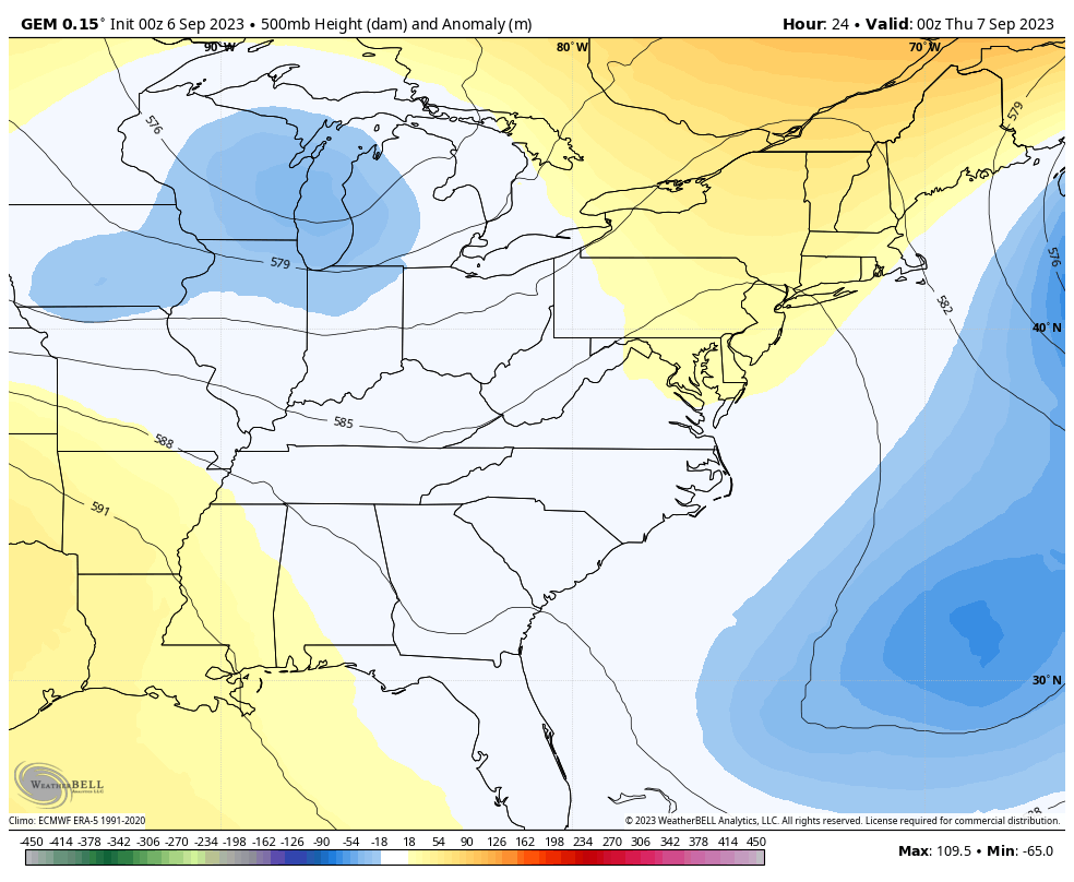
Windy and cooler air blows in behind this front for the next few days and takes us into the weekend. This happens as a trough slides in from the northwest and cuts off from the main flow, spinning across our region through the weekend…
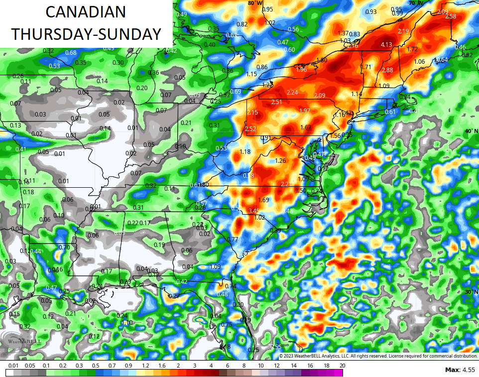
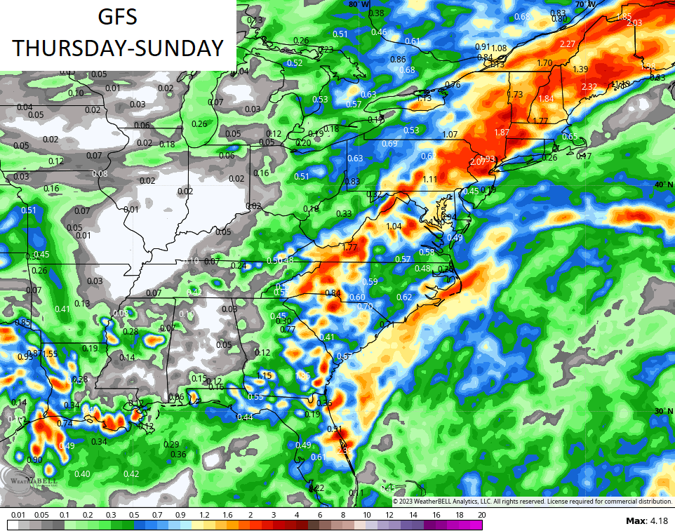
That’s a great feeling pattern but it’s one that can throw a few showers into the region over the next 4 days. No, it’s not constant stuff and the greatest chances look to be Saturday and Sunday with some wraparound showers.
The models are seeing a lot of rain across the Appalachian mountains and east with lighter amounts in our area…
The setup for next week is looking more and more like it wants to turn anomalous with a monster cut off low spinning into the east as a hurricane spins in the Atlantic…
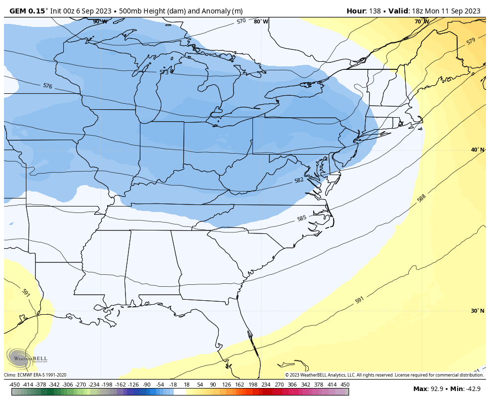
An upper-level system like that means well below normal temps with the chance for widespread 40s for lows at some point. If we get clouds and showers on any given day late next week, I could see highs in the 60s.
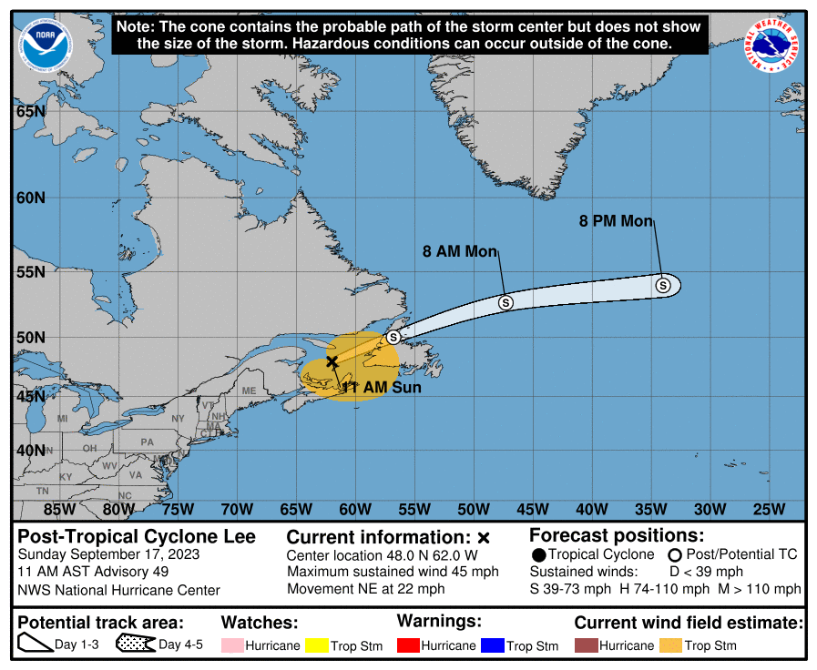
Tropical Storm Lee continues to spin in the Atlantic and will become a major hurricane over the next few days. Here’s the latest information and track forecast from the National Hurricane Center…
The hurricane models look like this…

There’s another system right behind Lee and this will become a named storm very soon…

I leave you with your Wednesday storm tracking tools…

Current watches

Possible Watch Areas

Have a great day and take care.

It stands that with day length declining, it will get cooler. Precipitation pattern still remains unchanged. Our Autumn weather could be the same as we had last year, with colorful Fall foliage and delightful temperatures with low dew points.
Winter still a guessing game. Largely depends on ENSO and the Pacific Decadal Oscillation. If we have an abrupt change to a real EL Nino. A real active atmospheric / ocean El Nino would have a very positive PDO and a very negative AMO. Not happening yet, as we still have an active Atlantic tropical storm season. Remanence of La Nina from the last three years.
Quite unimpressed with rain chances, honestly.
Jeff not a fan of your kind of weather lol