Good Friday to one and all. We have another day of pleasant temps and this continues into the weekend as we focus on a system to our southeast trying to throw some rain at us. All of this is ahead of what looks like a big blast of October air coming later next week.
Temps today generally range from 75-80 in most areas with a mix of sun and clouds. Just like Thursday, the potential is there for a shower or two to go up. This isn’t very widespread at all, so you may have to squint to see the drops on our radars…

A slow-moving system meanders from the southern Appalachian Mountains to the Mid-Atlantic states. While this keeps the heaviest rains to our east, some showers and storms may get into the eastern half of the state. This action spins in from the east and southeast and this shows up well on the NAM from Saturday afternoon through Sunday night…
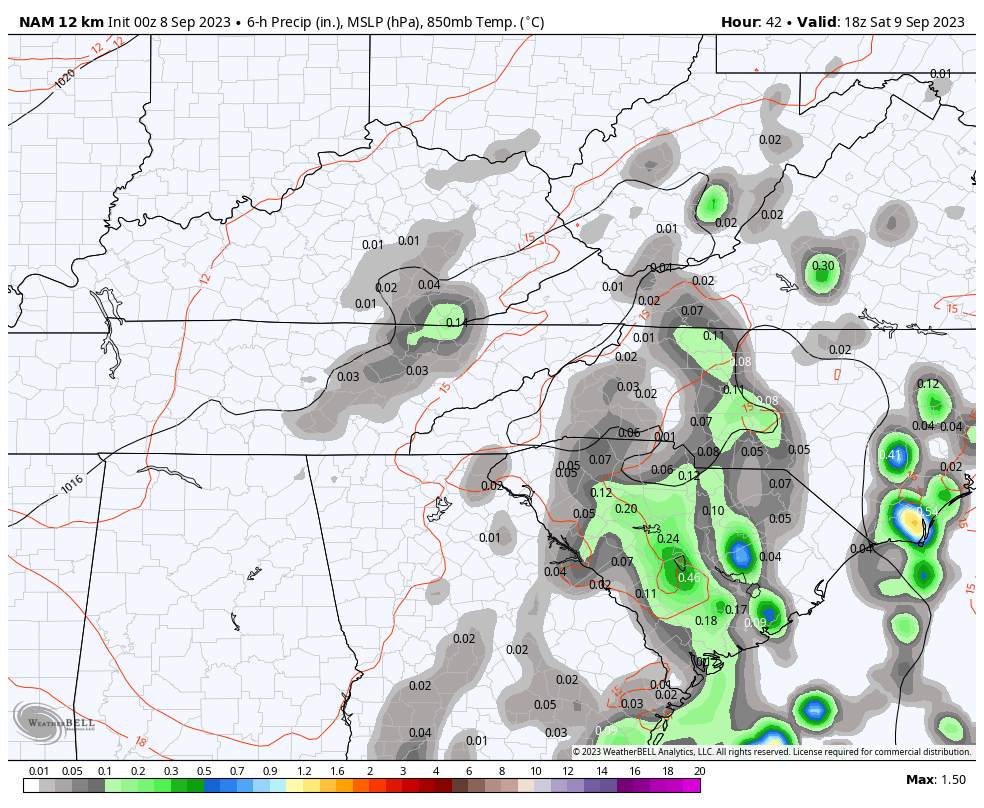
The NAM and the EURO are the most robust with rainfall numbers across central and eastern Kentucky during this time…
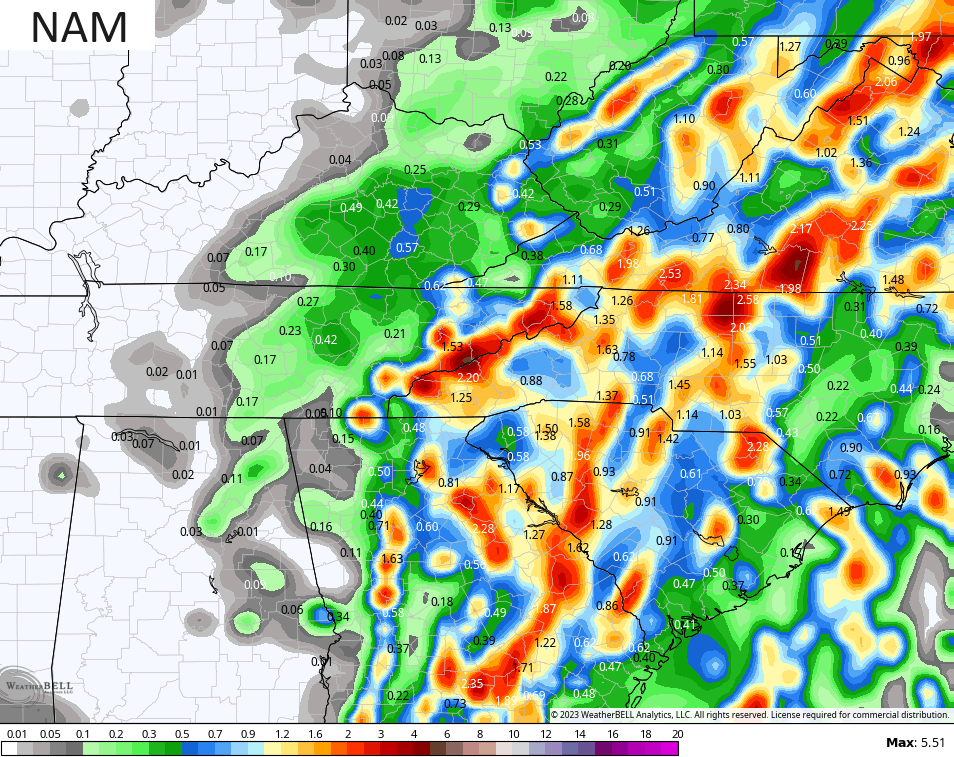
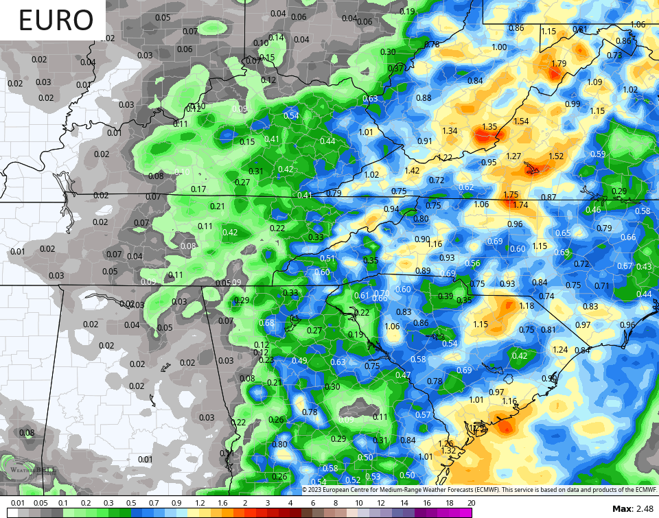
You can clearly see the higher numbers showing up in the far east and tapering the farther west one goes. The best chance for this comes late Saturday through Sunday. I’ll keep finessing this part of the forecast as I get a better handle on just how far west this system can get.
This is ahead of a very potent mid-September setup next week. A couple of monster troughs are likely to swing into the region and the eastern part of the country. These troughs have a chance to impact the track of Hurricane Lee .
Check out the EURO tugs Lee back toward New England next weekend…

The EURO says stay alert Maine…
The latest GFS has a similar overall look as it also tries to pull Lee back toward New England…
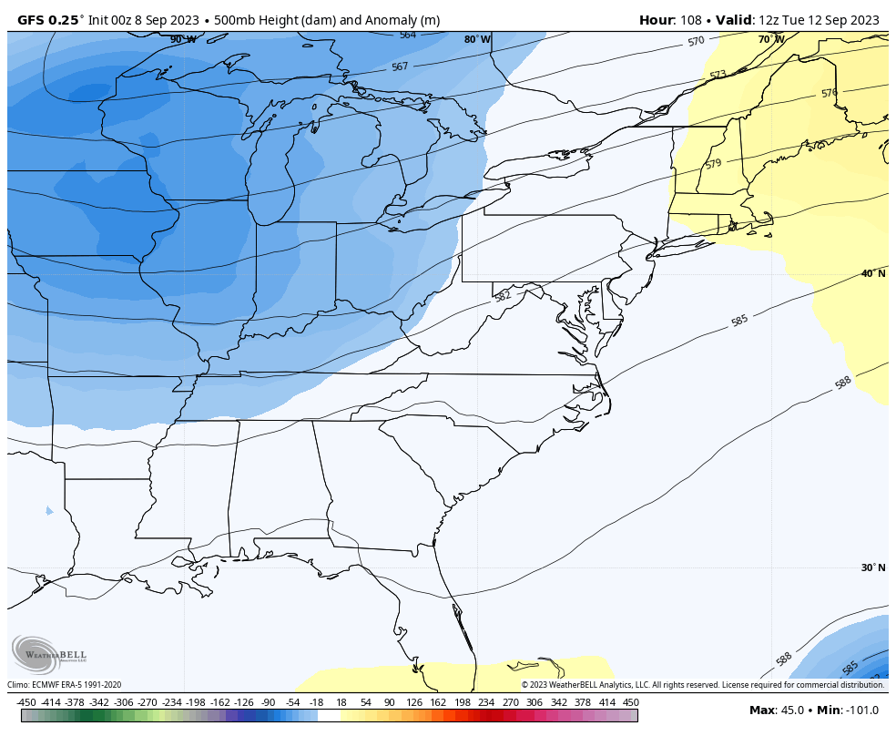
The surface maps from the GFS are just a bit farther east withe Lee but also has a Maine impact…
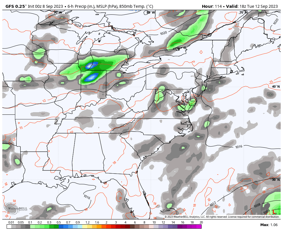
For us, showers and some storms rumble in here on Tuesday with some general showers. gusty winds and falling temps on Wednesday. This is an air mass that’s more typical of late September or early October and even the GFS is seeing the chance for lows to get deep into the 40s with this…
It’s possible for highs to only reach the upper 60s for a day or two by the end of next week. That would be pretty uncommon for this time of year.
Overall, this is a continuation of the summer pattern of deep troughs impacting our region with cooler than normal temps. Winter lovers want this pattern to stay through the fall and into the cold season that follows. Ya know what? I think it can do just that, but let’s keep that just between us. 🤫
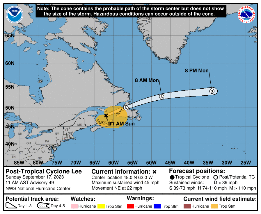
As far as Hurricane Lee goes… Wow, what a storm. This is a monster of a Cat 5 hurricane…

Here’s the latest info and track forecast from the National Hurricane Center…
Some extreme stuff is on the table next week, folks.
Have a fantastic Friday and take care.

Lee is certainly a monster, and will easily be one of the strongest Atlantic hurricanes on record, rivaling the1969’s hurricane Camille, with winds at landfall estimatedat 190mph, and 2005’s hurricaneWilma, which holds the record for the lowest central pressure ever recorded of 882 millibars, or 26.04 In/Hg. One of the NHC forecasterssays that over the next 36 hours, the storm could produce sustained winds of 180-195 mph. As Lee approaches the Bahamas, it will run into strong wind shear, which will diminish its strength and begin to curve it towards the northwest. The shear is due to El Niño’s effect on the trade winds. According to the CPC, the current El Niño has a 95% chance of maintain or slightly increasing strength through the Winter of 2023-24. Also, the latest SSTA chart shows the warner than normal plume extending farther west, which could help our Winter chances!
Joe, I remember Hurricane Camille very well in August 1969, and I’m sure you do also. A major disaster for the Gulf coastal states is an understatement. Cat 5 at landfall !
I might make chili this weekend. Nobody needs cold weather for that. 😉
Sounds good Jeff. I can’t have Chilli anymore due to health concerns. Got to watch my Blood pressure even with medication.
Sorry about your BP.. May I suggest going to youtube and looking up frequencies for heart and or BP? It sounds crazy but frequencies are amazing. Listen with headphones. Hey, it can’t hurt
https://www.youtube.com/watch?v=C-zJKQdIdCI
That’s very interesting Mark. I’m glad you posted it. Hope it is something that will help you Schroeder. Couldn’t hurt!
Thank you for sharing this! I have listened to frequencies for other things (like my tinnitus) and it does help for periods of time. I am going to check this out!
Thanks Chris. Hoping all the models are correct and the rain moves west to cover all of the state. Also hoping Hurricane Lee gets sheared off before reaching any potential landfall. We do not need another disaster. I also hope the pattern we have now stays through the Winter with an active storm tract to our south and the Old Farmers Almanac is right about a cold and snowy Winter.
Thanks Mark and Dottie for your concern, but as long as I take my medication and stay on my saltless diet I’m good for now. Hopefully I’ll be around for a few more years.