Good Saturday, folks. We’ve made it to the weekend and we have some pleasant temps with a shower or storm going up. This is ahead of what looks more like a mid to late fall pattern taking shape for next week. Our temps may take a walk on the chili… I mean chilly side before the week is over. 🍁😏
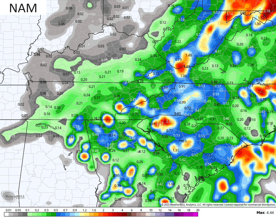
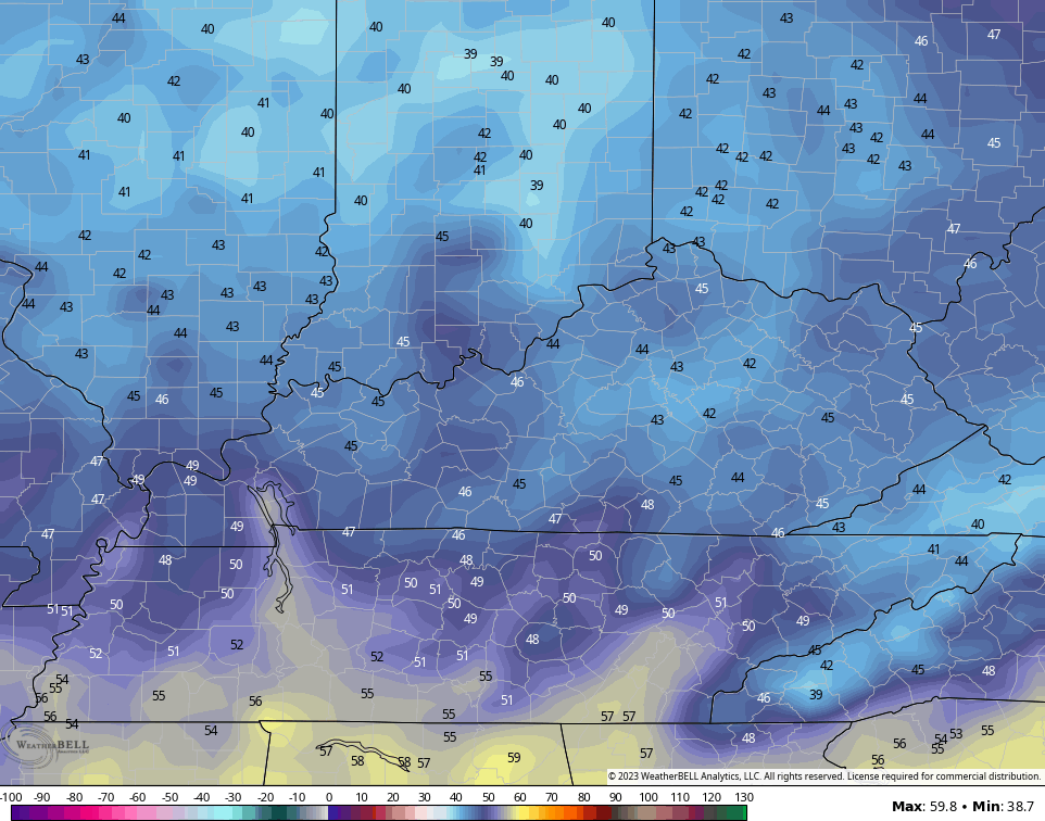
Temps today and Sunday are likely mid and upper 70s once again. The threat for scattered showers and storms will be with us across central and eastern Kentucky, with the greatest potential being in the east.
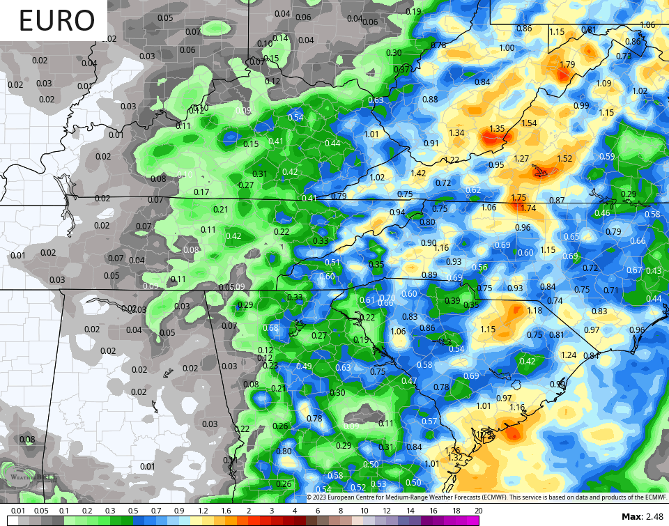
This doesn’t look terribly widespread by any means, but the models continue to spit out some pockets of decent rainfall…
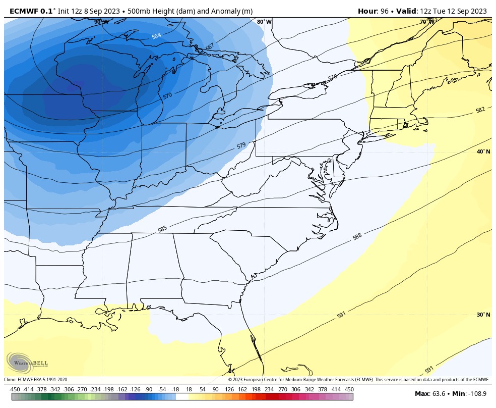
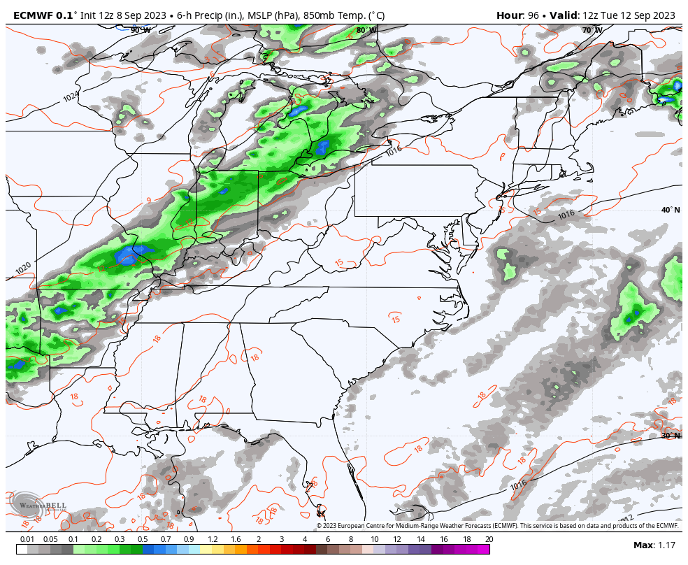
Once this moves away, it opens up the floodgates on a couple of big troughs to swing through the region. The first is a beauty as it moves through here Tuesday through Thursday…
Showers and storms will be along and ahead of the front with some wraparound showers possible on a chilly northwest wind for Wednesday…
Temps may not get out of the upper 60s and low 70s for Wednesday and Thursday. Lows for Wednesday and Thursday morning will likely drop into the 40s. Some of the models, like the Canadian, are pretty darn chilly…
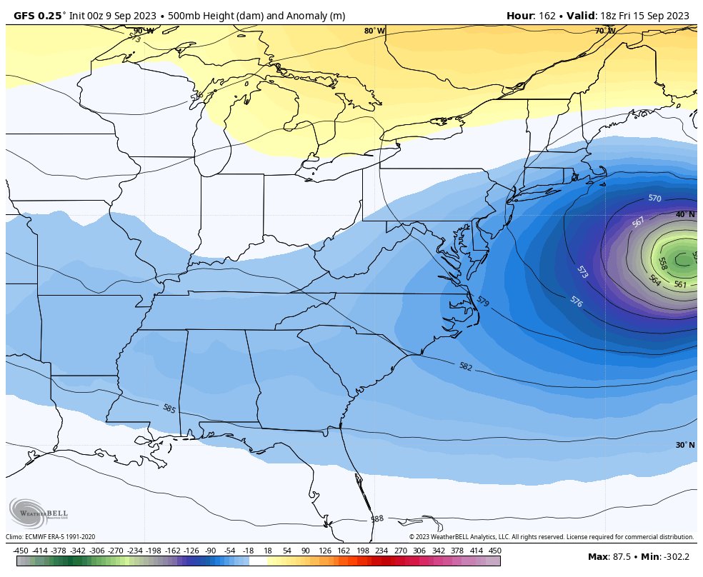
As all this is happening, Hurricane Lee will be working northward between the east coast and Bermuda. Can this storm impact the northeast and/or Nova Scotia? That’s certainly a possibility and the models are trending in that direction.
These same models do bring another trough dropping in behind this next weekend into early the following week…
GFS
EURO
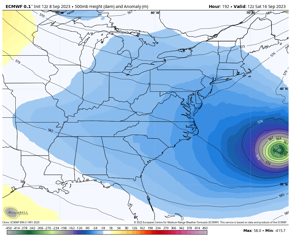
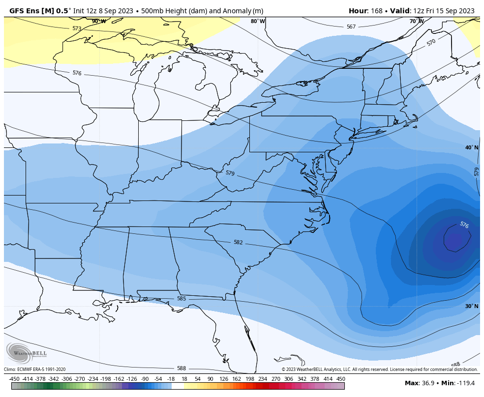
The various ensembles are on board with the idea of a pretty deep trough continuing through the week of the 18th…
Fall certainly appears to be settling in earlier than normal around here, kiddos!
Hurricane Lee continues to spin in the Atlantic…

This system is much weaker than the Cat 5 status we had a few days ago, but is still like to be a 3 for much of the next 5 days…
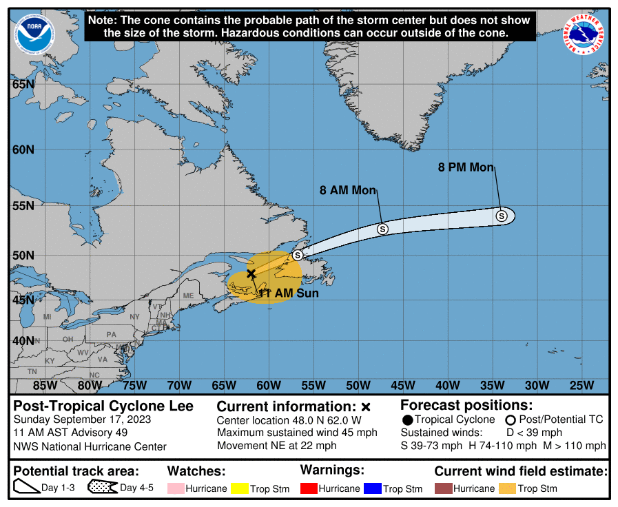
That’s a really slow-mover and that means there’s still a long while before this impacts land.
Make it a great day and take care.

Thanks Chris. Those good soaking rains may be a long ways off ? An early Fall sounds really refreshing. A ” Chili Alert ” may be needed by Wednesday. Glad Hurricane Lee is beginning to show signs of weakening.