Good Monday, folks. We are kicking off the week in fine fashion as true fall weather gets set to flex on us. 💪 The chilliest temps since spring are on the way for the second half of the week with another big fall blast on tap for late weekend and most of next week.
Today features a mix of sun and clouds with temps hitting the upper 70s to low 80s. Winds will gust up a bit from the southwest as we get ready for a cold front to blow across the state late Tuesday into early Wednesday. Temps ahead of this front will likely be in the upper 70s and low 80s again for Tuesday with a big crash behind the boundary.
Scattered showers and storms will be noted with this front and some wraparound showers behind it on Wednesday as northwest winds kick in.
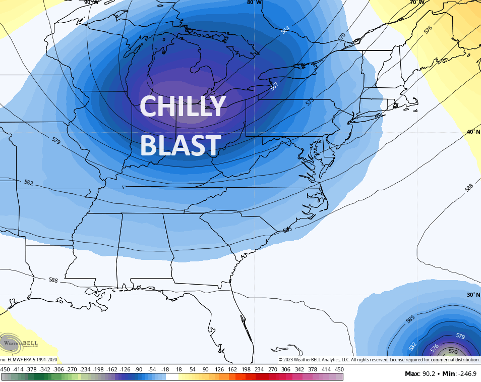
This is one deep trough sweeping through for this time of year…
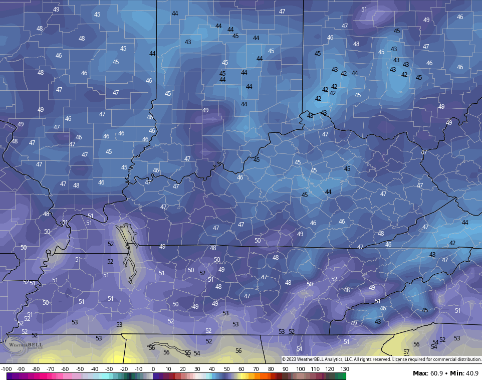
Highs for Wednesday and Thursday will range from the upper 60s to low 70s for many in central and eastern Kentucky with 70-75 in the west. Friday’s highs are generally 70-75 for most of the region.
Lows can hit the 40s for many…
The weekend may feature a few more showers trying to get in here ahead of another big system dropping in from the northwest. This would be around the same time as Hurricane Lee takes aim at Nova Scotia or even New England.
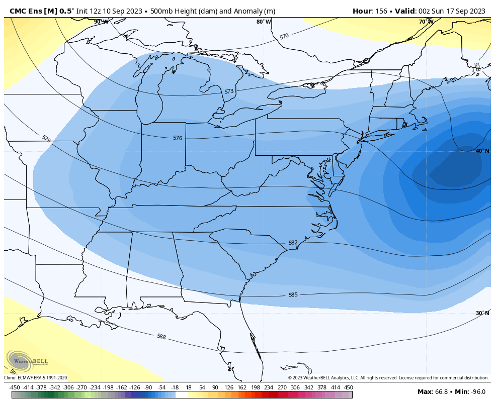
The Canadian is a Nova Scotia hit with our trough diving in behind it and carrying us through next week…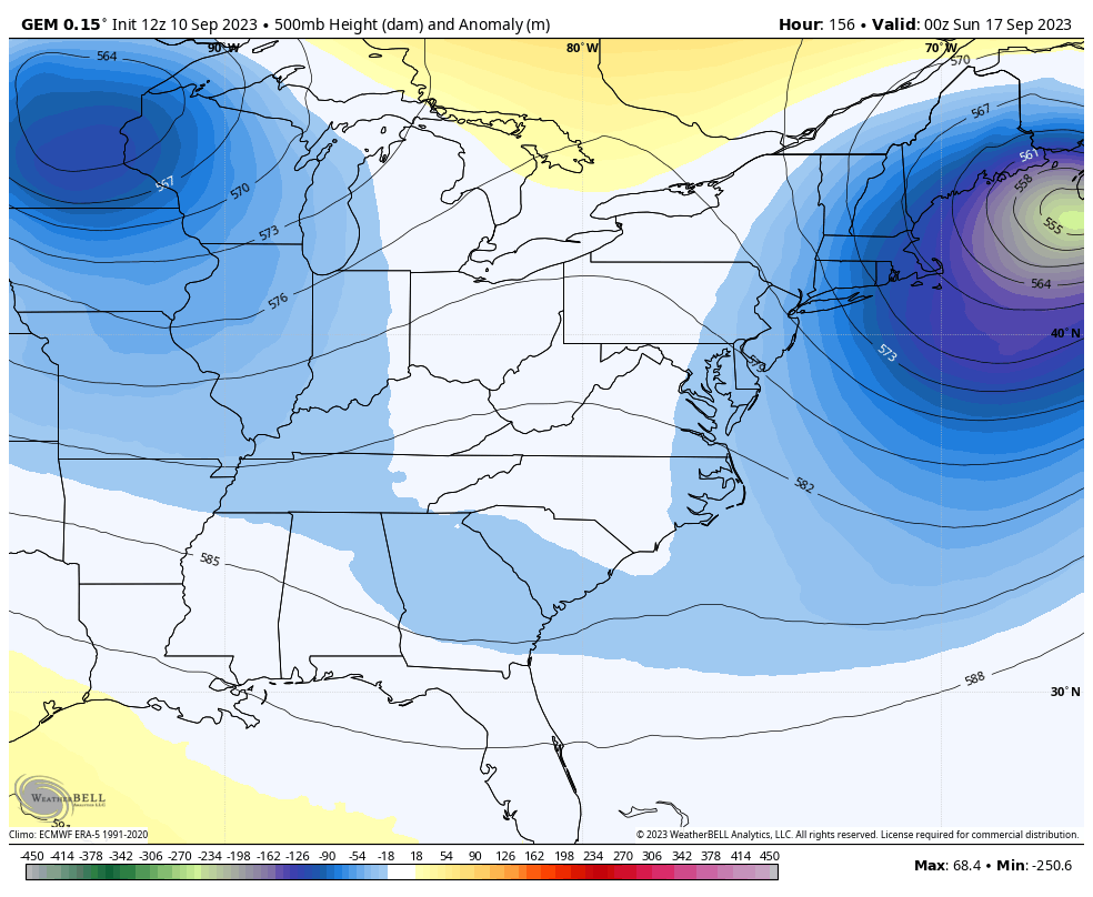
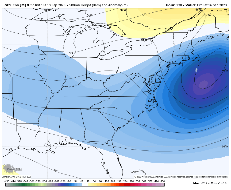
The GFS is literally showing some really wild swings with Lee and our trough. This version of the GFS likes New England with Lee and has the monster trough behind it…
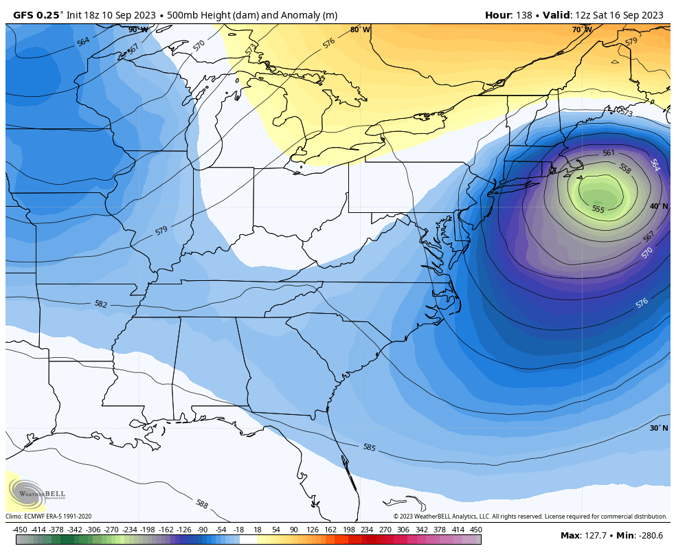
Folks, the GFS is by far and away the wost of any model out there right now. Until the folks at NOAA get a handle on the absolutely ridiculous temps the model spits out, it simply cannot handle the overall pattern because of that. You’ve seen me ripping it all year long as it consistently forecasts temps to be 10-20 degrees above reality in the medium range.
The overall setup from the weekend through next week is for this deep trough to stay across the eastern half of the country…
GFS ENSEMBLES
CANADIAN ENSEMBLES
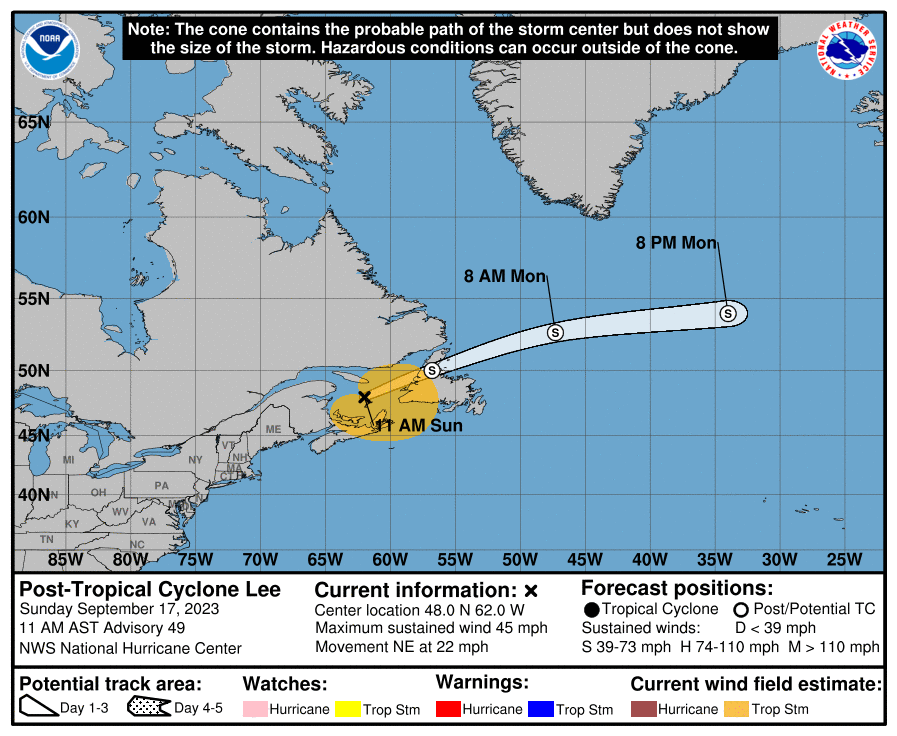
Hurricane Lee continues to slowly churn across the open waters of the Atlantic. This storm will slowly turn toward the north in the next few days. Here’s the 5 day track forecast from the National Hurricane Center…
Here are the latest forecast tracks from the Hurricane Models…

The GFS Ensembles…

Canadian Ensembles…

The Atlantic remains active behind Lee with Margot and two other developing systems…

Have a great Monday and take care.

I wonder if we will have these troughs this winter? I hope so if it will help the snow chances. I always look forward to fall and winter.
I know the tropics are really busy right now, but Chris promised us some winter talk in the last post! I would like to see some long range forecasts! It’s that time of year
If we receive that many troughs throughout the Fall and Winter with a well established El Nino in place ( + PDO and a negative – AMO ) I would say the chances for many Snowy days increases.
Fall and winter are good for sending bugs away. That’s all. 🙂
If you listen very closely after the first hard freeze, you might hear the screams of dying mosquitoes.
It is a good sound.
The only insect that really bothers me at my place is the Asian Lady Beetle. This insect comes in many droves after the first hard freeze in October or November and loves to hibernate inside the home. The insecticide that will control them is called Demon W P sprayed on the outside of the home sometime in early October.
Just had some great chily. Just saw the winter forcast from Famers allmanic it says for us cold and snowy
An early fall perhaps? but officially first day of fall is less than 2 weeks. Have a great day!!
There are signals suggesting an early Autumn and a colder Winter ahead.
I’m seeing the warm water anomaly off the west coast of South America begin to extend farther to the west, which is a key piece that needs to be in place to maximize the Winter weather impact in our neck of the woods from El Niño. Some climatologists that I follow are thinking that the effects of a moderate El Niño may extend into mid Spring, but in this changeable climate, 6 months is a long time. We’ll wait and see.
Speaking of warm water, the path that Lee is taking towards the Canadian Maritimes will take it over some warmer than normal water, exactly what we DON’T want to see with this storm! But there is strong shear off the New England coast, which should knock Lee down substantially.