Good Thursday, everyone. Fall is sometimes a rather short season around here, but that’s not the case this year as fall starts earlier than normal. This awesome weather goes into the weekend before some changes start to show up.
The forecast for today and Friday are just phenomenal with lows in the 40s for many and highs mainly 70-75. Skies will be mostly sunny with just a fair-weather cloud or two showing up.
All of this comes from a big dip in the jet stream allowing Canadian high pressure to setup across the Great Lakes and Ohio Valley…

That’s a really good looking map, folks! 🍂🍁
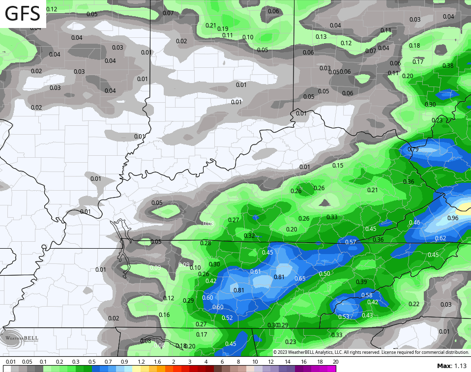
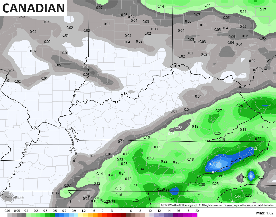
An upper level system scoots across the region this weekend and brings our next chance for some showers and a reinforcing shot of pleasant temps…
The showers with this look fairly scattered from late Saturday into early Sunday with the greatest concentration of rain across southeastern Kentucky…
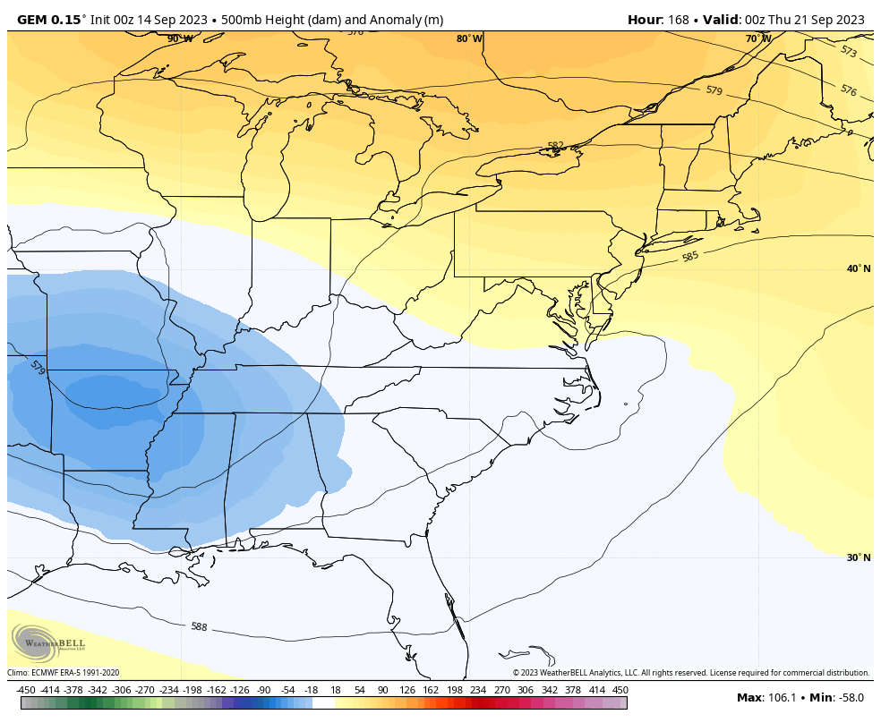
The setup later next week is a little complicated as we watch the potential for a cutoff low to develop at the same time another tropical system may be approaching the east coast…
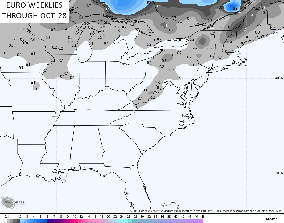
As we transition deeper into fall, the EURO Weeklies now go out all the way into the closing days of October. The model is seeing some mid and late October cold shots and even have some flake chances just to our east in the high ground of the Appalachians…
Speaking of winter, my next post will show some new data coming in for the winter ahead. 👀
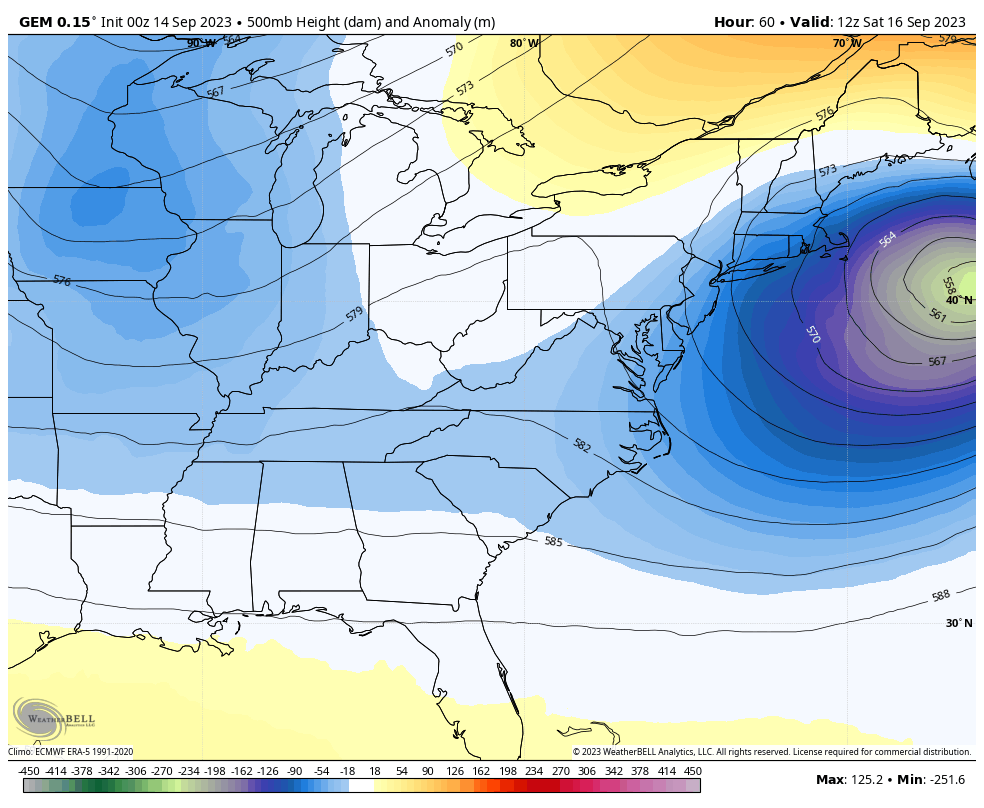
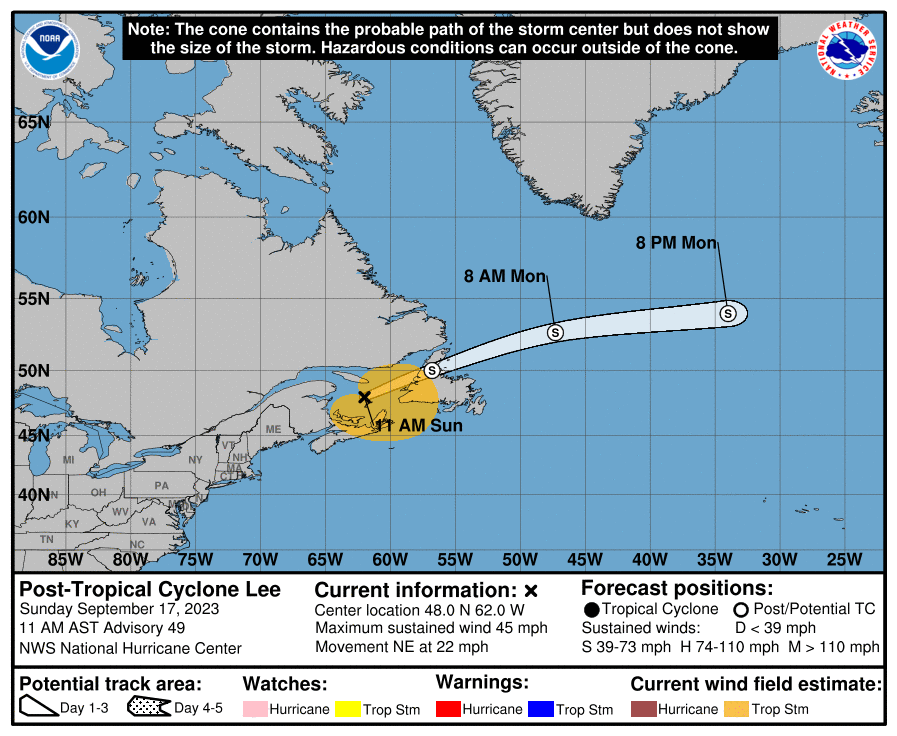
Hurricane Lee is a MASSIVE storm in the western Atlantic and essentially spans the length of the east coast and then some…

This storm will impact much of New England with a Hurricane Watch out for parts of the Main coast. The forecast track on this is pretty insane…
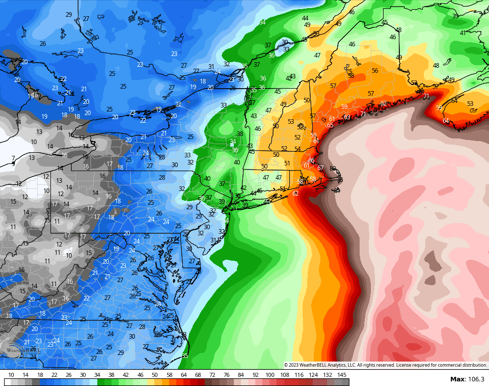
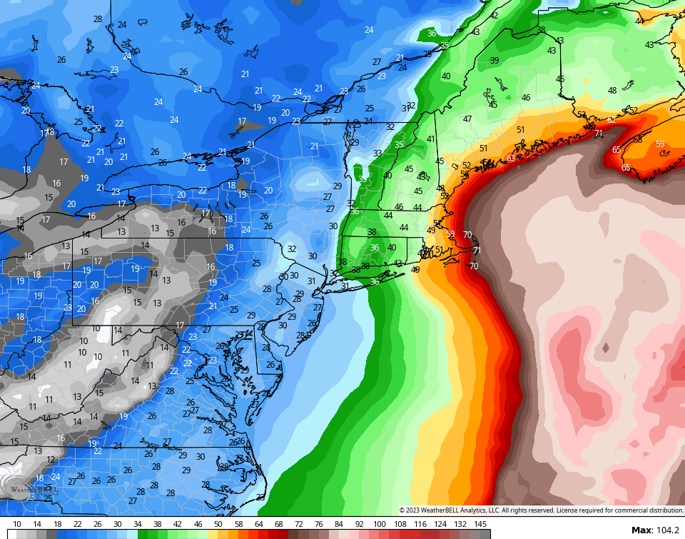
The operational models show some big time winds in New England…
NAM
GFS
Have a great day and take care.

Thanks Chris. Currently 47 degrees here in Maple. A very pleasant September Fall. Hoping this delightful Fall weather continues into October. Our Fall foliage should be colorful this year, because of the increased sugars stored in the tree’s sap.
We’ve not seen our last 80° high. Book it. 🙂
we hit 80 yesterday in my woods Jeff, wouldn’t be surprise hit 85 when said and done.
I LOVE this weather!
Me too Dottie!!
Excited to see what winter will bring
What a perfect day. I love this time of the year!
yall i had my heat on for a little bit this morning. as someone who loves summer and thrives in 90+ degree weather, ill never make it through the winter 🙁
probably no one sees this because I feel like if the comments get read, they get read in the morning… anyway – reverse it for me…I don’t turn the heat on until the bitter end…and even then we keep it on 64
Awesome weather here in the Chicago Metro Area, with temps in the low 70s under sunny skies and light winds. On my hike in the forest preserve near me yesterday, I noticed some leaves are already in the process of changing colors.
The warm weather isn’t over yet, as highs in the low 80s are predicted here for next Tuesday and Wednesday.