Good Friday to one and all. It’s another absolutely awesome fall day across the region but some changes are blowing in for the weekend. These changes bring an increasing threat for rain, especially into central and eastern Kentucky.
Our morning lows are starting out in the 40s once again. This comes after Thursday morning temps were deeeeeeep in the 40s…
Temps bottomed out in the low and mid 40s this morning. The Kentucky Mesonet site in Cumberland County hit 41 degrees. Wow! #kywx pic.twitter.com/YvTRZlF19B
— Chris Bailey (@Kentuckyweather) September 14, 2023
Highs this afternoon are back into the 70s with just a few clouds around, especially in the southeast. A shower or two may get awfully close to the far southeastern counties before the day is over…

Another big bowling ball upper level system swings eastward across the region Saturday and Sunday…
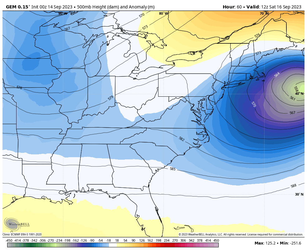
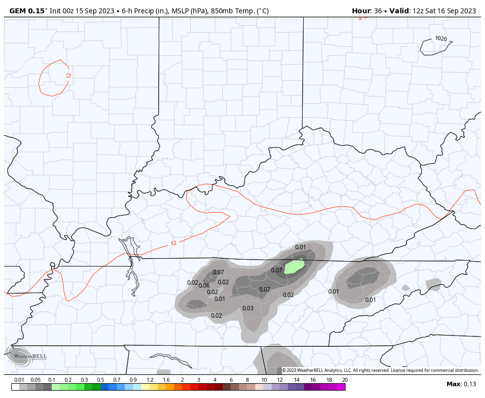
This brings some showers and a rumble of thunder to the region on Saturday with the best chance across the eastern half of the state. This action comes in from southwest to northeast.
By the time we hit Sunday, wraparound showers, gusty winds and fairly cool temps will be common…
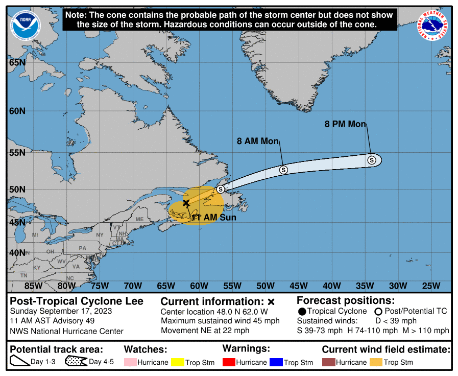
At the same time, we continue to track Hurricane Lee heading toward the northeastern US and Nova Scotia…

This storm is moving into cooler waters and should weaken some, but Tropical Storm Warnings and Hurricane Watches are out for a lot of real estate…
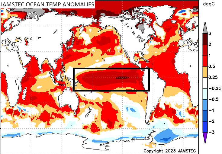
Looking ahead toward winter, our developing El Nino will be one of the main players on the weather field, but it’s impact really isn’t known yet. With oceans across the globe now much warmer than normal, the temps of the equatorial Pacific Ocean likely don’t have the same impact they had before.
This El Nino is likely moderate to strong by the winter with the focus of the warmer waters migrating westward into region 3.4…
The placement of the warmest waters typically bodes well for winter lovers in our region. But is that still the case with this new climate? That remains to be seen, but the seasonal models are pretty much all on board with a trough in our region for the winter ahead. That’s certainly the pattern we’ve been in since late spring, so it’s interesting to see the models keeping it going.
The latest JAMSTEC forecast for temps shows colder than normal for our region into much of the east and southeast…
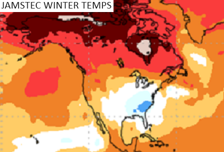
Look at all those warmer than normal temps from the west coast through Canada and into the arctic. That suggests blocking showing up in those areas with a trough in the east. That’s also what we see coming from the latest JMA winter forecast. Look at this winter trough in the east…
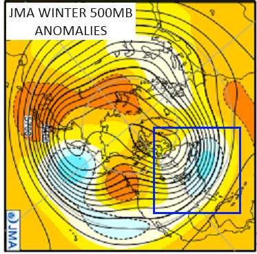
That’s a very interesting look that should make for a fun winter around these parts.
Have a great Friday and take care.

The mid-September ENSO report is out, reporting that El Niño is anticipated to continue through the Northern Hemisphere winter (with greater than 95% chance through January – March 2024). The report goes on to say that the odds of at least a “strong” El Niño (≥1.5°C for the November-January seasonal average in Niño-3.4) have increased to 71%. El Niño’s effect on the trade winds is quite evident in shear zones that are having a negative effect on Atlantic hurricanes, and will continue to do so through season’s end. Finally, an observed strengthening of the warmer than normal water in the central and east/central Pacific is a signal that could bode well for Kentucky snow lovers!
https://www.cpc.ncep.noaa.gov/products/analysis_monitoring/enso_advisory/ensodisc.shtml
Thanks Chris and Joe for the very detailed update on ENSO. Hoping the PDO goes positive and then we will have a complete El Nino to make an impact on our Winter weather. The PDO as of May 2023 was strongly negative and remains so.
I don’t trust long range models, but wouldn’t be mad if those verified.
I always look for agreement when it comes to long range weather models.
This article from last year has real proof that Climate Change is happening. I always wondered about this and was a skeptic up until now. Not the same as it was back in 1960 to 1979. I’ve observed some real changes in precipitation patterns and temperature patterns.
https://archive.nytimes.com/www.nytimes.com/library/national/science/012000sci-environ-climate.html
I’ve been looking at a number of historic sea surface temperature anomaly charts during moderate or strong El Niño’s, and the big difference in each one was the absence of warmer than normal water in the north Pacific. This pool of warm water has been and continues to push the polar jet stream over Alaska farther northward, resulting in heat domes in the far west, and troughs plunging out of Canada. With a strengthening El Niño in place affecting the southern storm track, the northward jogs of the polar jet could help bring colder air into the Midwest and East, and make the upcoming Winter very interesting. I guess that’s my bold prediction!
I’ll make my prediction for this Fall and Winter as we get later into the year ( Thanksgiving. ) Should have more information on ENSO by then.
Could this really be our year for snow lovers???? I hope so but I guess time will tell! I do love the weather now.it’s almost time to put the old blanket back on the bed.
Really hard to predict where the Snows will be this Winter. Last time we had a very cold Winter with a couple of major Snowfalls ( 15 inches ) was in 2015. That year we had a very strong El Nino with a positive PDO that began in 2014. This year’s El Nino is different, currently holding on to a negative PDO. Will it change later this Fall ? That’s what I’m waiting on. NOAA should know by mid November.