Good Tuesday to one and all. It’s another winner of a weather day across the Commonwealth as our gorgeous September rolls on. We will change things up a bit later this weekend into next week as a big upper level low works into the region.
Temps out there today range from the middle 40s to middle 50s across the state and wind up in the 70s again with a mix of sun and clouds.
Wednesday is a bit milder with mid and upper 70s central and east and low 80s west. Those numbers come up into the upper 70s and low 80s for central and eastern Kentucky Thursday and Friday. The west may see numbers a degree or two better, but this area may also see some showers.
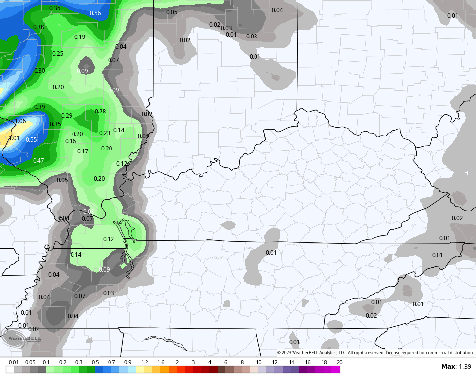
Scattered showers may very well show up in the far west on Thursday. The NAM sees these showers…
As this is happening, a system develops along the southeastern coast and slowly lifts to the north along the east coast. The National Hurricane Center is even highlighting this region for possible development…

That would likely be a subtropical system, but you get the idea.
As mentioned, the models take this up the east coast this weekend and early next week. Can it get far enough west to throw a shower into the region? I have my doubts but a few models like the Canadian are doing just that…

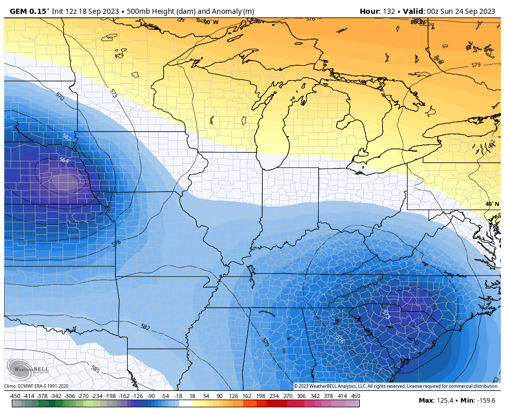
As that system pulls away to the northeast, it opens up the pattern to produce a big cutoff system across the Plains and Mississippi Valley. This would likely roll into our region at some point early next week, but the details are still to be determined.
Here’s the Canadian Model showing this…
At the surface, that kind of setup would produce rounds of beneficial rains in our region. This animation starts Sunday night and goes through next Thursday…
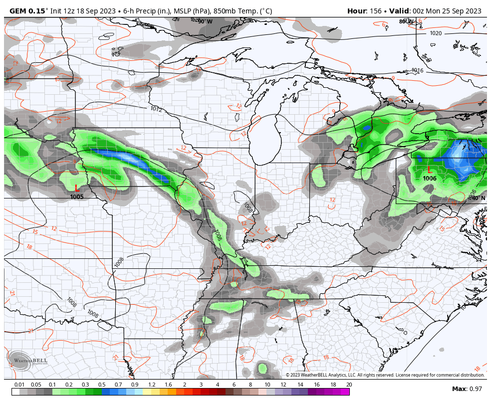
Bring on the rain!
Looking longer range toward October, we find the European Weeklies showing a lot of ridging across Canada with a weak trough in the east and southeast…
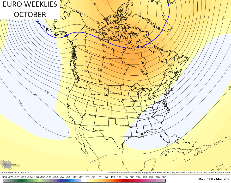
The control run of the EURO Weeklies has a much more pronounced trough across the central and eastern parts of the country…
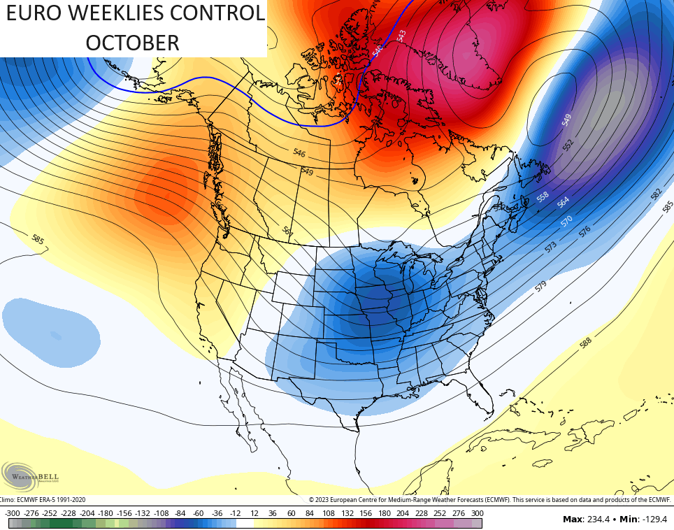
Check out that massive block across Greenland! That’s what a -NAO looks like, folks.
Have a great Tuesday and take care.

I definitely need some rain.
I wonder if the Greenland blocking will continue through out the winter?
Thanks Chris. Hoping for rain too. Only GFS ( only model on this I can find ) is indicating the negative NAO, so my confidence is low on that forecast. The current Tropical activity would indicate a very positive AMO. NOAA keeps publishing ridiculous articles on ENSO, so my confidence is low on that also. We shall see if this changes later this Fall or Winter.
We don’t need a ton of rain.
We do need an all day slow rain soaker though. It’s pretty dry out there.
We need whatever rains in any amount. This time of the year the rains are light to moderate, so I don’t expect too much rain.
Wrong. We don’t need a flood.
Jeff no one has mentioned we need a flood rain. We need rain replenish our dry ground. Unless you live in southeast part of ky that has some rain.
The current Sea Surface Temperature Anomaly chart shows an area of cooler than normal water east of the Bahamas & the US, which turns out to be “upwelling” from hurricane Lee. This occurs when cooler, nutrient-rich water from the deep sea mixes with the warmer water at the surface, which helps phytoplankton, the primary food producers in the ocean, to bloom & provide food for other organisms in the ocean.
https://www.ospo.noaa.gov/Products/ocean/sst/anomaly/
Joe, Here’s the link to the current SST’s and the anomalies SST’s both are completely different, like night and day.
https://weatherstreet.com/hurricane/sea-surface-temperature-atl.htm
They should be different, since the SST is showing the current temperature at a depth of 9.8 meters, while the value displayed on the SSTA chart is recorded via infrared satellite, and displays the deviation between actual temperature and an established average value. The infrared image is more sensitive and better suited for capturing something like upwelling, which may be visible for a day or so.
Thanks Joe for explaining the two charts. I won’t bring that up anymore, or I won’t be talking about the PDO or the AMO, or any teleconnection because I really don’t Know.