Good Wednesday to one and all. We have a little milder air pushing in here and this is being accompanied by more clouds. A few of these clouds may produce a few showers into western Kentucky over the next few days, but most of us have to wait until early next week for some rains.
Temps out there today range from the mid 70s to low 80s across the state as clouds stream in from the west. There’s a small chance for a shower in the west with a better shot for some showers and rumbles of thunder in this same area Thursday. This animation from the NAM goes from 8am Thursday to 8am Friday…
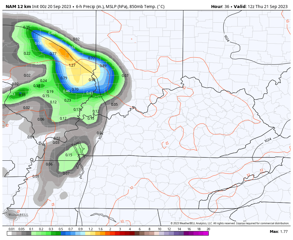
There’s also the smallest chance for a shower in the far southeastern part of the state.
The setup for Friday into the start of the weekend features a massive storm system spinning across the southeast coastline. This system may wind up as some kind of hybrid tropical system and the NHC is monitoring it…

Can this system come far enough west to bring the threat for some showers into eastern Kentucky? Probably not, but the Canadian isn’t writing off that chance…
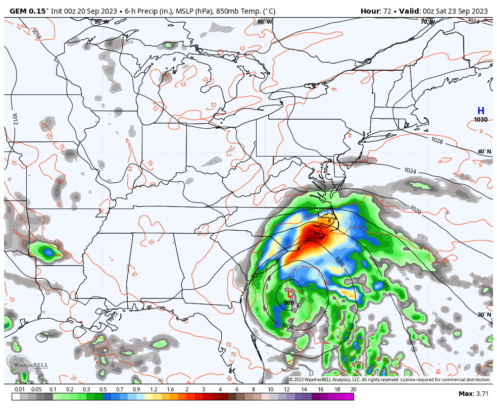
You can also see the system to our west slowly sliding toward western Kentucky. The models are going to struggle mightily with this setup because we have a ton going on in this type of a setup. The Canadian continues to carve out a pretty extensive trough with reinforcing systems spinning around…
Obviously, the models will change a lot from run to run because of how much cutoff energy we have going on.
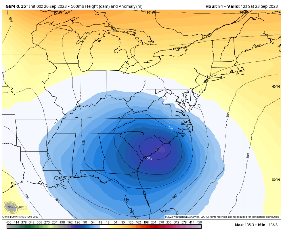
In looking at this overall pattern, a few things stand out:
- The amount of summer blocking we had this summer across Canada is carrying over into the fall.
- This can cause some major fall storm systems to develop across the eastern half of the country.
- Can we get a scenario where one of those systems picks up something tropical down in the Gulf or along the east coast at some point in the next month? The chance is there.
- As a winter weather lover, I really like seeing this pattern holding tough. Give us this kind of pattern in the winter and it’s go time… Or should I say snow time. ❄️😎
Have a great day and take care.

Thanks Chris. Hoping all of that happens, so we Snow Lovers will have a lot of Snowstorms to track this coming Fall and Winter.
Does anybody have any ideal when we will see some rain across the whole state? I was hoping yesterday we would see some rain at least in Louisville on Monday.
I don’t know with this new climate we have in place. We use to get our weather out of the Southwest, but it seems that doesn’t happen anymore.
This trough after trough situation is partially to blame, especially when they setup south of Kentucky. The counterclockwise flow can steer systems out of the southeast, northeast, and even the east. I’m hoping that we can get some tropical moisture to ride up the front, like we used to see. For now, one thing seems certain… that tropical system won’t originate in the Cape Verde area, but in the Gulf or western Caribbean.
Really enjoying this solidly above normal weather and will be sure to get my yard mowed this weekend. It can rain all it wants after that.