Good Thursday, folks. Mild winds are blowing across the area today and Friday, but a big time change is on the way for the weekend. It’s another monster storm system set to bring another blast of November weather to the region.
Let’s start with the mild before we get to the weekend change. Highs today are in the mid and upper 70s for many with the local 80 in the west and north. Skies are mostly sunny.
Winds increase on Friday as our storm system gets closer from the west. Sunny skies early will soon cloud over from west to east with highs again mainly mid and upper 70s.
Scattered showers and storms develop in the west and roll eastward across the state Friday night and early Saturday as a cold front rolls in from west to east. This front is being pulled through here by a potent low pressure spinning across the Ohio Valley.
A short dry slot will be noted behind this on Saturday but the window closes as wraparound clouds and showers sink in late Saturday and continue into Sunday…
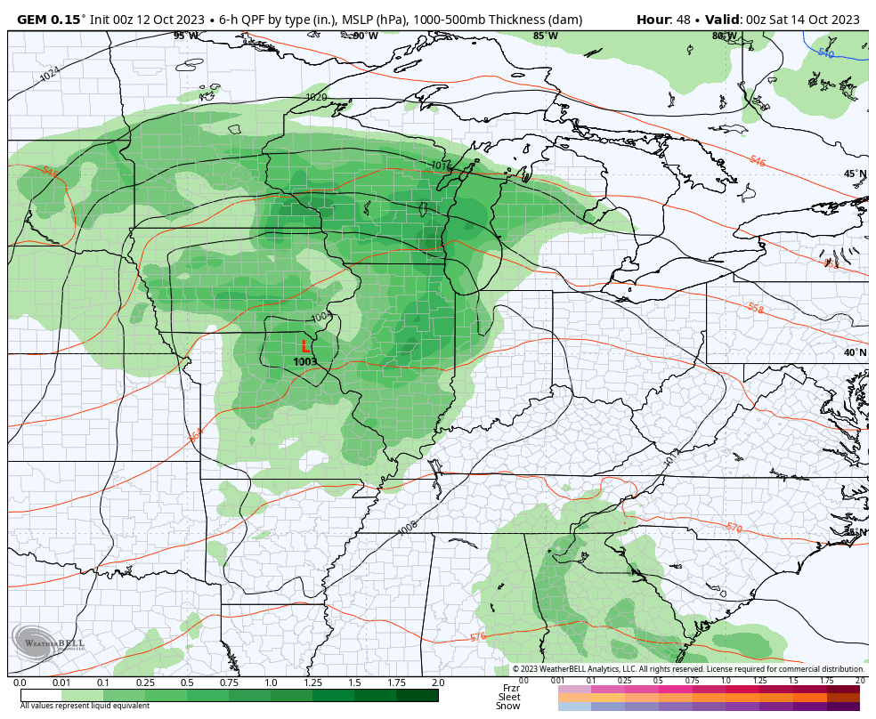
Winds will be very gusty during this time with peak gusts topping 30mph at times Friday night and Saturday.
Temps crash from the 60s to the 50s Saturday afternoon and evening. Highs Sunday stay in the 50s.
From there, a few showers will be with us again for Monday and Tuesday as the strong northerly wind flow continues. Highs are likely to stay in the 50s both days. Lows for nights with clear skies can drop deep into the 30s through the middle of next week.
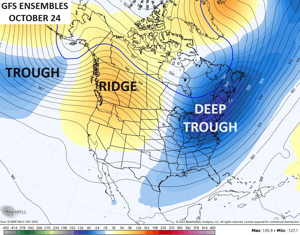
Another deep trough makes a run at us by the end of next week into next weekend.
That trough may get enhanced by what’s going on out in the Pacific, where Super Typhoon Bolaven is spinning north of Guam…

This monster storm is forecast to recurve, missing land…

This is the time of year we focus on recurving typhoons because those are usually a good signal for troughs in the eastern half of the country. That signal looks to get a boost by what’s left of Bolaven moving toward Alaska as a major storm system. In turn, that helps crank the ridge along the west coast and deepens the east coast trough.
Looking toward the final week of the month, our stable pattern shows no signs of letting up. Trough south of the Aleutian Islands with a ridge along the west coast and a deep trough in the east…
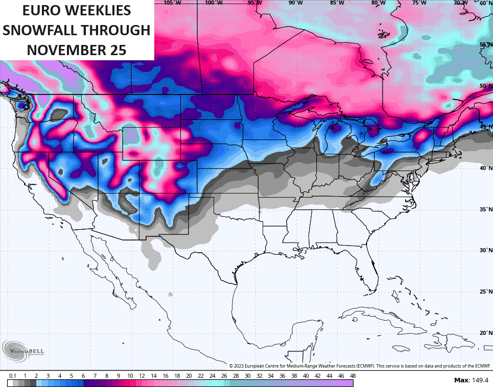
If we look much deeper down the road via the EURO Weeklies, we find the model trying to keep this train going through November. The farther out you go on any forecast model, things get smoothed out pretty good, especially with ensembles. The 30 day averages ending the Saturday after Thanksgiving has the model giving us a good idea of lower heights across much of the lower 48 with blocking to our north..
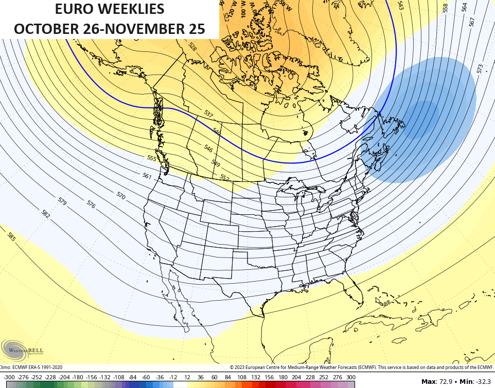
That’s actually matching what a lot of seasonal models have been suggesting going into the winter season.
The same 30 day period shows above normal precipitation around here…

That much more active pattern would have the chance to produce some November flakes around here…
Y’all having fun, yet? Don’t answer, it’s rhetorical. 😜😏
I will have another update later today, so check back. Have a great Thursday and take care.

The CPC has published their October ENSO update, and they are predicting an 80% chance that our current El Niño will extend into the March to May 2024 period. They’re also predicting a 75-80% chance that the event will be a strong El Niño during the November to January period. Plus, there are indications that the warmer seas surface readings are further offshore, which could be good news for Kentucky Winter lovers!
https://www.cpc.ncep.noaa.gov/products/analysis_monitoring/enso_advisory/ensodisc.shtml
I’m also glad to get back to posting on KWC, after I battled with a step stool during a DIY project, which the stepstool won! I was fortunate to escape with badly bruising my ribs (and my ego!).
Happy that you have your health.
I love your deep dive postings.