Good evening, friends and neighbors! That mild wind is set to kick into high gear before transitioning into a very chilly wind over the weekend. This happens as another massive upper level low spins through the region.
I really have no changes to the ideas I’ve had out for more than week now on this this system plays out. I’ll spare you another recap. 😁
Watch how this upper level low deepens right on top of us this weekend and early next week…
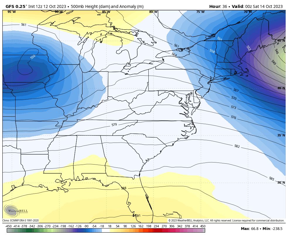
That’s a really anomalous setup, but we’ve said that a lot lately.
We need some rain, but this doesn’t look like the rain maker I thought from a week ago. That system in the Gulf of Mexico is robbing the northward transport of deep moisture, so we are left with scattered showers and storms ahead of the Friday night and early Saturday front. Wraparound showers then kick in late Saturday and are on and off through early next week.
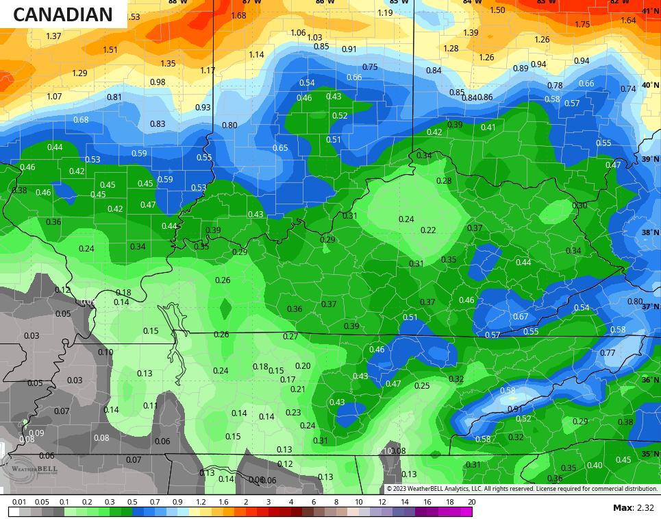
The Canadian is the most generous with rainfall…
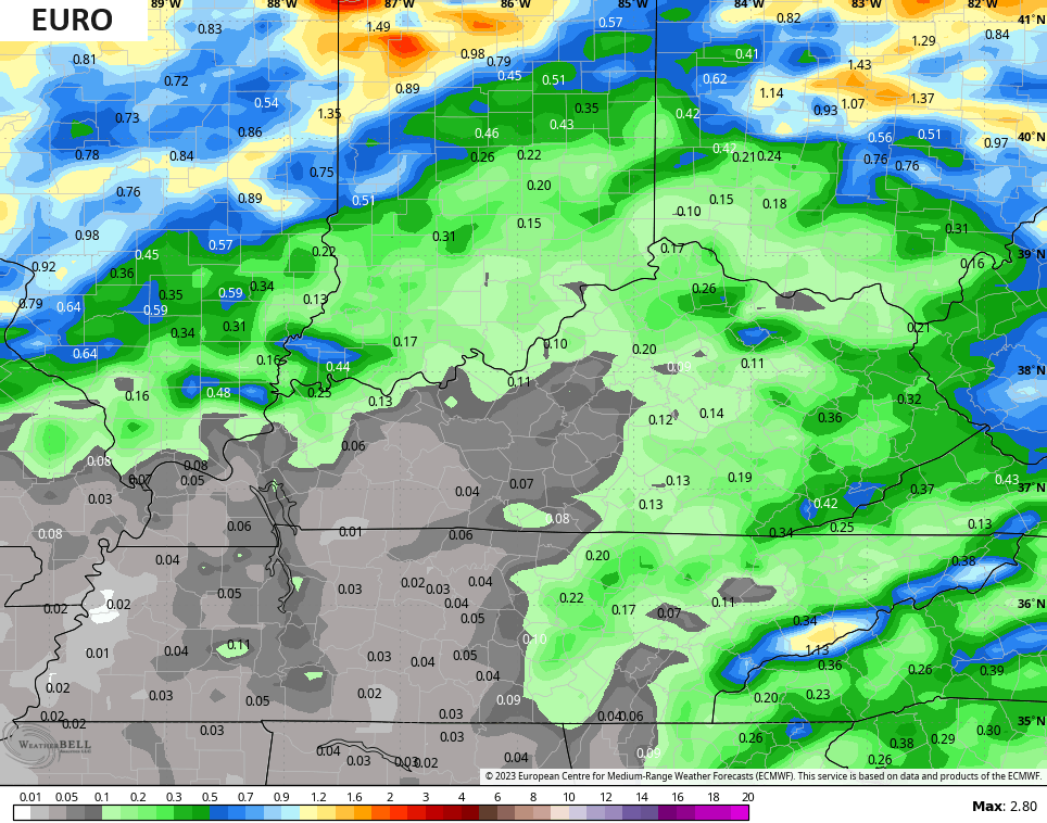
The EURO is a bit stingier…
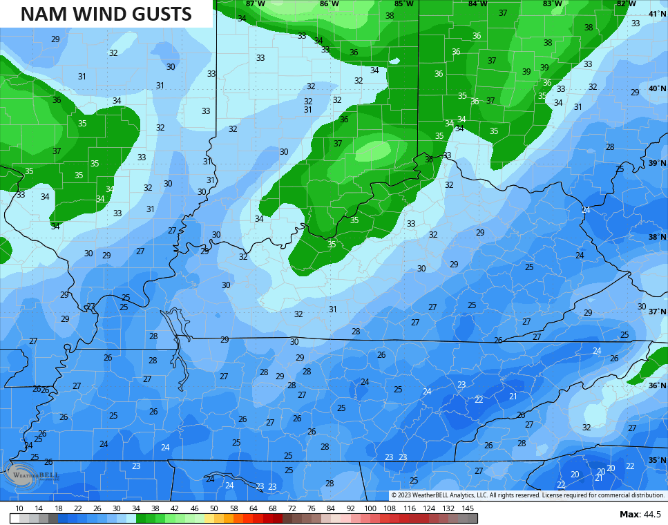
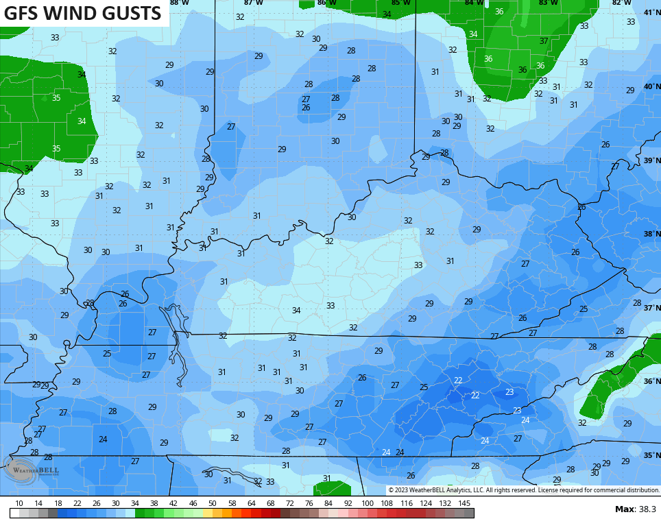
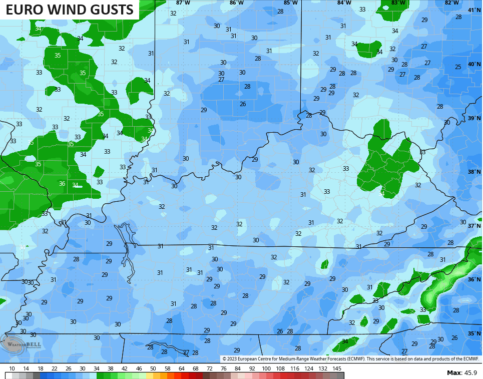
Winds are a big player with this whole setup. Gusts Friday night can reach 30mph-35mph at times with gusts of 20mph-25mph will be common later Saturday and Sunday.
All models are showing the peak gusts in excess of 30mph…
Temps then stay in the 50s for highs Sunday through Tuesday on this much colder than normal setup.
Have a great evening and take care.

Thanks for the update.
I would like to see some beneficial rain.