Good Friday to one and all. It’s a really mild day across the region as a strong southwest wind kicks up ahead of a major fall storm system. This rolls in tonight and Saturday and unleashes another blast of November air that hangs tough into early next week.
Let’s get to the breakdown of how things are likely to play out:
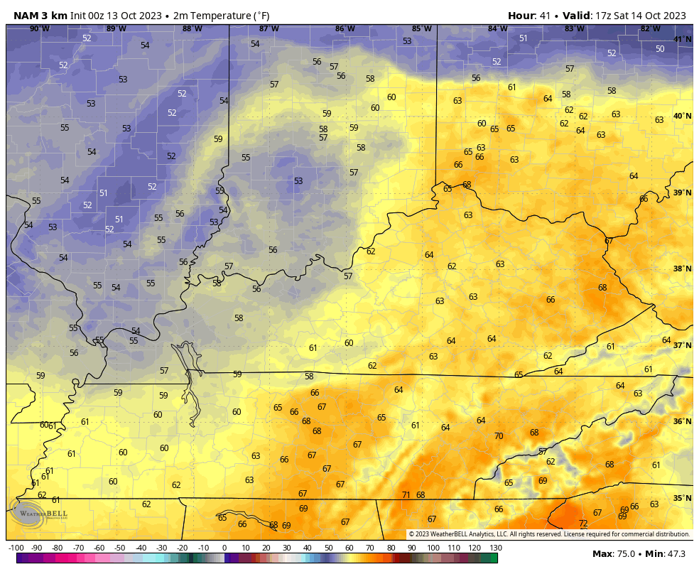
- Temps today make a run into the 75-80 degree range for many with a strong southwest wind. Clouds increase during the afternoon.
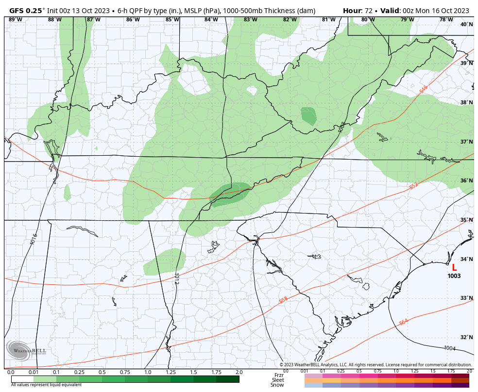
- A few showers and rumbles of thunder get into western Kentucky during the late afternoon and early evening. That line then rolls eastward overnight into Saturday morning, but it’s not a lot of rain.
- Saturday features a mid morning to early afternoon break in the clouds, but that won’t last long. Clouds crash back in from the northwest and will bring some showers in during the afternoon and evening.
- A few showers will be scattered throughout the region Saturday night through Sunday night as a strong north to northwest wind kicks in. Believe it or not, some lake effect rain showers will be possible.
- Winds are a major player this weekend. Gusts tonight and early Saturday can spike to 30mph-35mph at times. Gusts Saturday through Saturday night will be in the 20mph-25mph range before coming down into the 15mph-20mph range for Sunday.
- Temps Saturday start in the 60s then drop quickly into the 50s from northwest to southeast during the afternoon and evening. Highs for Sunday stay in the 50s.
- A few scattered showers hang around for Monday and Tuesday with temps staying in the 50s for highs.
Watch the temperature slide from Noon Saturday through 11pm Saturday…
The upper low actually drops through here late Sunday and Monday, increasing the overall shower potential. If you look closely, you will even see some wet snow in the Appalachian high ground from West Virginia to western North Carolina…
Temps underneath all this may not even get out of the 40s across the eastern half of Kentucky on Monday. This temp animation goes from 8pm Sunday through 8pm Monday…
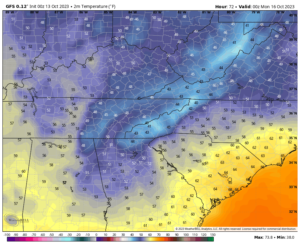
Another month from now and we would be talking about a light snowfall from this same kind of setup.
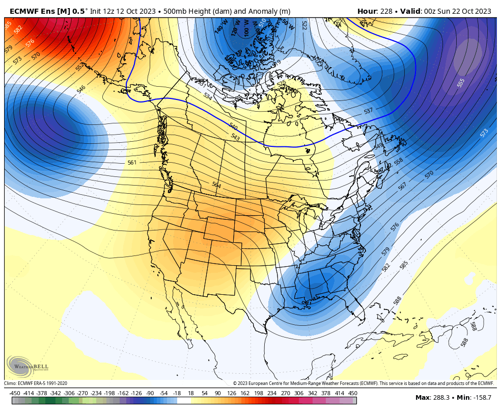
The next system arrives late next week into next weekend with the timing bouncing around on the models. Regardless, the overall pattern continues to favor a deep trough in the eastern US as evidenced by the EURO Ensembles starting next weekend and going through October 27th…
The Control run of the EURO WEEKLIES shows what the smoothed out average of the EURO WEEKLIES Ensembles are trying to show. This is a 30 day average that starts October 24th and rolls through November 25th…
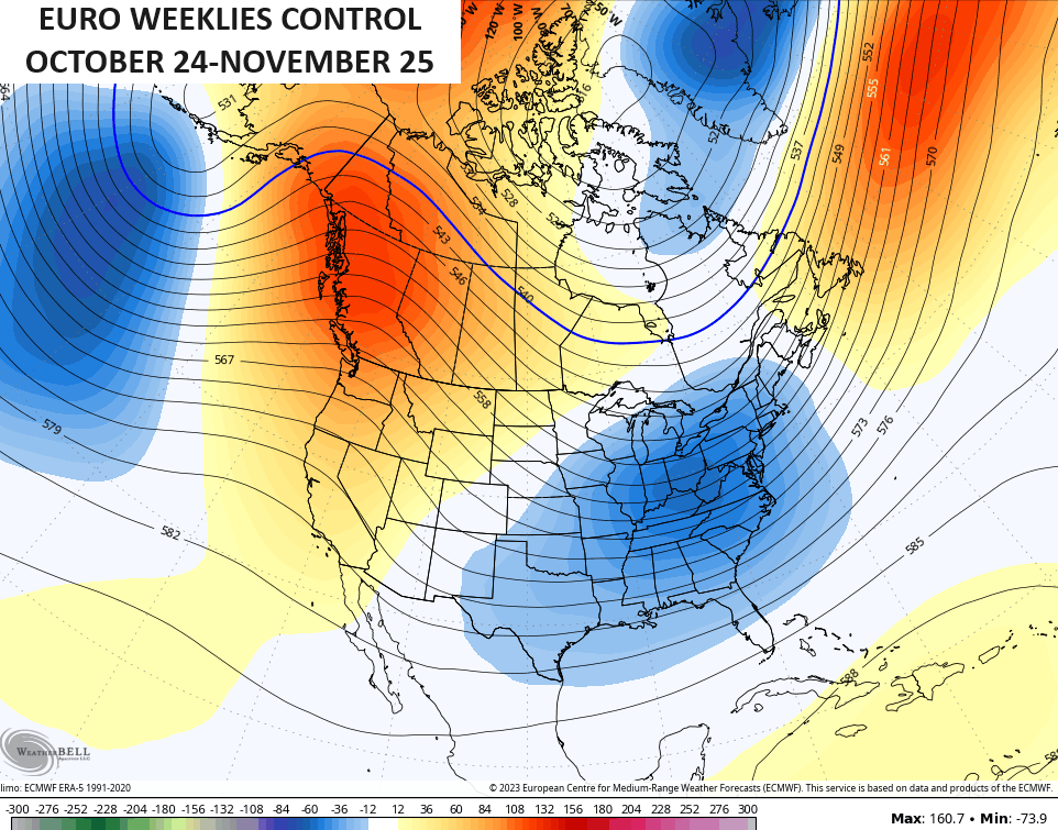
Look where the heart of that trough is… right on top of our region into the east. This has been a familiar sight since late spring and early summer. Look at the average 500mb height anomalies from this past June through September…
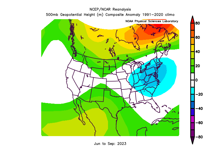
This has been a VERY steady overall pattern for our region for months now and it looks to continue through much of the rest of fall, at least. If we can keep that rolling right on through winter, then cold and snow lovers are in business!!
I will have another update later today, so check back. Until then, I leave you with your radars to follow the showers and storms in from the west…

Have a fantastic Friday and take care.

If the amount of snow this winter relies on a precipitation pattern we’ve been experiencing, then it’s going to be flurries with a couple of inches here and there. Will die-hard snow lovers be satisfied? Doubtful.
Thanks Chris. Sure has been Beautiful Weather. I just wish the rains would hold ( that are now in Western Illinois ) when the line reaches Kentucky. This may be our only chance for another week or so. It is very dry even for this time of the year.
The Winter still could be Cold and Snowy. As Chris and Joe from BG said the warm waters of El Nino have extended far out into the Pacific. I also found out the PDO will turn positive sometime this Winter. Then we will see El Nino’s full impact on the World’s Climate. Hopefully, we will receive one or two of those Heavy , Wet Snowstorms. Don’t really know.
Northern IL and the Chicago Metro Area are right in the bullseye for a steady, soaking rainfall this afternoon and evening. Many areas here will receive between two and three inches of rain by Saturday morning.
I wish we could receive Rains like that here. Maybe when El Nino kicks in. Don’t know.