Good Sunday, folks. It’s another chilly and windy day with scattered showers roaming about the region. It’s the “straight outta November” pattern I’ve been yapping about for some time now. This rolls into the early part of the upcoming week before we focus on another big system by week’s end.
Highs today are back into the 50s with gusty winds that can top 20mph at times. This gusty wind adds a little more bite to those already chilly temps.
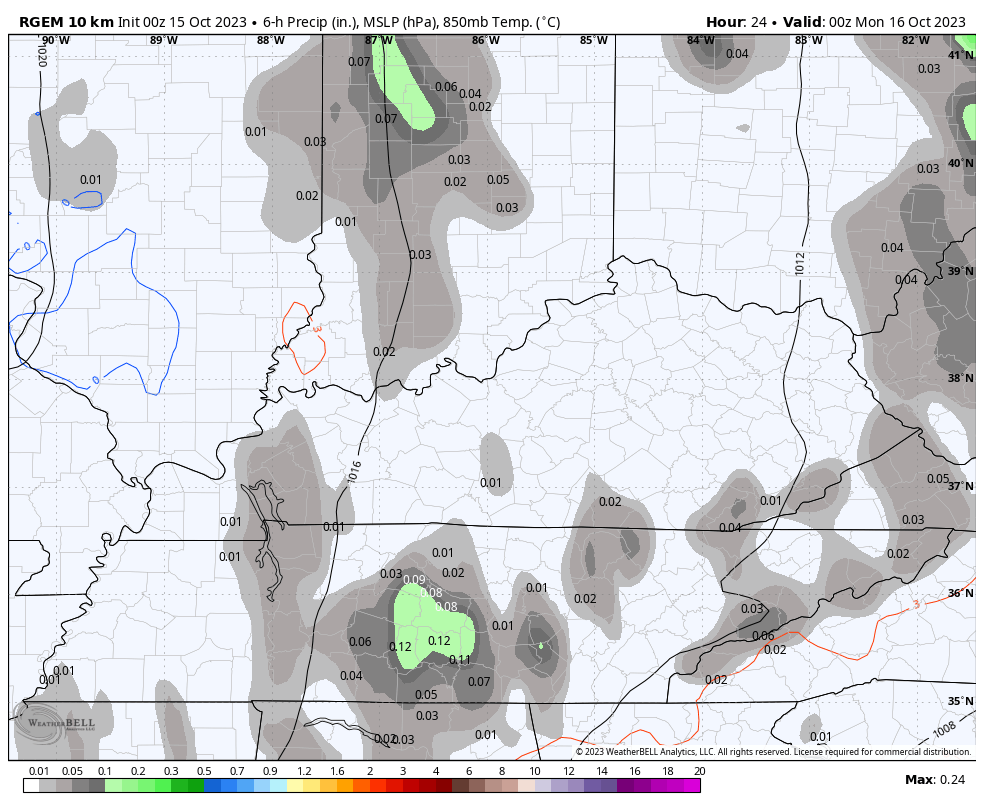
A few showers will continue to drop in from the north today and will be fairly scattered early on. Pockets of mist will also be noted. Expect all this action to begin to increase late today and tonight.
In the meantime, here are your radars to follow along with what’s out there today…

Just like with Saturday’s rains, a lot of this won’t be showing up on radar.
I mentioned an increase in rain tonight and Monday and this comes as the pocket of coldest air aloft passes right on top of us…
This same setup in the wintertime would be producing multiple light accumulating snow events over a 3-4 day span. Heck, a month from now would be producing, at least, one light snowfall.
High temps on Monday are just downright cold for the middle of October. The numbers across central and eastern Kentucky range from the mid 40s to low 50s…
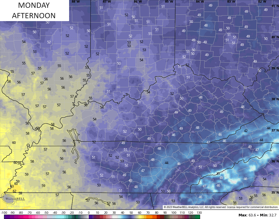
Gusty winds make it feel even colder!
Leftover showers taper off on Tuesday with another chilly temperature day, but it won’t be anything like Monday.
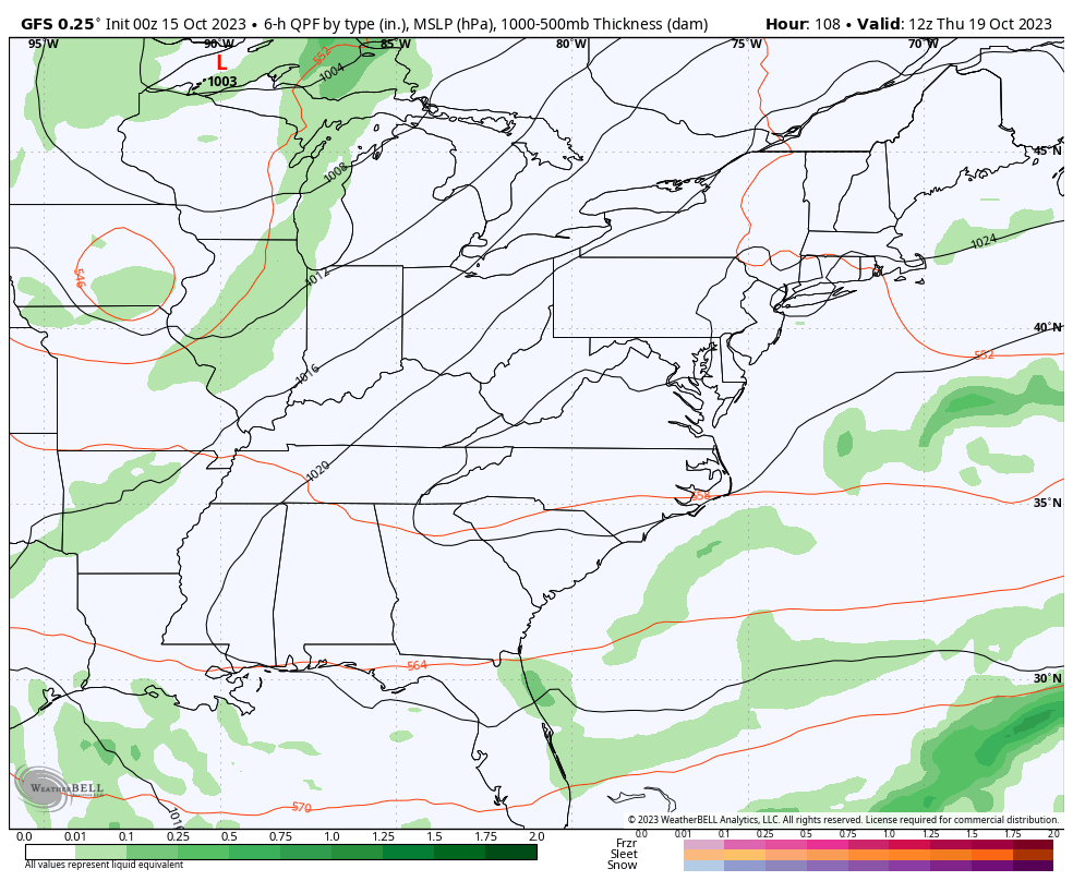
Those numbers climb to seasonal levels for Wednesday and Thursday as we get set for the next big storm system to roll in here. The models are having their usual timing and placement issues from this far out, but the signal is strong for an intense east coast storm system and potent upper level low.
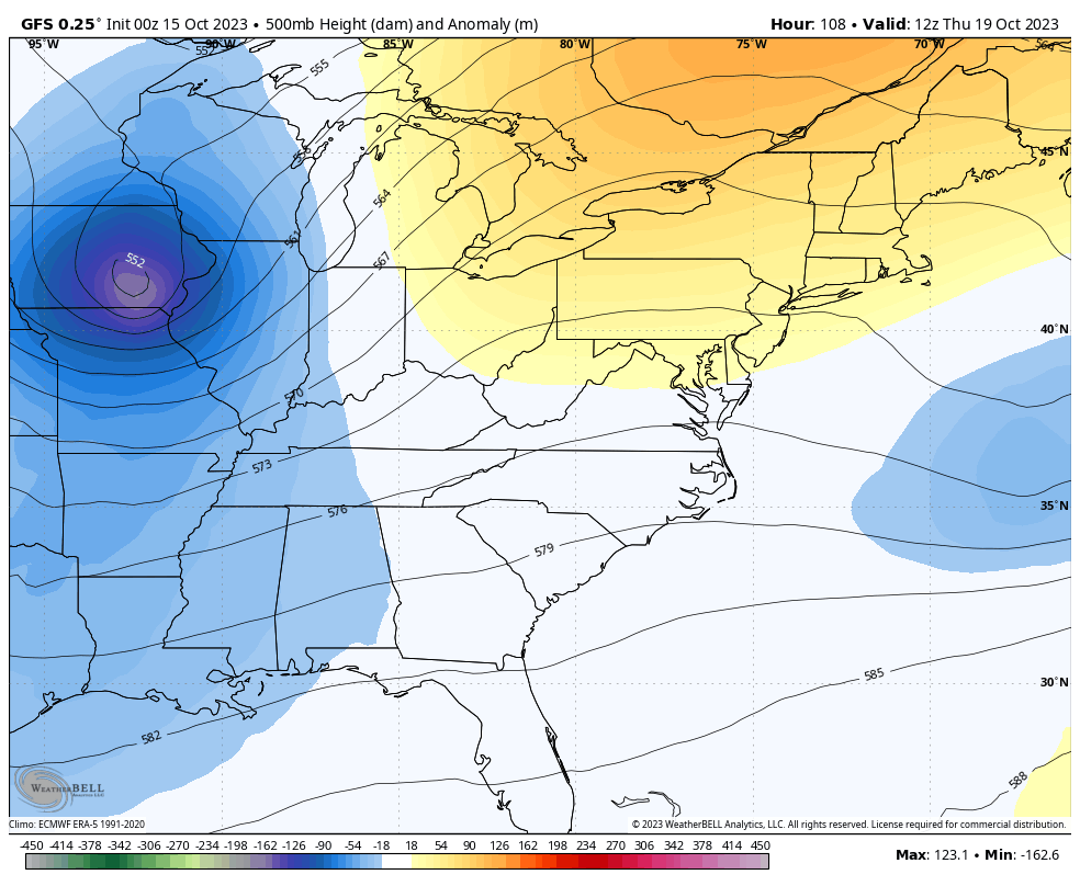
At the surface, we find a big eastern US storm system with the potential for a clipper-like system dropping in behind it…
I’ll have another update later today. Make it a great Sunday and take care.

Thanks Chris. Nice Fall like Temperatures. I just wish we would receive the Rains other areas of the State have had. Only .19 ” for the month of October and 35 ” for the year so far. The average yearly Rainfall for my area of Kentucky is 51. ” I’m hoping we will have more chances of soaking Rains as we enter late Fall. Again don’t know.
Having some accumulation of Snow on Thanksgiving week would be festive. With El Nino in play, could happen.
Yesterday’s “rainfall” amounted to a total of 0.01″, most that in the form of drizzle. The equatorial Atlantic remains active in the form of two tropical depressions, but they pose no threat to North America, due to strong shear and vorticity in the central Atlantic from El Niño, which is pushing anything that makes it to the vicinity of the Leeward Islands sharply to the north.
Temps are still not forecasted to get below 32 in Louisville for at least another week.
Which is good because I need to move some plants inside.