Good evening, everyone. It’s another dreary day across the Commonwealth and we have one more before we catch a brief break. Behind this break comes another big blast of November by the end of the week and into the weekend.
A few light showers continue out there this evening, especially across the east and southeast. The rest of the region just sees a little mist or drizzle from time to time. Here are your radars to follow along…

Tuesday will feature more of the same with clouds, chilly temps and isolated showers for central and eastern Kentucky. Highs stay in the 50s once again, with the west doing best by hitting the 60s.
Wednesday gets us back to normal with a mix of sun and clouds. Those clouds are ahead of the next big system blowing in by later Thursday and Friday.
A cold front moves into the state and slows down on Thursday. Low pressure then rolls along this boundary Thursday night and Friday, enroute to becoming a big fall storm for the east…
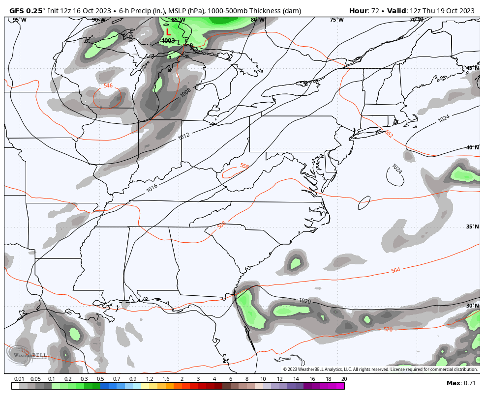
A storm track like that would make some folks happy in the wintertime.
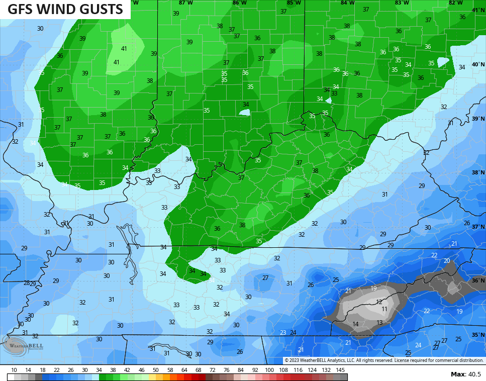
Winds are a big player with this system, especially right alone the front. Gusts may approach 40mph Wednesday night and early Thursday…
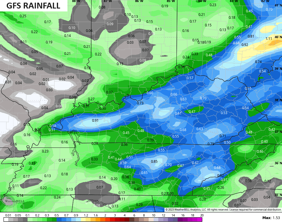
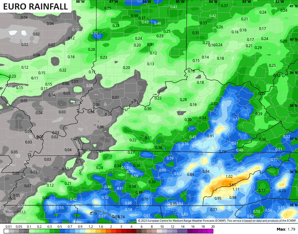
We need some rain and this looks to deliver some decent totals for central and eastern Kentucky, especially.
The GFS is the most generous…
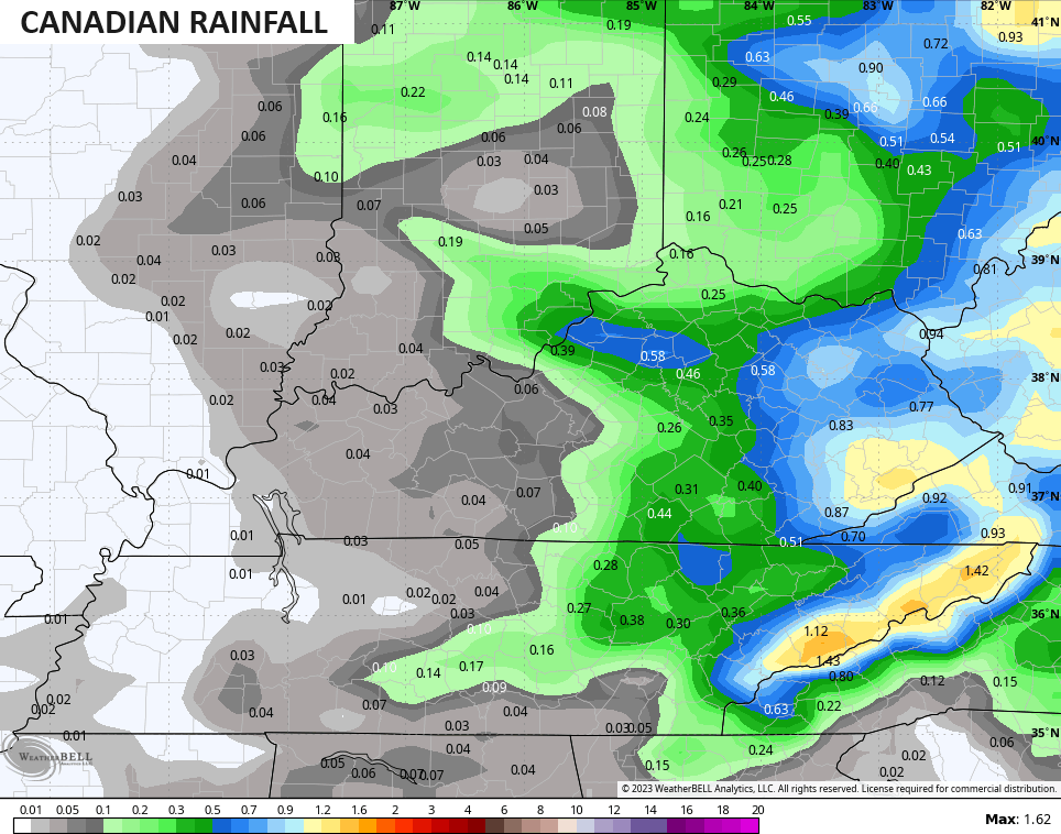
The Canadian isn’t too far behind…
Then we have the EURO…
This comes with more in the way of November temps from late week through the weekend and into early next week.
The pattern looks to relax some by the middle of next week and may turn mild for a few days before we see another trough advancing in toward Halloween Weekend…
I’ve got a new seasonal model for the winter to dive into with my overnight post. I’ll see you guys then. 🥶🥶❄️
Have a great evening and take care.
