Good evening, folks. It’s a really nice evening across the Commonwealth as we get set to track big changes over the next few days. These changes come from a cold front crossing the state with gusty winds and much-needed rains.
This front becomes very active as it gets into central and eastern Kentucky Thursday night with wraparound showers into Friday. Here’s the progress of it all…
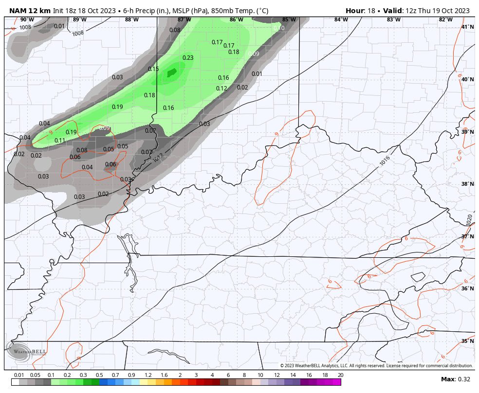
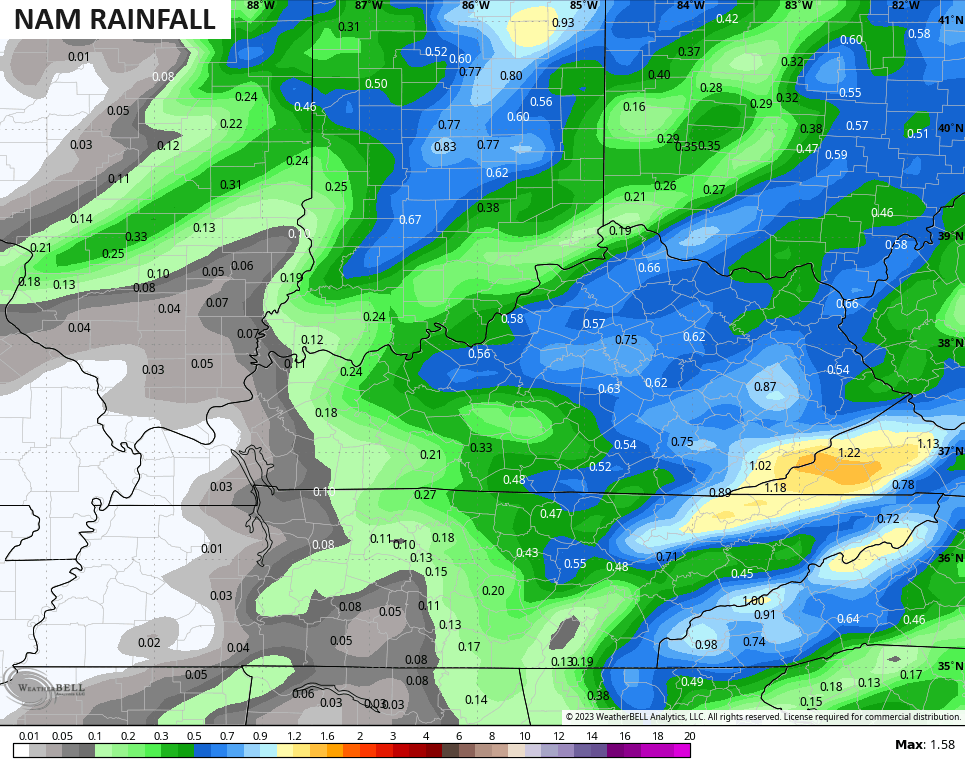
Those beneficial rains are really showing up on some of the short-range models. The NAM is among them…
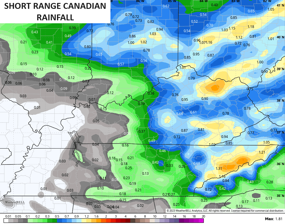
The Short Range Canadian is even more robust…
Other models aren’t that wet, so let’s hope the above models are onto something.
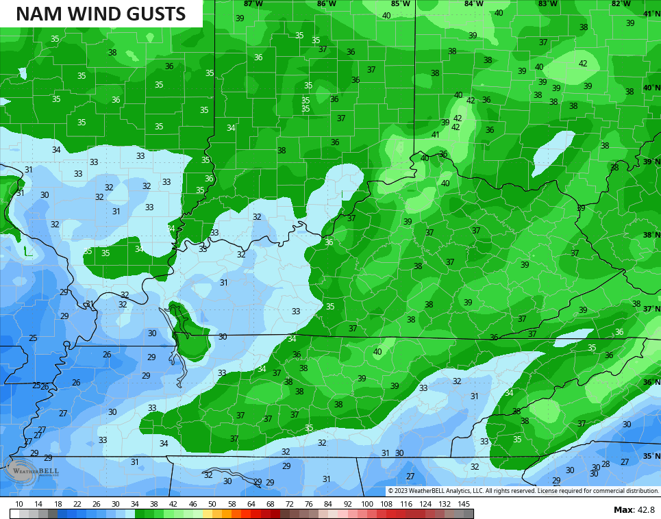
Winds a are a big player with gusts that may reach 30-35mph at times over the next 24 hours. The NAM fam continues to advertise some 40mph gust potential…
A clipper can bring a few more showers in here on Saturday, but this doesn’t look widespread.
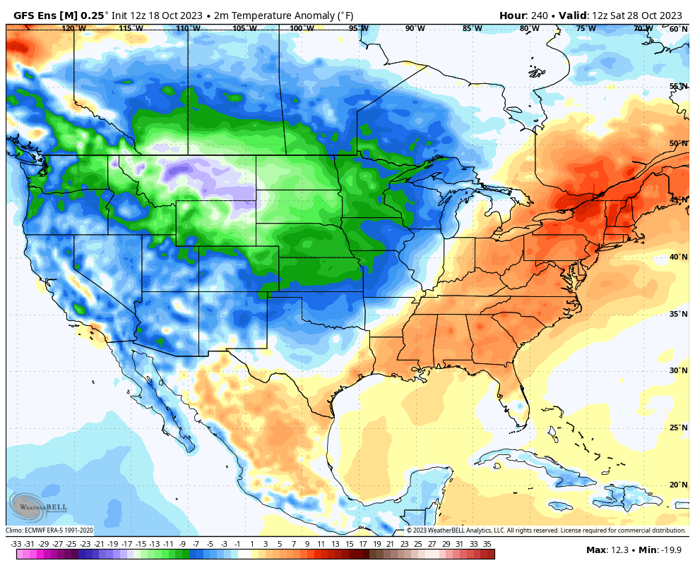
The weather behind all this looks really good next week with mild temps a good bet. This milder air will give way to colder temps coming in at some point late week or next weekend…
Enjoy the evening and take care.
