Good evening, folks. Our much anticipated fall cold front is rolling across the state tonight and it’s bringing gusty winds and some decent rains. This front also ushers in some chillier air as we wrap up the work week on Friday.
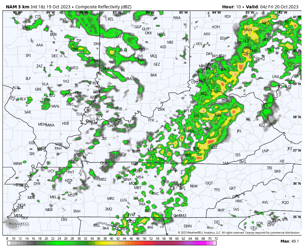
Waves of fast-moving showers and a few thunderstorms continue to sweep from west to east across the Commonwealth, putting down beneficial rains along the way. Here are your radars to follow along…

Gusty showers then continue overnight into Friday before tapering off from northwest to southeast late afternoon into the early evening. The Future Radar from the HI RES NAM show how the bulk of the Friday showers are across central and eastern Kentucky…
Winds are gusty from the northwest, likely keeping temps in the 50s for the eastern half of the state.
Speaking of gusty winds, Saturday can crank some 30-35mph winds once again as a clipper dives in from the northwest. Temps can also spike ahead of this with 70 in the west and south. A few scattered showers then show up in the north and east.
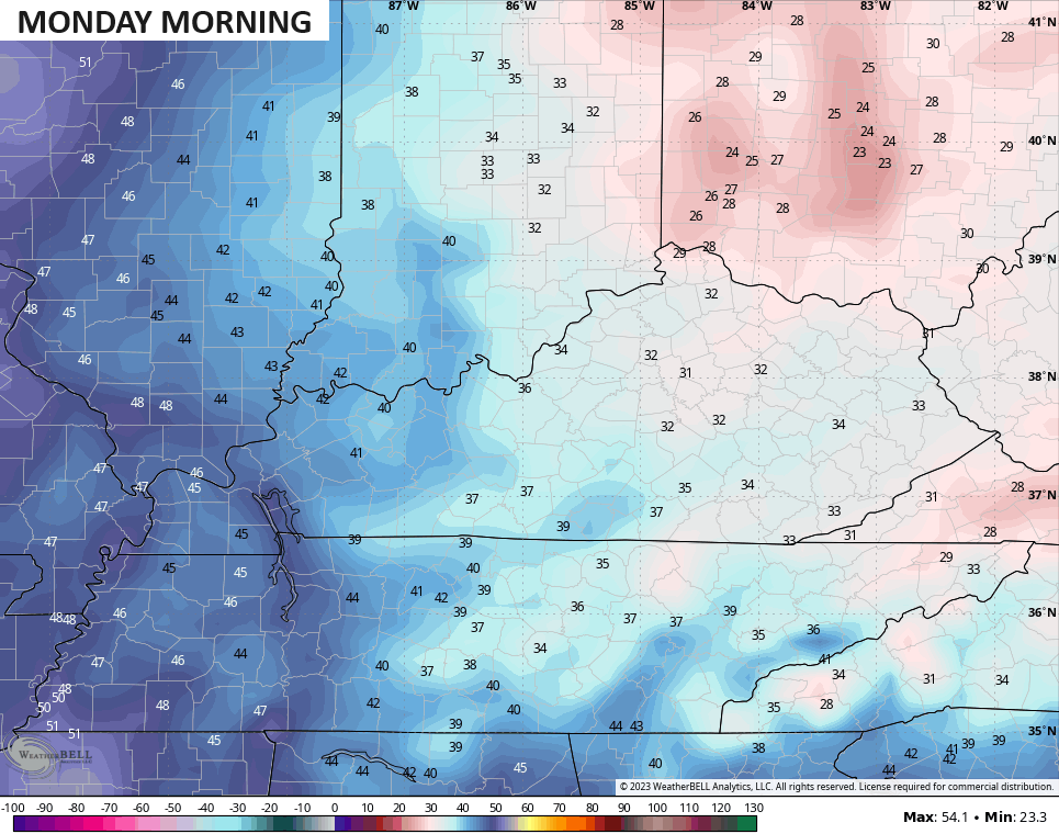
Sunday looks really good, albeit seasonable chilly. This sets the stage for the potential of widespread frost Sunday night and early Monday. Readings may hit 32 or even a bit below…
The numbers climb after this with some 70s showing up for the middle of next week.
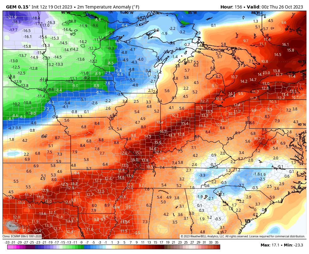
A big blast of cold air is likely to follow this, but when that hits and how it gets here is still in question. The GFS has had a few runs trying to bring one chilly shot at the end of next week with the true cold following next weekend through early November. It has since backed off that idea, but the Canadian decided to trend in that direction…
The Canadian Ensembles are just a bit slower in unleashing the cold air…
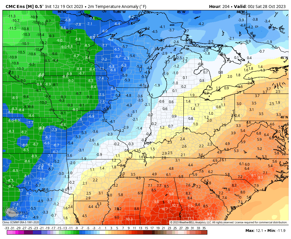
Again, the closing days of October into the first few days of November can get pretty cold.
Enjoy the evening and take care.
