Good Friday, folks. Gusty showers continue today for much of central and eastern Kentucky as a potent system sweeps to our east. This sets the stage for a windy weekend featuring a clipper delivering a glancing blow to Kentucky.
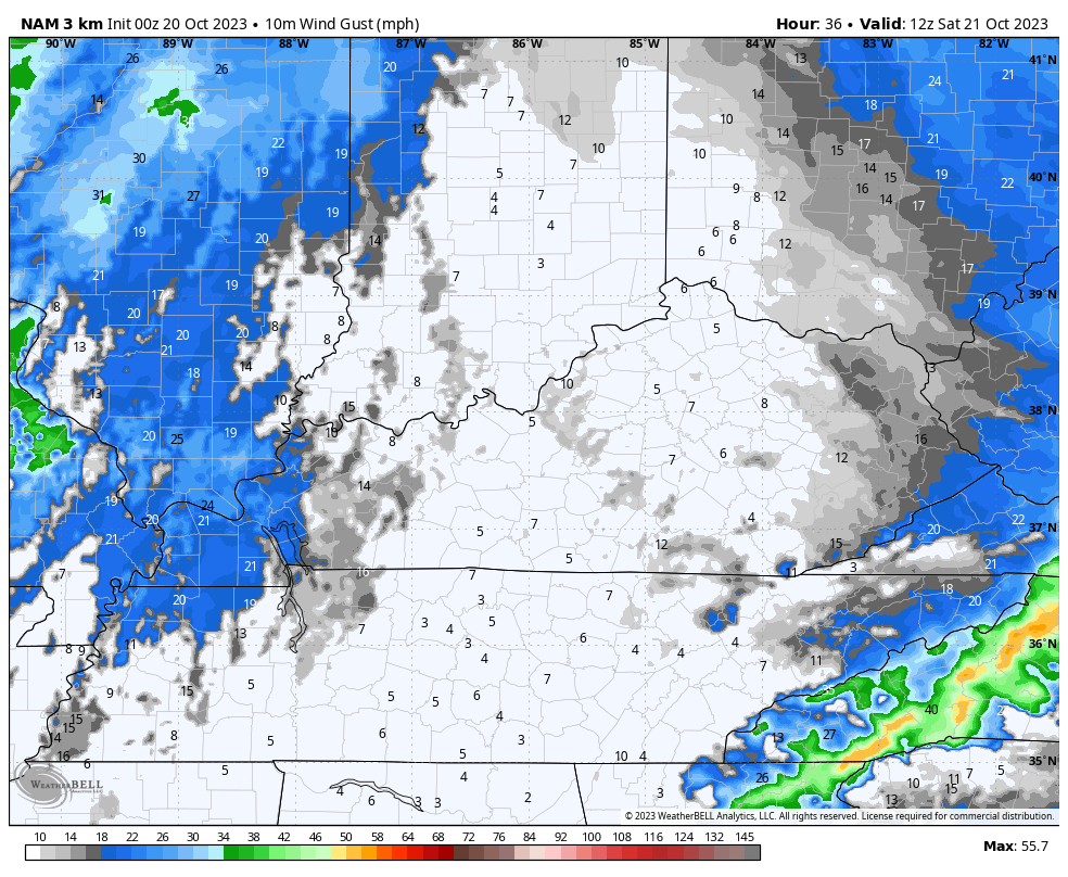
Let’s kick this thing off with the rain out there today. As mentioned, the showers are mainly impacting central and eastern Kentucky as the upper level system drops in from the northwest. This action will be accompanied by gusty winds of 20mph or a little better as a strong northwest flow kicks in.
The showers will become much more scattered from northwest to southeast this afternoon and evening with much better weather across the west. Here are your radars to follow today’s action…

Clearing skies settle in overnight with upper 30s and low 40s to start our Saturday. With the clipper system hanging just to the northeast of us, it only delivers a glancing blow of some showers to the north and east. Temps will be mild ahead of this across the west and south with 70. Areas north and east will be much cooler.
Winds are another big player and the Hi Res NAM shows gusts of 35mph or better from time to time in this animation that runs from 8am through 11pm Saturday…
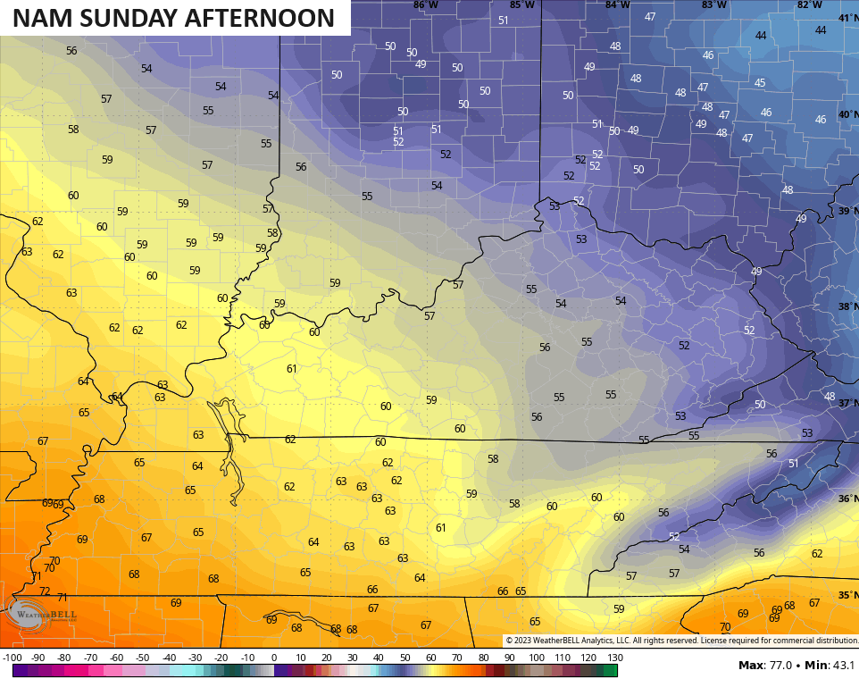
Temps as we head into Sunday will generally be in the 50s for most of central and eastern Kentucky with upper 50s and low 60s in the west…
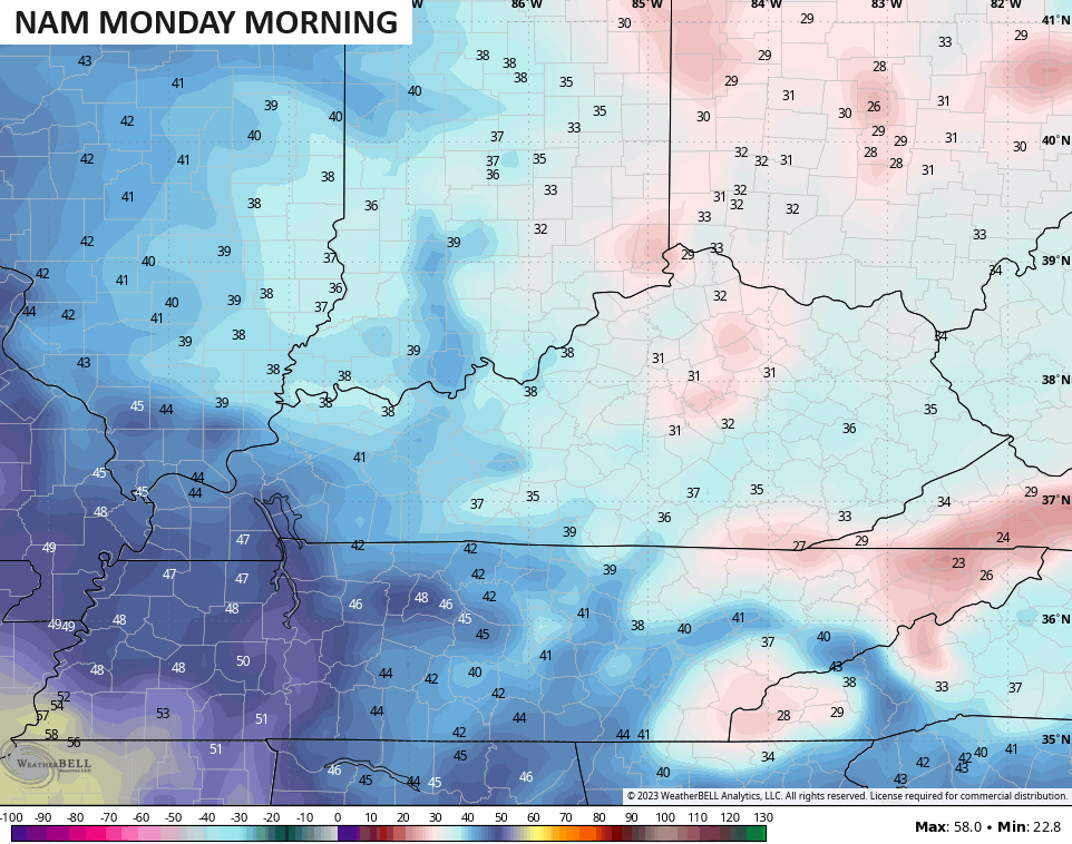
This sets the stage for a cold Sunday night and Monday morning with widespread frost likely. Temps may even drop below freezing…
Much milder temps then take over into early next week with temps making a run toward 70 or a little better by the middle and, potentially, end of next week.
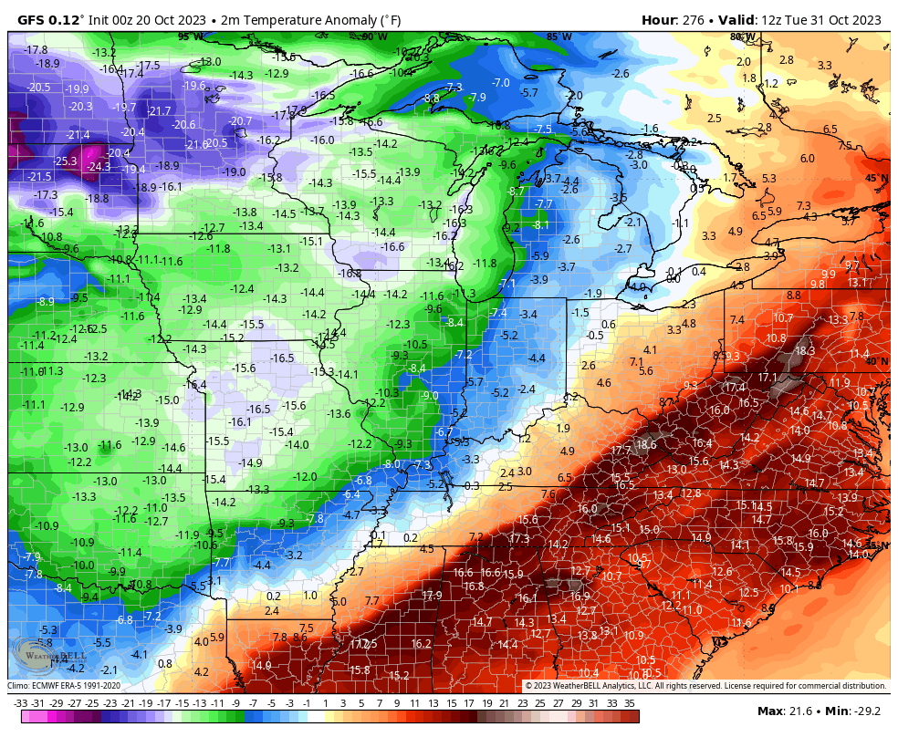
There’s a big blast of very cold air invading the western half of the country during this time. This is going to overwhelm the pattern for the rest of the country, but the timing on this is still a work in progress.
The Canadian continues to bring the cold in earlier than the GFS. This shows the cold settling in by the end of next week and continuing into the weekend…
The GFS is a little slower but brings well below normal numbers in…
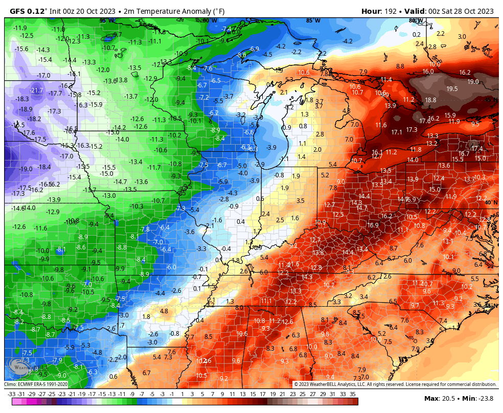
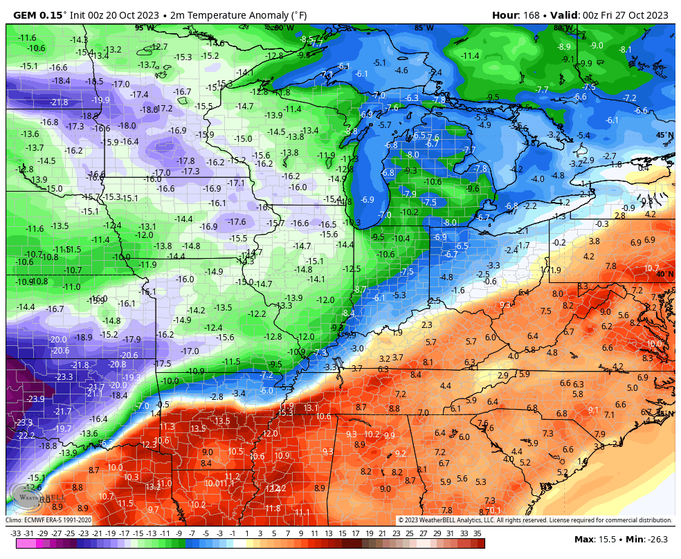
The potential for very early season arctic air to invade the country is on the table as we head into week one of November. The GFS temperature departures into the first few days of November shows this possibility…
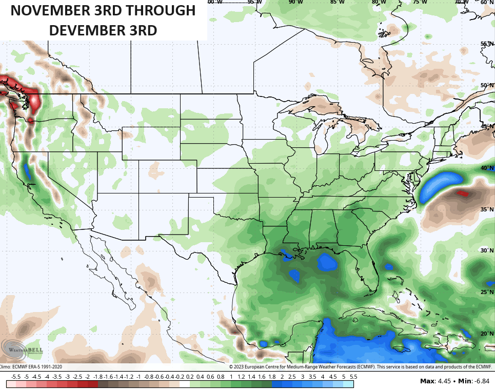
The look for November is one that’s likely to feature much more activity in our region as the storm track becomes active. The EURO Weeklies are going with above normal precipitation November into the start of December…
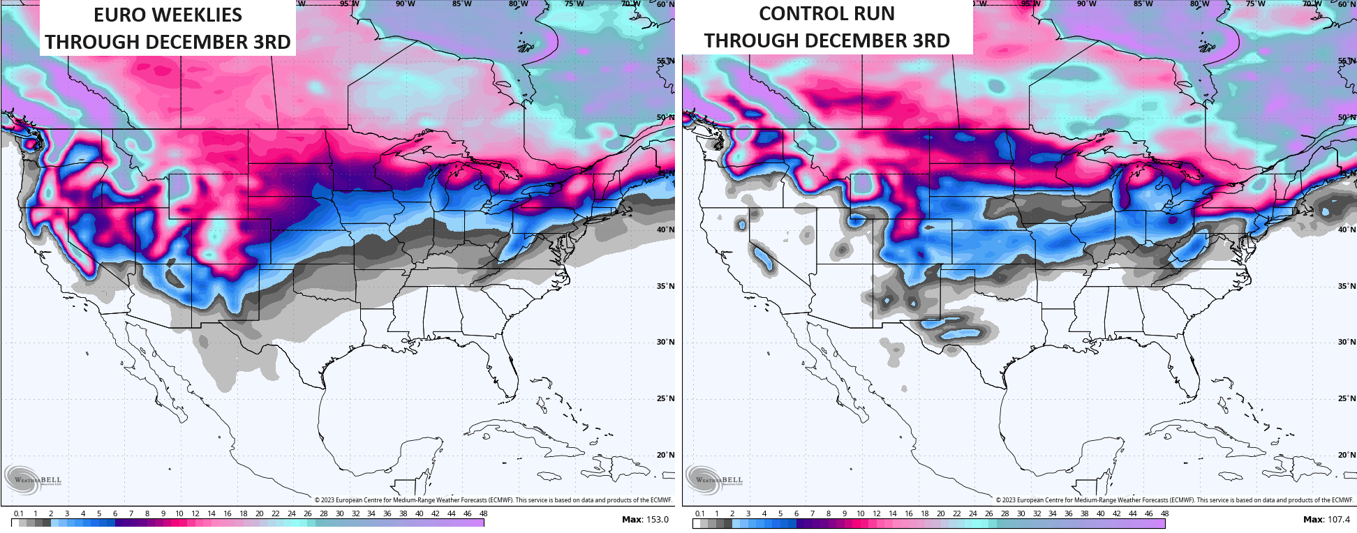
I do expect some of that above normal precipitation to be in the form of snow during that time. The EURO Weeklies and the Control Run of the EURO Weeklies are showing the potential for some flakes during the same period…
I will have another update later today. Have a fantastic Friday and take care.

My PWS near Bowling Green recorded 0.30″ of rain yesterday evening, most of it from a small but concentrated little storm that suddenly materialized overhead, and just as quickly dissipated. We’ll take whatever’s available!
Yes it looks like the rainfall did over performed in Louisville. I will take it.
Looks like the rain is ending, yet we are thankful for the .68” that fell in our yard. Gentle rainfall meant the ground absorbed every drop.
Seeing another eastern Pacific hurricane getting ready to hit Mexico, near the tip of the Baja Peninsula. The stout west to east flow in the mid and upper levels of the atmosphere is another telltale showing that El Niño is flexing its muscle. That same flow is responsible for slowing the movement of eastern and central Atlantic hurricanes, and ultimately pushing them to the NW, then north.
wow we actually had 0.75 of rain. I’m shocked. Definitely overperformed