Good evening, folks. I wanted to drop by for a quick update on the weekend ahead and to take a look into changes showing up as we head into the final week of October and early November.
Before we look ahead, let’s talk about the beneficial rains we picked up across central and eastern Kentucky. Some areas picked up more than one inch of rain…

Isolated showers are winding down across eastern Kentucky. Follow them out of town…

Winds are gusty on Saturday as a clipper brushes the region. Temps in the western half of the state hit the 70s ahead of this system. The 60s show up in the east.
Colder winds kick in for Saturday night and Sunday with highs ranging from the 50s east to 60s west. This sets the stage for widespread frost Sunday night and Monday morning with some areas possibly going below freezing.
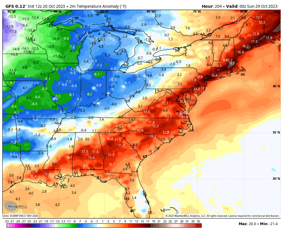
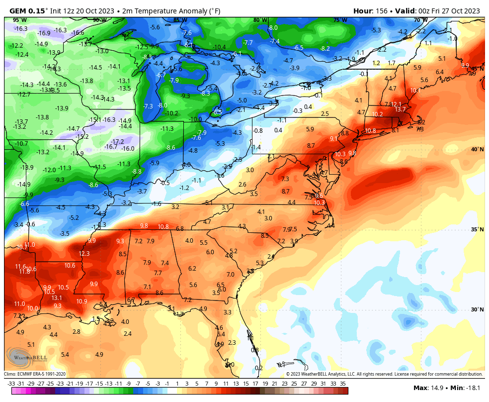
Mild winds then flood the region next week ahead of big time changes showing up by late week and next weekend. A very cold pattern takes over for much of the country and the models are still trying to figure out how we get into it.
The GFS has two big systems leading us into it. The first arriving Friday and Saturday with the other a few days later. Watch the blue on this animation that goes through the first few days of November…

Temps go well below normal with this setup on the GFS…
The Canadian is a little faster with the cold arriving as early as Thursday…
Halloween is looking cold!
Enoy the evening and take care.
