Good Saturday to one and all. Our weekend is a pretty good one for the most part, but we do have a few hiccups to go through today. Once into next week, the temps look to really climb before likely crashing down in the closing days of October.
Let’s kick this KWC party off with the precious present.
A clipper is zipping into the Ohio Valley today and taking a farther north track than what I originally thought several days ago. This means temps can surge ahead of this with 70s across the west and 60s in the east. Winds will gust up and may approach 30mph at times by the late afternoon and evening.
A couple of showers may also graze northern and eastern Kentucky during this time. Your friendly radars are on duty…

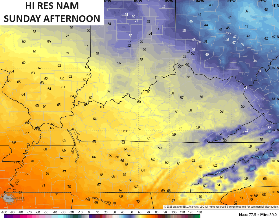
Sunday is a REALLY nice fall day in our region. Highs come way down with 50s across the eastern half of the state and 60s in the west…
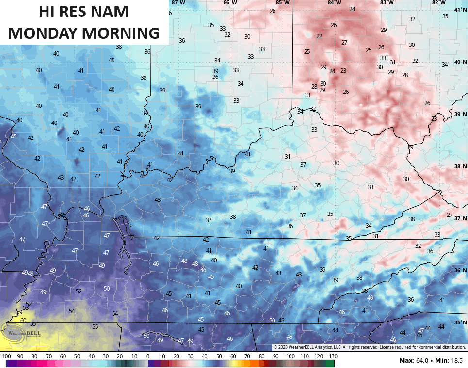
This sets the stage for frost Sunday night and Monday morning. Temps can reach 32 degrees or a bit below with a light freeze possible for some…
It’s the time of year I really start looking at the MJO (Madden-Julian Oscillation). Just what the heck is the MJO? Here’s a quick explanation from NOAA:
” The MJO is an eastward moving disturbance of clouds, rainfall, winds, and pressure that traverses the planet in the tropics and returns to its initial starting point in 30 to 60 days, on average.”
” The location of the convective phases are often grouped into geographically based stages that climate scientists number 1-8″
The different phases have major implications on the overall weather pattern across the United States. The current forecast of the MJO is to for it to briefly go into Phase 6 before heading through Phases 7 and 8…
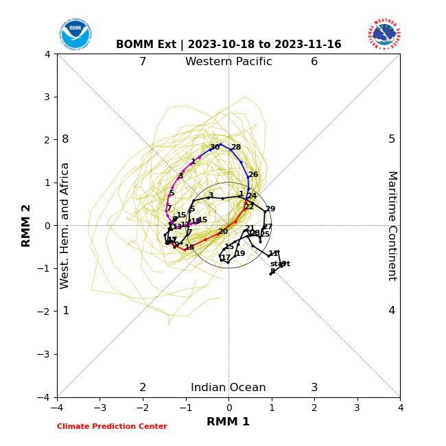
I know that’s a pretty tough plot for most folks to read and understand. The different phases are numbered from 1-8 along the inside of the outer edge. The forecast line that looks like a crazy scribble in the middle has numbers to show the dates for that particular point of the forecast. The part of the line in black is where we’ve been with the bright colors showing the forecast going forward for the rest of October and into early November.
Based on that plot, it has us going into Phase 6 for the week ahead with the line sliding into 7 and 8 by the end of October into the first week and change into the first week November. If we look at the composites for what those phases mean as we enter November, this is what we come up with…
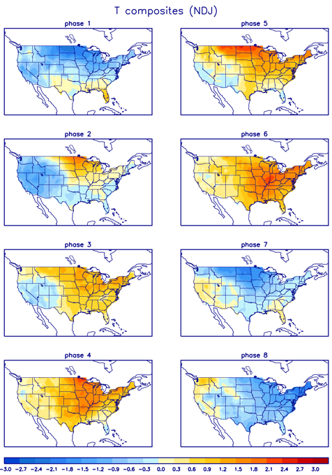
Phase 6 is a warmer than normal look with Phase 7 and 8 turning cold for much of the country. Sound familiar to what I’ve been talking about coming our way for the next two weeks? Warmer than normal into much of the week ahead (Phase 6), with a turn toward cold for the closing days of October into early November (Phases 7 and 8).
Forecast models will struggle on the timing on the change and that’s to be expected, especially with a Hurricane lifting from the Caribbean into the western Atlantic. Say hello to Tammy…

This is likely to turn harmlessly out to see, allowing the pattern to progress smoothly across the country. Still, models will try to keep that thing meandering around longer than it actually will and those models will slow the pattern down a bit.
Case in point was the Friday night GFS. You can see Tammy in the Atlantic with the cold a little slower getting in here…
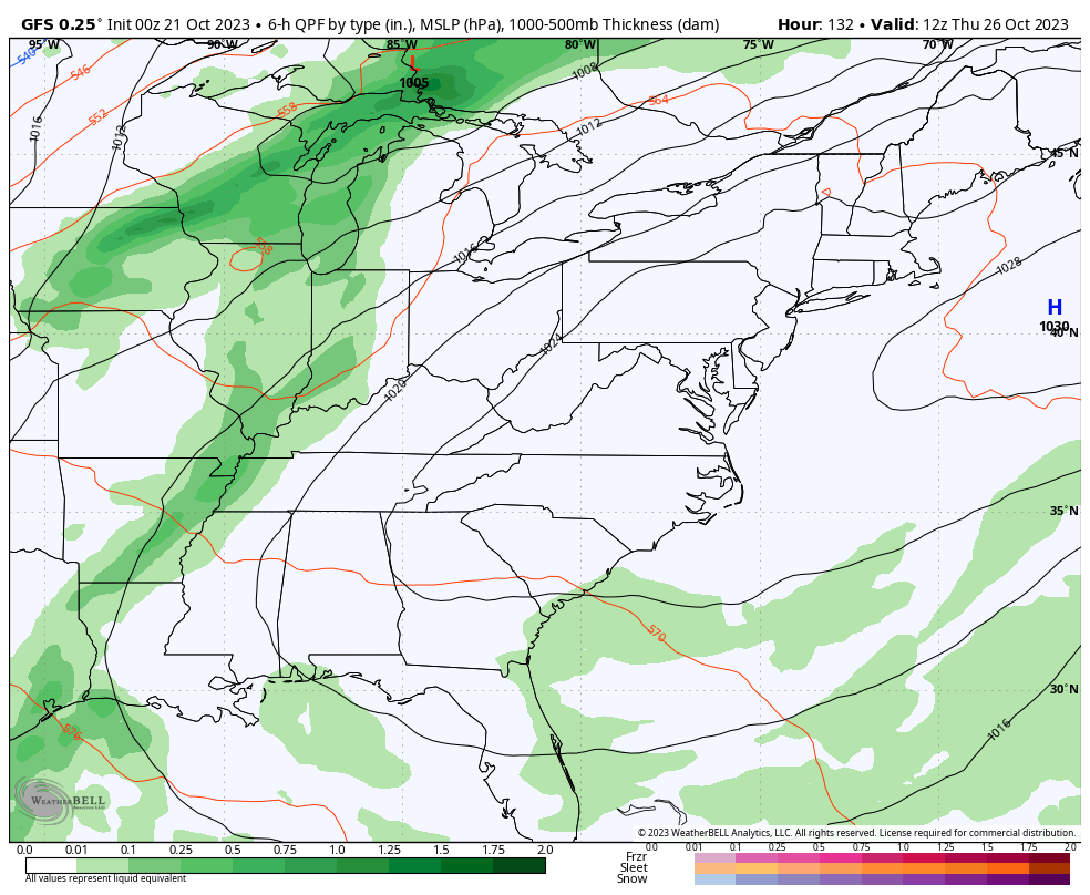
You also notice a little winter with that to start November, but that’s a long way away.
I will have another update later today. Make it a good one and take care.

I don’t care how warm or cold it gets we need much needed rain . But it doesn’t look like the next system later next week is going to provide much moisture either. It’s a pattern that I’m very concerned with
I didn’t think we were going to get much from the last system but we got 0.76…Not enough but definitely not bad either.
Now that we’re into late Oct I expect the rains to return soon
Well I guess I was one of the lucky ones we had some good downpours yesterday. How can you find out how much rain exactly a certain area has???? I wonder how the Halloween forecast will be? I was reading good things possibly coming this winter if you like snow good things but lately I have been reading for winter more of drier and warmer weather for winter has anyone else? I know we have to wait and see but curious if anyone else has been reading that???
Crystal, here’s the link for NOAA’s Winter Outlook: https://noaa.gov/news-release/us-winter-outlook-wetter-south-warmer-north
It looks like a very tame upcoming Winter for the Chicago Metro Area, with above-normal temps and below normal precipitation, just like last Winter was. Heck, you guys in Kentucky might be seeing more decent snows that us here in the Chicago Metro Area, since the storm track will be further south.
Thanks Mike