Good evening, folks. With the weekend wrapping up, I wanted to drop by for a quick update on the pattern ahead as we get set to close out October and roll into November. Some big changes are lurking during this time.
Frost and a light freeze are likely tonight across central and eastern Kentucky. Some of the colder valleys will drop into the upper 20s. The rest of the region bottoms out in the low and middle 30s.
The week ahead continues to be dominated by above normal temps. This will be a really warm spell kicking in Tuesday and likely going into the upcoming weekend. Highs in the 70s will be common with 80 in a few spots, especially in the west.
The threat for some showers and storms will show up by late Thursday and Friday, with the bigger system holding off until late Sunday or Monday.
Hurricane Tammy is clogging the pattern a bit as this system slowly weakens and drifts toward the west by the second half of the week…

The hurricane models are showing the slow movement of Tammy very well…

The GFS Ensembles also show the meandering storm that drifts around Bermuda for a few days before trying to turn back to the northeast…

You do see a couple of the members taking whatever is left of that toward the southeastern coast, but that isn’t the preferred solution as of right now.
The cold air coming into the Rockies and Plains is REALLY cold for this time of year and it slowly spreads eastward this weekend into Halloween, sticking around into the first week of November.
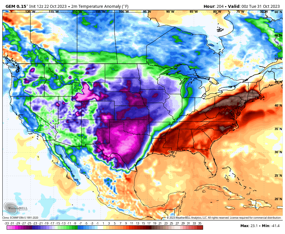
The EURO and Canadian Models are similar with the progression of the cold…
Canadian
EURO
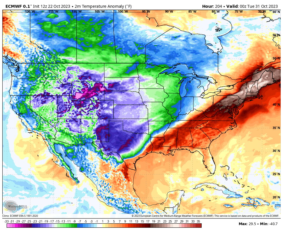
Those are some serious temperature departures for any time of year, let alone the end of October. This looks like the first time since spring that we wipe out the heat that’s gripped the southwestern part of the country.
Make it a great evening and take care.
