Good Monday to one and all. It’s a frosty start to the day but we have some serious mild air on the way for the rest of the week. This comes ahead of a big change to cold as we get closer to Halloween and into early November.
As mentioned, frost is out there in many areas this morning with a few spots in the upper 20s for a light freeze. The rest of the day features temps running in the mid and upper 60s eastern Kentucky to low 70s west.
Temps starting Tuesday will hit the 70s statewide and they will continue to run mild for the remainder of the week. A few 80 degree numbers will likely show up, especially in the west. This comes with a mix of sun and clouds. Overall, this is some great weather to get out and see the peak of the fall colors!
While we are basking in mild air, the Rockies and Plains states will be invaded by honest to goodness wintertime temps. This cold will be slow to roll our way, likely because of what’s going on in the western Atlantic. This is where slow-moving Hurricane Tammy continues to slowly churn…

We continue to find the hurricane models and the ensembles keeping this system meandering around Bermuda as it weakens quite a bit from where it is now…
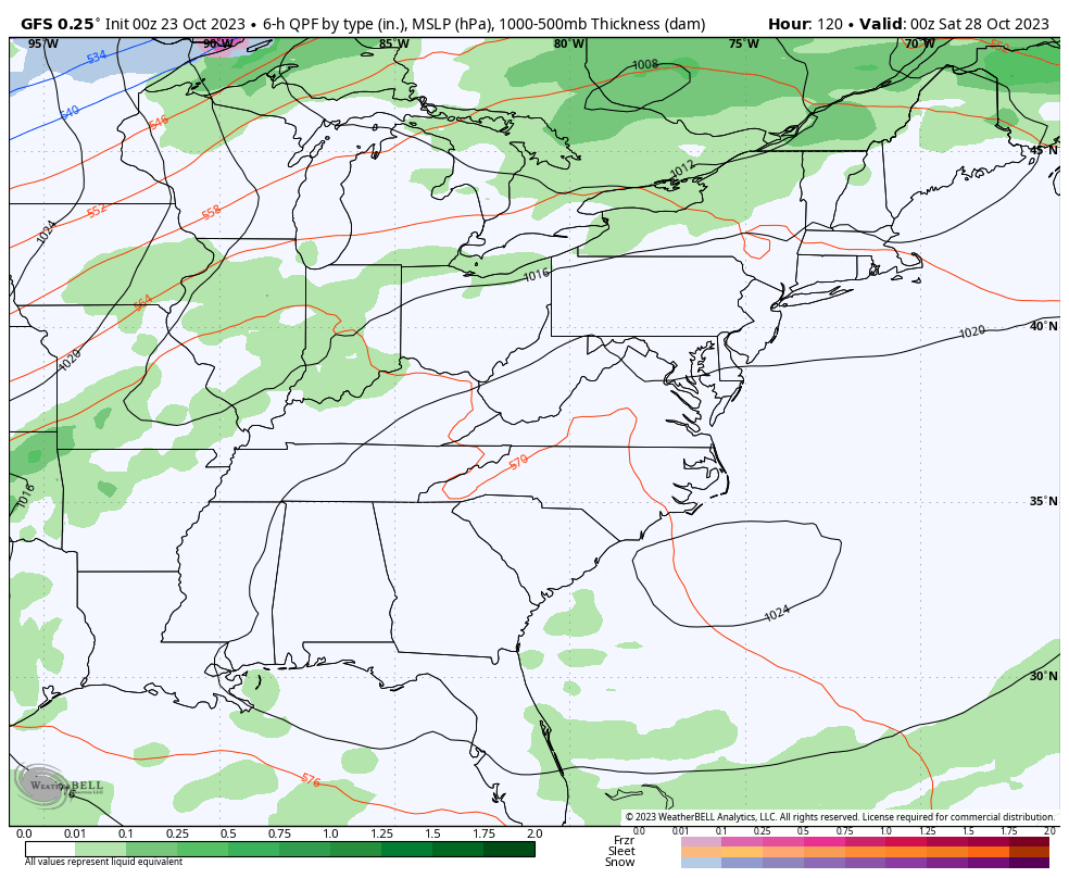
HURRICANE MODELS

GFS ENSEMBLES
What does all this mean for our weather?
We get the first chance for some showers Thursday into Friday as gusty winds crank as a boundary slides close to us. This slows down with waves of low pressure developing along it over the weekend and early next week.
This scenario likely brings gusty winds and showers and storms before cold air crashes in. The timing on that cold air crashing in is still a work in progress as the models try to figure it all out.
The GFS runs 4 times a day and gives us 4 different solutions each day. This is something that typically happens during the cold weather months, so that tells you a little something about the cold coming in.
The overnight run of the GFS even has a little flake action with the cold coming in as Halloween ends and November begins…
That looks way too strung out to me as the cold is likely much more powerful than the GFS sees.
The Canadian is seeing this cold slamming in here just a bit later than the GFS…
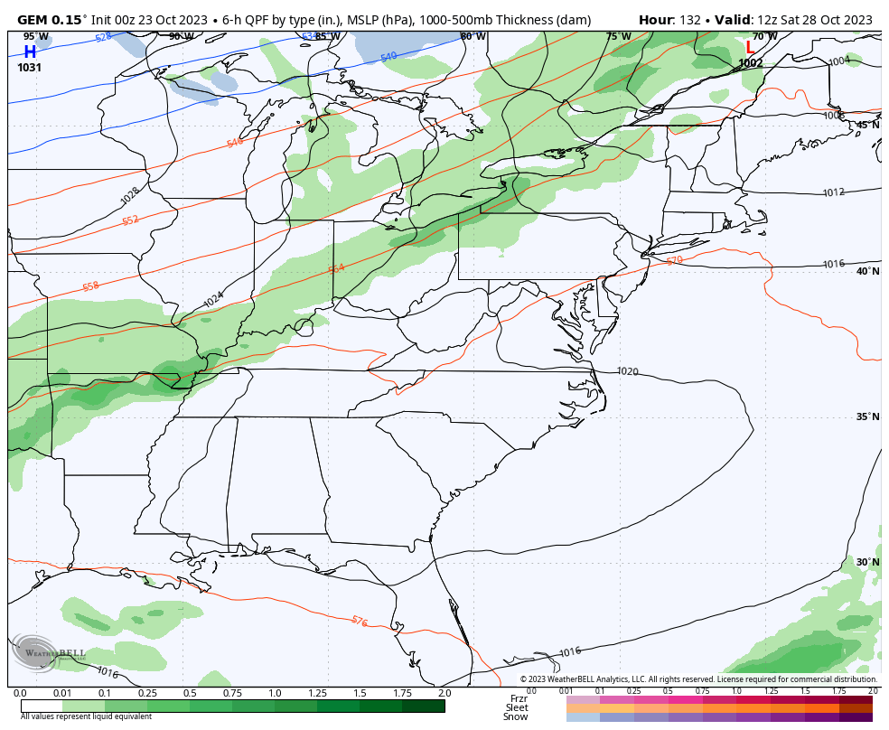
That also brings a few flakes nearby to start November.
I’ll drop by for another update later today so check back. Make it a great Monday and take care.

I have a question how does the hurricane that’s far away from us slow down the cold getting here?
The way I understand it Crystal is that steering winds in the central Atlantic blow primarily in an east to west and southeast to northwest direction, and when hurricanes are directed towards the coast, they act like a block, slowing down the normal west to east movement of weather systems over the continental US.
The thing that the models don’t seem to be picking up is that those central Atlantic steering winds are currently blowing from south to north, and then southwest to northeast, which will tend to push Tammy away from the coast. It may a bit further west, but it will weaken considerably and eventually pushed north and then northeast.
Thanks Joe. I never knew weather was so interesting.
I never knew this either until someone on this blog mentioned it and I started noticing that indeed our pattern gets so BORING during tropical season…It can be a different story if the storms are in the gulf…but this year they’ve mostly been Atlantic.
What’s ironic about this is the fact that El Niño and La Niña are both based on temperature anomalies, which means that their effects are more predictable. But the area of water upon which ENSO is a relatively small segment of Earth’s oceans, therefore because ocean water temperatures world-wide have increased, Programmers of forecasting software will need to take a hard look at their algorithms!
Excellent explanation as to What is going on in the Atlantic Joe. I read that the Atlantic Multidecadal Oscillation, may stay positive some years to come interrupting our normal weather cycles from year to year. Which would mean more La Nina events in the future.
My fear Schroeder, is that because the extensive amount of warmer than normal ocean water temperatures, and the fact that water represents ⅞ of the total surface area of the planet, the effects of warming on many of the ratios that we have depended upon for so long, has made them unreliable.
That is absolutely right on Joe. The warmer than normal SST of both the Pacific and the Atlantic will have a say in this Winter’s outcome. I just wonder what areas will get the Snowstorms this Winter ?
Thanks Chris. Many areas in the Northeastern part of the State saw their first or second Frost / Freeze ending their growing season. I had a low temperature of 39 degrees with No Frost. My area may get through the entire month of October without any below freezing temperatures.
Looks to be a nice stretch of weather this week. That’s good because my Family is visiting. Hoping for Rain next week. The Colder weather, I read won’t last too long. I expect more of the same in the month of November. Doesn’t seem like the overall weather pattern is changing.
Schroeder you should have nice weather this week when your family visits. I wonder how Thanksgiving weather will be? Too far out I guess to know yet.
Thanks Crystal. My Family and I always a Great time. Sure is perfect weather today. Should hold on through the week. Not sure how the weather will be at the end of November ?