Good Wednesday, all. Our mild pattern continues out there today and sticks around for the rest of the week before changes slowly show up. Rain chances press in as early as Friday with a big storm system arriving late this weekend. That unleashes some really cold air for Halloween into early November.
Temps today and Thursday are deep into the 70s with a gusty southwest wind to go along with a mix of sun and clouds.
A few showers look to show up around here by Friday as a cold front approaches from the northwest.
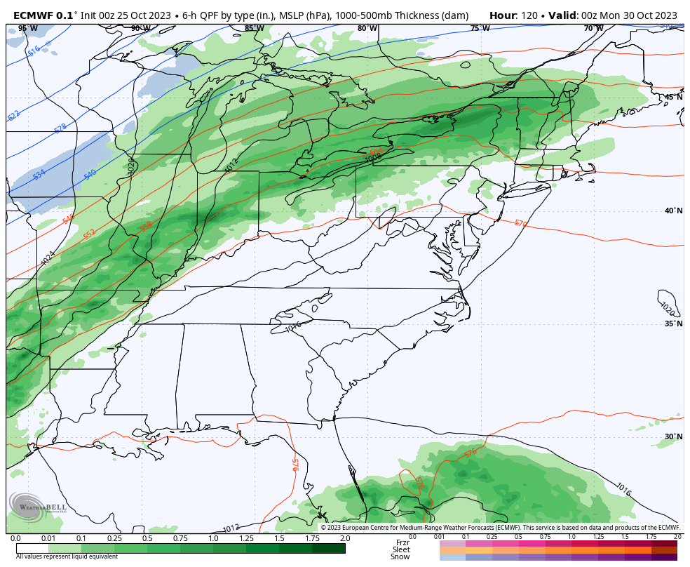
This front slows down on Saturday and waits to crash through here late Sunday and Monday. Widespread rain and gusty winds will be followed by a major blast of cold air.
The timing on all this continues to come into focus and is a bit of a work in progress. A work in progress that also includes the chance for a few flakes to make an appearance on the first day of November.
The Canadian continues to be the most enthusiastic about the flake chance…
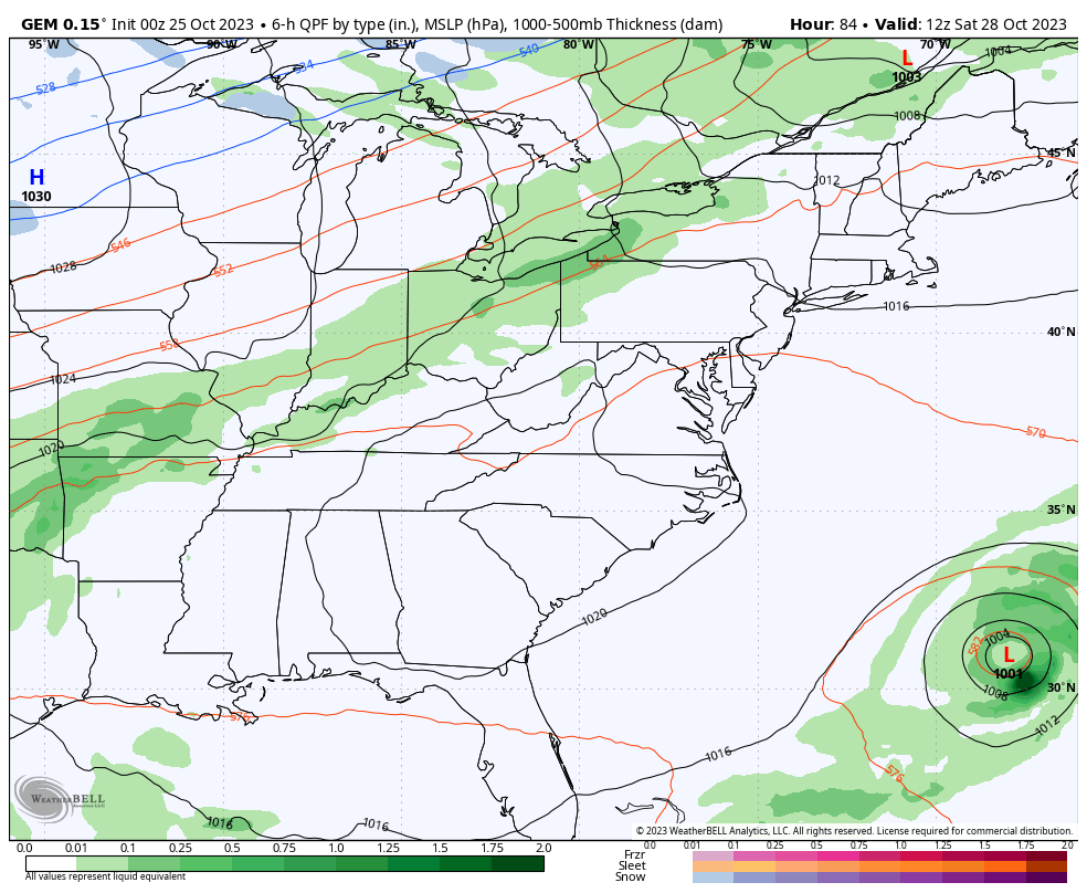
It does so by dragging a deep trough through the region…
The ICON is even more pronounced with this upper level system…
![]()
![]()
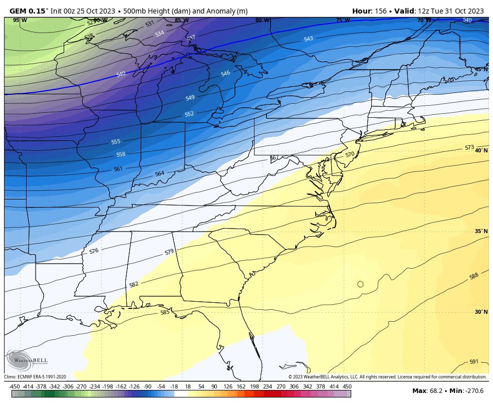
This is similar to what the latest EURO is showing…
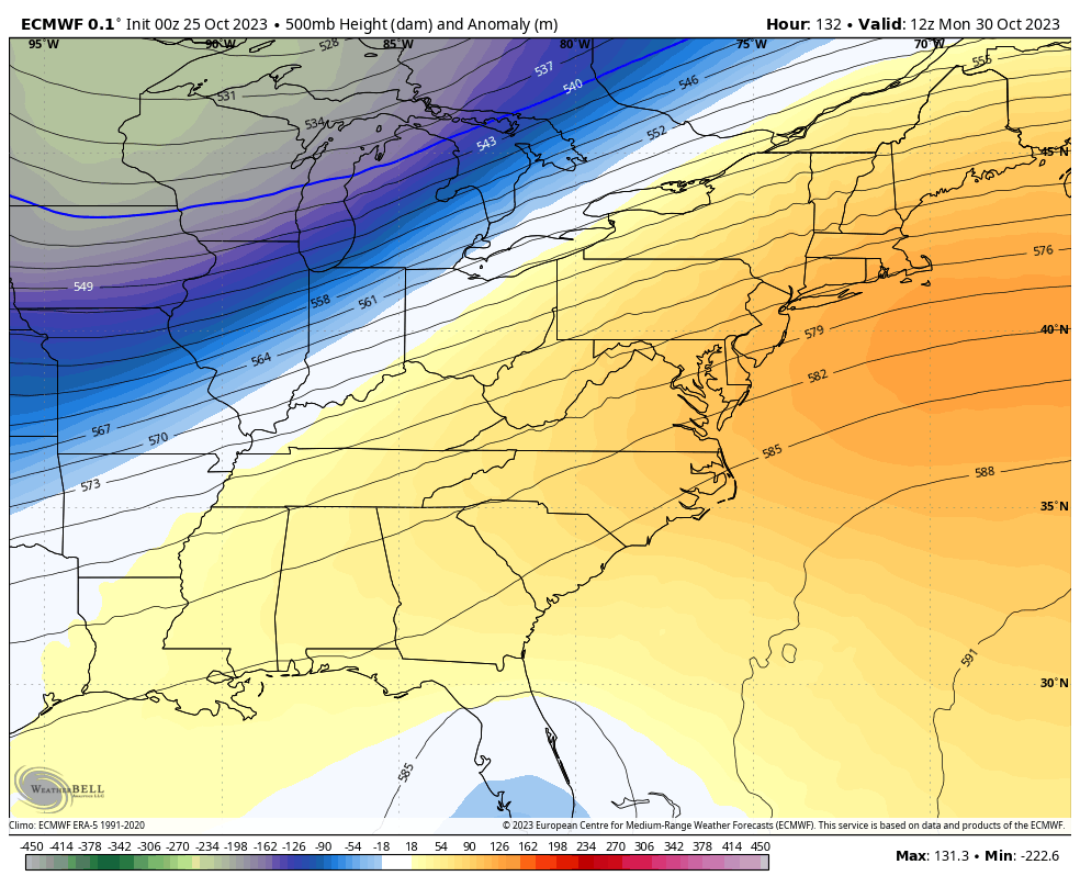
It’s not quite to the flake making levels, but it’s pretty darn close…
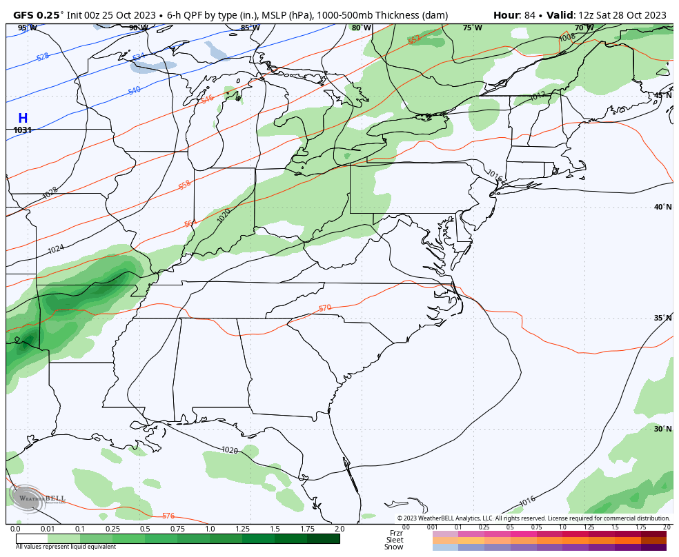
The GFS is slowly coming around and will continue to trend much colder in the coming days…
This is a REALLY cold pattern for our region and much of the country. This will make some headlines with how much real estate turns so cold so quickly.
Before I go, I want to talk about a historic storm making landfall early this morning near Acapulco, Mexico. Otis went from a Tropical Storm to a monster Category 5 hurricane in less than 24 hours. Not a single forecast from man nor machine had this storm intensifying anywhere close to what it did. Here’s a look at the satellite of this catastrophic storm…

BTW, Acapulco has a population of around one million people. I can’t imagine what a storm like this is doing to that size of a city that literally had just a few hours to prepare.
In the Atlantic, Hurricane Tammy continues to weaken as it churns toward Bermuda…

That storm likely hangs around a while before fading away.
I will have another update later today. Make it a wonderful Wednesday and take care.

Holy friggin crap that hurricane looks absolutely extreme… I hadn’t even been paying attention to it… Wow….
The NWS didn’t predict the ” Blizzard of 1978 ” either.
You’re right Schroedor they sure didn’t . It caught us off guard not just here across most of eastern US
I think I remember Marcia Yockey saying back before the ” Blizzard of 1978 ” the day before that there may be a major Snow event in the making. You never get weather forecast like that anymore.
She was a legend at her work with that black marker and board. Sure do miss her!!
Thanks Chris. Lots of Snow action is beginning to show up in the central Rockies into the northern plains. Looks like La Nina Snow forecast to me. A fourth year of La Nina would be rare. NOAA each month has been predicting a strong to moderate El Nino for this Winter, and I think their just “kicking the can down the road. “
Otis totally caught the NHC flat-footed. As recently as 5pm EDT (2100 UTC) Monday, they still had it making landfall as a TS.
https://www.nhc.noaa.gov/archive/2023/ep18/ep182023.fstadv.006.shtml?
When they can’t forecast major Hurricanes anymore. Then we all should be worried about any weather event. I think we are beginning the END TIMES of the World.
I hadn’t noticed the hurricane either till I saw someone post a picture of the eye and I thought wow. It looks like we will be cold and rainy just in time for Halloween too bad it couldn’t wait a day or two so the kids could have this nice weather. I have a question if the hurricanes in the Atlantic effect our weather here does the hurricanes else where say the pacific effect out weather at all??
Not out weather our weather lol
Absolutely, El Nino, La Nina and Neutral phases in the Pacific affect our weather. What goes on in the Atlantic blocks the West to East migration of storms and fronts. Like now it’s the Southeast Ridge ( Bermuda High. ) that’s blocks and weakens rains and hangs up fronts and forces them back North and West of our area. That’s why it’s so dry now. Hope it changes for the wetter.
Hurricane Otis could affect our weather if the Subtropical Jet Stream was more active. The continuation of a Negative PDO prevents the jet stream from changing.
First photos are indeed catastrophic. The city of Acapulco basically went to sleep one night with the knowledge that a tropical storm would be in their vicinity in 24-36 hours, then learned yesterday that a Category 5 hurricane was barreling towards them. They literally had no time to prepare.
With sea surface temperatures at record levels, explosive intensification has become one of the watchwords of our New Normal, since tropical systems literally “feed” off of warm ocean waters. The warmer the water, the more likely that a tropical system will undergo rapid intensification, just as Otis did. Also contributing to this disaster is the presence of El Niño, which caused the prevailing winds to blow towards the Mexican coast instead of out to sea, and helped direct the storm to make landfall where it did. Ironically, that same El Niño created conditions in the Atlantic that either impeded the intensification of most tropical systems, or push these storms to the north, away from land and into the central Atlantic.
Joe, read this article on the two various types of ENSO. You will find it very interesting. NOAA doubts now that this will be a central base El Nino event. An eastern based El Nino event is favored for the coming Winter 23 -24.
Subject to change however. Here’s the link :
https://www.aoml.noaa.gov/ftp/hrd/annane/DIS/Q3.pdf
I see people on X (formerly Twitter) have given up on Winter for the east coast… bold move.
Weather history was made yesterday in the Chicago area, as O’Hare Airport made it all the way up to 83 degrees, tying the record for the date set 60 years ago. The normal high for the date is only 59 degrees. The month is now averaging a healthy 3.6 degrees per day above normal.
Here in the SW Suburbs, away from the urban heat island effect of the city, it still made it to 80 degrees.
Winter weather is very much alive though, with Winter Storm Warnings in effect for the next few days for much of North Dakota and Montana.
Mike, Our chances now for that Snowy Winter have really decreased here in our part of the Country. I’ve had my doubts since late Summer as the PDO did not go strongly positive to activate the Subtropical jet as it did in 2014. Your area may have the most Snow as well as the lee side of the Great Lakes this Winter. To tell you the truth, I don’t want to be Snowbound like we were in 2015-16. I would be content if it would just rain and maybe a couple of 4″ Snows that melt off in a day or so.
According to NOAA though, they are predicting above-normal temperatures and below-normal precipitation for much of the Midwest this Winter, including the Chicago Metro Area, which is typical for an El Nino Winter.
I still hope we get more than the measly 20 inches of snow (16 inches in the SW Suburbs) that fell last Winter.