Good Thursday to one and all. It’s another really nice weather day across Kentucky, but things are changing as we roll through the next few days. Scattered showers show up for Friday into the start of the weekend before wind and rain settle in, bringing frigid temps for Halloween into early November.
Temps today are back into the 70s across the Commonwealth as we see more clouds filtering in. That strong southwest wind will continue to gust up and may reach 25mph at times. There’s also a small chance for a shower or two later this afternoon and evening.
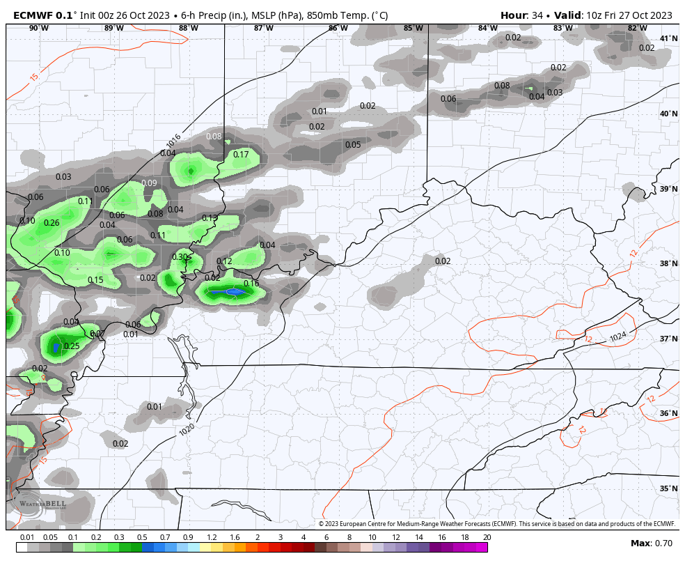
Here are your radars to follow along…

The threat for scattered will indeed increase Friday with a few carrying over into Saturday…
Temps start to come down some but the big plunge holds off until Monday and Halloween with even colder temps following into the first couple of days in November. This happens as a huge upper low sweeps into the Ohio Valley and Great lakes…
CANADIAN
EURO
The disturbance diving in actually starts out in the Arctic before it dives across Canada and into the USA. That means it has plenty of cold air to work with.
Let’s break down how things may play out:
- Friday and Saturday are still in the 70s with a few scattered showers.
- The cold front slowly slides in from the northwest on Sunday. Temps will be mild in the south and east and much cooler in the north and west.
- Rain and wind will increase late Sunday into Monday as the cold front slips through here.
- Highs Monday will likely be in the 40s for many.
- Halloween is cold with lows in the 20s and highs in the 40s. Trick or treat temps look to drop into the upper 30s before the little ones are done with the candy rounds.
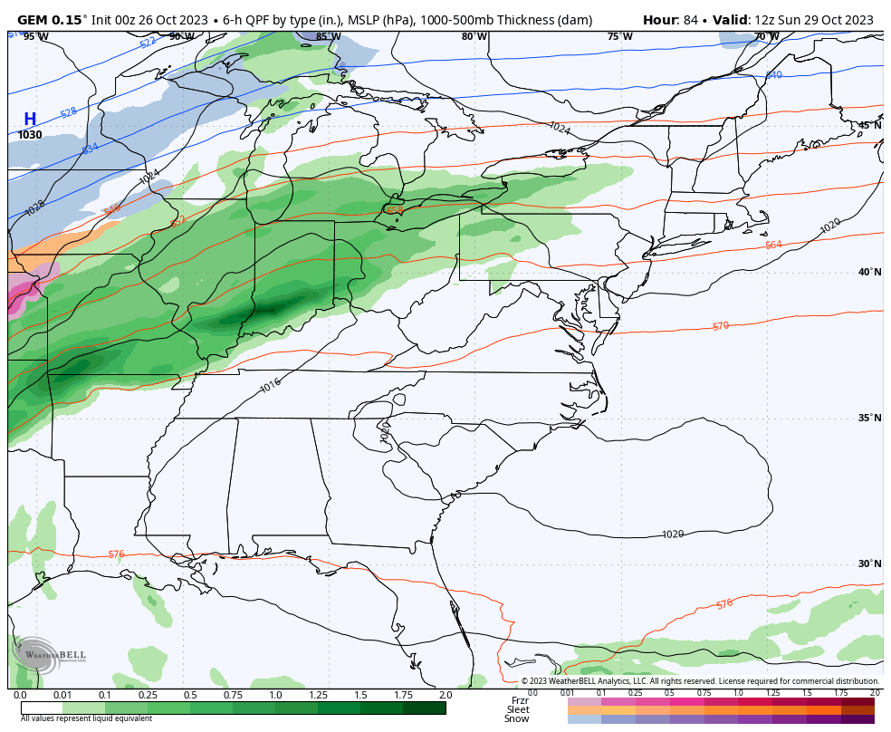
- As the upper low drops in Tuesday night and Wednesday, it may also spawn a second low to pop along the eastern slopes of the Appalachian Mountains. That could spawn quite the rain and snow system.
- The potential for the first flakes of the season is with us on Wednesday, the first day of November. 👀
- Temps will be frigid for the first few days of the month. Lows can reach deep into the low 20s with a wind chill as low as the teens possible.
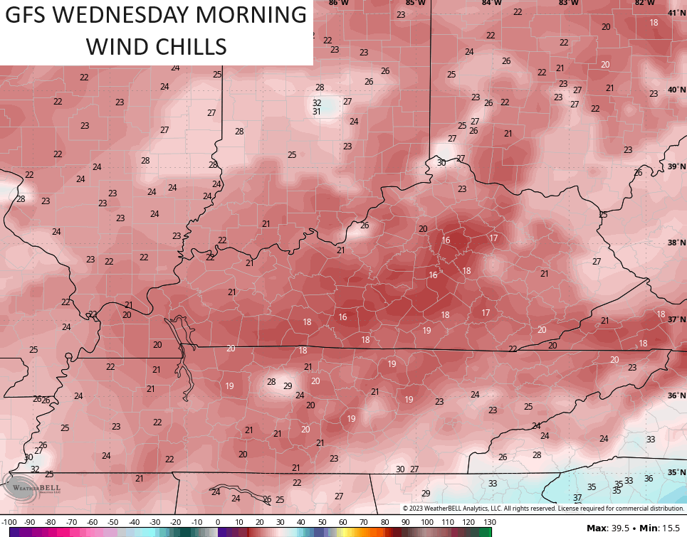
In terms of models, the GFS continues to be a disaster and struggles with reality. There are some situations where it can still be useful, but those are very situational. The folks at NOAA know they have a serious problem with this model, but a fix is a long ways off, unfortunately.
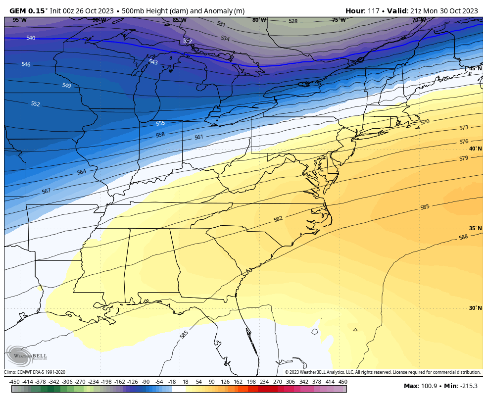
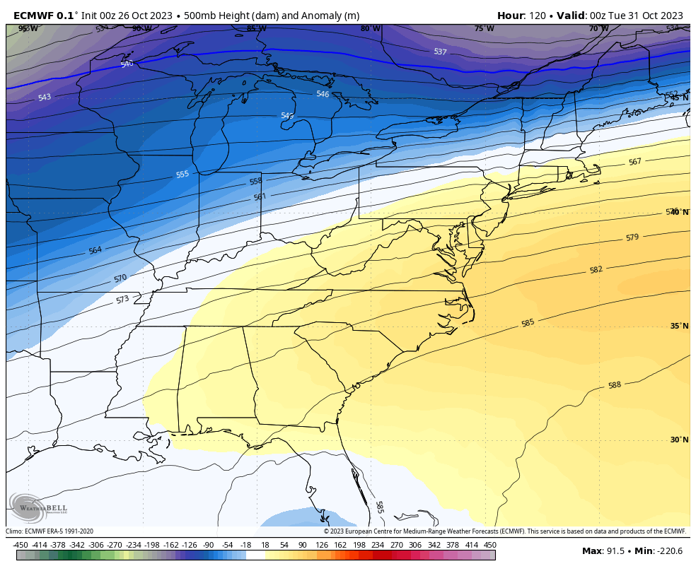
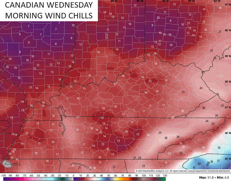
On the other hand, the Canadian and European Models continue to have a better handle on the overall setup and have been fairly consistent with each other and from one run to the next.
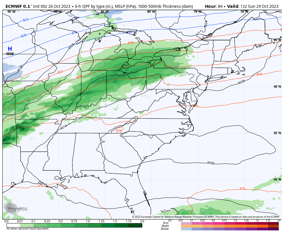
The Canadian Model shows our Monday front and the late Tuesday/Wednesday winter looking setup…
The EURO is very similar once again…
I mentioned the potential for a morning or two with wind chills reaching the teens. Wednesday morning appears to be one of those…
Even the GFS sees this potential…
The cold relaxes some late week into the following weekend as it becomes more seasonable. Week two of November has some potential to check off a few of the extreme boxes. The potential is there for a tropical system coming out of the Caribbean at the same time a deep trough dives into the eastern half of the country.
I will have another update later today. Make it a great day and take care.

I’ll believe the flake “potential” when I actually see some.
Thanks Chris. All of the models struggle with their forecast. Won’t be much different than last weeks weather. The Asian Beetles are swarming big time in my area and is making my Families visit miserable. Looking forward to the end of the growing season.
On all the weather cams, looks like Corbin, Ky. has the best Fall foliage color. Here and other places the leaves are drying up and falling with the strong winds in the afternoon. I expect by next week we will have complete dormancy.