Good Friday, folks. Showers are working across the region today as heavier rains get set to move in here late in the weekend. That’s ahead of a massive push of very cold air to end October and begin November. It even has a bit of a winter look to it.
Let’s talk about today’s showers right out of the gate. These are moving from southwest to northeast through the evening, but isn’t all day rain by any means. Here are your Friday radars to follow along…

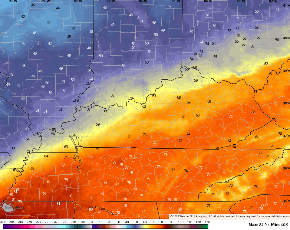
Temps today range from the upper 60s to middle 70s depending on where you are. Speaking of where you are, the cold front gets into the region and slows down Saturday and Sunday and this sets us up for a big temp gradient.
Saturday afternoon temps fall into the 50s in the far north and west while the east and southeast see temps well into the 70s. The rest of the state is somewhere in between…
Scattered showers will once again be with us Saturday and Saturday evening.
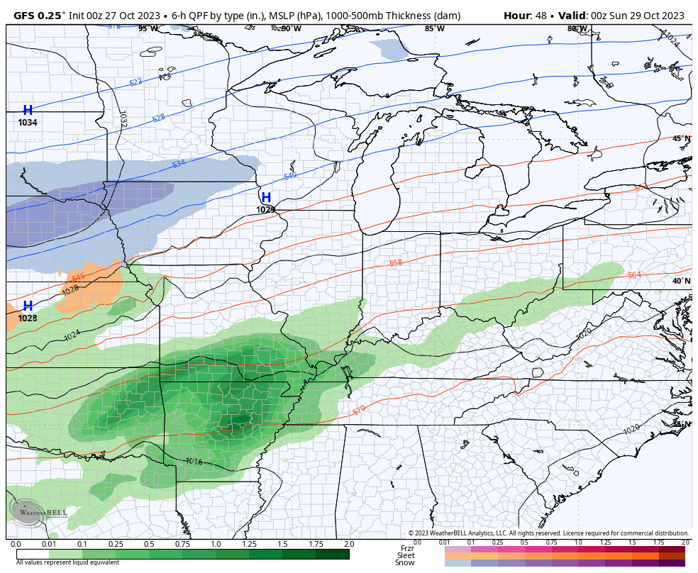
Rain then increases and becomes widespread Sunday into Monday. Some hefty amounts may show up from western Kentucky into parts of central and northern Kentucky, especially. 1″-3″ of rain will be likely in these areas. This happens as a wave of low pressure rides along the boundary as it slowly slides through the state…
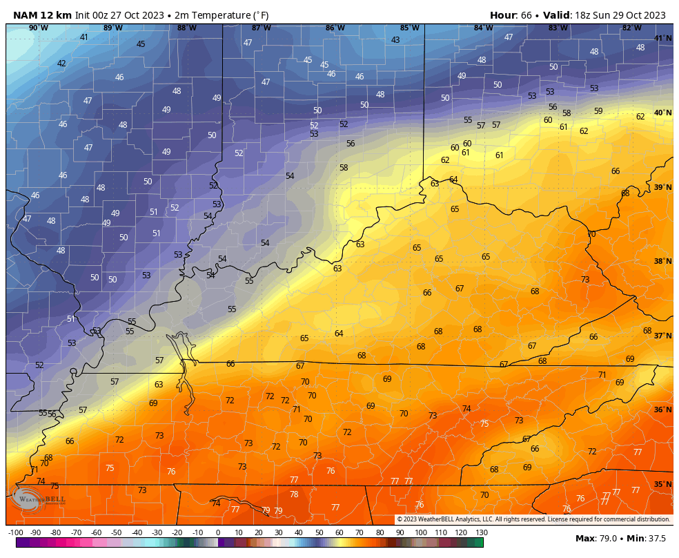
Temps crash behind this. Check out the numbers on the NAM from 2pm Sunday through 8am Monday…
Temps continue to drop through the day Monday as that strong northwest wind settles in. This sets the stage for a cold Halloween with temps in the 20s to start the day and highs in the 40s. There’s the chance for a shower or two in the east and southeast.
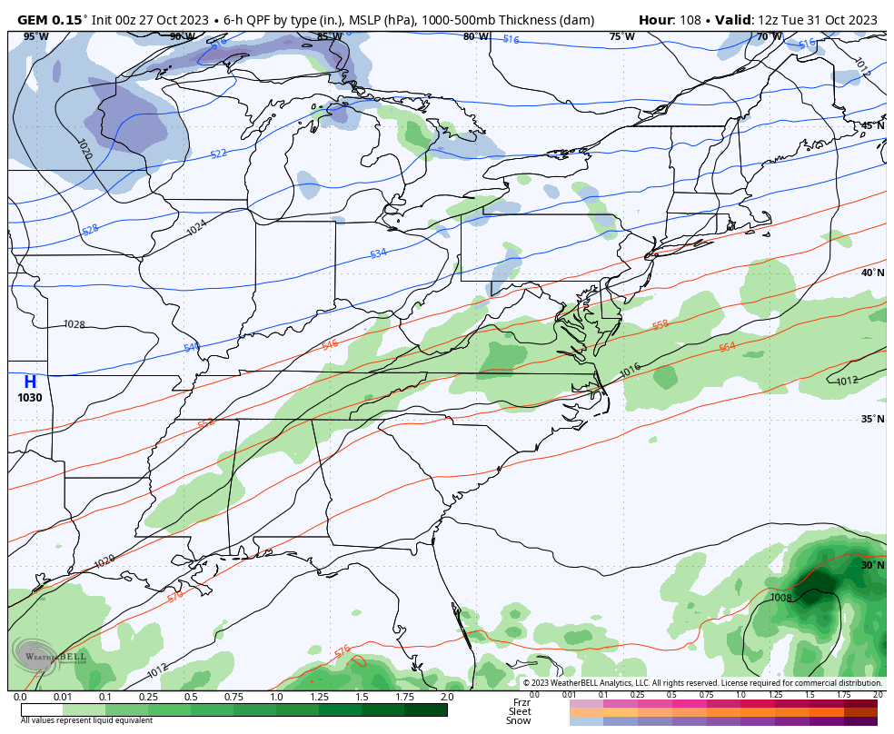
This is ahead of another system dropping in from the northwest Halloween night into Wednesday. This brings even colder temps in here and has the chance to spit out a few snowflakes on Wednesday. The EURO is leading the flake charge right now…

The Canadian continues to spit a few out…
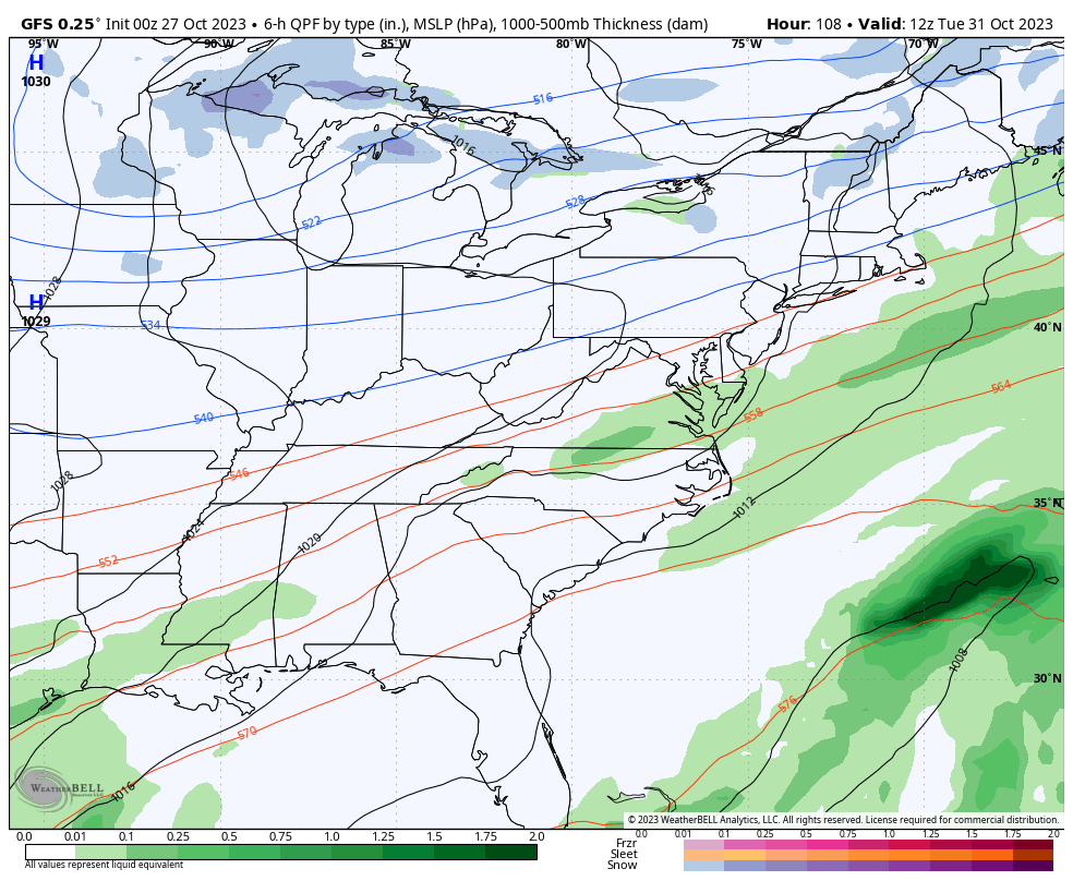
As expected, the GFS is trending toward this possibility and even shows a few flakes in southeastern Kentucky…
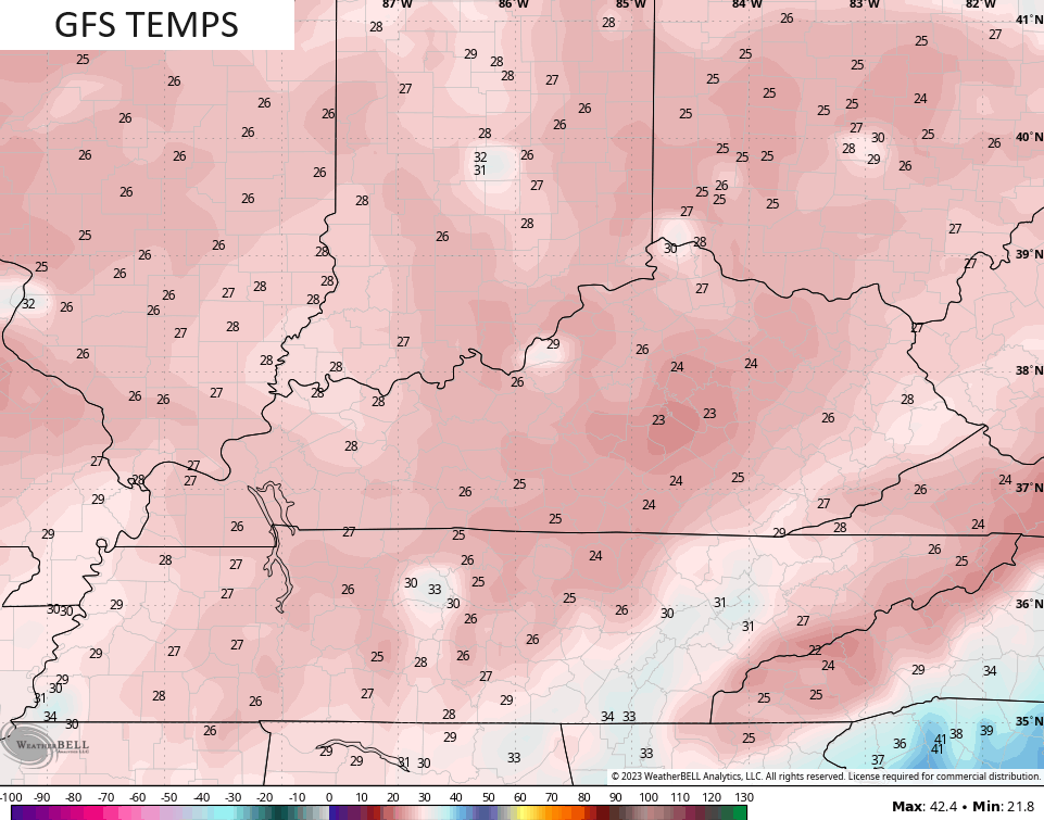
Now that the GFS is catching on to the depth of this trough, you’re seeing the temps coming down and getting more in line with the other models. Lows are now dropping into the low 20s for some by mid-week…
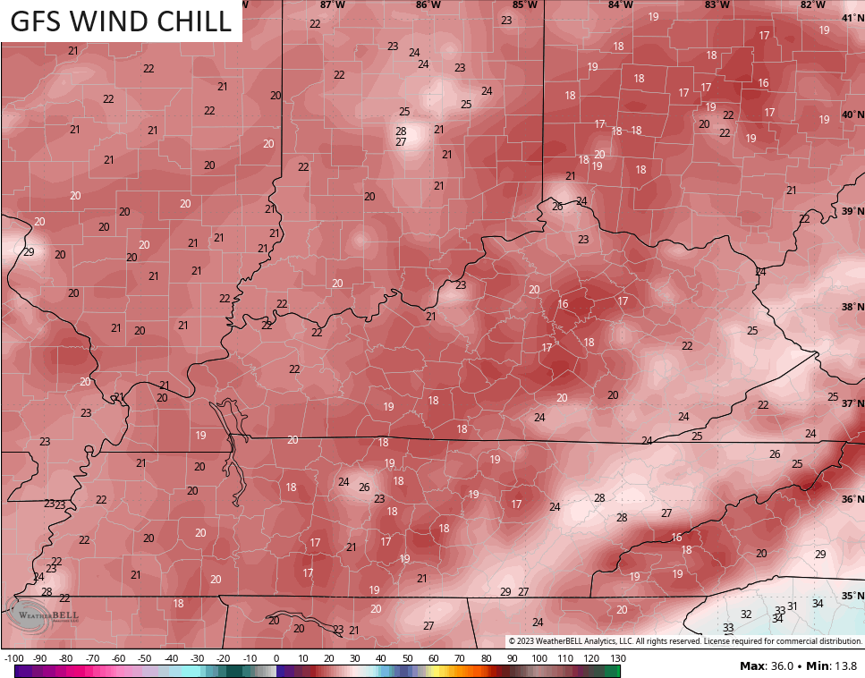
Wind chills keep trending deeper into the teens at the same time…
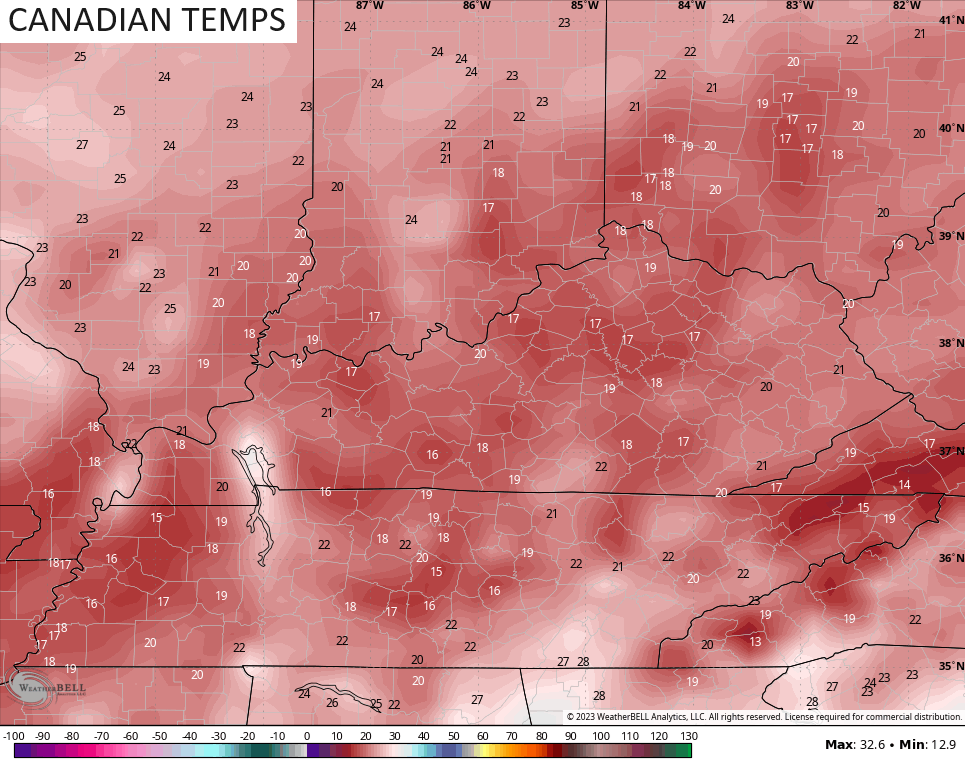
Actual temps from the Canadian has a morning with lows in the upper teens…
Highs from Monday through Thursday are in the 40s and may not stray too far from the low 40s on a couple days.
Seasonably chilly temps stay with for the end of the week into the weekend but another deep trough looks to develop in the eastern part of the country for the second week of November. The EURO Ensembles see this well…
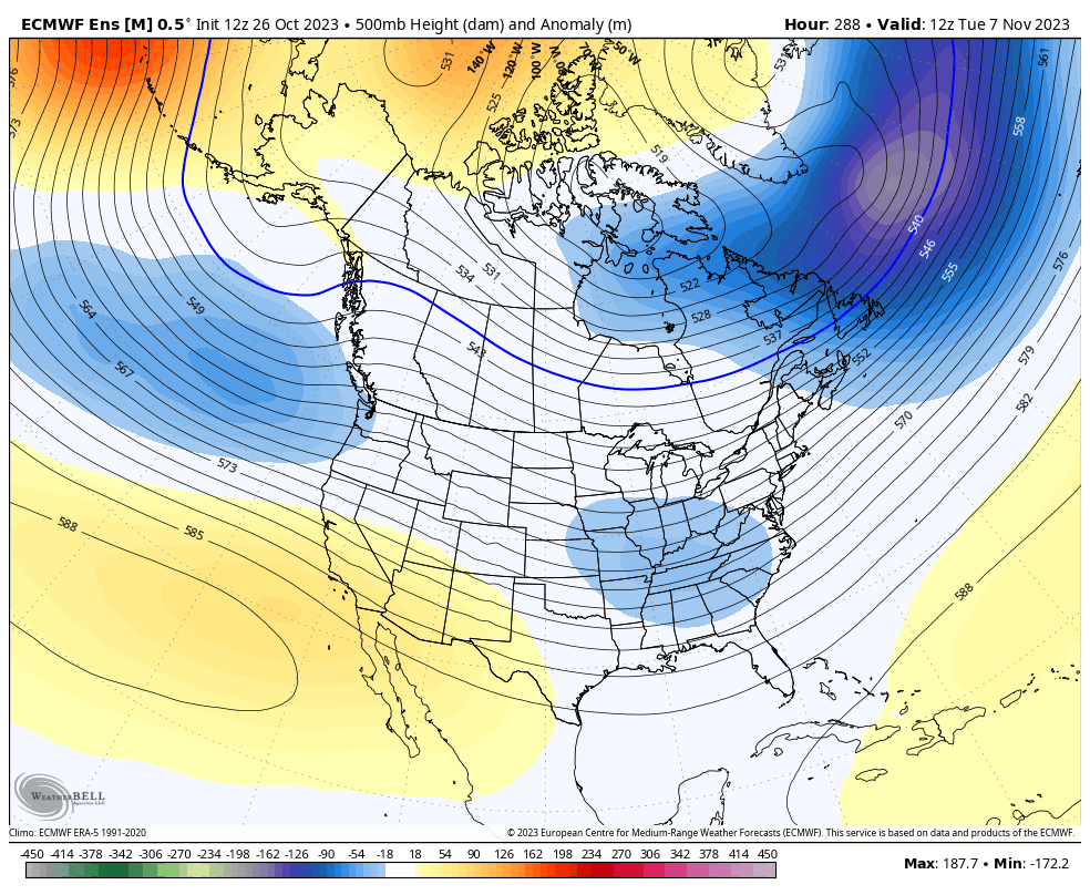
The overall propensity for troughs to dig into our region and the eastern half of the country has been with us since the spring and shows no signs of letting up. This is what many of the seasonal models continue to show for the winter ahead and that bodes well for cold and snow lovers in our region.
The EURO Weeklies are getting within range of the first week and change of winter, so it’s time to start looking at them a little more. The latest EURO WEEKLIES goes through December 10th and has this look for snowfall through that date…
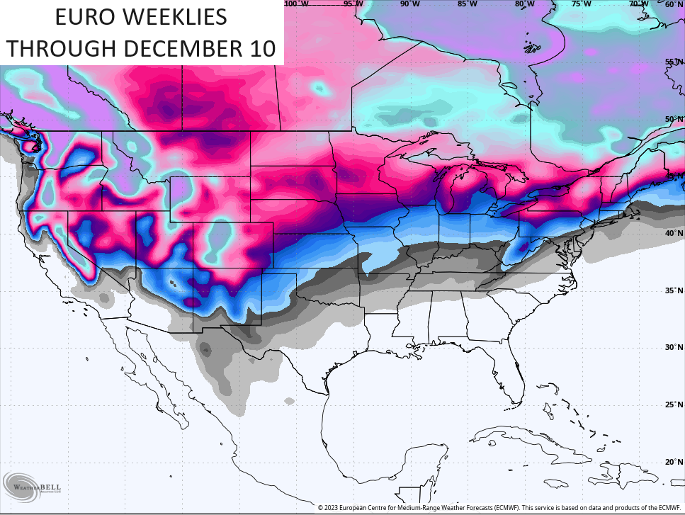
Remember, the Weeklies show the average of 100 different member runs.
The Weeklies also have a single run model that’s called the CONTROL. Here’s what that run shows over this same 46 day period…
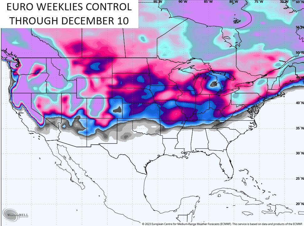
Oh! Of course, that doesn’t mean much, but it’s fun to look at. 😜
I will have another update later today. Have a good one and take care.

“I’ll believe it when I see it.”
Copy and paste all winter. 🙂