Good evening, folks. Showers continue to push across the region and this is a sign of things to come as our pattern gets ready to flip. This flip includes quite a bit of rain, gusty winds and crashing temps as we end the month.
As mentioned, showers are scattered about the region and will take us through the overnight. Here are your radars to help guide you through the start of the weekend…

Scattered showers continue on Saturday with a healthy temp spread of 20 degrees or so taking shape from northwest to southeast. That’s with the front moving in and slowing down through Sunday. That’s when widespread rain shows up and takes us into Monday.
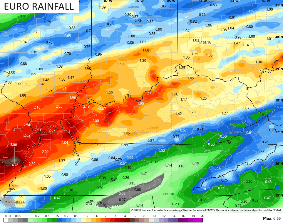
I’ve mentioned the likelihood of a 1″-3″ rainfall for much of the area and this continues to show up…
The temp drop late Sunday into Monday is pretty stout. This temp animation from the NAM goes from 8pm Sunday through 8pm Monday…
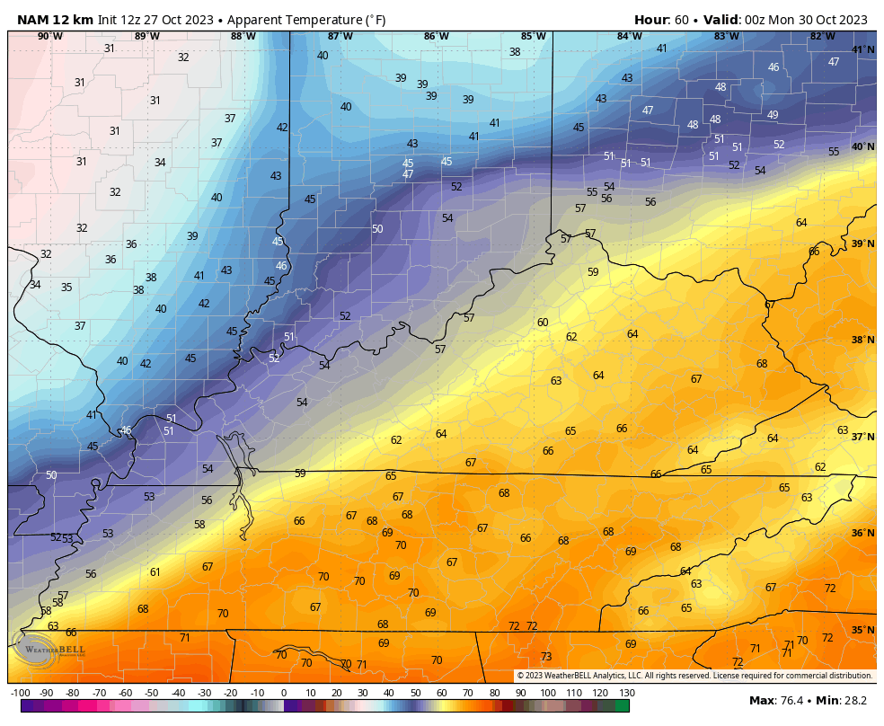
Gusty winds make it feel colder than that.
The upper level system then zips through here Halloween night into Wednesday and continues to have the chance to spit out a few snowflakes.
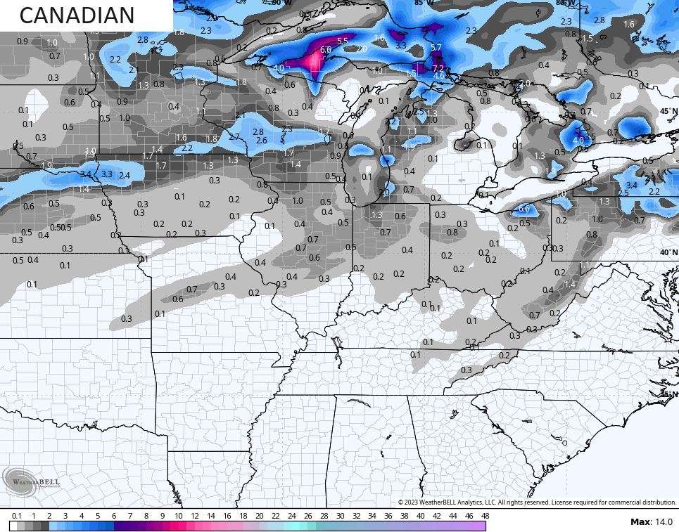
The Canadian Model is currently the most enthusiastic with the chances…
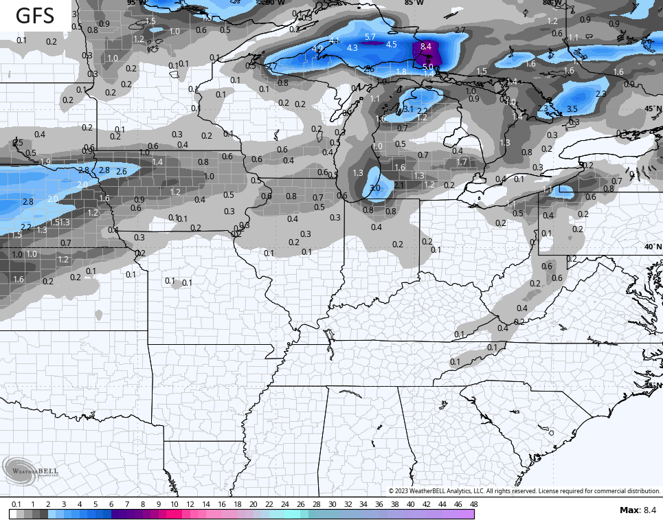
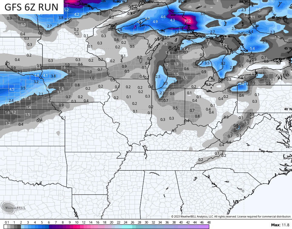
The current run of the GFS likes some flakes in the far southeast…
An earlier run was more generous with the flakes…
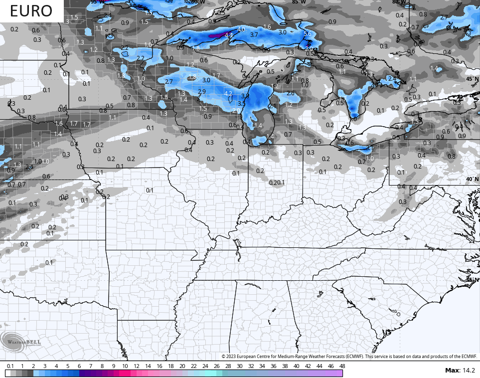
The EURO decided to keep the flakes north of the Ohio River…
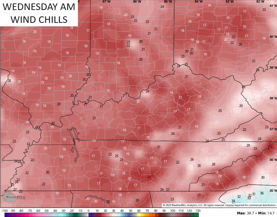
This system brings really cold air in here for Halloween into the first few days of November. Wind chills in the teens will be possible to start the new month…
I will go more in depth on all this with the overnight post. Enjoy the rest of the day and take care.

Thanks!!!!