Good Monday, everyone. It’s the first full week of November and it’s off and running with more in the way of mild weather. The mild is the dominate weather of the next few weeks, but a couple cold shots take some punches at it later this week and weekend.
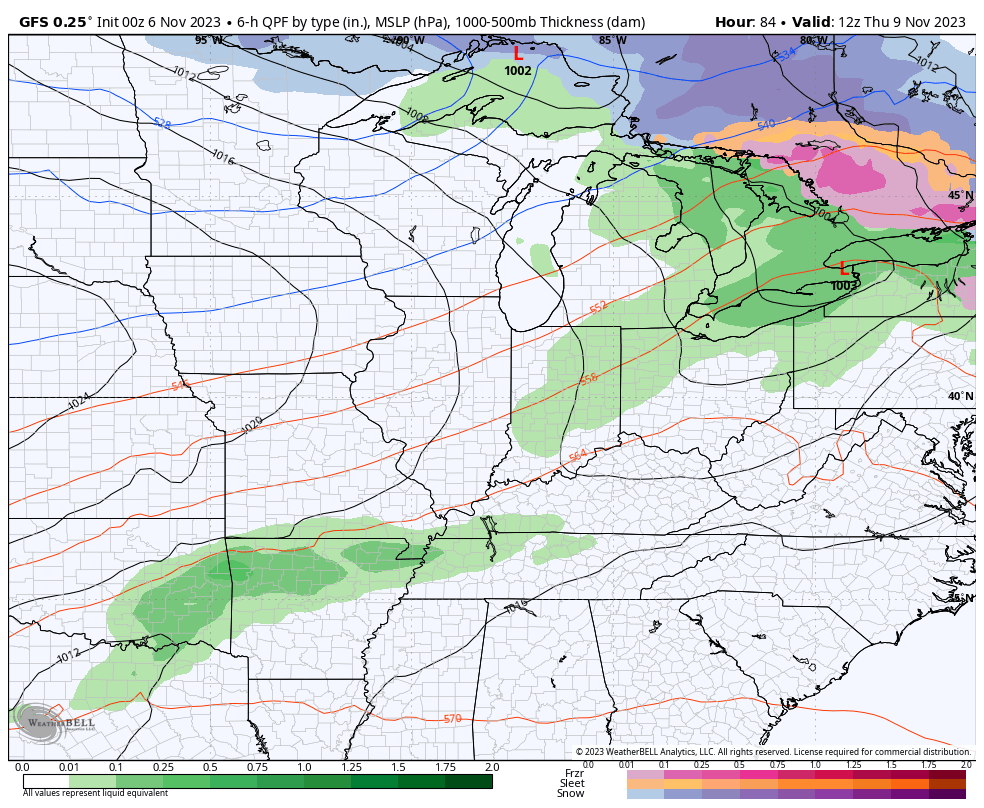
Highs today through Wednesday range from the upper 60s to middle 70s on a strong southwest wind flow. That flow is ahead of a pretty stout cold front arriving on the scene later Thursday and Friday. That means slows down and allows for a wave of low pressure to ride right on top of us during this time.
The end result is a pretty good surge of rain…
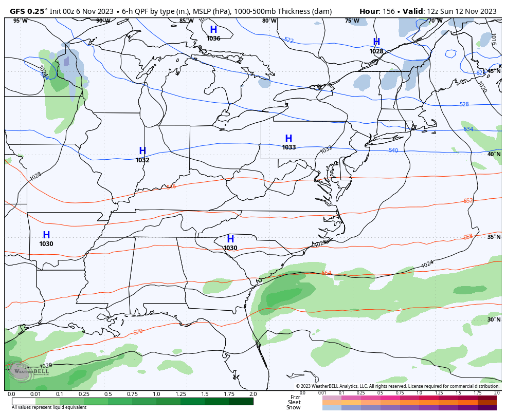
Cold winds then take control behind this boundary with another upper-level system dropping in from the northwest later this weekend and early next week. The cold with this is more targeted toward the Great Lakes and New England instead of our region, but we get a glancing blow of cold…
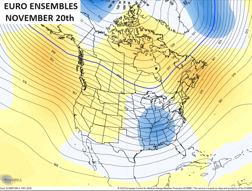
I continue to look toward Thanksgiving week and the potential for a deep trough to dig into the region. This happens as a ridge pops out west and you can see this on the EURO Ensembles…
The EURO Weeklies 7 day average for Thanksgiving week continues to show the lowering heights across much of the east…
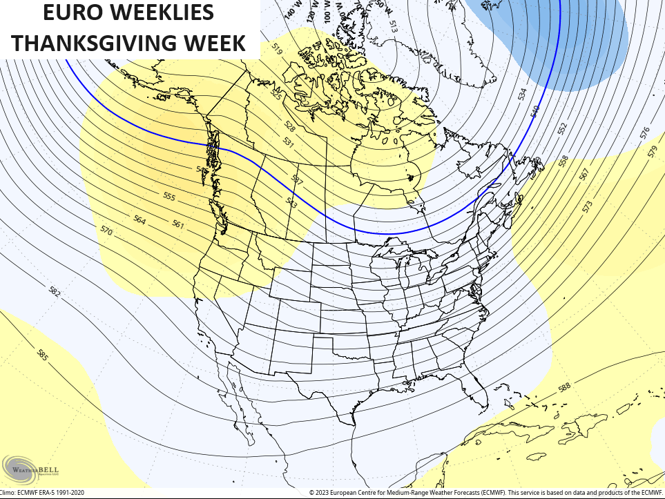
Keep in mind that the EURO Weeklies are made up of 100 members so you’re seeing the average of those members.
The Control run of the EURO Weeklies for the exact same time shows this the bullseye of the trough on top of us…

I like my turkey cold.
Another update comes your way later today so check back. Make it a great day and take care.
