Good evening, folks. It’s almost Election Day here in Kentucky and the weather continues to be very mild and windy. This pattern is the dominant setup over the next two weeks but it does take a break late this week into the weekend.
Election Day looks pretty mild yet again with upper 60s to middle 70s across the state with a mix of sun and clouds. It’s a mostly dry day but there’s the small chance for a shower to pop up.
Wednesday is windy and warm as temps spike into the 75-80 degree range for many. Winds really start to crank late Wednesday into Wednesday night as our cold front drops in from the northwest. Gusts of 35-40mph will be possible…
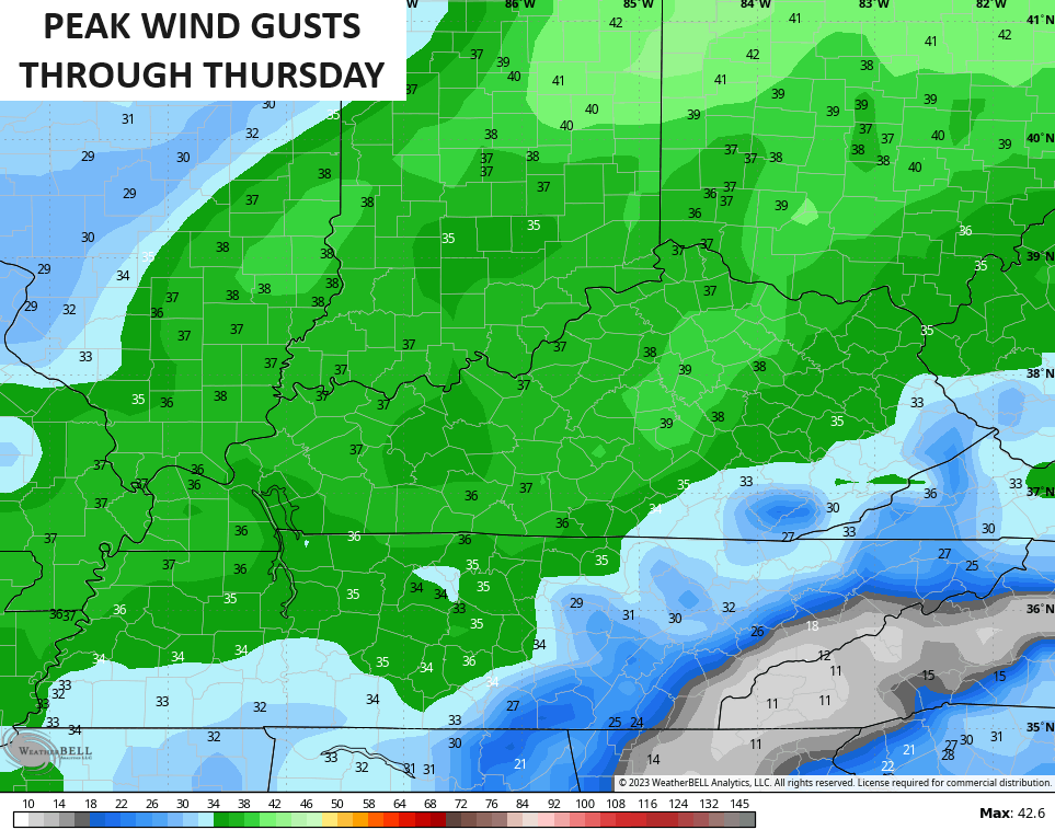
The front brings gusty showers in here from northwest to southeast on Thursday. That front then slows down allowing for a wave of low pressure to develop along it and roll across the southern Appalachians on Friday. The end result for us is chilly showers with the greatest concentration across the east and southeast…
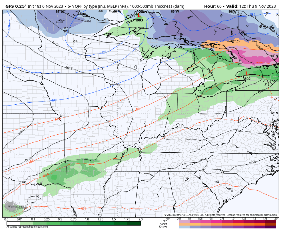
Temps come down behind this boundary on Thursday with Friday having the potential to stay in the 40s for areas with rain. The weekend looks seasonable with highs in the 50s and lows dropping into the upper 20s.
Temps next week look very mild once again but a colder pattern fighting in for Thanksgiving week.
I’ll talk more about that later tonight. Have a great rest of your evening and take care.
