Good Wednesday to one and all. Near record highs are likely today across the state as a strong southwest wind gusts up ahead of a cold front. This boundary brings some rain to the region and also knocks the temps way back down to normal.
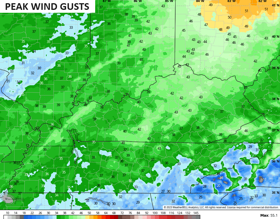
Highs out there today warm into the 75-80 degree range across Kentucky with a few records in jeopardy. Southwest winds gust up this afternoon and evening with some of these gusts tonight possibly reaching 40mph at times.
Check out the peak wind gusts through early Thursday…
The front blows in with some scattered showers tonight and early Thursday as cooler winds take over. This front slows down as a wave of low pressure develops along it and scoots across the southern Appalachian Mountains. This throws a band of rain across parts of the state with the south and east getting the bulk of the action.
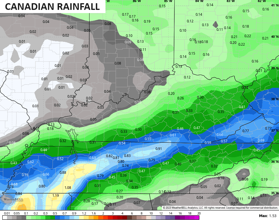
The Canadian continues to be the most generous with the coverage of the showers…
The GFS is the stingiest…
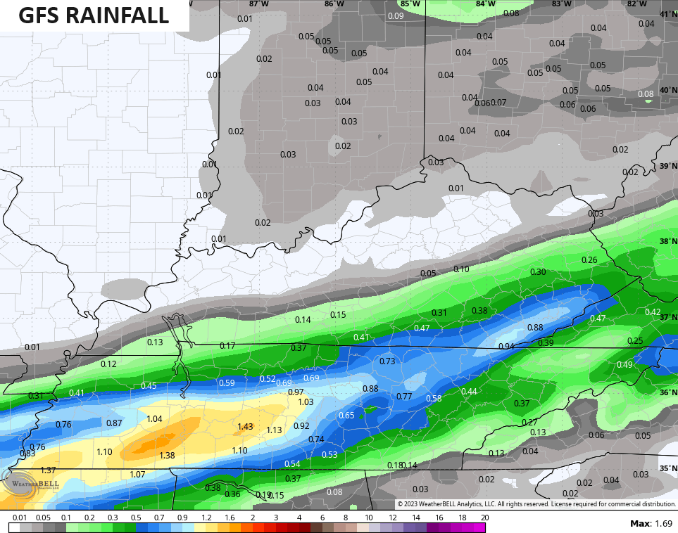
Still, all models bring a decent shot of rain to the southeast where those forest fires are still burning out of control, so that’s welcome news.
Chilly winds come in behind this with near normal temps into the weekend. Skies look dry except for the GFS that’s trying to blow up another system by Sunday…
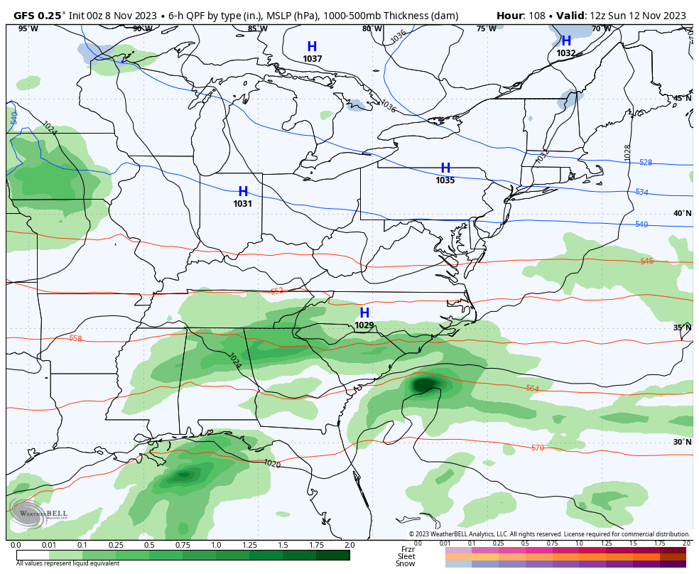
It’s the GFS so that’s a big strike against that happening, but I can’t totally rule that out based on the pattern.
Seasonal temps then hang tough into early next week before we mild it up again for the second half of the week.
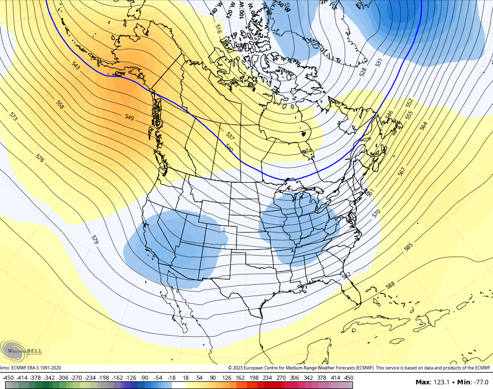
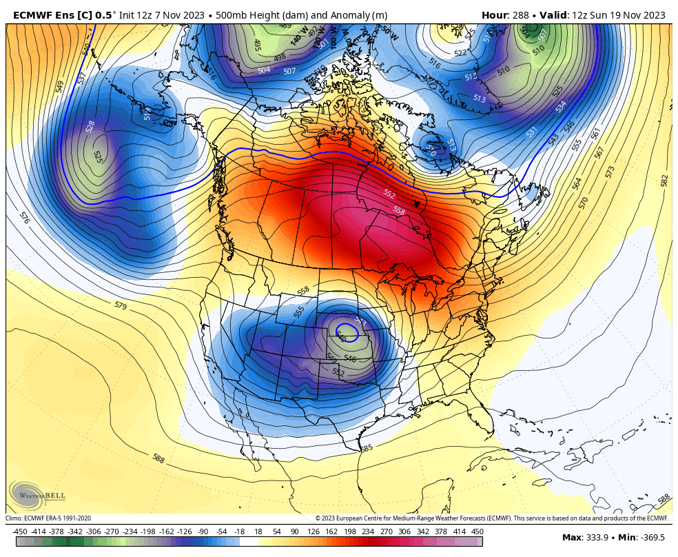
The focus continues to be on a colder pattern taking control for Thanksgiving week and the EURO Ensembles continue to show this change very well…
Just like in recent days, the control run of the GFS is even more aggressive…
Another update will find its way into your life later today. Have a wonderful Wednesday and take care.

Thanks Chris our area in the southeast will take whatever we can get for these fires. I just hope the wind gust doesn’t spread the fires.I hope we get enough to help. Does anyone remember did we have a warm November last year??
Crystal, my records for last year show that we hit a high of 76°F in Bowling Green. The record for Nov. 8th is 82°F, which was set in 2020, and we’re forecasted to hit 84°F today, which would break that record.
Thanks Joe we definitely hit 80 here
More signals are showing up for a significant change later this month. I’m hoping for the Wetter – Cooler or Snowier – Colder.
I am starting to believe that the weather pattern we have been subject to since the spring is what we’re going to see this winter. A roller coaster temperature pattern.
I also wonder will there be any moisture to work with when we are in a cold spell.
The overall weather pattern is beginning to change. What we have today is what I learned many years ago Indian Summer. Happens every year after the first hard freeze. The next warm up forecast next week will not last as long and may have better Gulf moisture to work with.