Good Tuesday, folks. It’s another in a series of gorgeous weather days across Kentucky before things change up by late this week. That’s when beneficial rains and colder temps roll through the region. That’s likely a sign of what’s ahead for Thanksgiving week and weekend when some winter weather may show up.
Temps out there today range from the upper 50s to low 60s for many with a mix of sun and clouds.
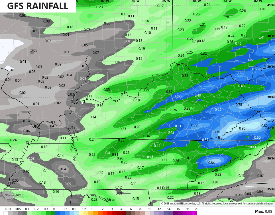
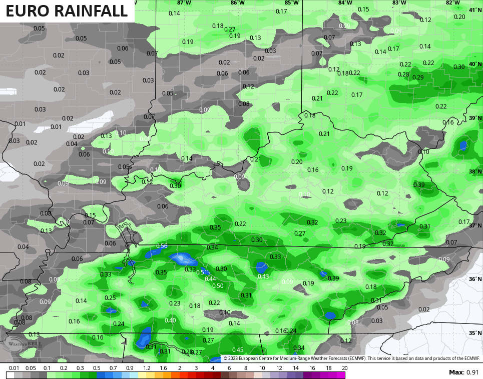
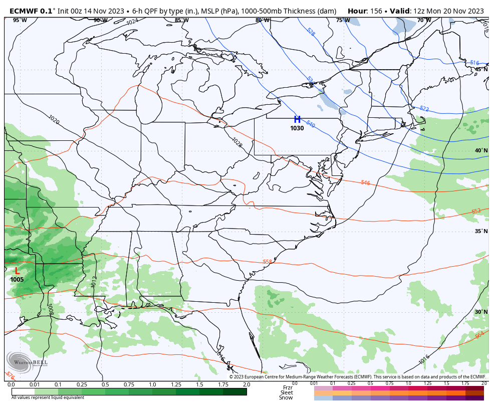
Highs for Wednesday and Thursday surge deep into the 60s on a nice southwest wind flow kicking in. This is ahead of our strong cold front sweeping in for Friday. Gusty showers will be likely for much of the region with areas of central and eastern Kentucky picking up on some pretty good rainfall…
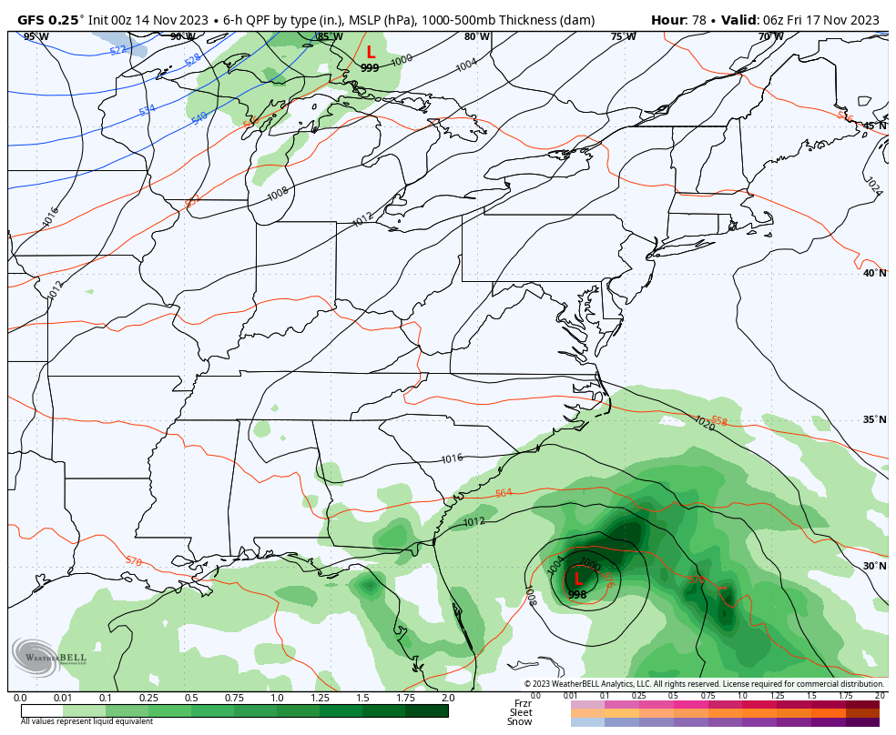
The GFS is spitting out more than a half inch for several areas…
The EURO says not so fast…
Cold winds crash in behind this front for the upcoming weekend with temps going below normal. Highs are generally in the 40s with lows reaching deep into the 20s.
The models continue to struggle with exactly how to handle the potent storm system rolling through here Tuesday and Wednesday of next week.
The EURO and the Canadian models have less of a phased storm system on their last runs, meaning it’s a lot of rain, wind, crashing temps, but no winter…
CANADIAN
EURO
The GFS has the storm in Mexico. No kidding, folks.
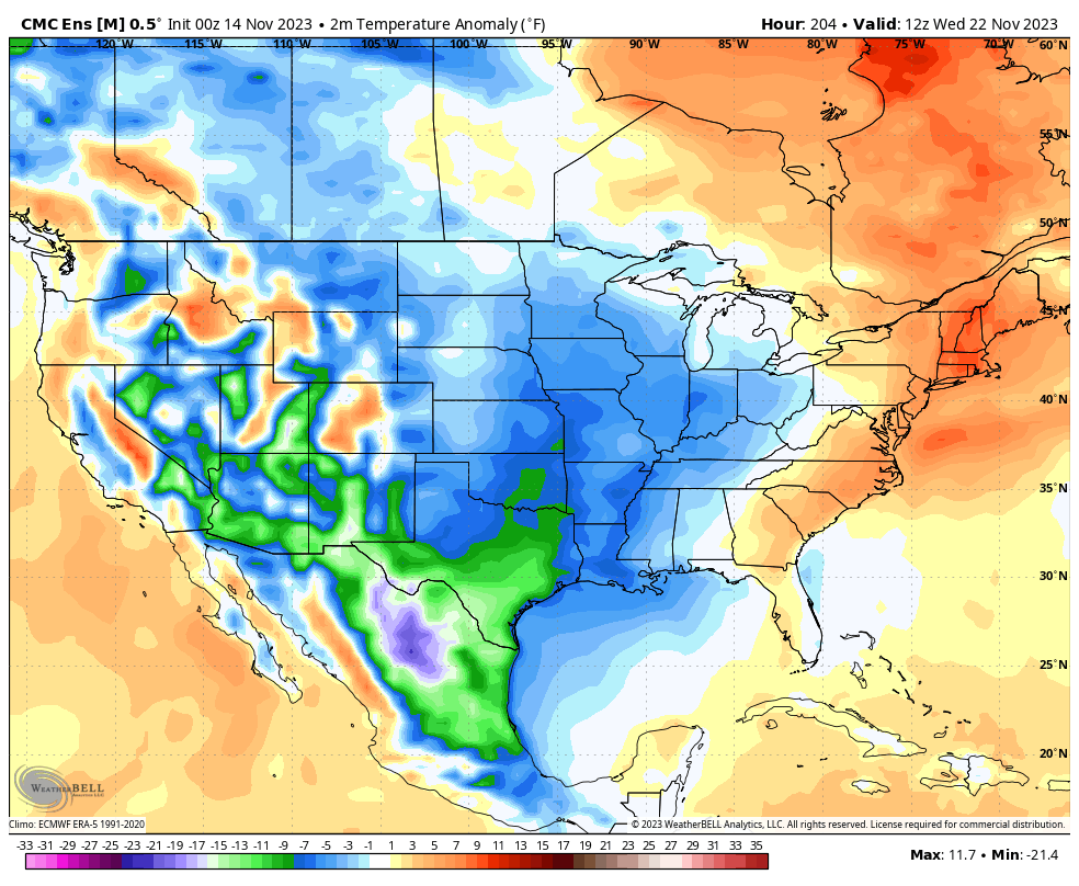
The ENSEMBLES are seeing the cold more than the current runs of the operational models. Check out the temp departures on the Canadian Ensembles from November 22 through November 28…
I’ll hit you with another update later today. Have a terrific Tuesday and take care.

Again these systems are not moisture starve that we need.
The most likely scenario we will see is a cold rain followed by insignificant flakes.(next week)
That is just the way we roll here in Kentucky.
We will just have to wait and see how all this plays out. I’m not just referring to the weather, but what’s going on in World in these trying times.
Gorgeous weather day? I mean, it’s not bad.. I’m thinking you weren’t anticipating the overcast?