Good evening, folks. Mild temps hang tough for the next few days before a strong cold front wipes out the above normal temps. This is likely the opening act toward a bigger system rolling in before Thanksgiving as a winter looking pattern shows up.
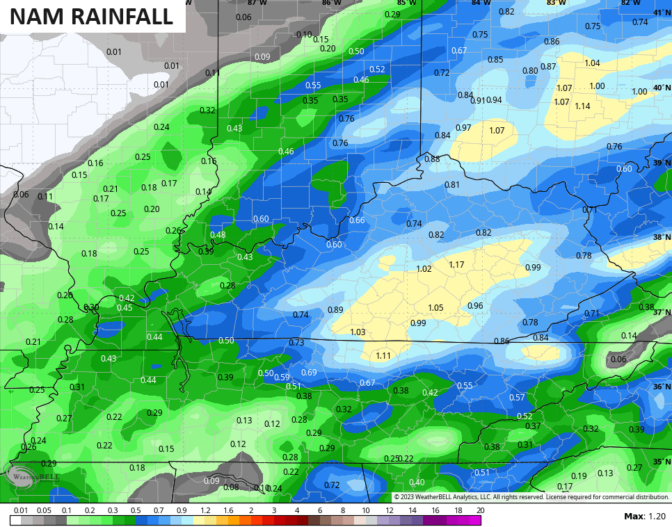
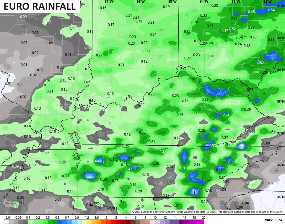
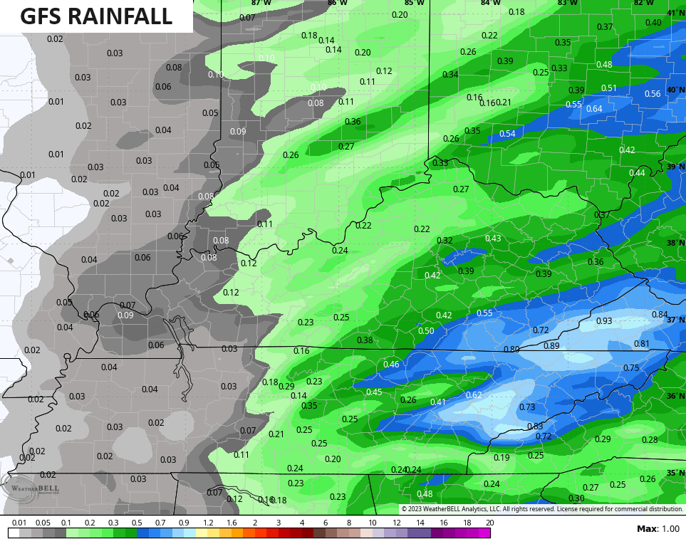
Our Friday cold front sweeps west to east across the state during the afternoon and evening. Rounds of gusty showers are likely along and ahead of this front and this has the chance to deliver beneficial rains for parts of central and eastern Kentucky.
The NAM has the highest rainfall numbers…
The EURO is among the lowest…
The GFS is somewhere in the middle…
Seasonably colder weather blows in for the weekend with lows dropping deep into the 20s and highs ranging from the mid 40s to low 50s for many.
The setup for Thanksgiving week continues to be a work in progress, but the signal for a big storm system continues to strongly show up. To phase or not to phase is the question when it comes to this storm.
A phased solution creates a monster storm with frigid air and snow behind it. That’s what the Canadian is currently showing…
You can see the southern system phase with the northern branch of the jet stream diving in from the northwest…
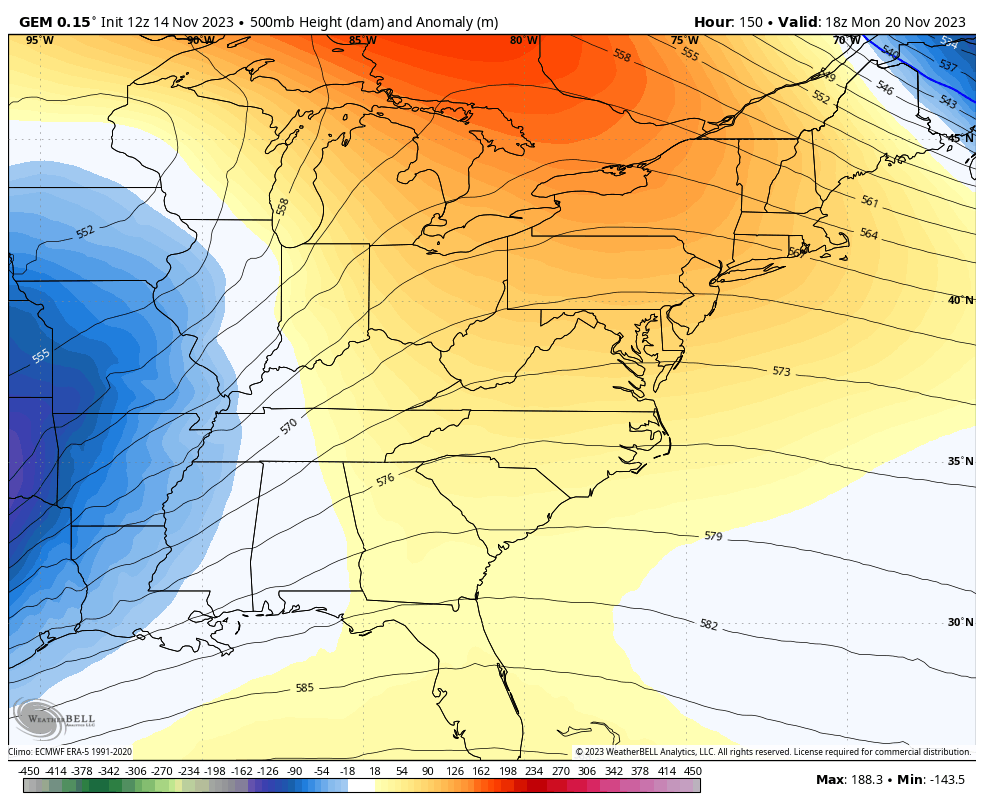
That’s clearly the extreme solution.
The EURO isn’t going toward the phase and keeps the southern branch as the dominant system. The end result is rain, wind and crashing temps with no winter…
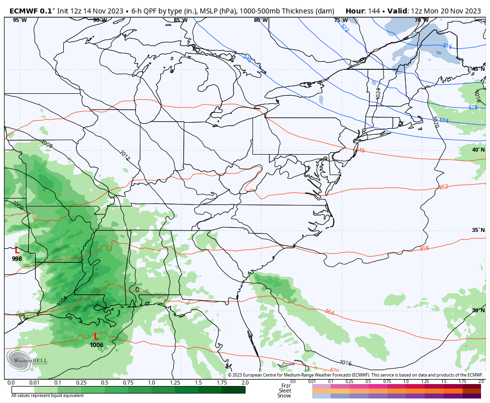
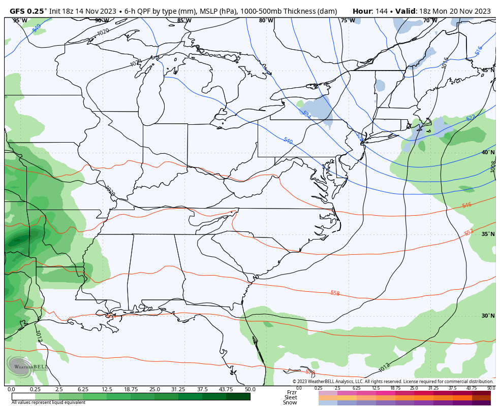
The GFS is once again stuck in the middle of the two extremes with rain and some snow…
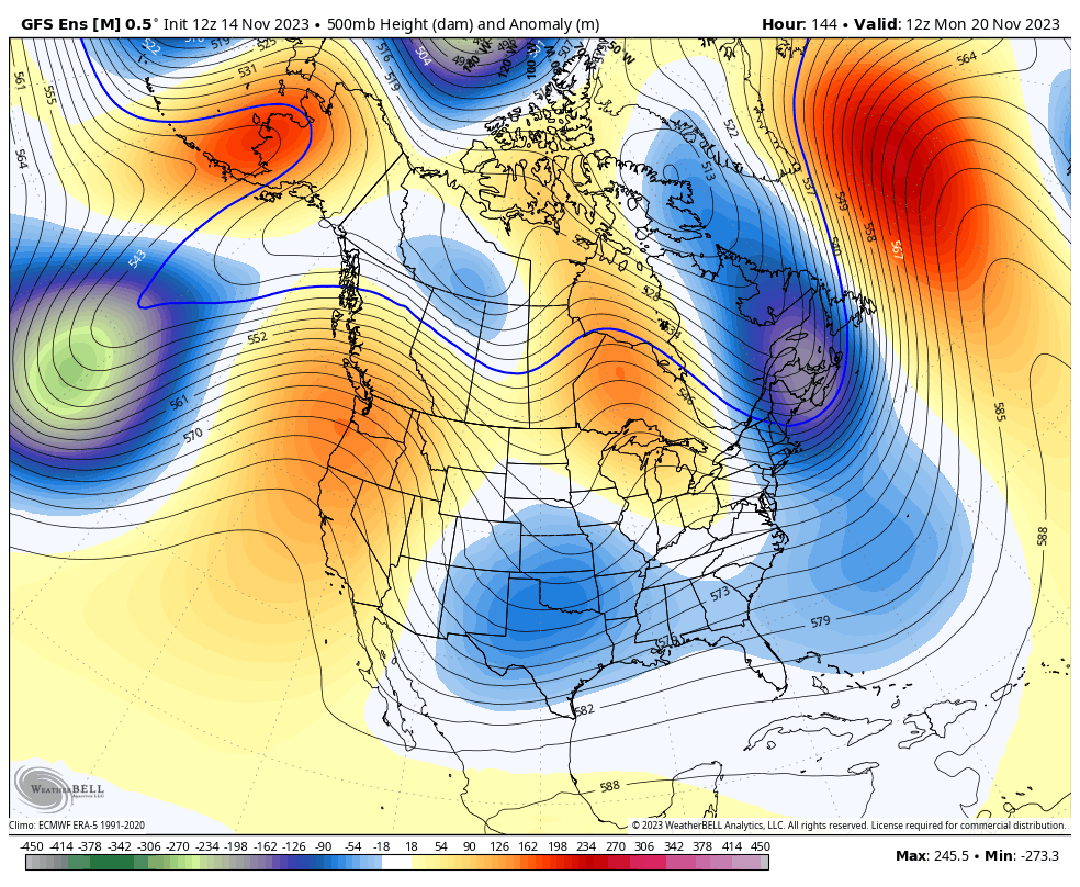
The Ensembles continue to go all in on troughs digging into the east next week into the closing days of November…
GFS ENSEMBLES
EURO ENSEMBLES
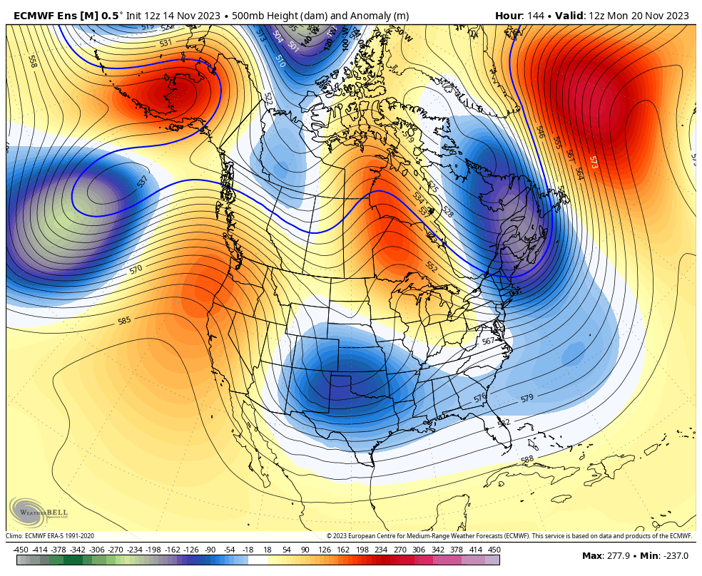
Troughs like that mean we have an increased chance of seeing, at least, some early season flake action.
Enjoy the evening and take care.
