Good evening, folks. Our calm pattern has one more day left in the tank before we change things up a bit. A Friday cold front brings some showers and chillier weather for the weekend with a big time pre-Thanksgiving storm system on the way.
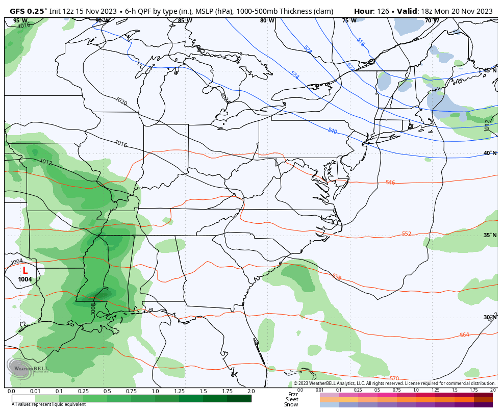
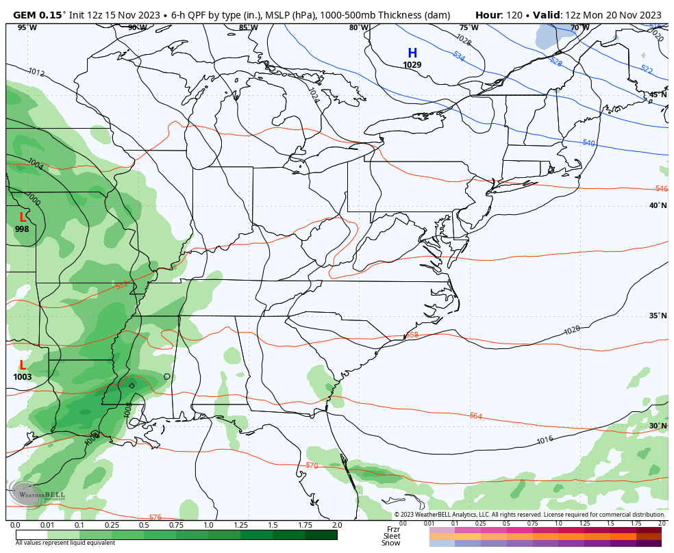
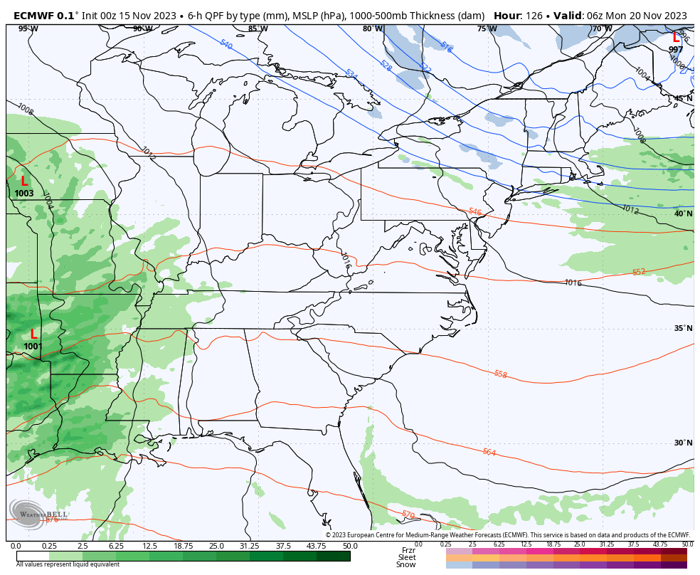
Let’s concentrate on the Monday through Wednesday storm system. To phase or not to phase… That is the question. Many of the latest models are back to showing much more of a phased solution with this storm system. The end result is the potential for some winter weather on the backside of this low.
The GFS has a pretty jacked up system with rain, wind, crashing temps and a little bit of winter weather …
The Canadian is on a similar page…
The EURO is trending in that direction as well…
The upper levels on the GFS show our phased system that’s followed by a deep trough through Thanksgiving weekend…
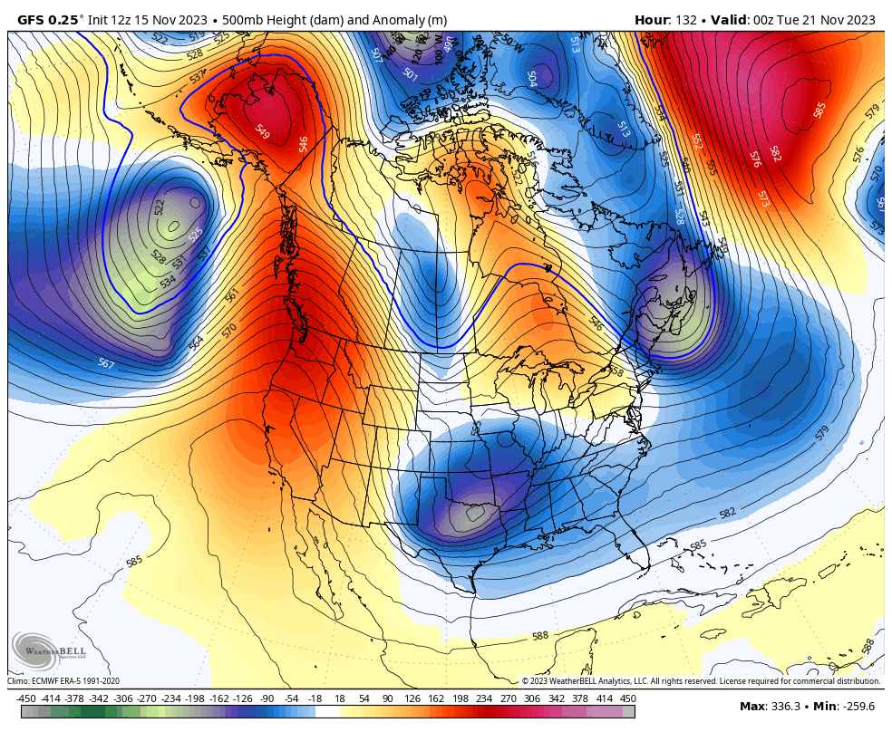
That’s some strong blocking showing up from Alaska into Canada and the Canadian Model has pretty much the same look…
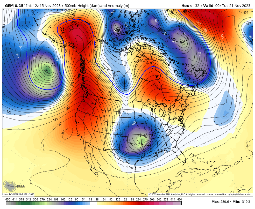
That’s a really cold look and this may take us through the rest of November. The 10 day average height anomaly across the North America shows a big block up in Alaska with a deep trough in the eastern part of the country…

Have a great evening and take care.
