Good Thursday, everybody. We are now one week from Thanksgiving and our weather pattern is about to turn super active. This busy setup brings a Friday cold front into the region and that opens the door for a winter looking pattern for Thanksgiving week.
Right out of the gate, don’t forget that my winter forecast comes out tonight at 6pm on WKYT-TV. Tune in or…
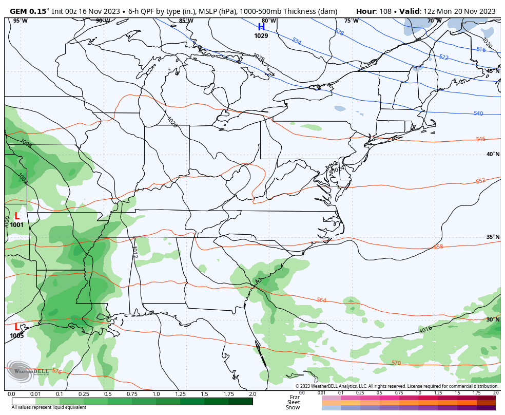
Temps out there today are generally 65-70 for many areas with a southwest wind kicking in. This wind is ahead of a cold front dropping in here from the northwest on Friday. This brings a healthy surge of showers and maybe some rumbles of thunder into Kentucky with the greatest rains falling in the central and eastern parts of the state.
The future radar from the HRRR shows this well on the animation that runs from midnight through 7pm Friday…
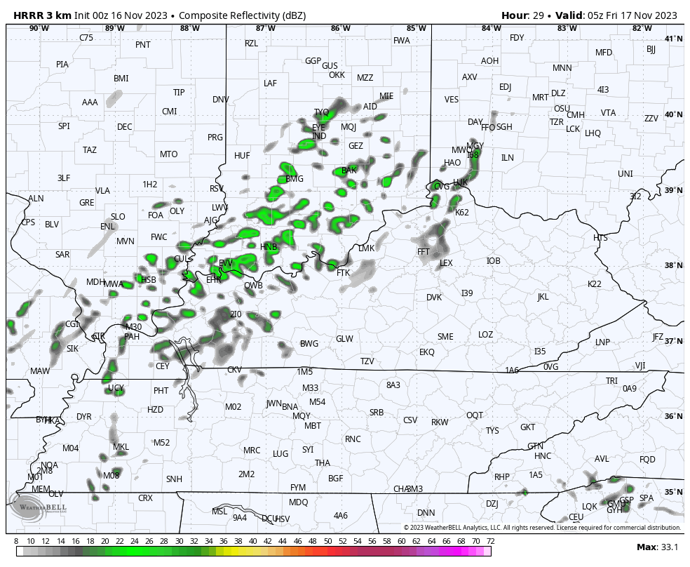
A quarter to a half inch of rain is a good bet across much of central and eastern Kentucky. Locally higher amounts may show up.
Seasonably cold temps will be noted this weekend with dry skies, so get out and enjoy because a big storm is set to impact us starting Monday.
For more than a week now, I’ve talked about cold air coming in for Thanksgiving week… A week that may feature two storm systems to bookend the long holiday period. That call is looking pretty good right now.
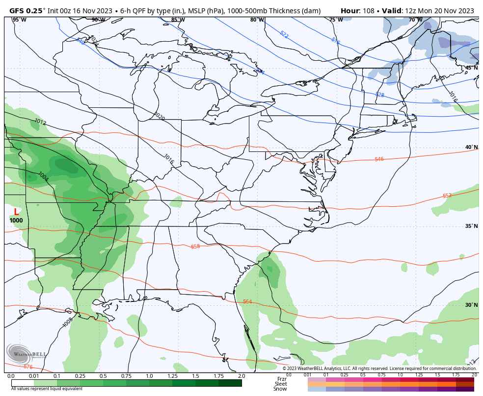
This first storm system impacts us Monday through Wednesday as it rolls from the southern Mississippi Valley into the Ohio Valley with a second low developing along the east coast. If that sounds like a wintertime setup that’s because it essentially is.
The models, as expected, still go back and forth on some backlash winter weather impacting us behind this storm. The GFS isn’t as phased as earlier runs and just goes from wind and rain to frigid temps without flakes…
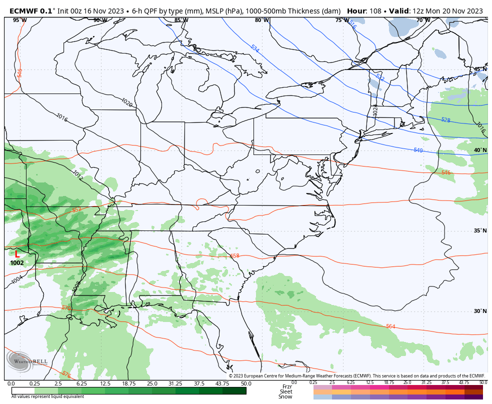
The EURO is, oddly enough, the most progressive with this storm system but also has frigid air mass behind it…
The Canadian Model has consistently shown the best chance for some winter weather behind this setup and it continues that trend and even keeps some flakes going into Thanksgiving morning…
If you think back to the flakes we had on Halloween, it was the Canadian that was the only model picking up on those with each run from about a week away. Will it make it two holidays in a row? Maybe.
Regardless of the flake potential, this is a frigid air coming in behind this storm system. Highs in the 30s will be possible Wednesday into Thanksgiving, at least. Gusty winds will make it feel even colder and the Canadian Model shows some serious wind chill action from the plains into our region. This animation goes from 7pm Tuesday through 7pm Thanksgiving…
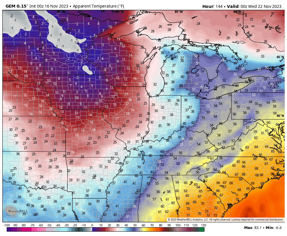
Ouch!
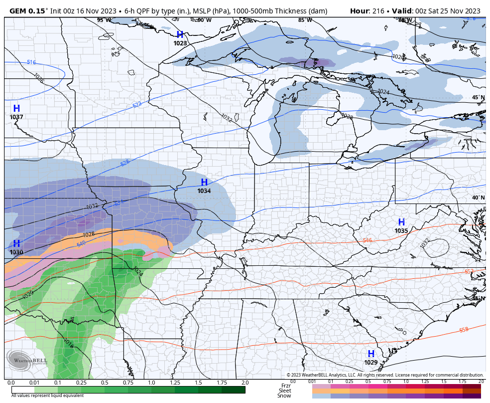
The pattern will then try to throw another storm system at us from the southwest into the holiday weekend. The Canadian shows rain and snow working into the Ohio Valley from the southwest…
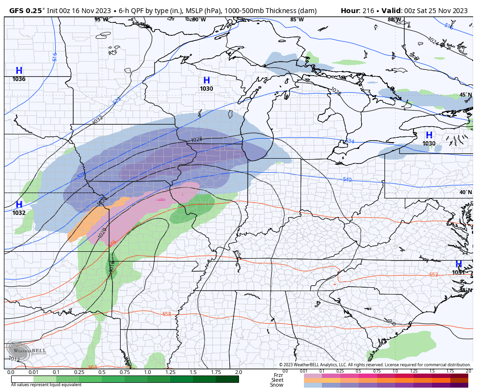
The GFS always jumps on too much northern stream energy so it’s, predictably, a bit north but has a couple of threats…
Overall, this is a very cold last few weeks of November taking shape.
I will have another update later today. Make it a good one and take care.

No flakes in Richmond on Halloween. Maybe this time is different. 🙂
None in Greenup Co either. Close but no cigar.
A typical fence riding system. (later storm)
I hate the fence can we move it somewhere else lol ??
Hey Chris, as an English major in college, PLEASE STOP USING the word ‘super’ and instead substitute ‘very’. It just sounds much more adult.
You could also filter sharpen your writing or penmanship though chatGPT……such as this from today’s post.
User
REWRITE We are now one week from Thanksgiving and our weather pattern is about to turn super active.
ChatGPT
Thanksgiving is just a week away, and our weather is gearing up for a highly dynamic pattern.
Chris knows what he’s doing. Quit being pedantic.
I agree. Don’t need anybody telling Bailey how to talk. If you don’t like It, DON’T READ IT!!!
Very, very petty and uncalled for…He knows how to do the blogs great, been a follower since the beginning and this is the first post like this. PATHETIC!!!!
I wonder if there will be a need for English Majors in the future. Let GPT do your writing.
Nope, dying job as lots of others.
Your kidding….right!!!
I hope he doubles up on the word SUPER just for your benefit!
Chris as always thanks for all you do, looking forward to your winter outlook.