Good Friday to one and all. It’s a wet day for much of the region as a cold front rolls across the Commonwealth. This boundary brings seasonably cold air for the weekend, but there’s an absolutely frigid air mass coming at us Thanksgiving week. This is a pattern that looks a lot like the heart of wintertime.
Let’s kick things off with what’s going on out there today. Showers are working from west to east with our cold front crossing into the state late this afternoon and evening. Beneficial rains of .25″ to .50″ will be common across central and eastern Kentucky with locally higher amounts possible. Much lighter amounts will be possible in the west.
The showers will taper from northwest to southeast this evening into the wee hours of Saturday morning.
Here are your fully rested radars to track today’s action…

Much colder air sweeps in behind this for the weekend. Highs on Saturday may not get out of the 40s for much of central and eastern Kentucky…
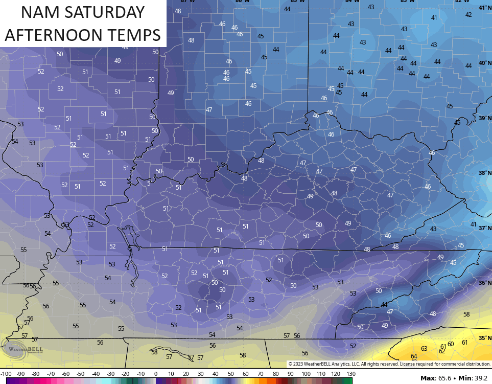
Sunday looks really good with near normal temps.
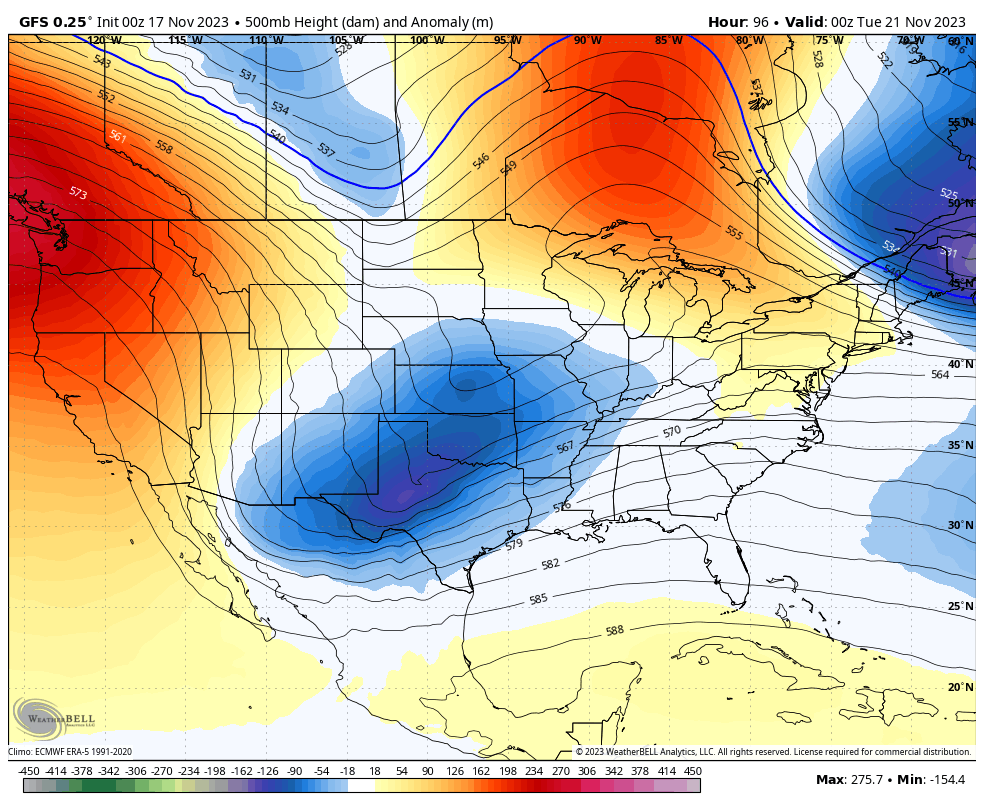
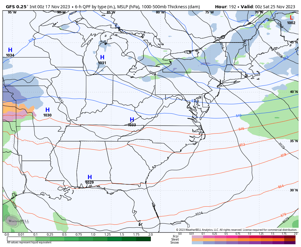
That brings us to our big storm system coming our way in the Monday through Wednesday time period. In the overall scheme of things, I have no changes to the thoughts I’ve had out on this system for quite a while now.
- Low pressure develops in the lower Mississippi Valley Monday and lifts northward into the Ohio Valley on Tuesday. From there, our strengthening storm works to the northeast with a second low popping along the east coast.
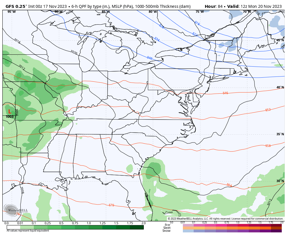
- Rain moves in here from southwest to northeast fairly quickly on Monday.
- Rounds of rain and gusty winds will be common Tuesday as the low works through the region. There could even be a rumble of thunder.
- Winds will be gusty as this low works through with peak gusts of 30-35mph possible.
- Cold air quickly surges in behind the departing low Tuesday night and Wednesday. Leftover moisture could be in the form of a few showers or even some snowflakes.
- Arctic air then surges in late Wednesday into Thanksgiving Day. Lows may reach the upper teens by Thanksgiving morning with highs 30-35 looking possible as of right now. Gusty winds make it feel even colder.
The forecast models continue to have a decent handle on this early season storm system.
The latest GFS went back to what it had been showing up until the past few days and that’s a fully phased system…
That’s stout, folks!
That upper level setup spawns a heck of a surface low that is cold enough to wrap some flakes back in here…
As mentioned, this is some serious cold for much of the country and could make for one of the coldest Thanksgiving Days for the country in a long, long time. Check out the wind chills from this run of the GFS from 7am Wednesday through 7am Thanksgiving Day…
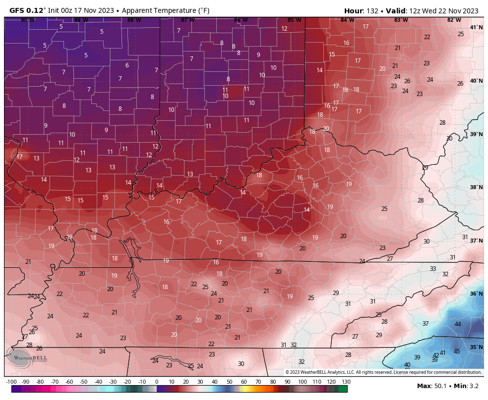
I mean… That’s some crazy cold for this early in the season.
The Canadian is similar to the GFS, but the EURO appears to be holding too much energy back in the southwest. That’s one of the biases of the model, as you know.
The setup for the rest of the long Thanksgiving holiday weekend is primed for another storm system or two to zip across our region from the southwest. Rain and/or snow will be possible with these systems…
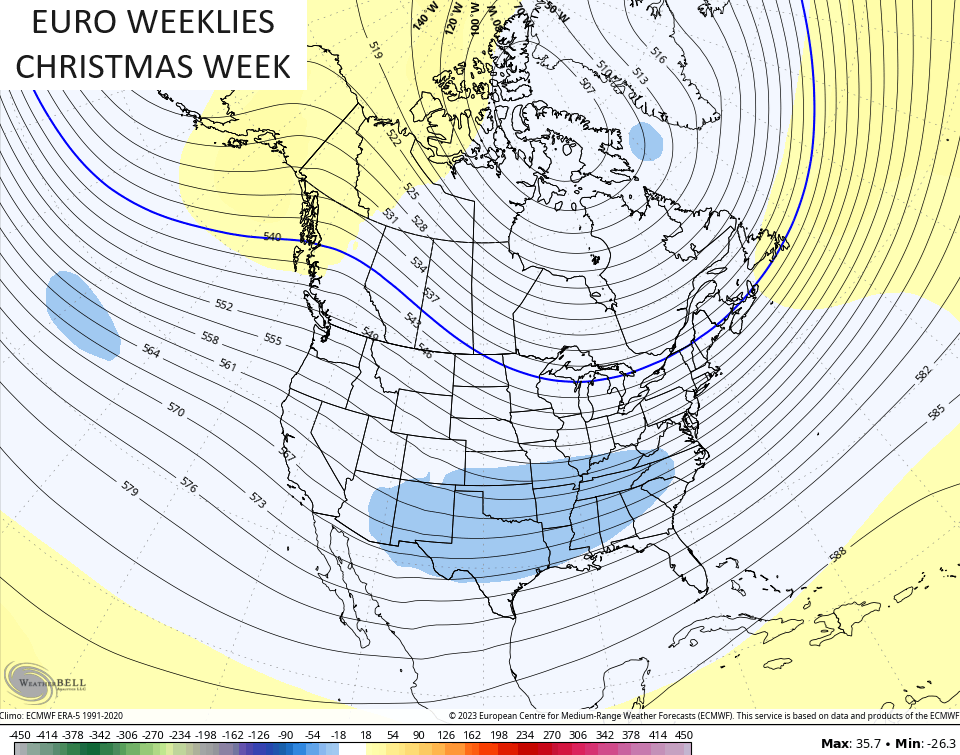
Looking long range toward the BIG holiday that is Christmas, we find the EURO Weeklies with a cold and active look for Christmas week…
I will have another update later today. Have a fantastic Friday and take care.

Thanks Chris, your winter outlook is a interesting one. Only time will tell.