Good evening, everyone. Much-needed rains continue to push across central and eastern Kentucky as a cold front slides through here. This makes for a nice weekend before a big storm system impacts the early Thanksgiving holiday travel period.
The showers this evening will end from west to east with a few overnight lingering showers possible in the east and southeast.
Here are your radars to follow along…

As far as the next system is concerned, I have no changes to my earlier thoughts.
The GFS is doing GFS things as it can no longer find even a storm system or cold air. This is what the model does before coming back around.
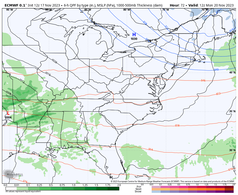
The EURO still has a healthy storm system…
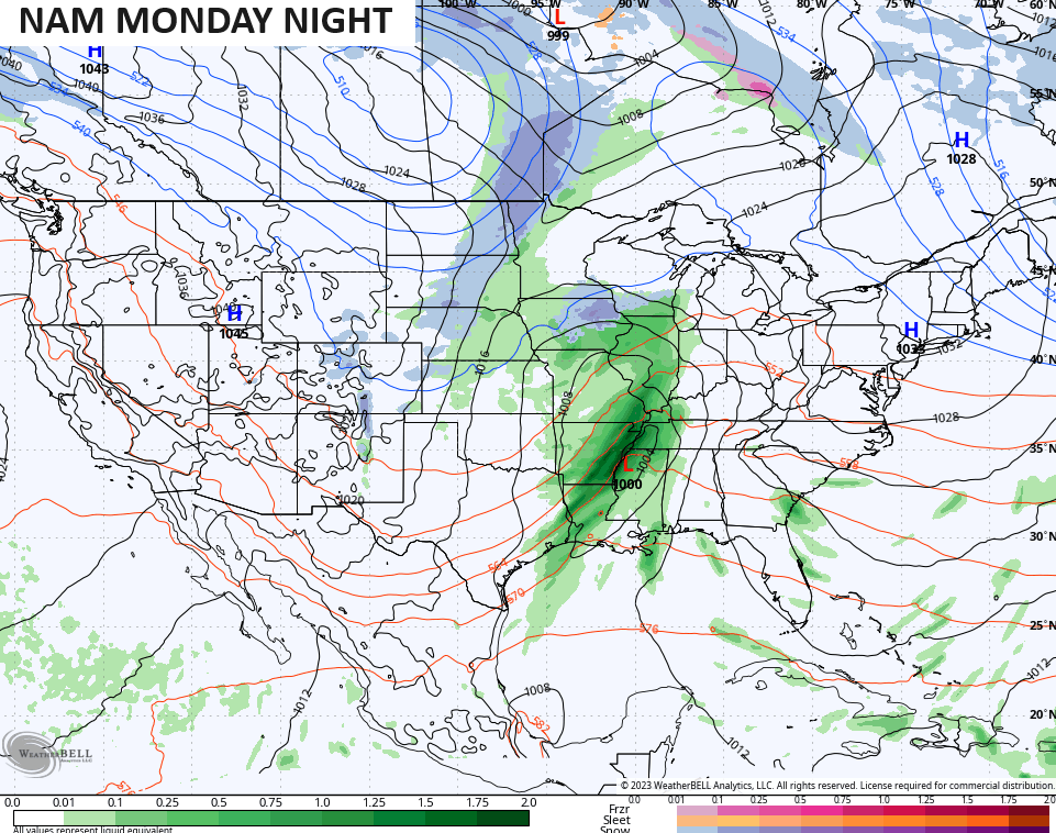
The NAM only goes out through Monday night but the model looks similar to the EUROm, but with the cold coming in quicker behind this system…
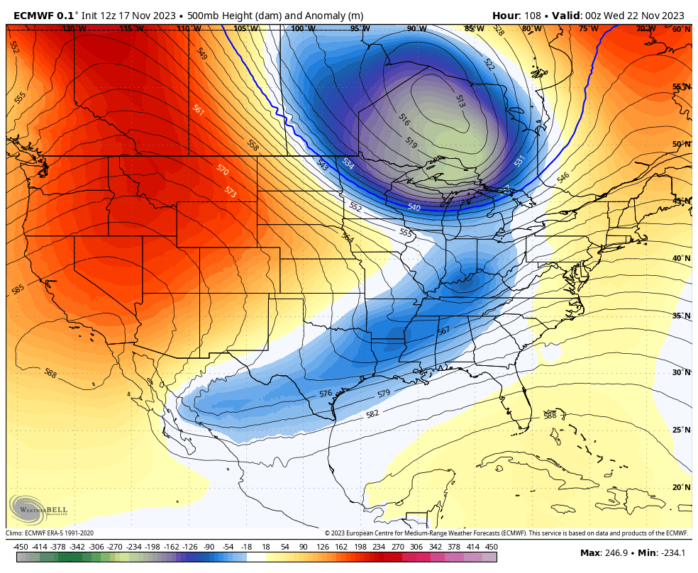
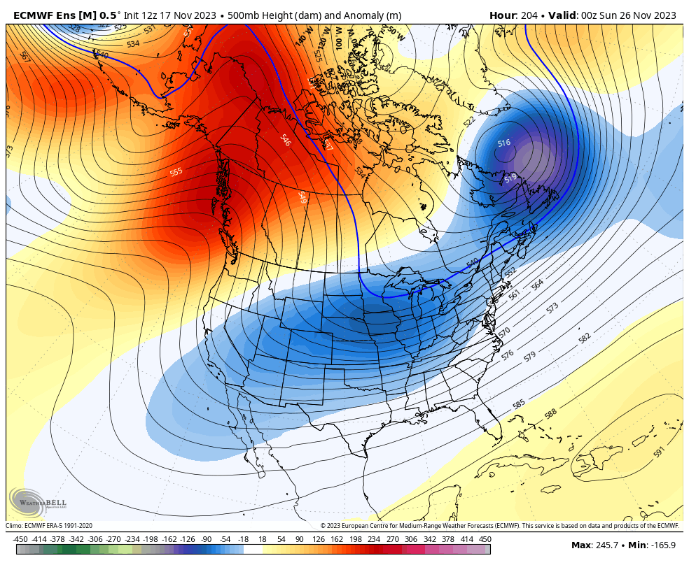
Once that system blows through, it sets the stage for cold air to continue to pour into the country with some healthy blocking up in Canada. Watch all this unfold upstairs…
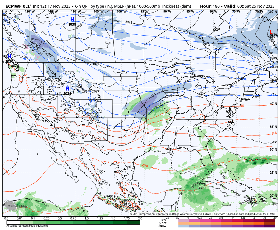
That setup would throw a few more systems with rain or snow into our region next weekend into early the folloing week…
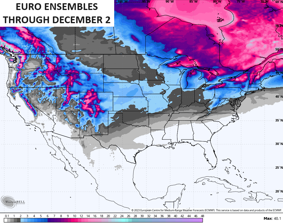
The EURO Ensembles are very cold looking all the way into the start of December. Watch how they keep that trough digging into our region…
The EURO Ensembles have some snow chances during this time…
Have a wonderful rest of the evening and take care.
