Good Saturday and welcome to the weekend. Much colder air is back in the bluegrass state today as high pressure noses in from the northwest. This is ahead of a potent storm system rolling our way int the start of the busy Thanksgiving week travel period.
Today may be a slow starter across the eastern half of the state as linger clouds slowly dissipate. By the afternoon, mostly sunny skies will be noted for the entire region as temps generally run from the upper 40s to low 50s.
Lows tonight are deep into the 20s to start a very nice Sunday. Highs are in the 50s with clouds increasing during the afternoon and evening. Those clouds are ahead of our storm system set to impact our weather from Monday through Wednesday.
Believe it or not, the exact details of this system are still being ironed out as the models struggle with continuity.
The EURO is probably showing the best run to run consistency right now…
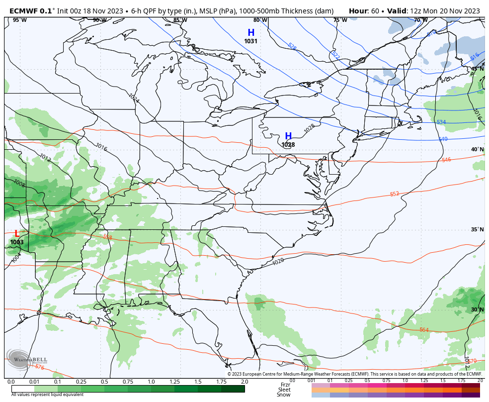
The GFS is absolutely all over the place and has been to every extreme over the past few runs. One of the latest runs had no big system, instead taking the system responsible for it deep into… Mexico. The latest run as of this post quickly abandoned that idea, but it threw another curveball into the mix as it now develops a second storm for Thanksgiving Day.
The model simply cannot handle this split flow pattern, but there’s really no pattern the GFS can fully handly anymore.
This latest run brings rain and wind in here late Monday through Tuesday and into early Wednesday, before popping another low to our southeast on Thursday…
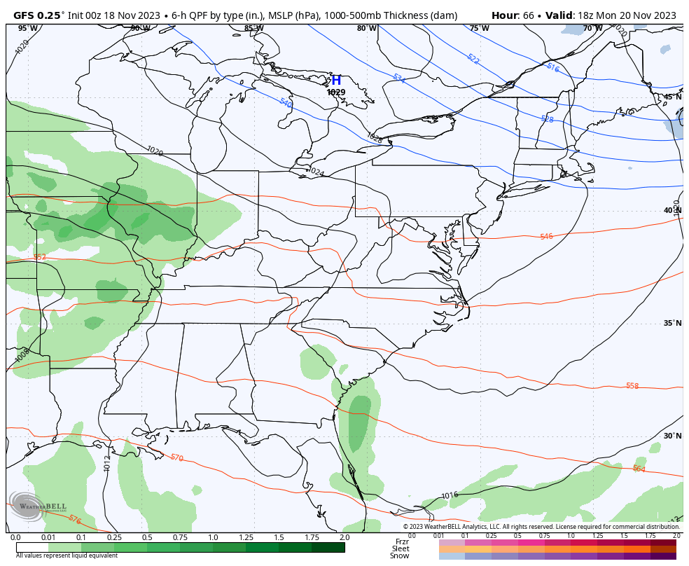
Now, the new EURO also sees the potential for this second system but keeps it to our southeast with additional systems coming in behind it next weekend into early the folowing week…

One thing’s for sure, this pattern is a lot different from last year!
I’ll throw you another update later today. Have a good one and take care.

.39 of rain in Corbin
The Southeast low on Thursday has a decent track, unfortunately there isn’t enough cold air to work with.
As expected, my PWS just south of Bowling Green recorded exactly 0.00″ of rain over the past 24 hours. However, chances for measurable rains during the Monday > Tuesday time frame seem to be growing, along with the possibility for some moderate to strong thunderstorms, especially in and to the south of the Bowling Green area.
the airport in lex recorded 0.04 … It seems like with these systems, whatever model shows the LEAST amount… that’s the one you go with.
Okay you all are too quiet on the weather blog lol where is Schroeder???? I did want to pop in and say I was very thankful for the rains we received and it was a good steady rain so hopefully it helped the fires get under control. Maybe none of us are commenting much because we are beaten down from no snow lol I hate I missed Chris winter forecast I have to find it on line and see if he made his Bold prediction???
Crystal, I believe his bold prediction was for a one day 10+ inch snowfall.
I finally saw that Dottie wow I hope
Here’s a link to Chris’s Winter forecast.
https://www.wkyt.com/2023/11/16/chris-baileys-2023-2024-winter-weather-forecast/
Thanks Joe