Good evening, folks. It’s all eyes on what looks like a very busy Thanksgiving week of weather across much of the country and that includes Kentucky. The potential is there for two or three systems to impact our weather over the next week.
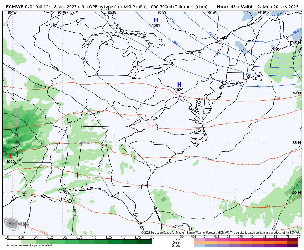
Let’s go straight to the big storm system rolling in here late Monday and Tuesday. This is a stout low pressure passing just to our west and will likely bring a lot of rain and wind to the region. There’s even the chance for some strong thunderstorms ahead of the low with much colder air wrapping in behind it, kicking off a full blown winter looking pattern.
The EURO is the model of choice as it has been very consistent of late…
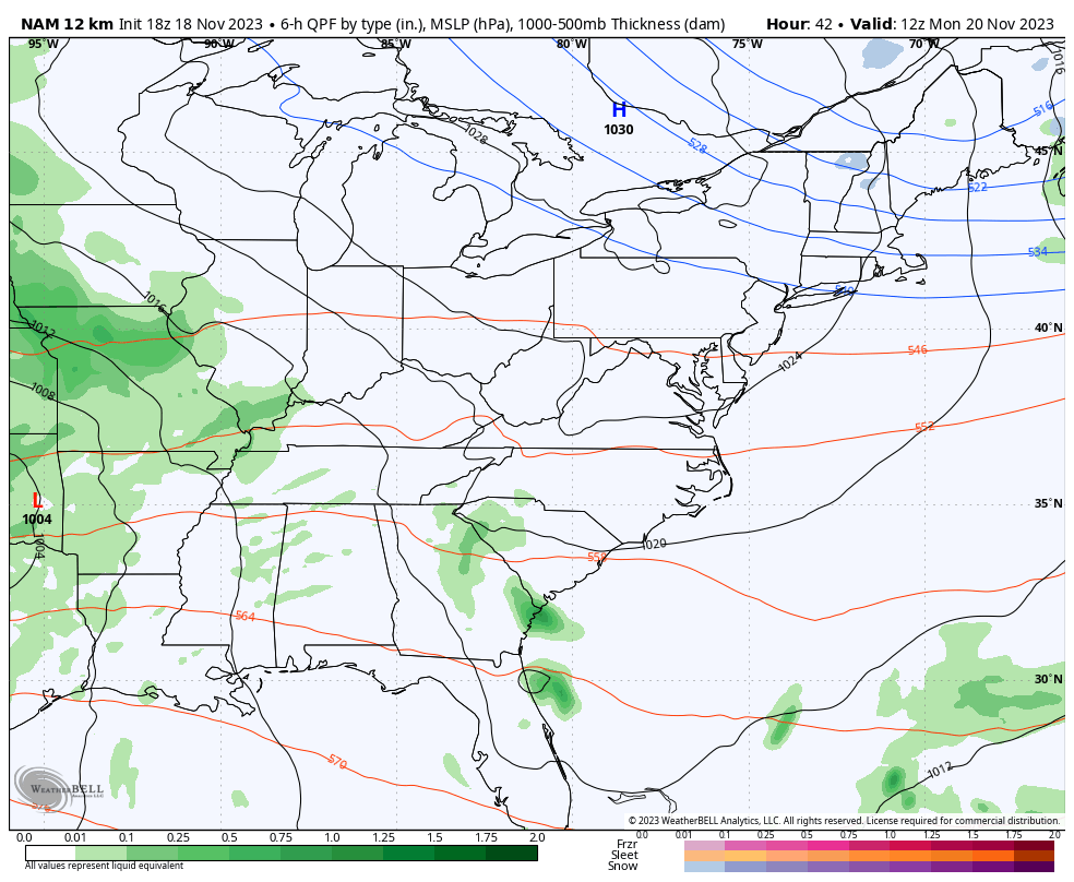
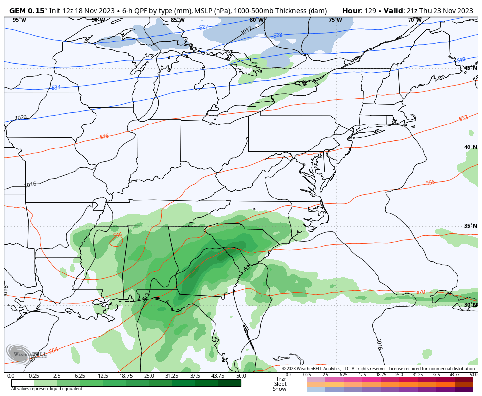
The NAM provided the EURO with some strong support…
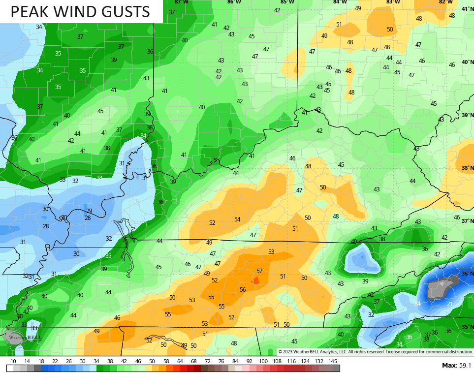
Winds look like a bigger player with this system as we get closer. The models are showing 40-50mph gusts…
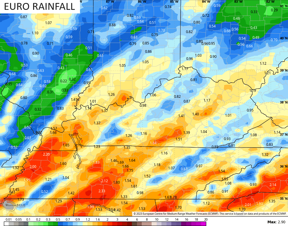
Widespread rainfall of a half to one inch looks common, but locally higher amounts will show up if thunderstorms do get into the mix. That’s what the EURO is seeing…
With the current setup, the REAL cold gets pushed deeper into Thanksgiving weekend, meaning Thanksgiving itself looks ok.
Make no mistake, this is a winter setup being unleashed with multiple storm systems that take aim at the region late this month and likely into early December.
The models will handle each system differently from this far out but you can see the potential…
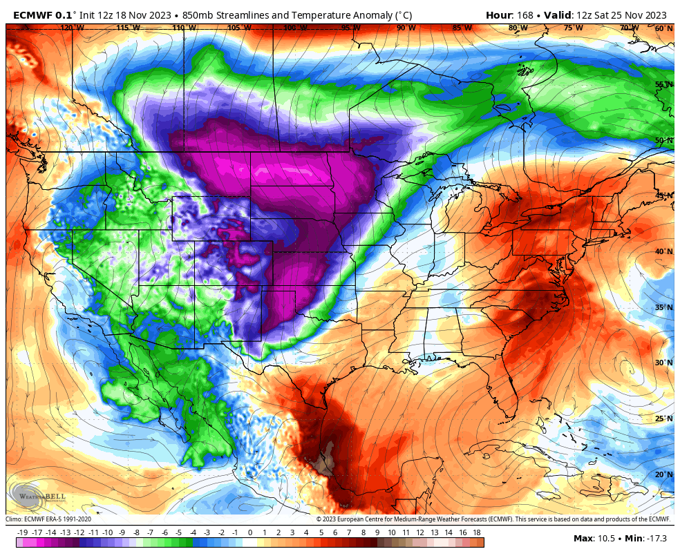
EURO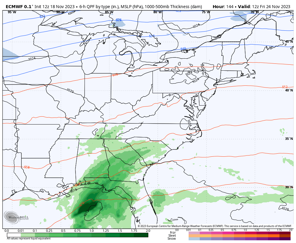
CANADIAN
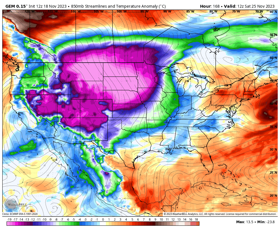
Watch the cold weather hammer drop on much of the country during this time…
EURO
CANADIAN
Some early season fun and games are on the table, kiddos.
I’ll see you later tonight for the main update. Enjoy the rest of the day and take care.
