Good Sunday, folks. We are just about to roll into Thanksgiving week and we have a major storm system set to impact our weather leading up to turkey day. This brings a lot of wind and rain in here before a winter looking pattern takes over.
Clouds will increase out there from west to east this afternoon and evening with temps into the 50s for most.
Here’s a breakdown of the storm to come:
- Low pressure develops in the southern Mississippi Valley Monday and rolls into western Kentucky Monday night and Tuesday. This winds up in the Great Lakes by Tuesday night.
- Showers develop in the west Monday and slowly push eastward into Monday evening.
- Rain and some thunderstorms then increase from southwest to northeast Monday night and Tuesday.
- I can’t rule out a few strong storms across southcentral and southeastern Kentucky.
- This action becomes more showery Tuesday night into early Wednesday as the low pulls away.
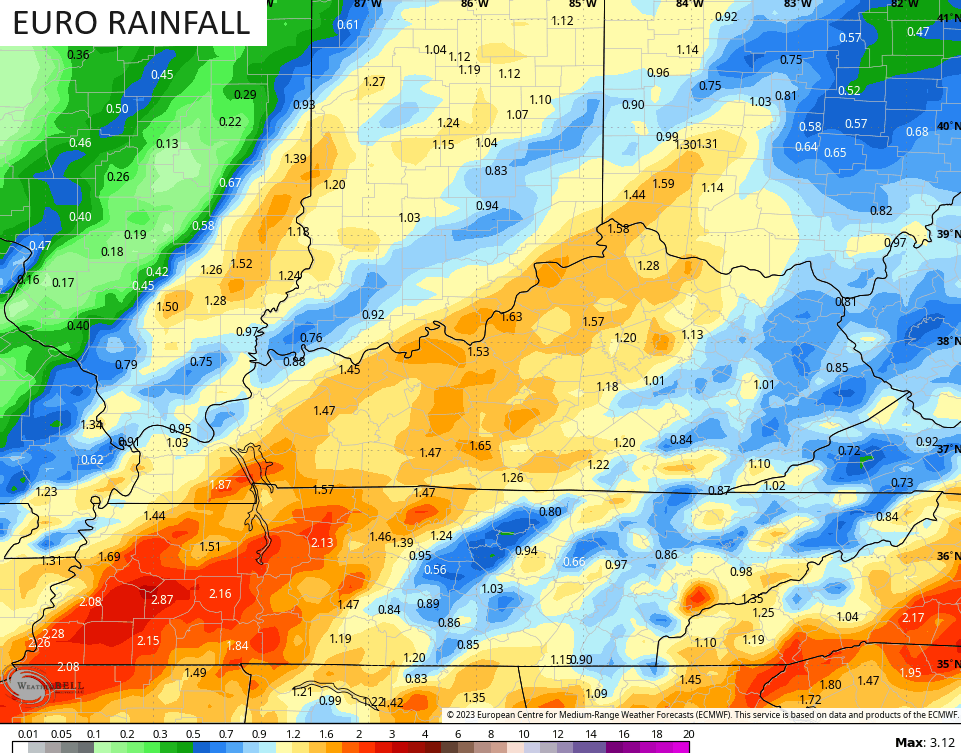
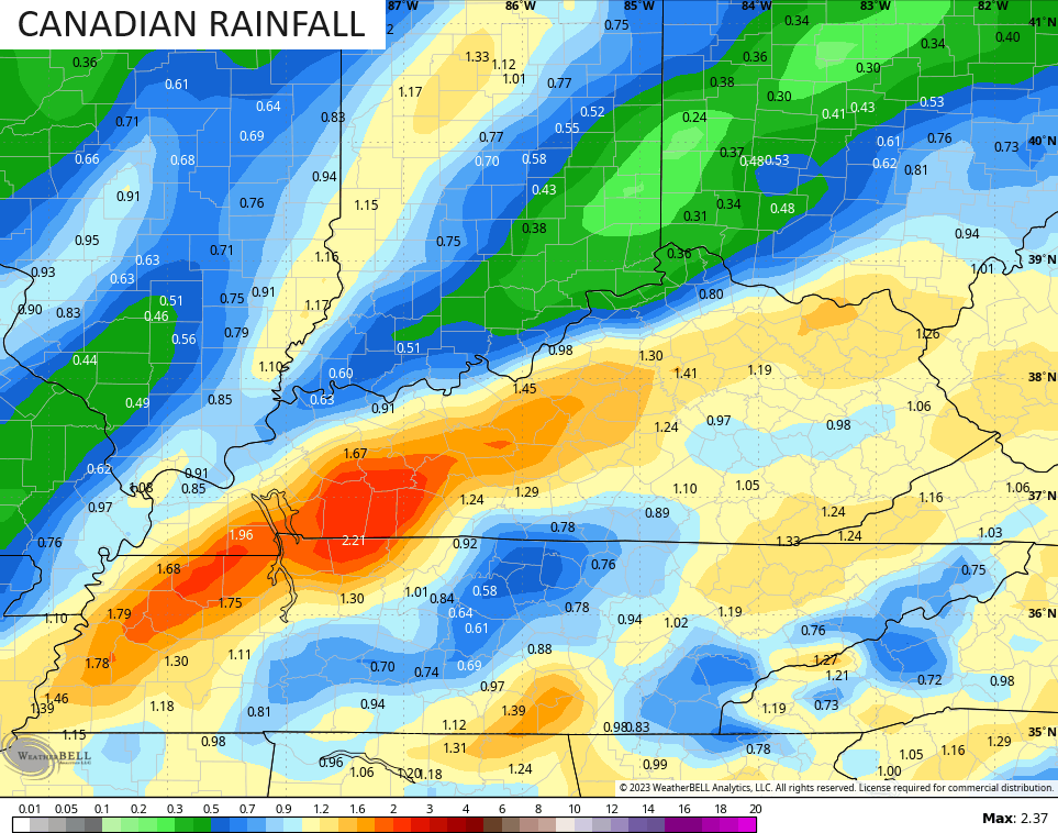
- Rainfall numbers should average .50 to 1.5″ for many with some local 2″ amounts possible.
- Winds are a big player with this system with gusts of 40mph possible. There’s an outside shot of gusts to 50mph.
- The air behind this is chilly but not as cold as what it looked like a few days ago. That’s pushed back deeper into the weekend.
- Thanksgiving Day looks mainly dry with temps upper 40s to low 50s.
Here’s how I’m expecting the most active part of this storm to look on Tuesday…
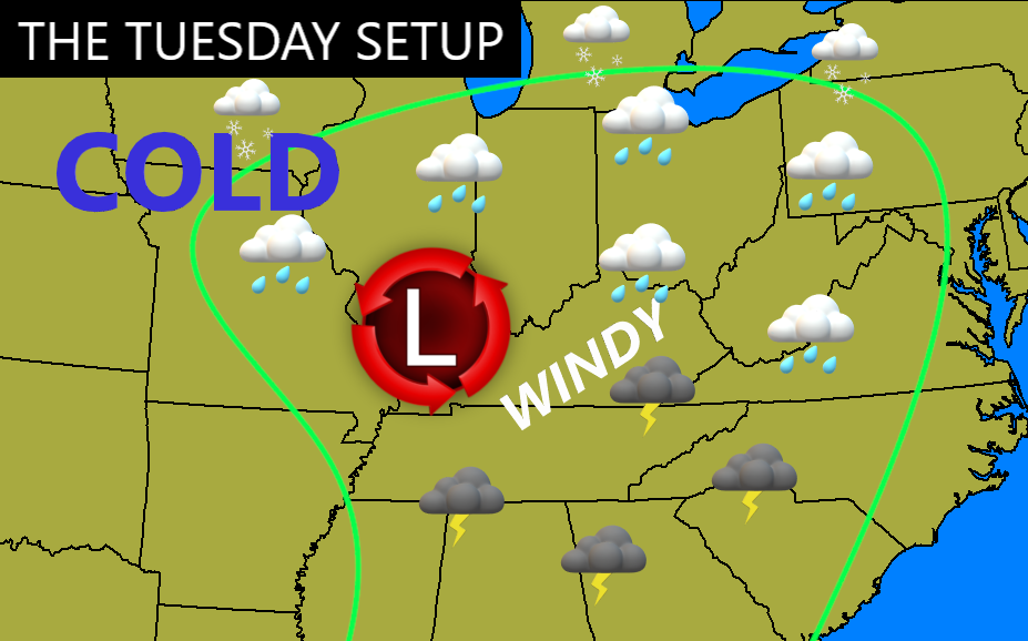
In terms of rainfall, the models are pretty juiced up for, what would be, our heaviest and most widespread rainfall in a couple months…

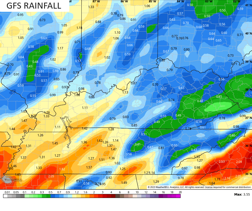
The GFS is not like the others, but it’s ALWAYS a work in progress…
What happens at the end of the week and weekend? Can we get another system to roll at us from the southwest on Black Friday? That’s certainly a possibility with the real cold slowly crashing in from the northwest.
The EURO is seeing it…
The Canadian Model is now up for this scenario…
It also likes another southern system a few days later…
There’s a ton of early season cold dropping into the country over the next few weeks. This is something the Ensembles have been all over for a while and the operational models have jumped into the cold water as well.
It’s not often you see the Barney colors showing up in November, but here we are…
Moral of the story is that the potential for early season winter weather is on the table as we end November and roll into early December. With a lot of cold air around and an active southern storm track, one can see the possibilities.
We haven’t had an early season thumper in a long, long time so we are overdue. Come on, extreme weather, do your thing in the snow department for a change! 😜
Another update comes your way later today. Make it a good one and take care.

Thanks Chris sure looks foggy out. I finally got to see your winter forecast I really like your bold prediction!! Looks like the cold will be there this winter now let’s see about getting it together with the moisture and please not a lot of cold rain unless it changes to snow lol.
I am not surprise that the models over hyped the cold air.
I haven’t been posting because there’s no real changes in the weather patterns over the last several years. The dry, mild Fall has been enjoyable, but the worse dry spell I’ve seen since 1987. We have been lucky so far as to not having any Forest Fires around my home. Hoping we receive some Rains soon. The system forecast tomorrow night looks like it won’t produce the widespread Rains as earlier thought. Why would they think that it would be different from the last several systems, which are not phased storms ? Always follows the same path.
Thanks Chris. Your outlook for the Winter as always may or may not pan out. Your presentation was great and I liked your explanation why this El Nino is not reacting to the atmosphere as of yet. NOAA is doubtful that this strong El Nino will have any influence on Kentucky like it did in the very strong El Nino in 2015. The 1969 -70 weak El Nino was the best for widespread Snowstorms that started in December and continued through March 1970. The wettest and warmest El Nino was in 1982 -83. This is what we need this coming Winter to get out of this ongoing drought.
Schroeder, this next system that’s coming our way is different than the previous systems. This one got a lot of moisture coming from the Gulf that will give us a decent soaker that we have been lacking lately. It’s a good southern flow that’s exactly what we need that we haven’t had a while. Hopefully this is a start of patter we need to be in to break this drought.