Good evening, folks. We’re putting the wraps on the weekend and with the Thanksgiving week of weather staring us right in the face. We have a super active setup that’s going to bring a lot of rain and wind before we get into a full blown winter setup.
Before we get into the latest data, let’s review where I stand on the first system coming into town over the next few days:
- Low pressure develops in the southern Mississippi Valley Monday and rolls into western Kentucky Monday night and Tuesday. This winds up in the Great Lakes by Tuesday night.
- Showers develop in the west Monday and slowly push eastward into Monday evening.
- Rain and some thunderstorms then increase from southwest to northeast Monday night and Tuesday.
- I can’t rule out a few strong storms across southcentral and southeastern Kentucky.
- This action becomes more showery Tuesday night into early Wednesday as the low pulls away.
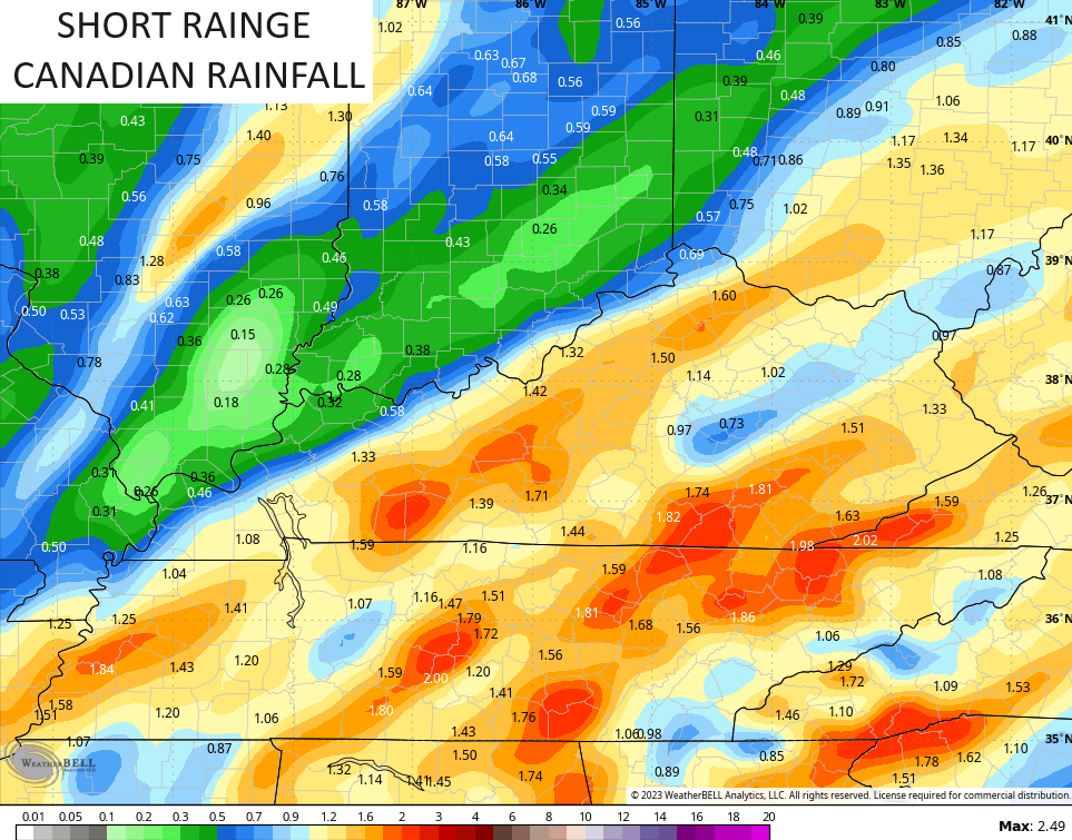
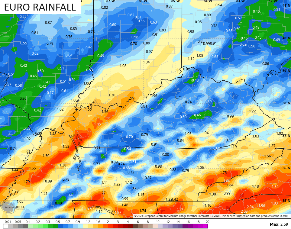
- Rainfall numbers should average .50 to 1.5″ for many with some local 2″ amounts possible.
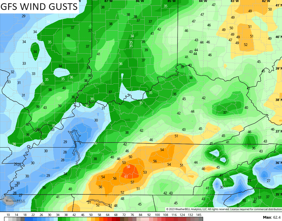
- Winds are a big player with this system with gusts of 40mph possible. There’s an outside shot of gusts to 50mph.
- The air behind this is chilly but not as cold as what it looked like a few days ago. That’s pushed back deeper into the weekend.
- Wednesday stays 40-45 for much of the day for highs.
- Thanksgiving Day looks mainly dry with temps upper 40s to low 50s.
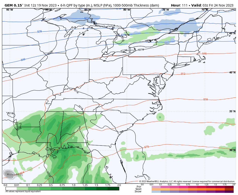
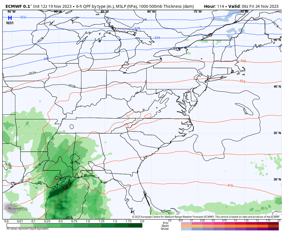
The forecast models are all in on the soaking rain potential over with this first system…
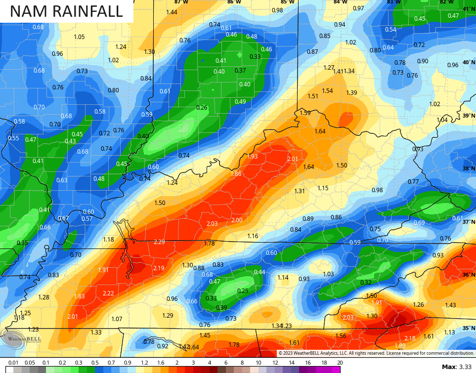
Those are some good-looking rainfall maps, folks!
Wind gusts to 40mph can’t be ruled out as the low works across the region onTuesday. The NAM fam and the GFS have higher wind gusts…

Cold showers last into Wednesday and there’s the chance for a flake to show up across the mountains of southeastern Kentucky.
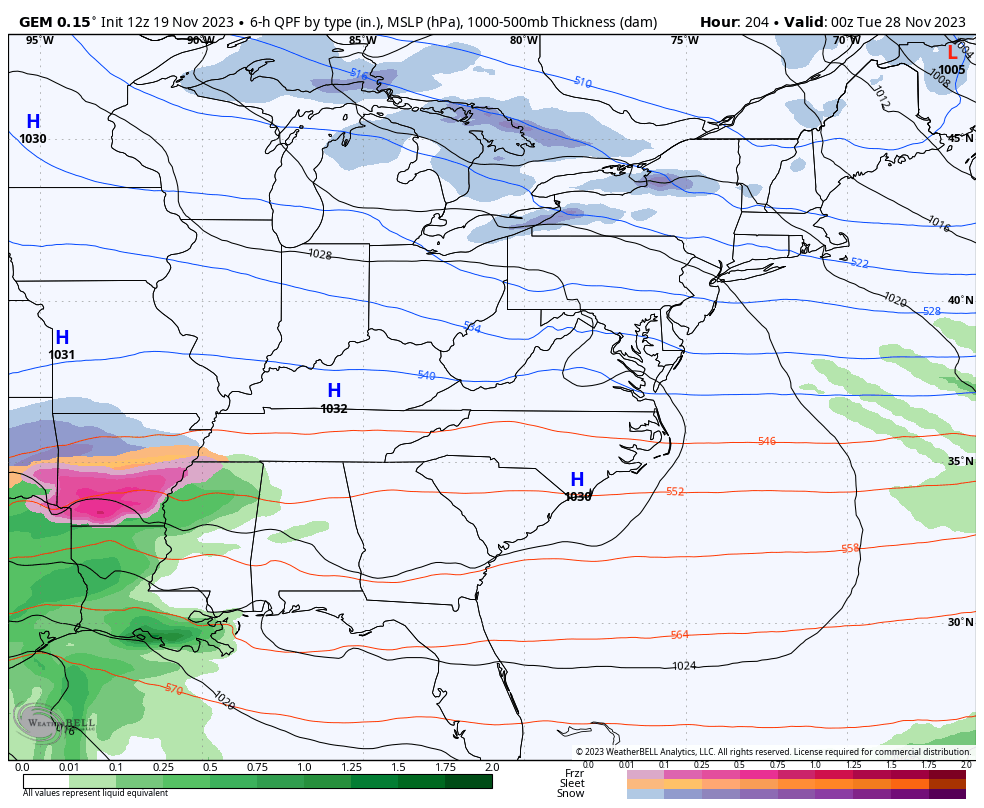
The next system then rolls in here with more rain Thanksgiving night and Friday. As this works through, it unlocks the cold air to our northwest and drills it in here over the weekend with the chance for some flakes to fly.
The Canadian sees this…
So does the EURO…
The stage is then setup for another storm system to try and develop and roll our way from the southwest a few days later. This may be our first “track of the low” storm system of what will likely be many this winter…
I will go more in depth on the post-Thanksgiving setup with my overnight update. See you then.
Enjoy your evening and take care.

We are all rooting for the Canadian, to score a coup.
The low will probably end up running up the Ohio River like so many other fence riding storms have done in the past.
I really hope we get the high-end of forecasted rain with this system, as the previous system (Friday afternoon) really underperformed. Around 3pm we got a gusty, soaking rain for about an hour & a half, maybe 2 hours, and then light rain that tapered off into nothing quite early in the evening (probably before midnight?)