Good Monday, folks. It’s Thanksgiving week and we have a big storm system ready to blow through here with a lot of rain and wind over the next few days. This is part of a very active pattern that takes on more of a winter look and feel this weekend into next week.
Speaking of winter, for those who missed it, here’s my winter forecast: WATCH | Chris Bailey’s 2023-2024 Winter Weather Forecast (wkyt.com)
- Low pressure moves from the Mississippi Valley into western Kentucky tonight and Tuesday. This winds up in the Great Lakes by Tuesday night.
- Showers develop in the west early today and these will slowly push eastward into the evening hours.
- Rain and some thunderstorms then increase from southwest to northeast tonight and Tuesday.
- I can’t rule out a few strong storms across southcentral and southeastern Kentucky Tuesday.
- Rain tapers to scattered showers Tuesday night into Wednesday morning as the low pulls away.
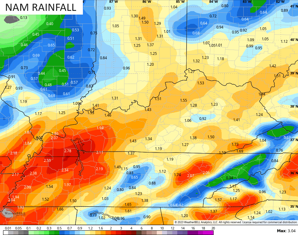
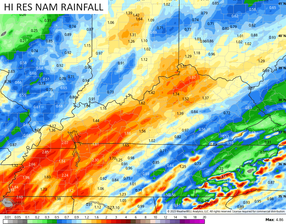
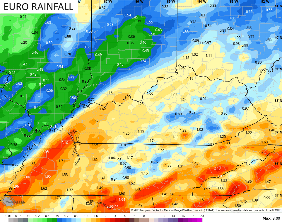
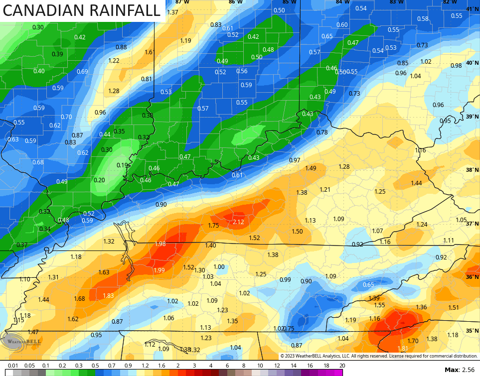
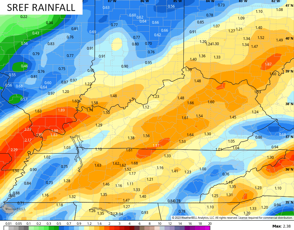
- Rainfall numbers should average .50 to 1.5″ for many with some local 2″ amounts possible.
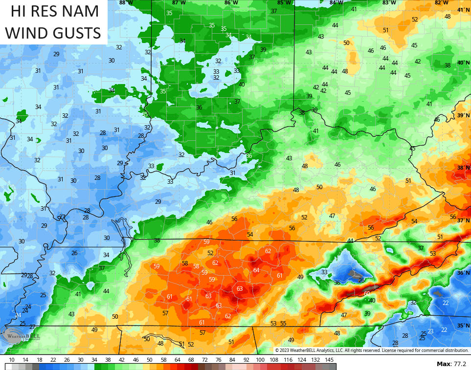
- Winds are a big player with this system with gusts of 40mph possible. There’s an outside shot of gusts to 50mph in the south and east.
- The air behind this is chilly but not as cold as what it looked like a few days ago. That’s pushed back deeper into the weekend.
- Wednesday stays in the 40s for much of the day for highs.
- Thanksgiving Day looks mainly dry with temps deep into the 20s to start with afternoon highs in the upper 40s to low 50s.
The models are in pretty good agreement with the rainfall numbers but differ a bit on placement…
In terms of the wind, the NAM fam has the highest gust potential with gusts topping 40mph in central and eastern Kentucky with gusts of 50 in the south and southeast…
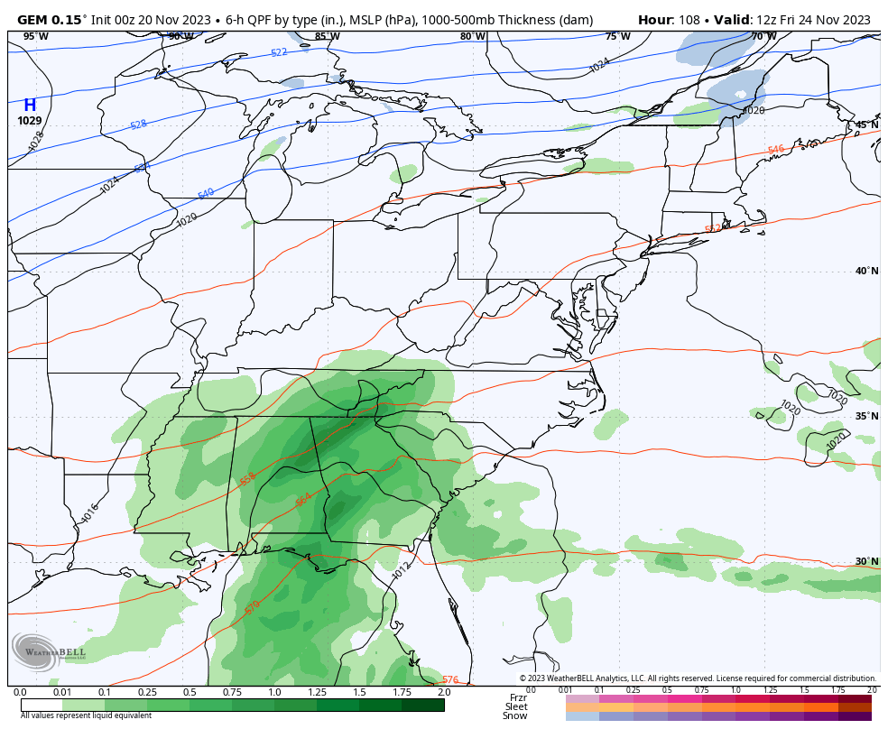
From here, we watch another system that can bring us some rain for Black Friday shoppers, but I’m not sure on how much of an impact this has on us. The cold coming in from the north may push the track of this system farther to the south. The Canadian is certainly showing this potential as it only brings some rain into eastern Kentucky before the cold crushes it…
The EURO is even farther south with this system…

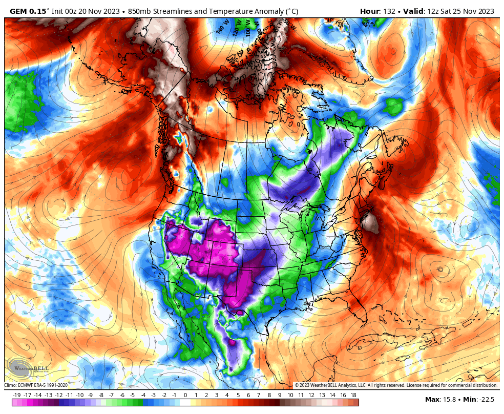
That makes sense given how this setup is bringing a lot of early season cold into the country and this likely carries us into the opening week of December.
Here’s the Canadian showing the cold…
Can we get a couple of winter weather makers to impact our weather over the next few weeks? The chances are a little above normal for this time of year!
I will have another update later today. Until then, here are your radars to track the rain in from the west and southwest…

Make it a great Monday and take care.

I guess we should be happy that the models were incorrect concerning Thanksgiving.
A seven to ten day model forecast is useless.
At least all the models are showing over an inch for us… Not holding my breath as the models last time gave us 0.25 to 0.50 and we got 0.06. Hopefully this brings an end to these strings of miserable anemic systems. But what we have had has certainly been better than nothing…
Chris – why did you stop doing a blog winter forecast? You used to. Now it’s only limited to WKYT.