Good evening, folks. It’s full steam ahead toward Thanksgiving Day with some lingering clouds likely impacting the temps for parts of the region. I’m also tracking a system to end the long weekend on Sunday.
Most of the misty shower action has ended across Kentucky but a shower or two is still going strong across the Virginia counties…

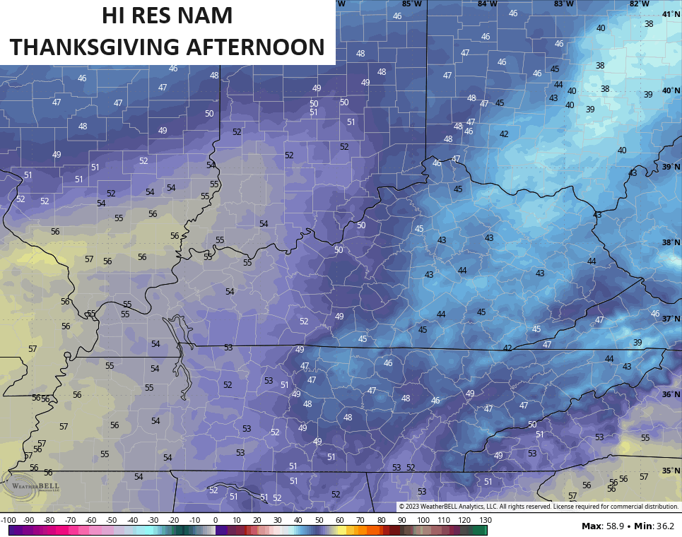
Lingering clouds continue for parts of the region on Thanksgiving day. Temps range from the mid 40s to mid 50s across the state. The Hi Res NAM continues to show more clouds than other models and you can clearly see that on the temp forecast…
A cold front drops in from the northwest on Friday with a healthy north-south temp gradient. 40-45 north and 50-55 south will be a good bet.
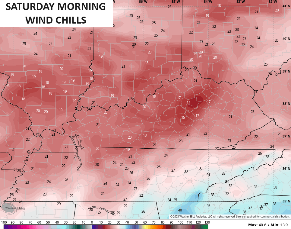
Colder winds then settle in for Friday night with lows deep into the 20s. Wind chills Saturday morning may reach the teens…
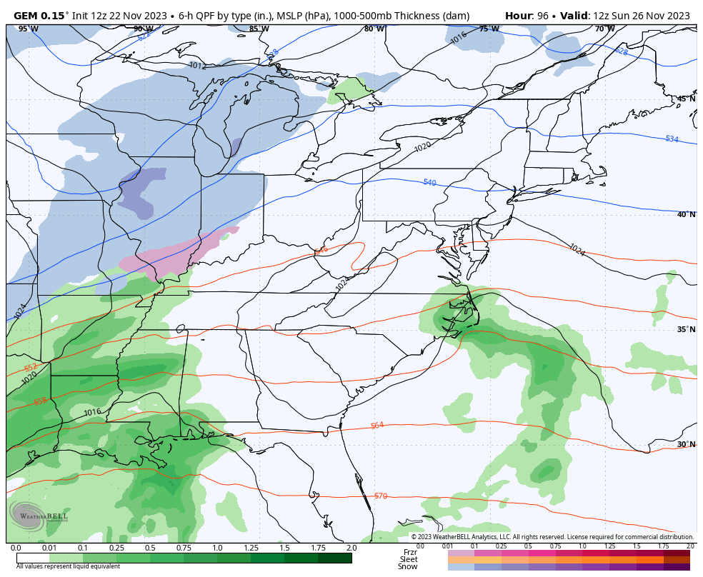
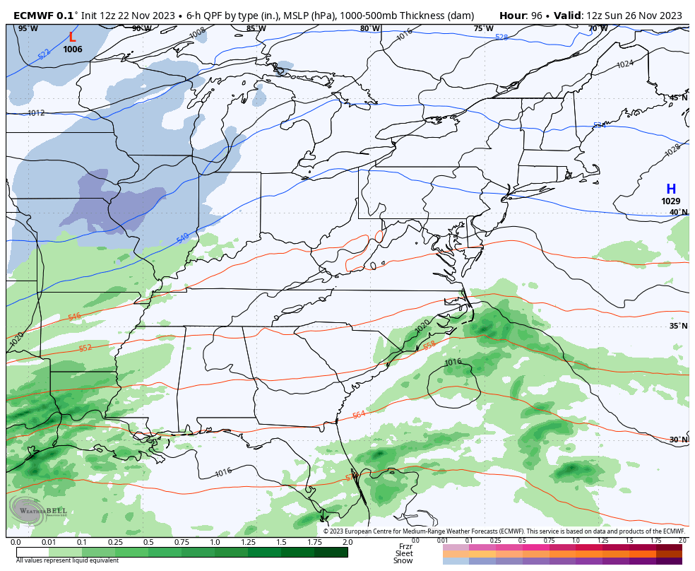
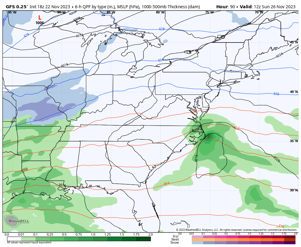
The system coming in Sunday and Sunday night looks messy for the end of this long travel weekend. Cold showers are likely with the chance for a mix to end things.
The Canadian shows this and the cold that follows, with another system approaching from the southwest to begin December…
Here’s the EURO with this first system…
And the GFS…
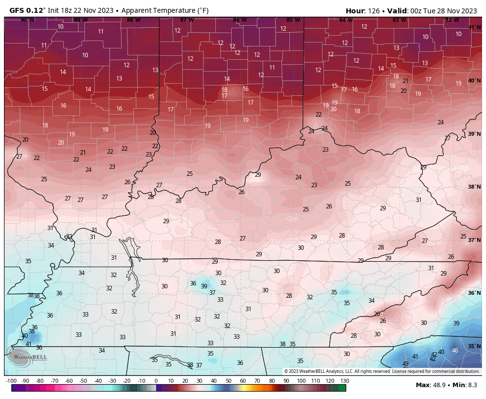
Some really cold air comes in behind this system from Monday through Wednesday. The GFS wind chill map looks like this…
Enjoy the evening and take care.
