Good Saturday, folks. This super-duper long Thanksgiving weekend rolls on with another nice one out there today before a Sunday moves in. Gusty showers will work through here with the potential for some flakes behind it Sunday night and early Monday.
As usual, we begin with what’s going on in the precious present before looking ahead. We are deep into the 20s for most to start the day with wind chills in the high teens central and north. Temps this afternoon range from 40-45 north with 50-55 in the south and west.
Clouds will increase this afternoon and evening as our Sunday system inches closer. Showers push into western Kentucky early Sunday morning and then sweep across the rest of the state during the afternoon and evening. The actual cold front arrives on the scene Sunday night with falling temps and the chance for some flakes behind it Sunday night and early Monday.
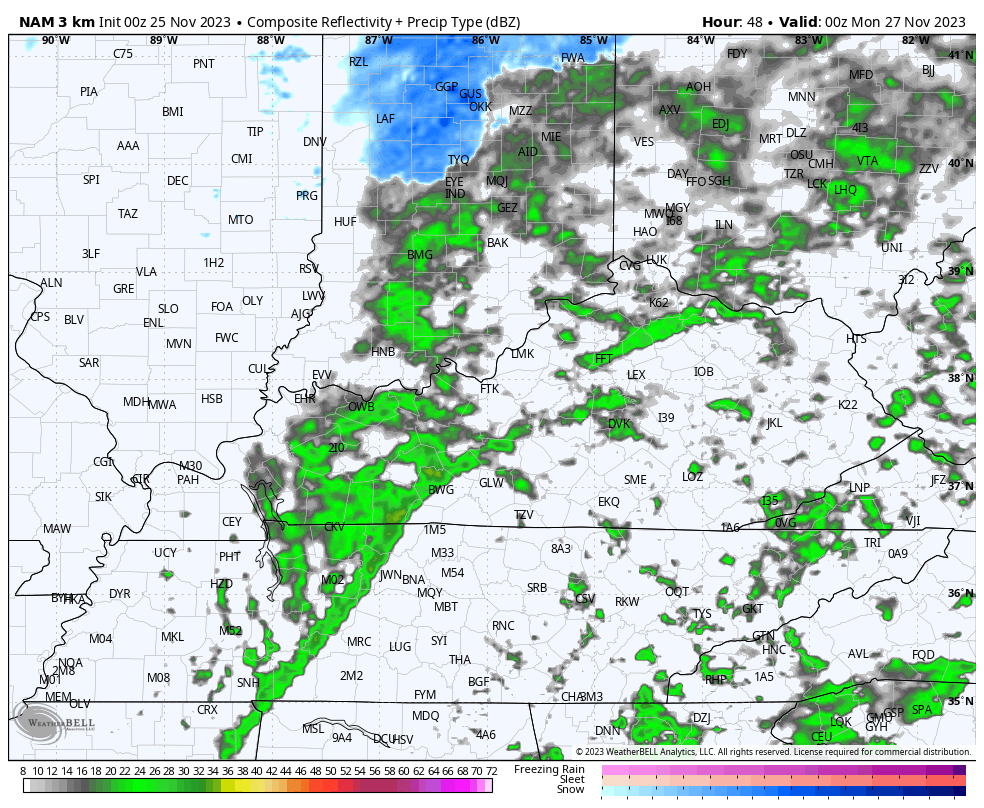
The future radar from the HI RES NAM only goes through Monday morning, but you can see some of those flakes showing up in central and eastern Kentucky. This animation goes from 7pm Sunday through 7am Monday…
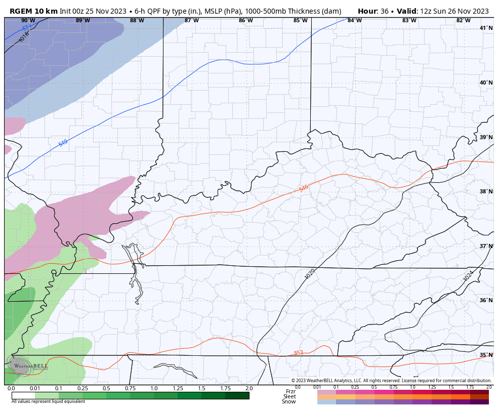
The Canadian family of models was the first to show any flake chance and they continue to have the best chance. This animation starts at 7am Sunday and runs through 4pm Monday…
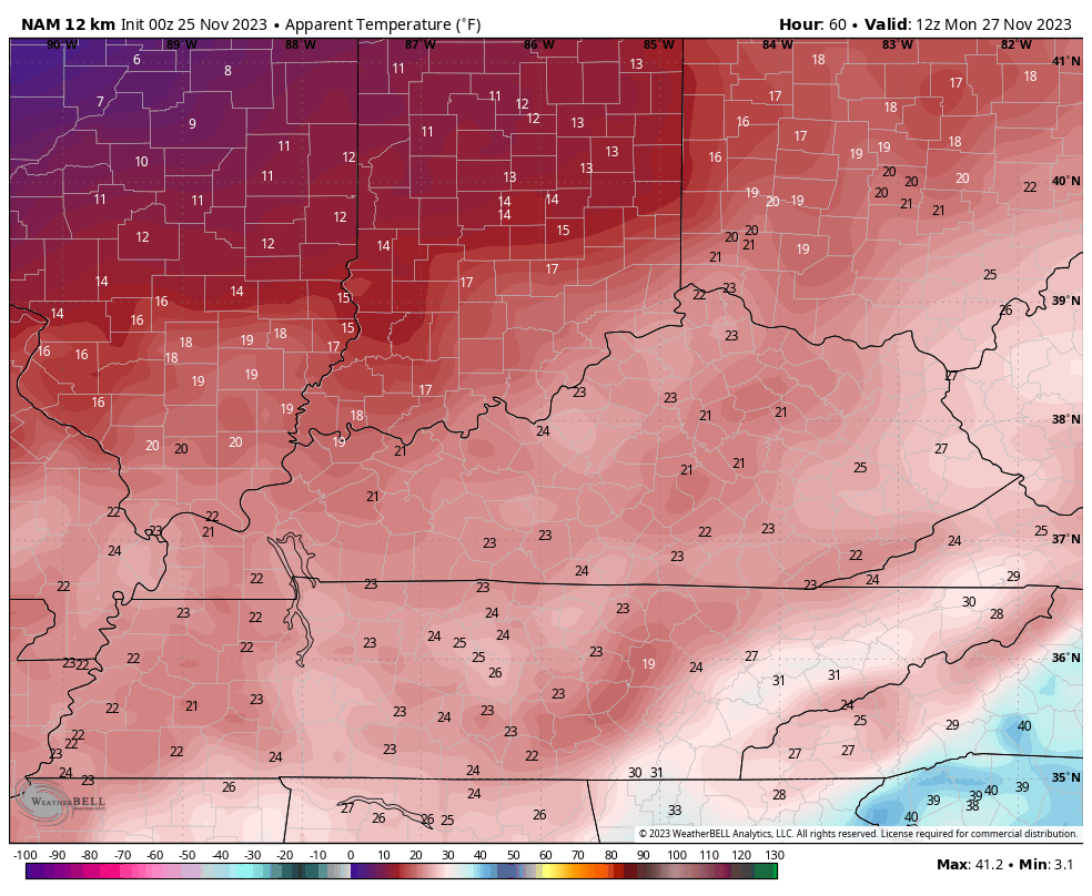
Cold winds will be noted Monday and Tuesday as highs hang out in the 30s. Lows by Tuesday morning can make a run at the upper teens. Wind chills are a player and will make it feel much, much colder.
You can see the numbers from 7am Monday through 7am Tuesday…
There’s a second system working through the Great Lakes on Tuesday and it has the chance to spit out a few flakes in the north and east.
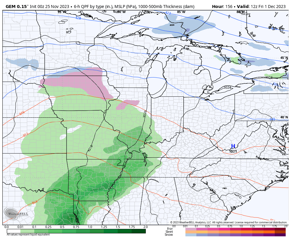
The numbers start to come up from late Wednesday into Thursday as we focus on the potential for significant rainfall from Friday through Monday. Rainfall totals of 1″-2″ will be a good bet during this time as a few systems roll right on top of us during this time…
Colder temps come in behind this and we see the return of the eastern US trough developing later in the first week of December. The Ensembles are pretty excited about this…
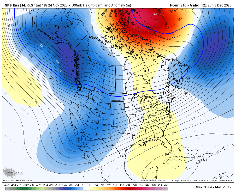
The longer range models like the GFS Extended and the EURO Weeklies are also pretty jacked up about this trough being the dominate feature through Christmas. These maps show the average 500mb height anomalies for the next month…
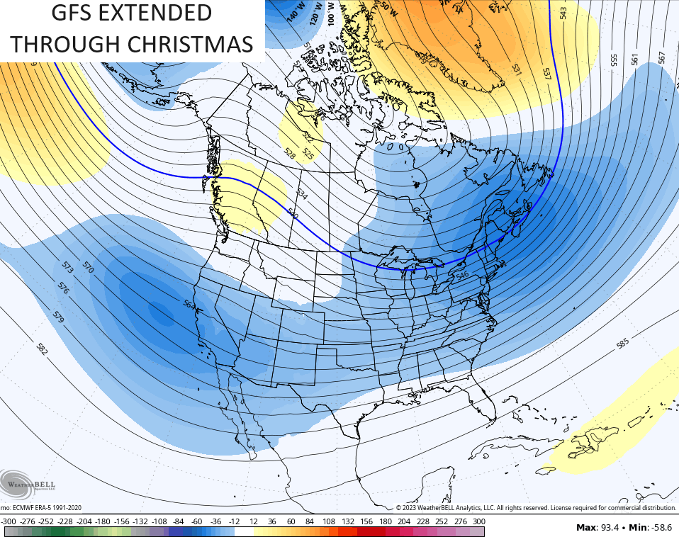
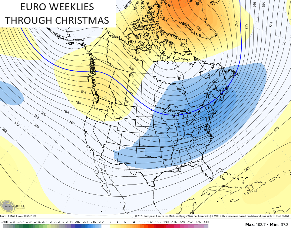
That’s not a signal I expected to see so soon this winter, but I don’t think any winter weather lovers will care if it arrives early and stays late. ❄️🥶😜
Another update comes your way later today. Have a sensational Saturday and take care.

Thanks Chris. Yesterday morning we had our really hard Frost for the first time this Fall. It was so heavy it looked like it Snowed. Hoping for some more good Rains later in the week like we had last week. Snows are getting closer and the models suggesting a cold period through Christmas and New Years. Will we have a White Christmas and New Years ? Time will only tell.