Good evening, folks. Our messy Sunday system continues to roll our way and will bring gusty showers before a blast of cold air settles in. Kicking off the cold will be some festive flakes flying Sunday night and Monday. The longer range setup features a lot of rain before winter looks to really settle in.
Showers move into western Kentucky late tonight and early Sunday before overspreading the rest of the state during the day. As the cold front moves through here Sunday evening, temps crash and the potential is there for a light snow shower or some flurries Sunday night into early Monday.
The future radar from the Hi Res NAM shows the streaking flakes…
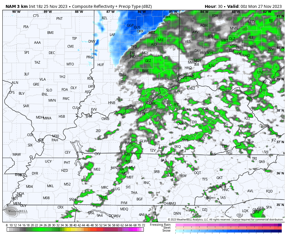
Festive flakes, folks! ❄️❄️
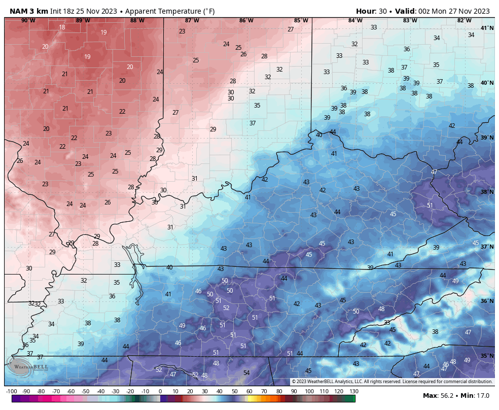
Very cold winds blow behind this front and your Monday is going to be a cold one! Look at these wind chills from 7pm Sunday through 7pm Monday…
Cold winds continue through Tuesday into early Wednesday before things relax a bit for the end of the week as the first of two storm systems works into the region. Rain is likely Friday and Friday night with the next storm system moving in with more rain Sunday and early Monday. In between will be scattered Saturday showers…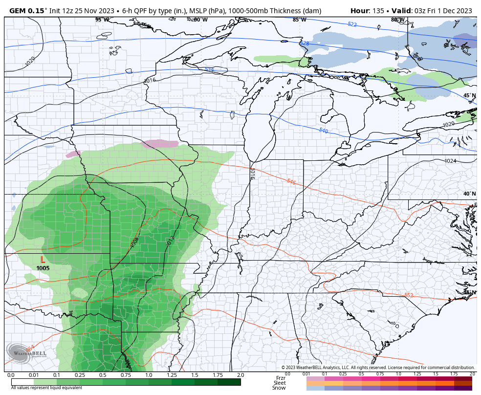
Cold air crashes in behind this into the middle of next week, setting the stage for a pattern favorable for winter weather in our region and much of the eastern half of the country.
The Ensembles have been jumping on a -NAO and connecting that block with a ridge along the west coast. The end result is a deep trough in our region…
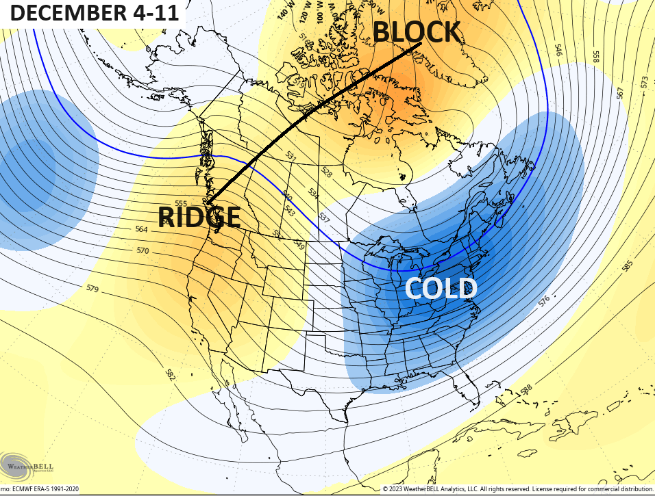
Now the operational models are jumping in headfirst…
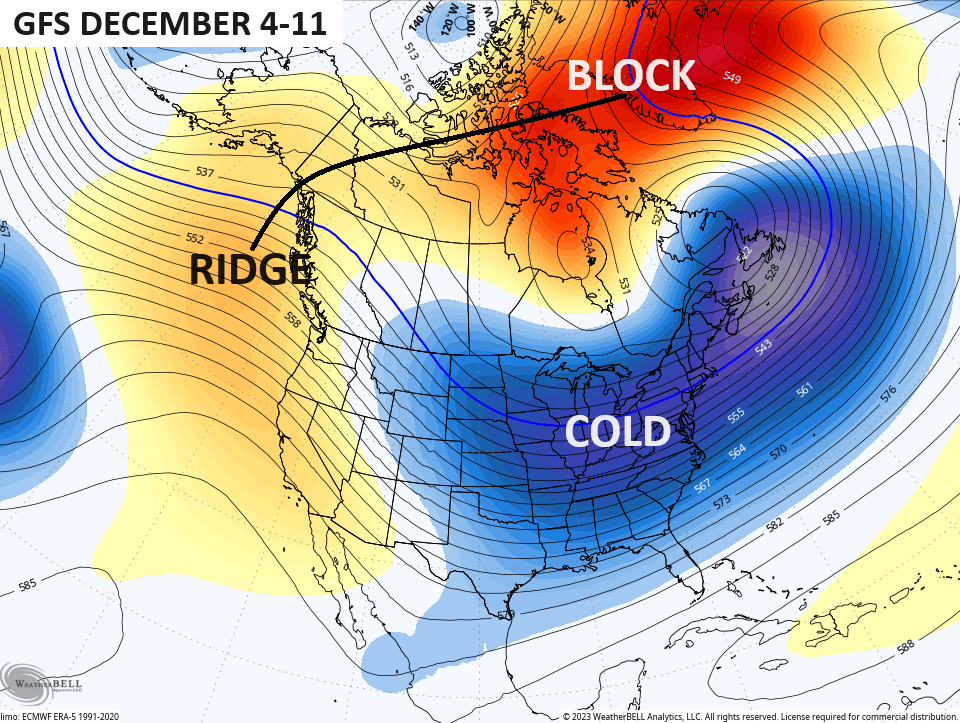
This is a pattern that has a chance to lock in through the holidays, bringing the chance for a much colder and, perhaps, snowier December than I thought.
I’ll see you guys back here tonight. Make it a good one and take care.
