Good Sunday, everyone. Showers increase from west to east today as a blast of winter rolls in behind it tonight and Monday. This brings the coldest temps of the season, so far, and the threat for a few light snow showers and festive flakes.
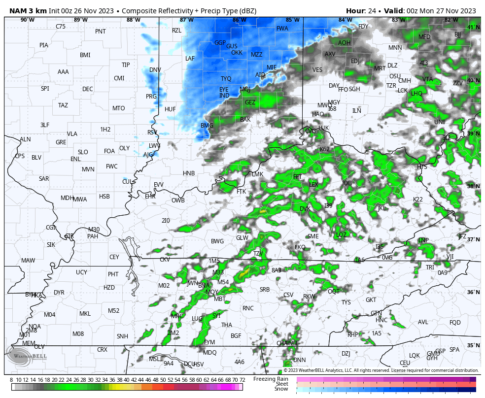
Today’s showers start in the west and expand the farther east we get. This isn’t a lot of rain, but it can spit out a quarter inch or so for many. Here are your radars to follow today’s rain in from the west…

Winds will also be very gusty today and may reach 30mph at times, making this a pretty ugly one, especially in the afternoon and evening.
The cold front works through here this evening with temps crashing behind it. As the temps come down, a few light snow showers and festive flakes start to fly overnight and into Monday. It won’t take much moisture to spit out some flakes and those may stick around in the east all the way into Monday evening.
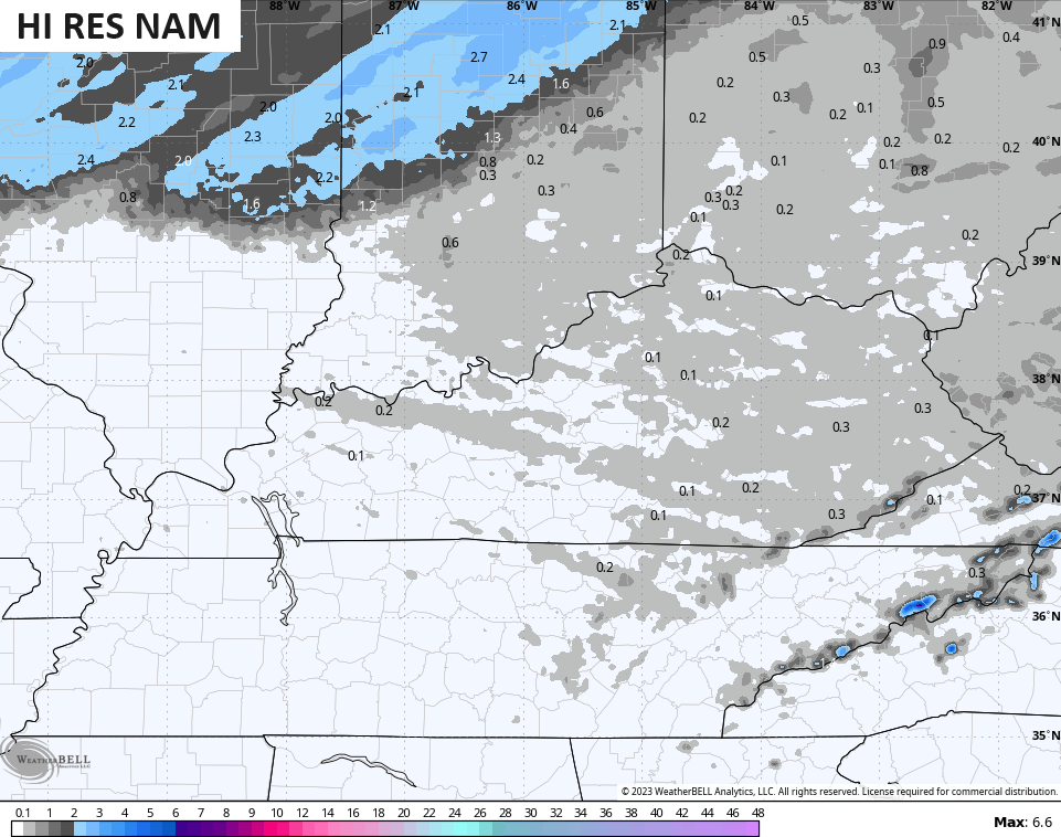
The future radar from the Hi Res NAM starts at 7pm this evening and goes through 7pm Monday…
Can we get a hit and run rooftop coating out of this in some areas? I think that’s a possibility. In terms of the areas seeing flakes, we now find the Hi Res NAM coverage area very similar to the Canadian family of models…
With temps going below freezing tonight, there’s the chance for a slick spot or two to show up on bridges and overpasses.
Speaking of temps, check out the numbers from 7pm this evening through 7pm Monday on the Hi Res NAM…
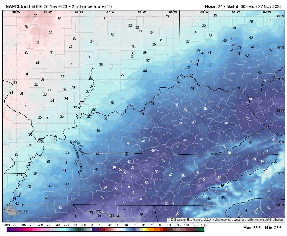
The accompanying wind chills are pretty darn frigid for the end of November…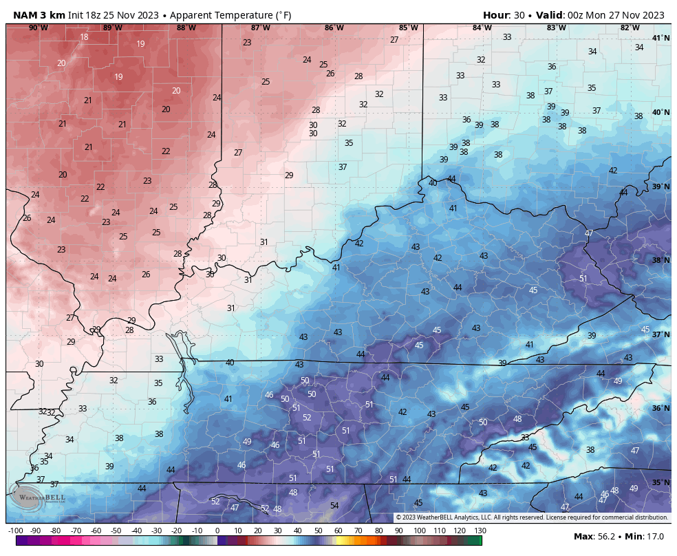 That’s a big ol BRRRRRRRRRR!
That same cold takes us into Tuesday before easing a bit later Wednesday as we turn our attention toward two systems on the way from Thursday night through Monday.
The first system brings rain to us Thursday night through Friday night with lingering showers into Saturday. The second system then arrives with more rain Sunday into early Monday with the chance for that to end as some snow as colder air rushes quickly back in early next week.
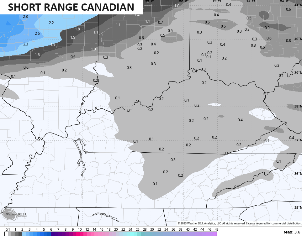
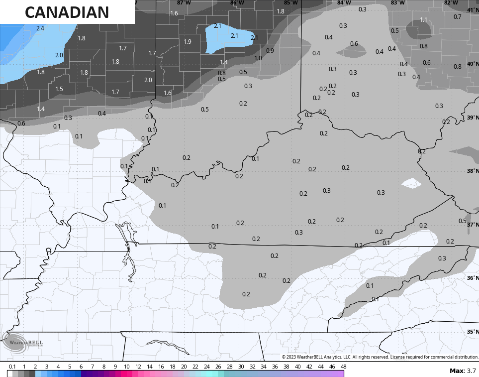
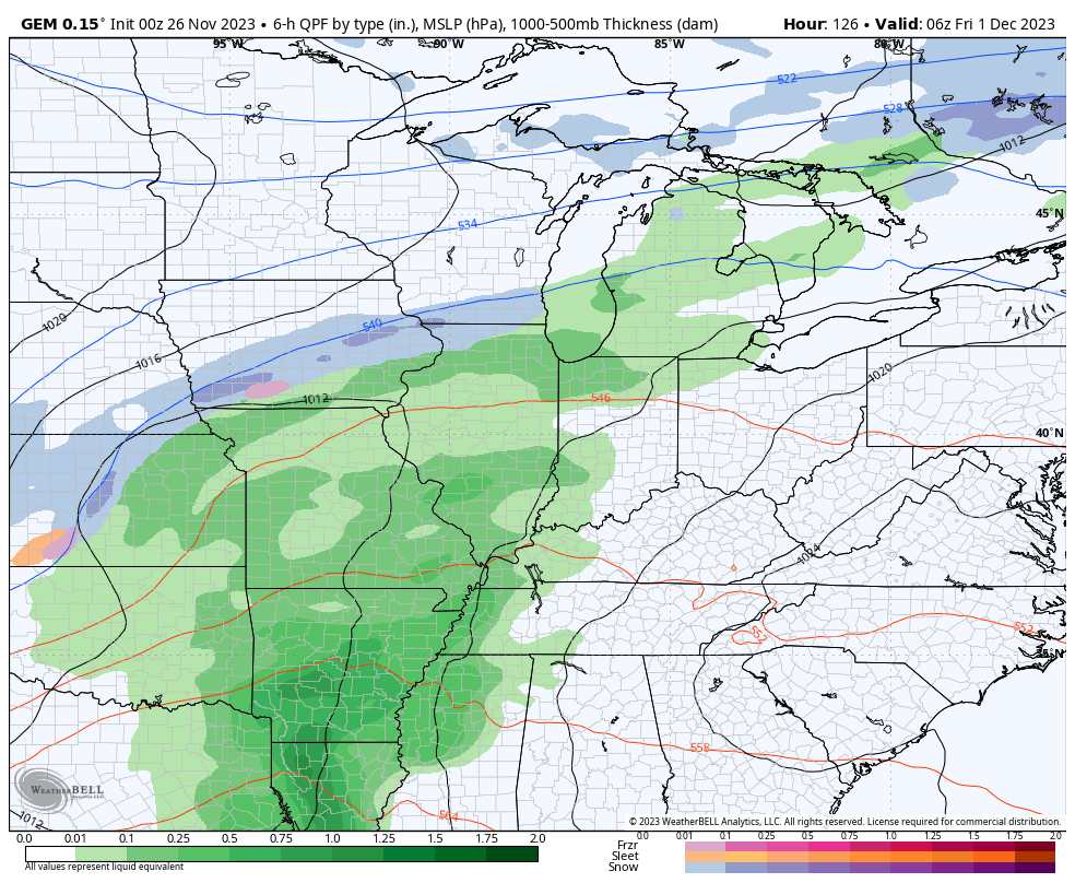
Here’s the Canadian Model with these systems…
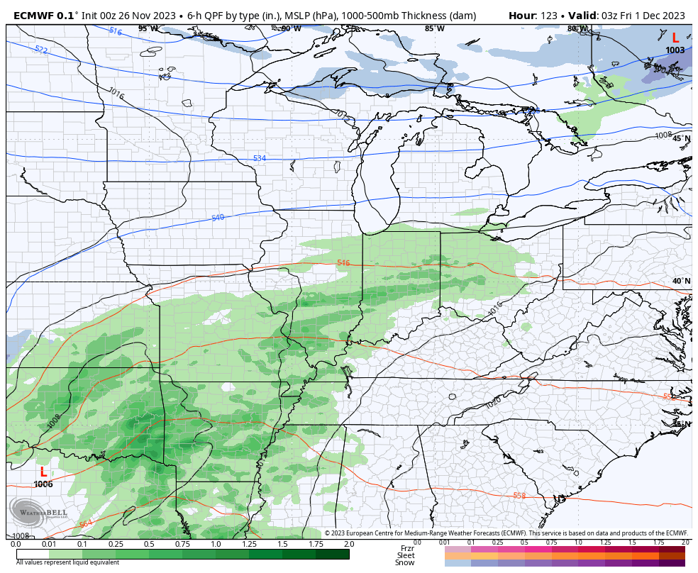
The EURO has a similar overall look…
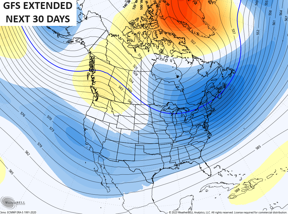
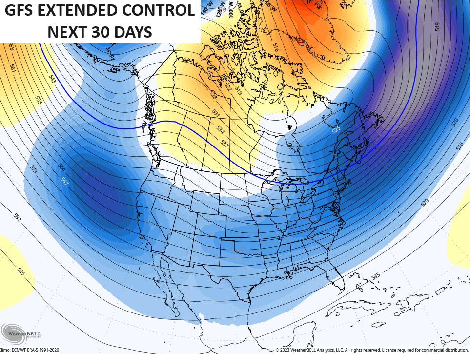
If we look at the extended models for the next month, they continue to be locked in on the trough in the eastern part of the country, with the GFS Extended being most generous across the country…
The EURO Weeklies are similar…
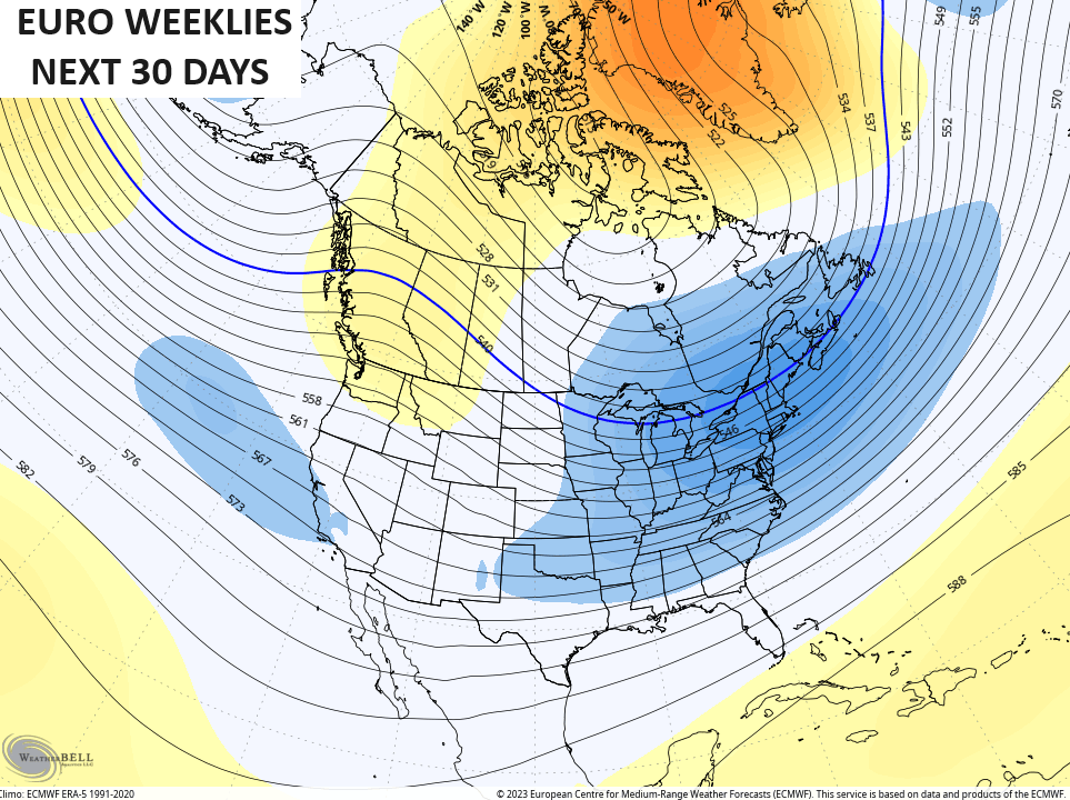
That’s a look of an active winter month across the country.
I’ll throw you another update or two later today. Until then, have a great Sunday and take care.

Thanks Chris. I would prefer just a cold Rain, and then some Snow Flurries at the end. Just don’t want to see Cold, dry weather.
The NAO has gone negative and we’re in the midst of a strong El Niño, key factors we would need to see for Winter weather in a year with normal climatic conditions. The problem is, our climate in recent years has been anything BUT normal, which means that the key factors we depend on won’t necessarily produce the results we have expected in the past. In some cases, it’s caused normally reliable models to perform erratically, and unfortunately, that narrows the time window for an accurate forecast prediction. Eventually the forecast model algorithms will be modified to produce a more realistic output, but expect more frustration in the meantime.
I agree Joe. They can’t use the same weather forecasting materials as they have used back in the 1960’s – 70’s and in today’s climate. Maybe, but not in my lifetime Artificial Intelligence may completely take over weather forecasting in the long range. Then one could make accurate plans accordingly.
I will be brief. The upcoming week is meh.
The weather will be boring next week, but next weekend we could see another system bring our area some widespread Rains, but that’s a ways off.
Persistent light snow has been falling throughout the Chicago Metro Area this morning. Around an inch or so has accumulated on the gra-ssy areas. With temperatures hovering right around freezing or just a bit above, the snow is not sticking to the pavement at all, so this isn’t a shovelable snow.
Cold Rain here Mike. I was amaze that one can see the Snow cover on the satellite that fell yesterday over the entire State of Kansas and I think Iowa too.