Good evening, folks. It’s a nasty Sunday across the region as cold air crashes in from the west and northwest. This will usher in some real deal cold over the next few days and will also bring some festive flakes along for the ride.
Showers slowly fade from west to east as the cold front passes through here. Winds are cranking as the cold takes hold and lingering moisture turns into a few snow showers and flurries overnight into Monday. The greatest concentration will be across central and eastern Kentucky.
The Future Radar from the Hi Res NAM continues to pick up on this very well…
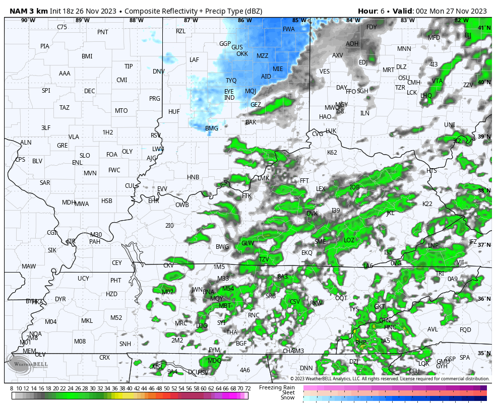
Keep in mind, that’s only picking up on the light snow showers and not the flurries.
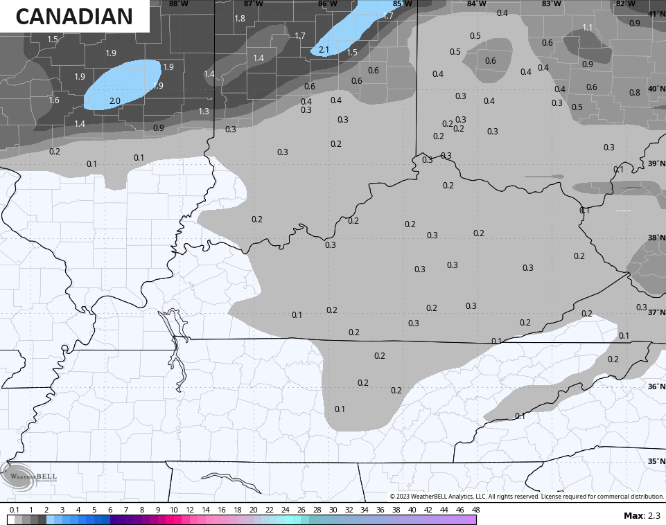
In terms of the models overall coverage of areas seeing some flakes, the Canadian family continues to lead the way…
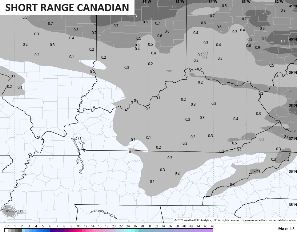
The Hi Res NAM is right behind it…
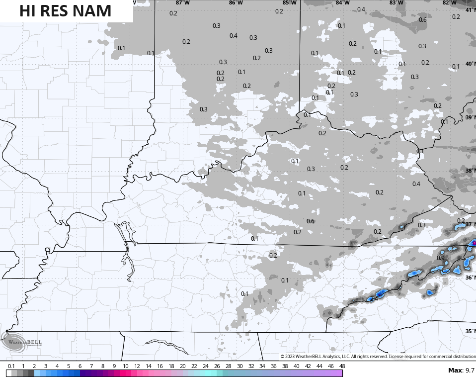
Even the NAM is starting to finally pick up on this…
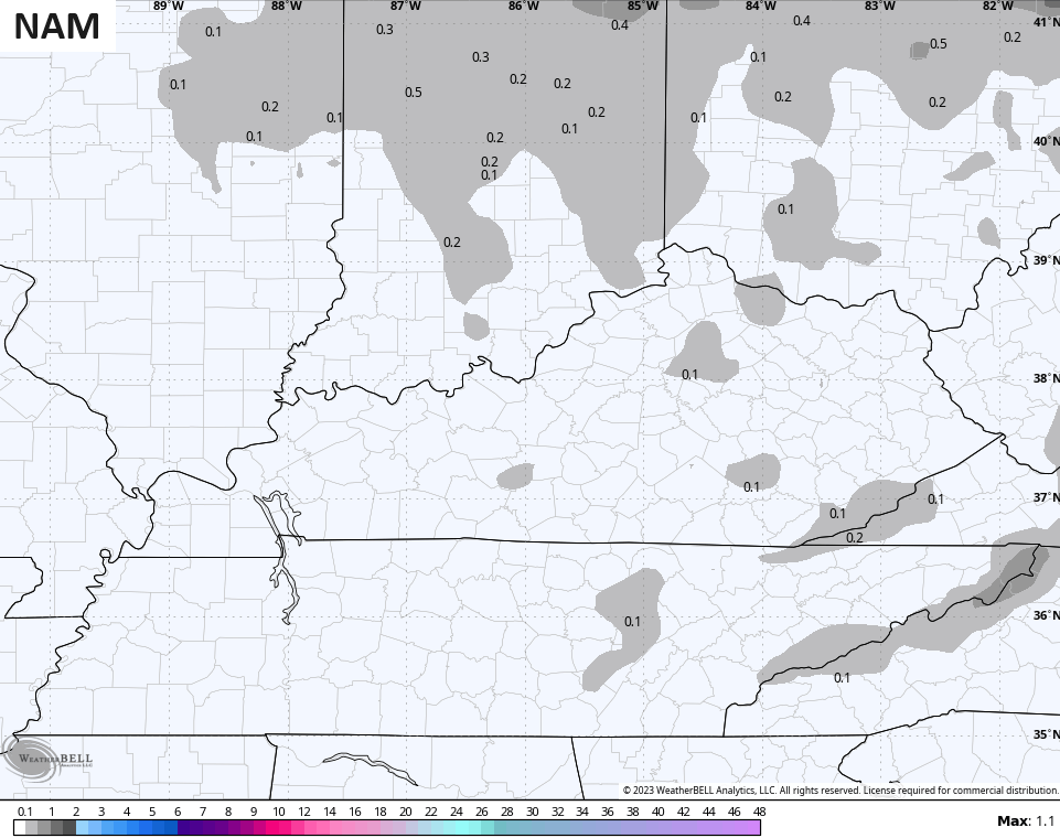
If you recall, the Halloween flakes only showed up on the Canadian and Hi Res NAM models from more than a day out. Y’all sensing a trend?
Here are your radars to follow the chilly showers that give way to the overnight festive flakes…

With temps going below freezing tonight and early Monday, there’s the chance for a slick spot on bridges and overpasses. Can the flakes deliver a local rooftop coating? There’s a chance, but I don’t see much more than that, folks.
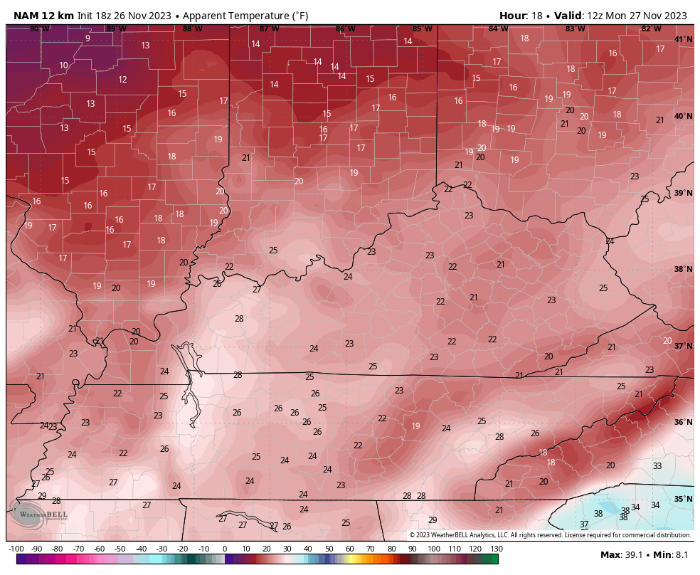
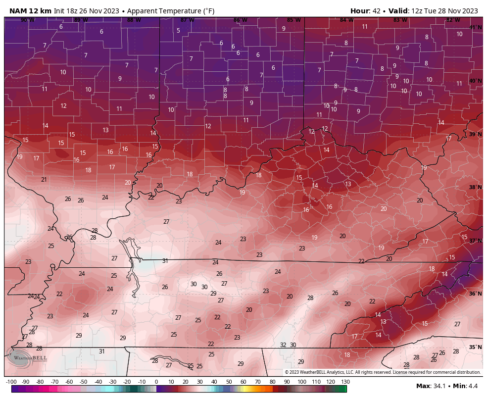
Temps are frigid behind this with 30s for highs Monday and Tuesday across central and eastern Kentucky. Gusty winds will make it feel much colder and I’m using the NAM for the wind chill numbers as the HRRR and Hi Res NAM look too cold.
This animation shows the wind chills from 7am through 7pm Monday…
The same model run keeps those frigid wind chills cranking from 7am Tuesday through 7am Wednesday…
Winds really crank on Wednesday as temps come up ahead of the next system. This will arrive Thursday night and Friday with widespread rain and gusty winds, and will be the first of two systems impacting our weekend. The next one develops and rolls through here with more rain and wind Sunday through early Monday, unlocking a cold pattern behind it.
The GFS had completely lost this second system, but it’s coming back around to what everything else is showing…
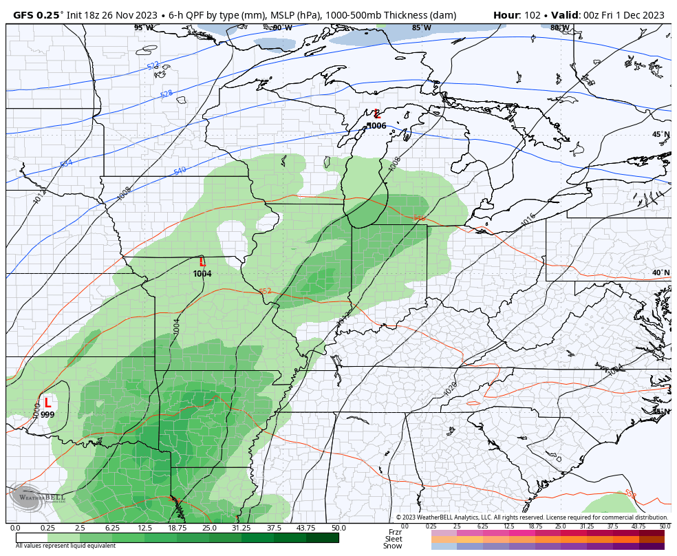
This is a general 1″-2″ rainfall from these two systems with the potential for locally higher amounts.
This is part of a very active pattern taking shape for the month of December. The split-flow look setting up across the country means some big systems rolling through. Some will bring rain and a few are likely to bring winter weather as cold air drops in periodically.
We will get into all this later tonight. Enjoy the evening and take care.
