Good evening, everyone. It’s a frigid setup that rolls on into Tuesday as wind chills take a walk on the ugly side. Beyond that, we track, at least, two systems toward the region from the end of the week into early next week.
My time today is rather limited, but I still wanted to drop by for a quick update.
Wind chills tonight may hit the upper single digits in some areas as lows reach the upper teens and low 20s. Highs may barely get to freezing for many of us Tuesday as that cold wind continues to gust up.
All of this creates crazy cold wind chills for late November. This animation from the Hi Res NAM starts are 7am Tuesday and goes through 7am Wednesday…
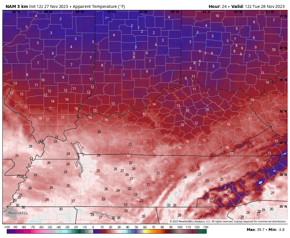
You can see a few single digits tomorrow morning, low 20 wind chills tomorrow afternoon, and wind chills back into the low teens to start Wednesday. Remember the “Barney” colors that I showed from several days ago? This is the kind of air you get with “Barney”.
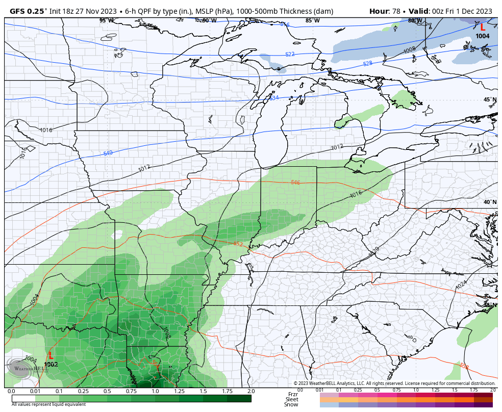
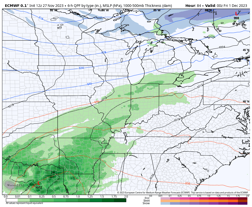
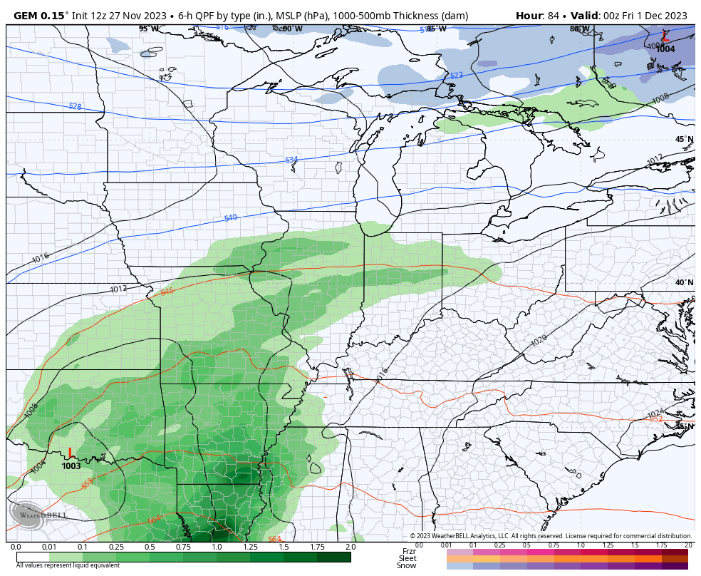
Our next system is a rain maker rolling in Thursday night through Friday night with lingering showers into Saturday. The next system then rolls in Sunday and Monday with more showers, but the extent of said showers is a little less clear as the EURO and GFS aren’t as consolidated with this system. In doing so, that leaves the door open for a possible third system behind it that can bring some winter weather early next week..
GFS
EURO
The Canadian has a stronger second system but also has the third system bringing the potential for a little winter…
I’ll get more into all that later tonight. Enjoy the rest of the evening and take care.

The models are in love with a system coming out of the northwest at the end of their runs.