Good Tuesday to one and all. Frigid winds continue to blow across the state today and this rolls into early Wednesday. From there, the focus is on a very active pattern setting up for the end of the week and next week. Several big systems are set to impact our weather during this time.
Let’s start things out with what’s going on out there today. We’re starting things out on a REALLY cold note with wind chills in the high single digits to low teens with actual temps in the upper teens and low 20s.
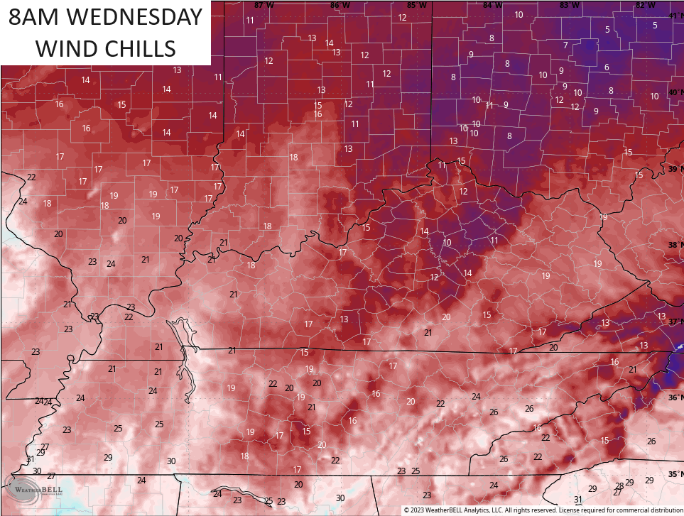
The frigid wind chills continue through the day. Check out the wind chill forecast from 8am this morning through 11pm this evening…
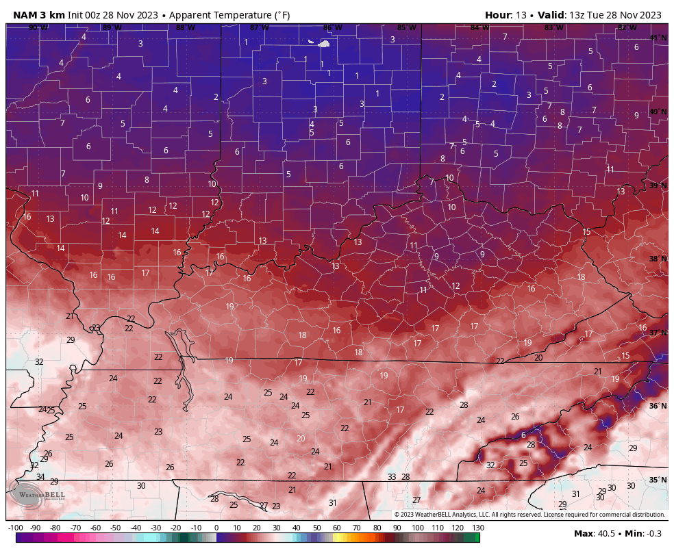
That keeps wind chills mainly 20-25 for during the afternoon hours for much of central and eastern Kentucky before falling into the teens again during the evening. Some wind chills may flirt with 10 degrees again by Wednesday morning…
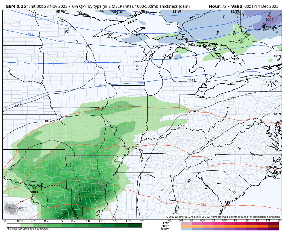
Wednesday afternoon temps recover greatly as we get set for the next system arriving with rain Thursday night into Friday. Lingering showers continue into Saturday with the next system arriving Sunday. How strong of a system is still a bit in question, but colder air comes in behind this with the chance for some flakes by Tuesday and Wednesday of next week.
The Canadian has the stronger second system before bringing in the chance for winter weather…
The EURO has a similar overall thought process, but isn’t as put together with the second system…

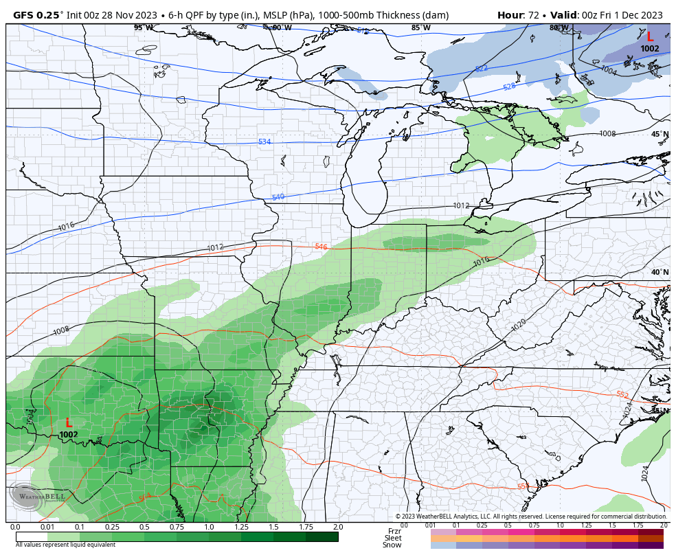
Stop me if you’ve heard this one before: The GFS runs 4 times a day and gives us a different solution 4 times a day. The latest solution has no Sunday system at all, but still manages to produce the Tuesday=Wednesday flakes…
I’ll see you guys back here for another update later today. Have a great one and take care.

What is that white stuff falling from the sky???? Cold with light flurries but still flurries.
Some backside lake effect snow shower action coming to towns east of I-75. Maybe.
Not much to get excited about but it’s still late autumn.
No Snow Flurries here, just cloudy, gloomy skies like last year at this time. Not much changing in the overall Atmosphere. Very boring weather. I read that the NWS has decrease our chances of widespread Rains later this week. I hope this changes as it is still Bone Dry in my area of the State. I just wonder if this drought is going to be with us all Winter ?