Good evening, folks. It’s another REALLY cold night ahead as this arctic air mass continues to do some work. This pattern will break quickly on Wednesday as we focus on a much more active setup from late this week through next week.
Temps tonight are in the upper teens to middle 20s with wind chills back into the 10-15 degree range once again.
The numbers climb from there Wednesday afternoon into Thursday as we get set for a storm system to bring rain at us Thursday night and Friday. This system has the best rain threat for the first half of Friday with scattered showers during the afternoon and evening…
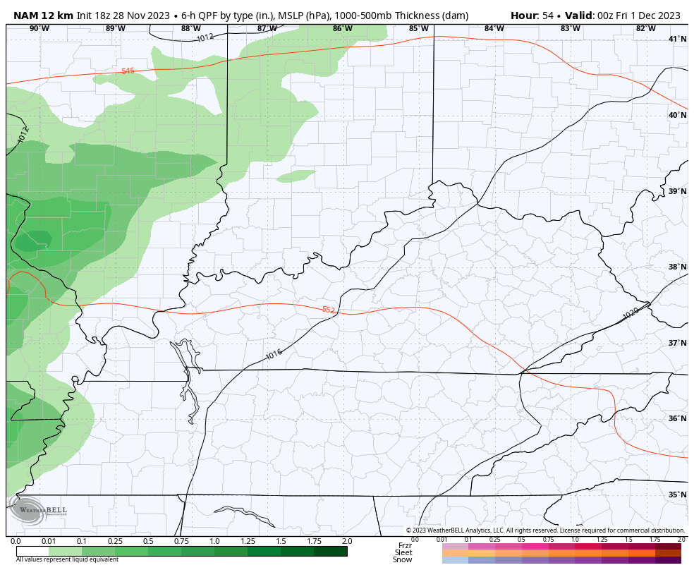
From there, we see a lingering shower into the weekend, but I still have some work to do on the Sunday forecast. Do we get a bigger system or a weak one working through? Regardless, a sharp hitting blast of cold comes in behind that with the potential for winter weather late Tuesday through Thursday of next week.
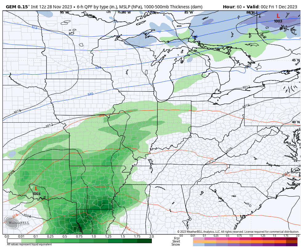
The Canadian continues to have a stronger system on Sunday…
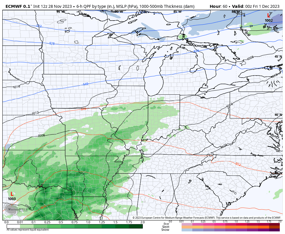
The EURO no longer has that…
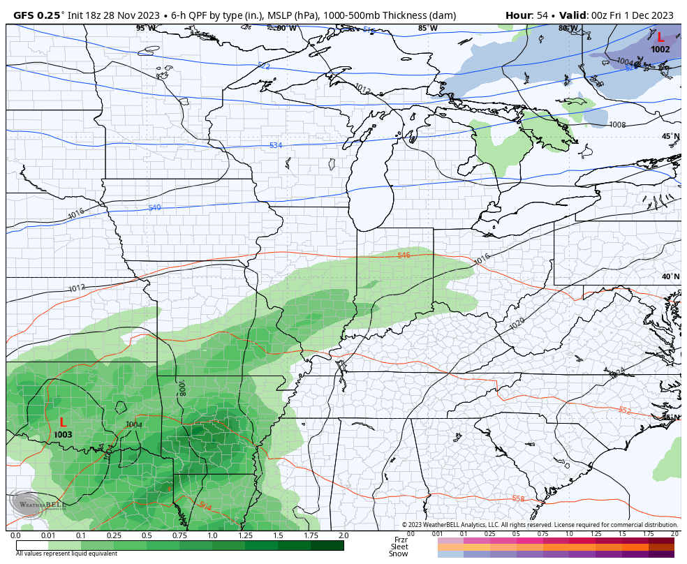
The GFS doesn’t have it either…
You will notice how all three of those models show a little winter weather for the middle of next week. That comes with another quick-hitting blast of “Barney” air…
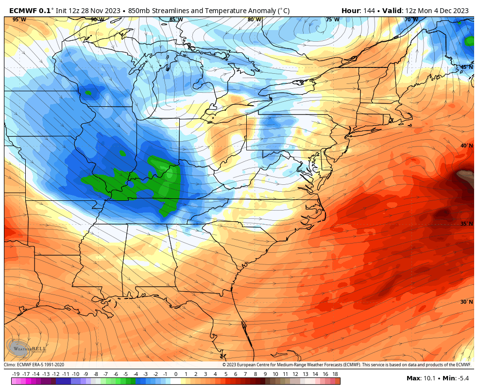
EUO
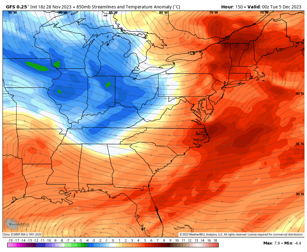
GFS
We are now seeing the models going toward a lot of back and forth in the pattern over the next few weeks and that’s much more in line with my winter forecast! 😎😁
Enjoy the evening and take care.
