Good Thursday, weather weenies. It’s a milder day taking shape as we await the arrival of a storm system rolling through here on Friday. This brings an increase in rain and very gusty winds to the Commonwealth with some more action into the weekend before colder changes next week.
Temps today reach the 50s with clouds increasing from the west. Low pressure rolls into the Ohio Valley tonight and Friday, bringing widespread showers from west to east. Locally heavy downpours show up for some areas early Friday before the rains slow down during the afternoon and evening.
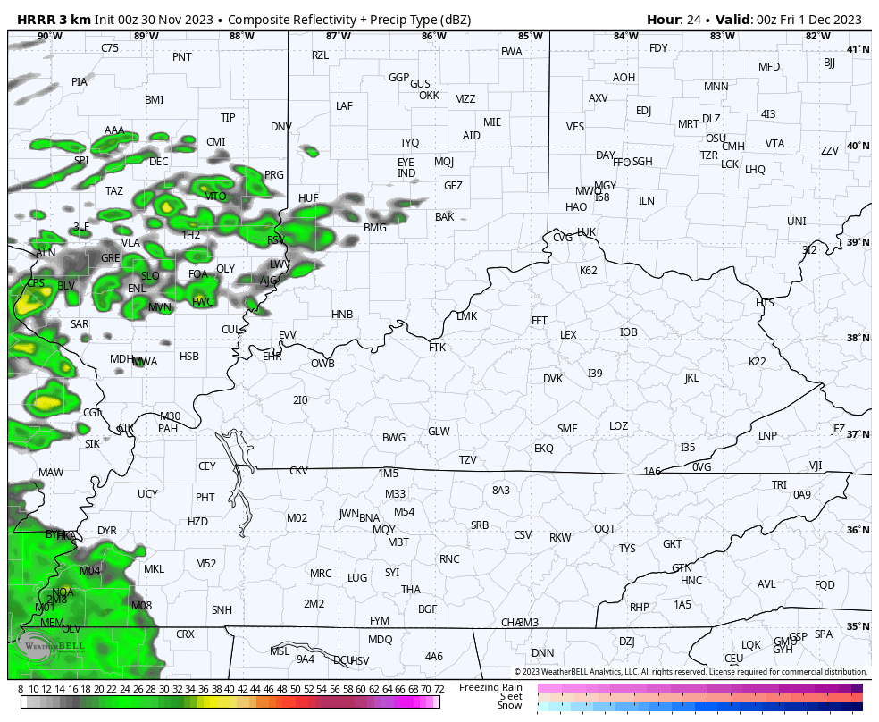
You can see all this on the HRRR Future Radar from 7pm this evening through 7pm Friday evening…
Winds are a big factor with this system tonight and Friday with gusts to 40mph possible. The Hi Res NAM continues to be on steroids with its wind gust forecast…
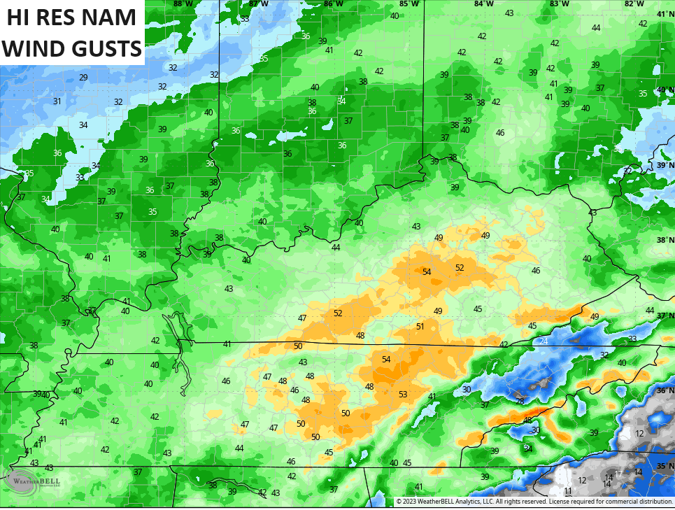
I don’t think we reach those levels, but you may want to batton down the Christmas decorations to be safe. 🎄🎅
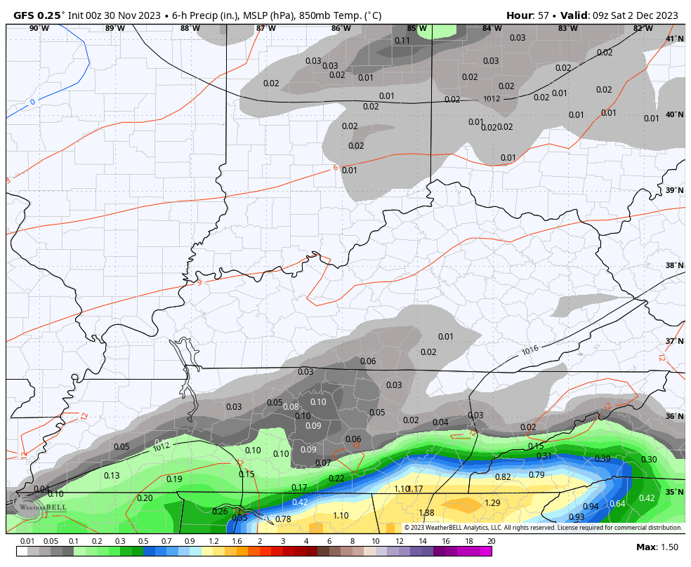
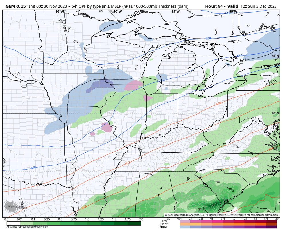
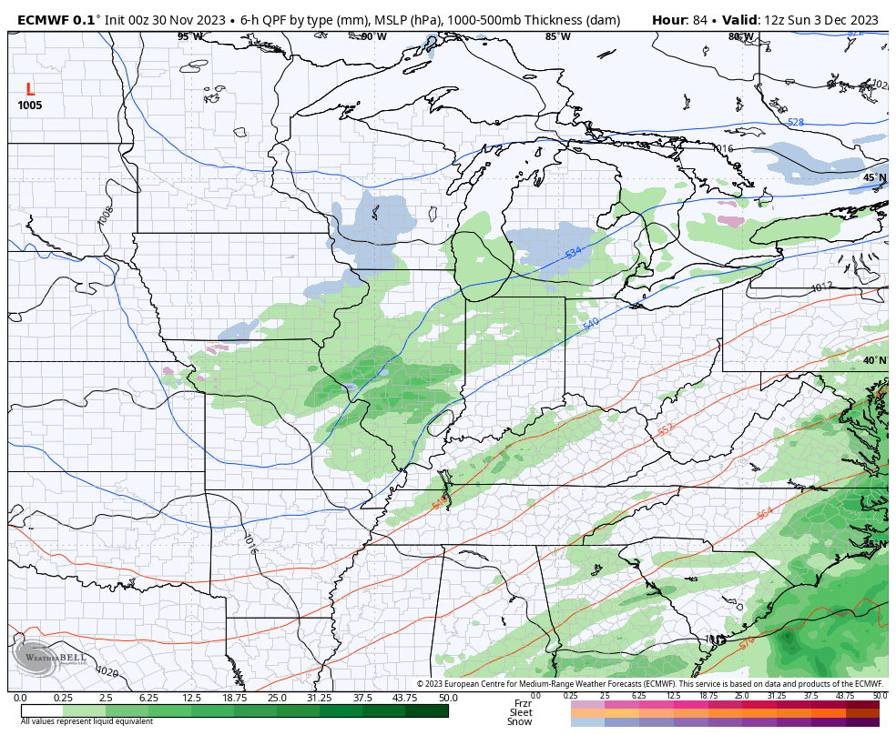
What do we do about Saturday and the rain threat? The models continue to get a little more aggressive with the showers, especially across the east and southeast but they’re trending back to the northwest with each run. The GFS continues to show Saturday showers all the way through central and northern Kentucky…
The trend is colder for early next week with at least two systems dropping in here early next week. With the colder air in place, the chance for a little winter weather is there for Tuesday and Wednesday, especially.
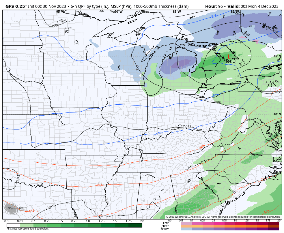
The GFS looks like this from Sunday through Wednesday…
The Canadian is a little stronger with the Monday system with the clipper looking system coming in right behind it by Tuesday…
The EURO is even faster with the cold and brings that in with a system on Sunday. Temps crash with the Monday system also swinging through ahead of a third system Tuesday and Wednesday. The EURO is the wintriest of the models (and that’s not much)…
There’s a lot of energy diving into the eastern part of the country, so you can see why the models are having timing issues…
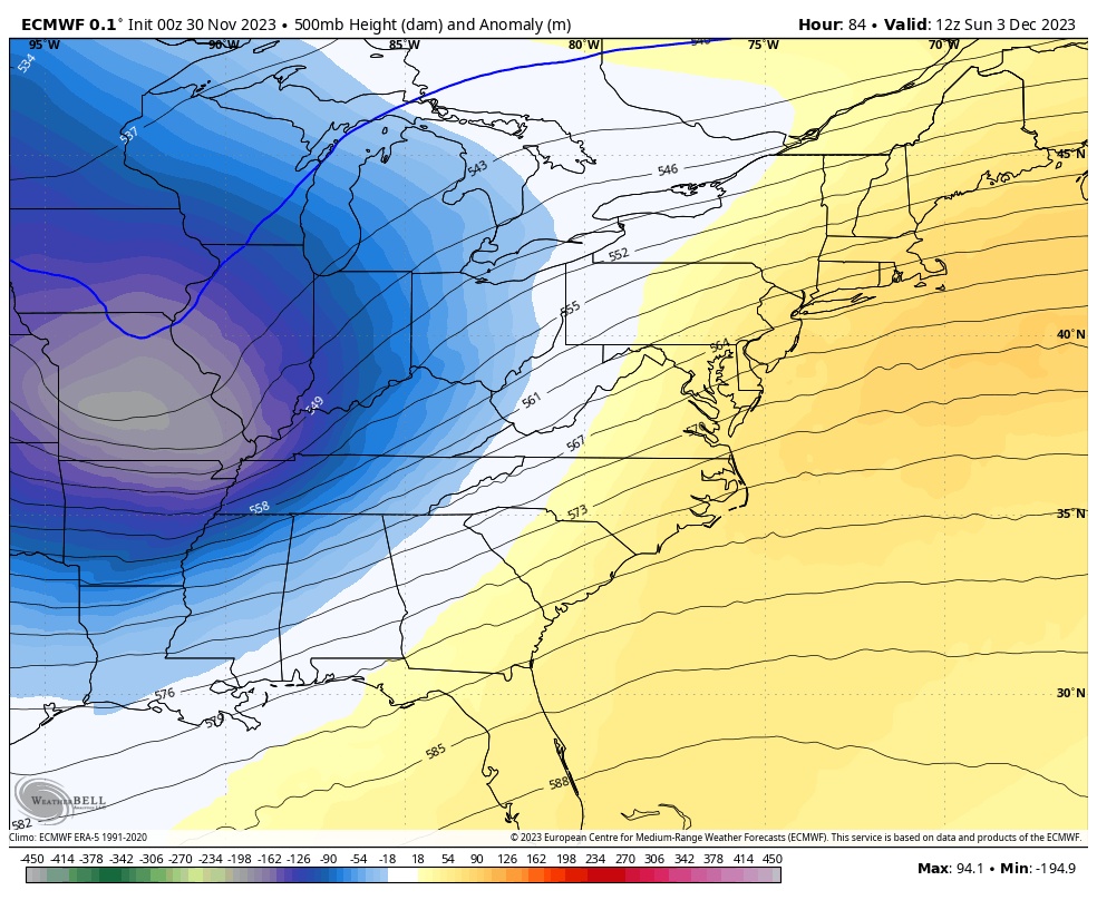
Those are deep troughs, but the air coming into those troughs isn’t really that cold.
Now, let’s look farther down the weather road.
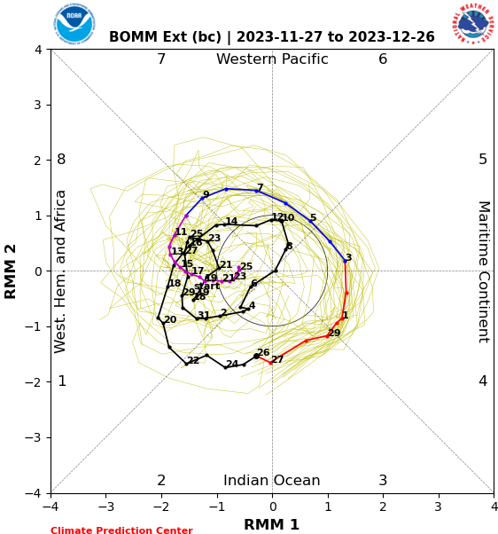
If we take a look at the latest forecasts of the Madden-Julian Oscillation, or MJO we find all the long range forecasts looking pretty similar. Now, these charts are really hard to decipher if you don’t know what you’re looking for. Let me give you a brief description… We have 8 phases of the MJO and those are numbered on the outer edge of the chart. The main squiggly line is the forecast line. The black part of the line is where the MJO has been. The colorful parts of the line show the forecast out in time. The numbers along the line show the corresponding dates for the next month.
The GEFS has the MJO going into phases 3 and 4 before crossing through the “nothing” phase and then circling through phases 7,8 and 1…
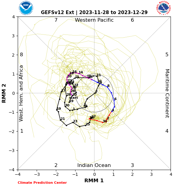
The CFS also gets to those same phases, but with a little different trip…
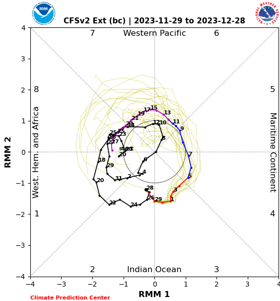
The Australian model is faster toward Phases 7, 8 and 1…
So what do those phases generally mean for temps this time of year? Take a look…
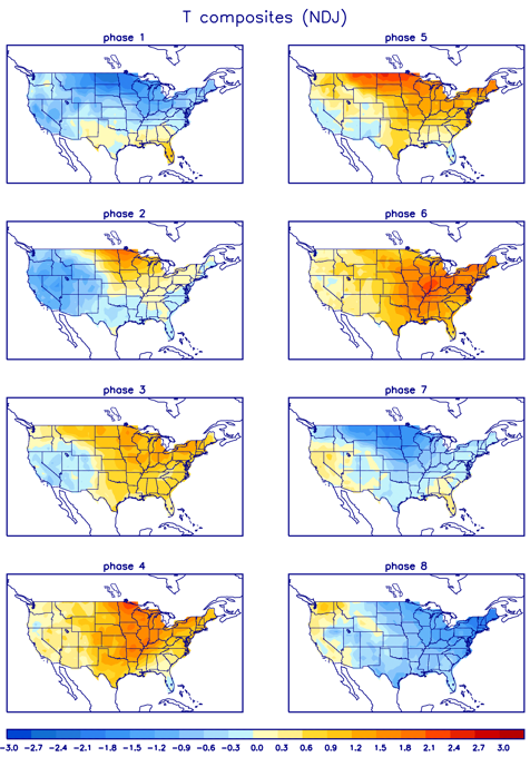
Notice how we are going through the warmer phases over the next week or two before entering into phases 8, 1 and 2 by the middle of the month. So, the temps over the next week are above normal with more of a back and forth setting up after that. That makes sense as the MJO crosses from the warmer phases to the colder phases. Does any of this make sense?

Obviously, there are many other factors at play, but the MJO signal can give us a pretty good indication of the general pattern from pretty far out.
I will have another update later today. Until then, here are your radars to watch the rain roll toward western Kentucky…

Enjoy the rest of the day and take care.

Great Blog Chris, and thanks for further explanation of the MJO. All oscillations whether positive or negative effect one or the other. That’s what drives weather system plus the Solar activity. With ENSO phases added in the weather across the Earth becomes more interesting.
The verification system on this site can be more frustrating than the weather.
Anyway it looks like we are going to be on the south side when the Clipper systems move through our area.
GFS and CMC still have a healthy little piece or energy dropping down, next week.