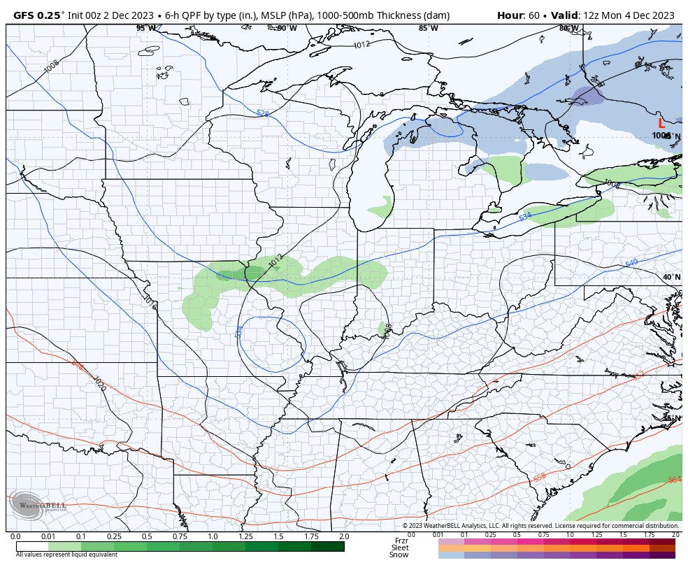
Good Saturday, everyone. It’s another day of nice temps, but rather dreary skies as another storm system impacts the region. This brings showers back in from the southwest and it has, at least, two more systems coming behind it. Those bring colder temps along for the ride.
Today starts with some mist and scattered showers with showers increasing from southwest to northeast today into tonight. The greatest chance for rain is across the eastern half of the state with smaller chances in the west.
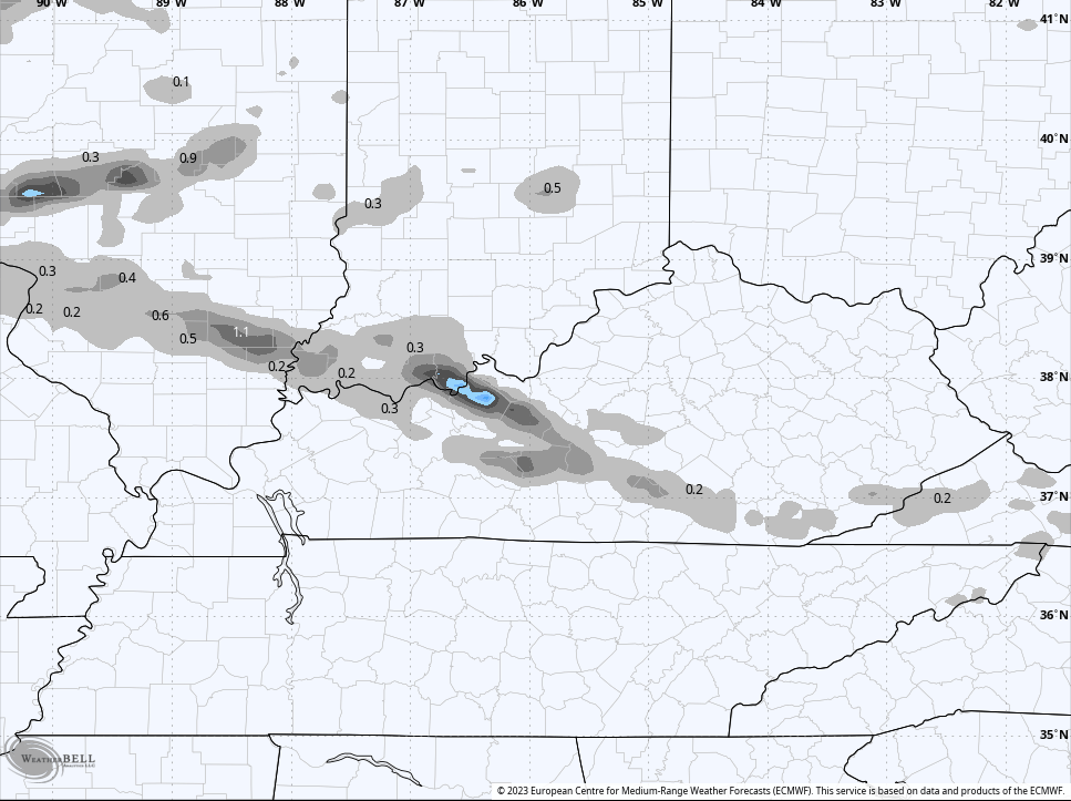
Here are your radars to follow today’s action…

Sunday morning showers slowly pull away with drier air coming in during the afternoon and evening. That also comes with colder air slowly pushing in from the northwest, setting the stage for another ugly weather maker on Monday. Chilly showers zip across the area with temps in the 40s. This sets the stage for a clipper to drop in here Tuesday and Tuesday night. A few showers accompany this and, as cold air crashes in, some snow showers or flakes will be possible behind it through Wednesday…
The Monday system is likely just rain, but the EURO actually sees a few flakes…
I continue to watch the MJO and we are seeing the forecast speeding this through the warmer phases enroute toward the colder phases…
GFS MJO FORECAST
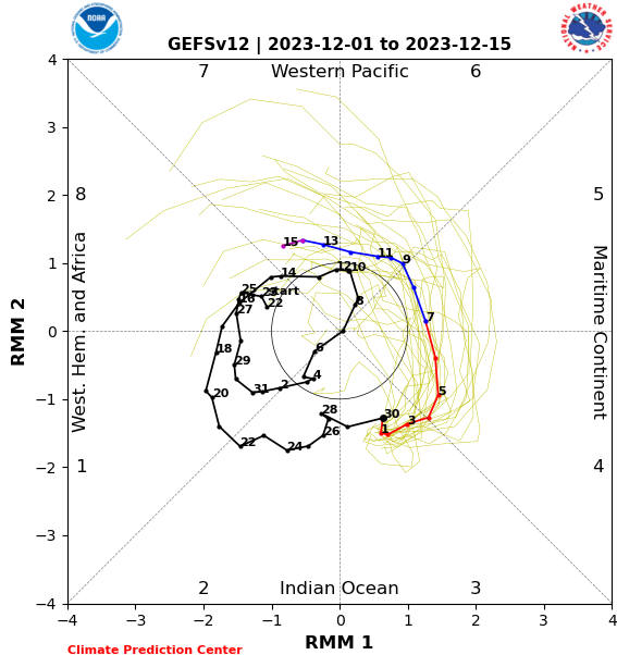
EUROMJOFORECAST
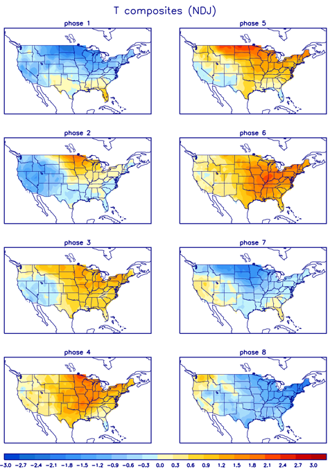
Phases 3, 4, 5 and 6 are warmer phases, but you see both the GFS and EURO getting into phase 7 by December 13th. That’s a colder phase…
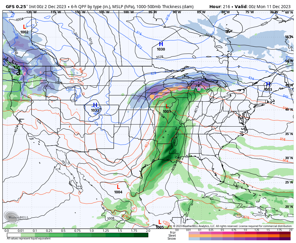
The operational models are starting to see that transition with the potential for a big storm in between…
GFS
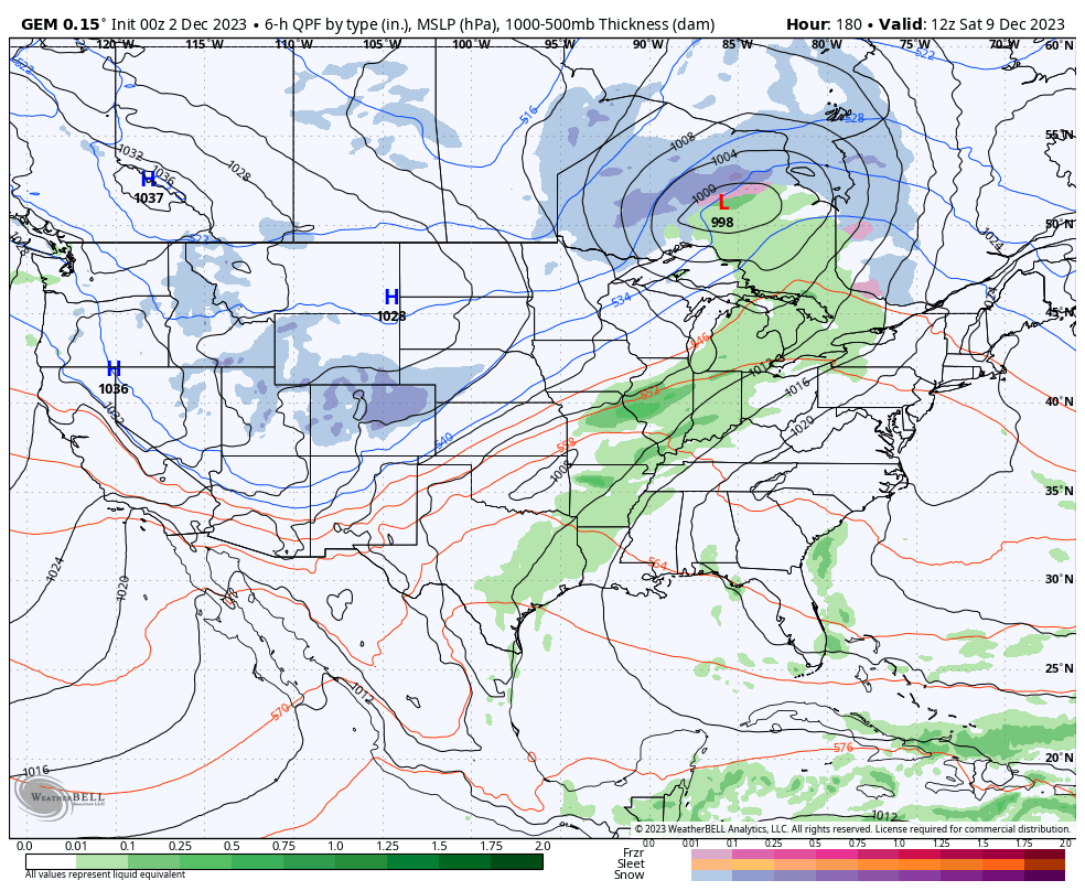
The Canadian is a bit quicker…
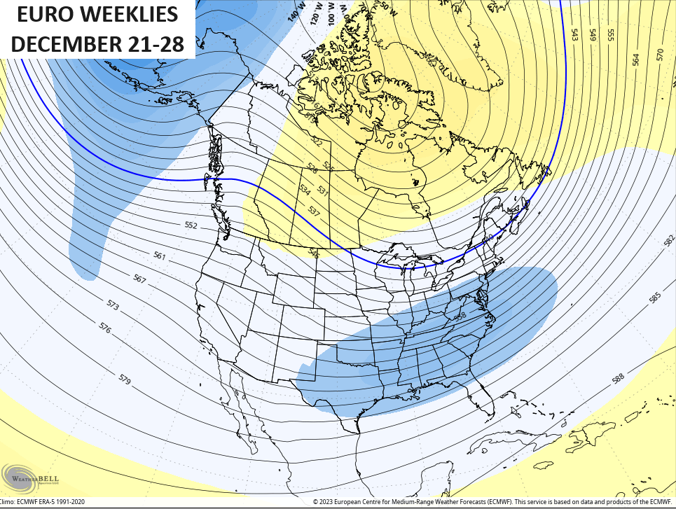
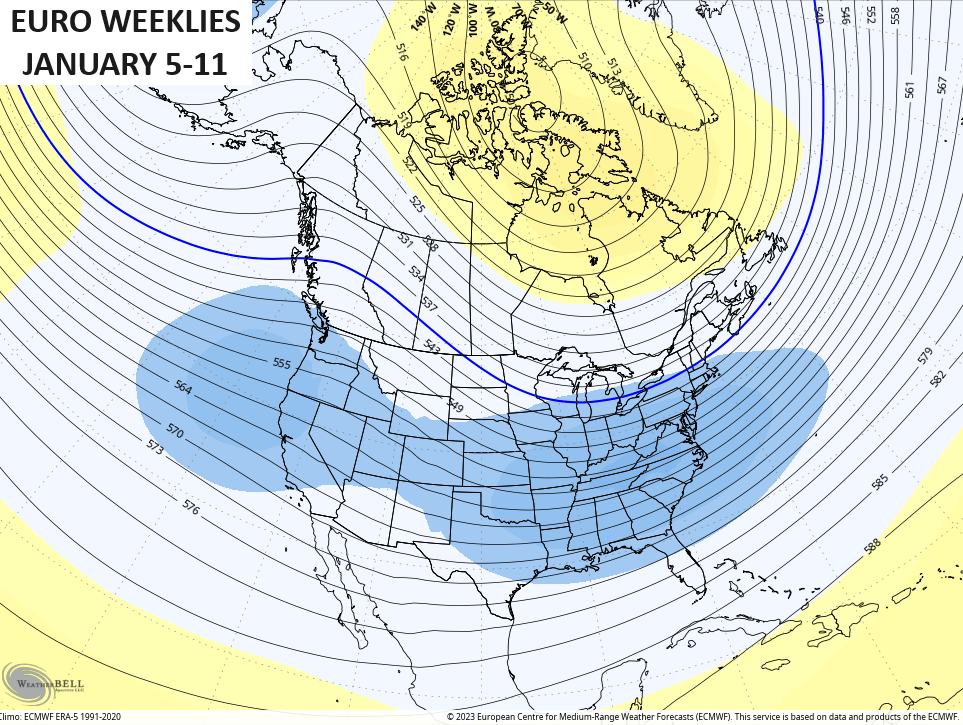
Low and behold, we also find the EURO Weeklies seeing these colder phases locking in later in December and early January. Look at this trough developing around Christmas…
This gets even deeper to end the year and kick off 2024…
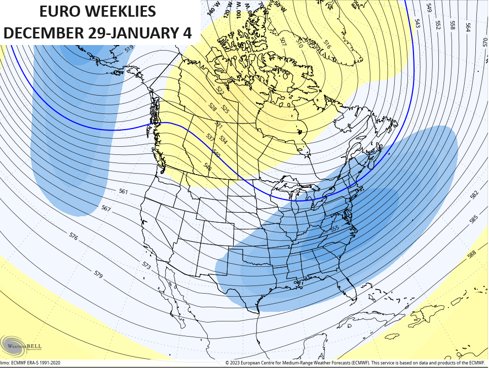
That trough engulfs more of the country into January…
All of this matches up well with my winter forecast. ❄️🥶
I will have another update for y’all later today. Have a great day and take care.

Looking at the MJO, the second half of December into January seems destined to deliver bona-fide Winter weather to South Central Kentucky, for the first time in many years. My snow shovels are tuned up and ready for action!
I hope Joe we will get some snow in eastern Ky too or in Pikeville but a lot of times we get in on the backside flurries or cold rains but just 30 minutes up the road they will get good snow I do believe it’s the mountains and elevation but maybe it’s our year because I would be 30 minutes up the road and see all the snow be so happy Only to get to Pikeville to see hardly nothing or rain it’s really strange .Whitesburg Harlan and on the Va borders is the sweet spots but I will be happy for whatever we get this year I think temperatures affect it too.
Crystal, Here’s what I found on Pikesville’s Climate :
https://www.bestplaces.net/climate/city/kentucky/pikevillehttps://interestingengineering.com/innovation/googles-graphcast-predicts-weather-under-minute
Opps miss up the link Crystal. Here’s the real one :
https://www.bestplaces.net/climate/city/kentucky/pikeville
Thanks Chris. Hoping your long range forecast for Winter pans out correct. Thanks again for your explanations on the MJO and ENSO.
We’ll just have to wait and see. Long-term forecasts make me skeptical.
Get ready to shovel.
My wife said, “We loved our wood stove inserts in the early 80’s. Let’s get another one.”
Brilliant suggestion it appears. Installed last month. Only burned a couple days, but it’s a beaut.
Cut and split a cord of wood, thinking that’ll get us through. Maybe not.
El Niño still strengthening..Region 4 is on fire..Guess We’ll see if this slows the MJO down in the warmer phases..