Good evening, folks. It’s a windy end to the first weekend of December and now it’s time to focus on the first full week of the month. We have a few systems rolling in over the next few days and they rain and a touch of some flake action. A much bigger system is lurking by next weekend and it’s getting more and more of my attention.
The firsts system working across the region Monday is mainly a cold rain maker, but it has the potential to spit out a flake or two under the heaviest precipitation band. This will be followed up by a clipper dropping in from the northwest Tuesday and Wednesday. That one will bring a few showers with some flakes and a few snow showers developing behind this system.
The future radar from the HRRR shows the Monday system pretty well and also shows the system approaching from the northwest by early Tuesday…

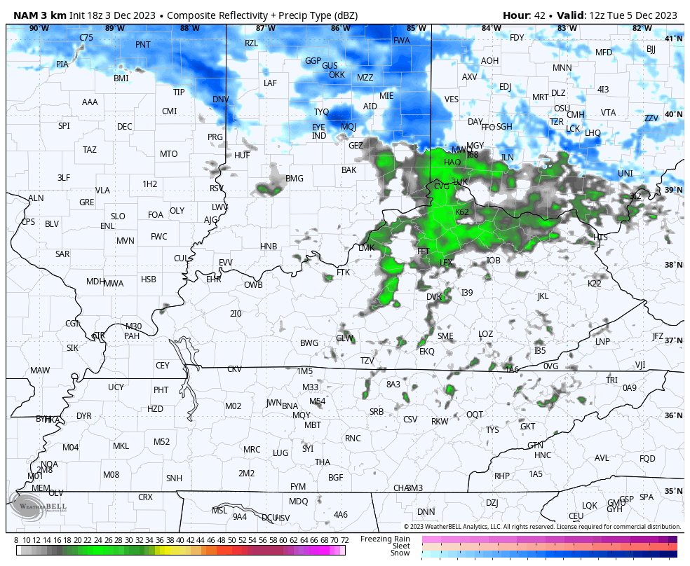
The future radar from the Hi Res NAM shows the Tuesday showers turning into Tuesday night flakes…
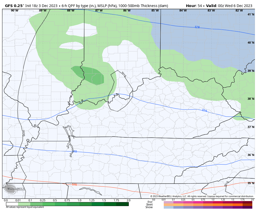
The GFS is also showing a few flakes around through Wednesday with the majority of those in the east…
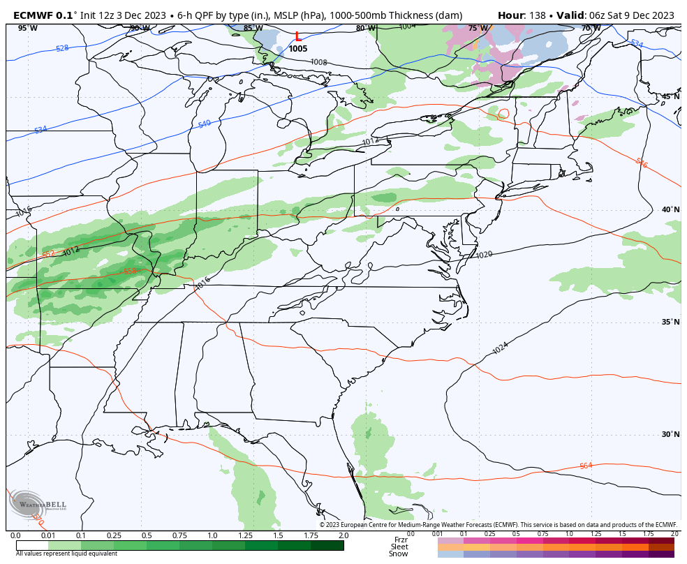
The setup for the weekend continues to gain attention as we continue to see the EURO going toward a big time storm that brings rain and wraparound snows in here…
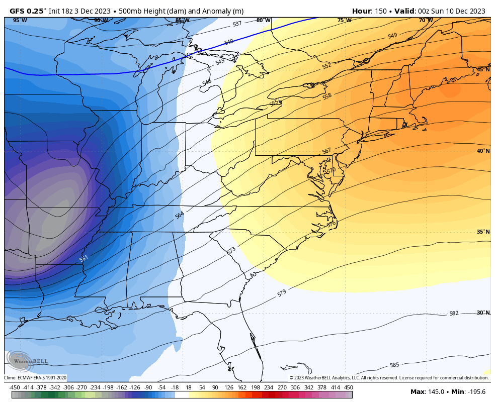
The afternoon run of the GFS is now showing a similar looking storm…
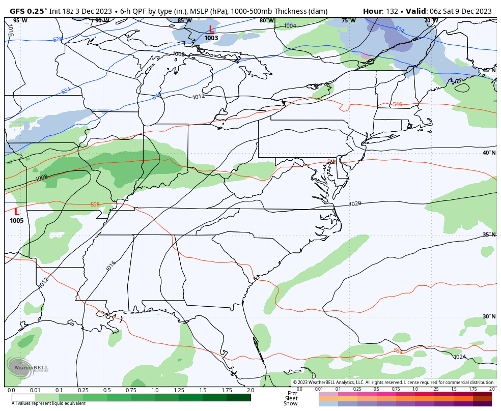
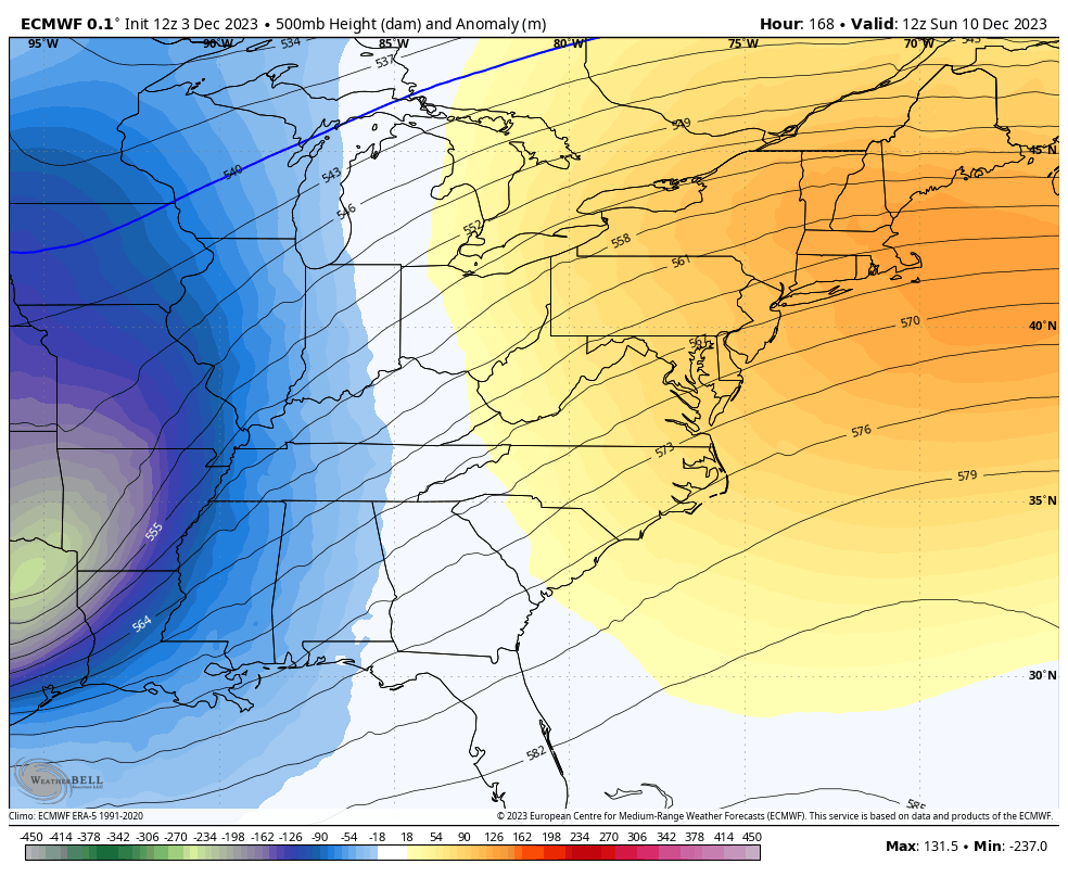
This makes sense considering how both models have identical looks at 500mb, bringing a potent upper level system across our region…
EURO
GFS
The AI generated GraphicCast Model was the first to sniff this potential out and it still shows a healthy storm that’s a bit farther east than the EURO and GFS…
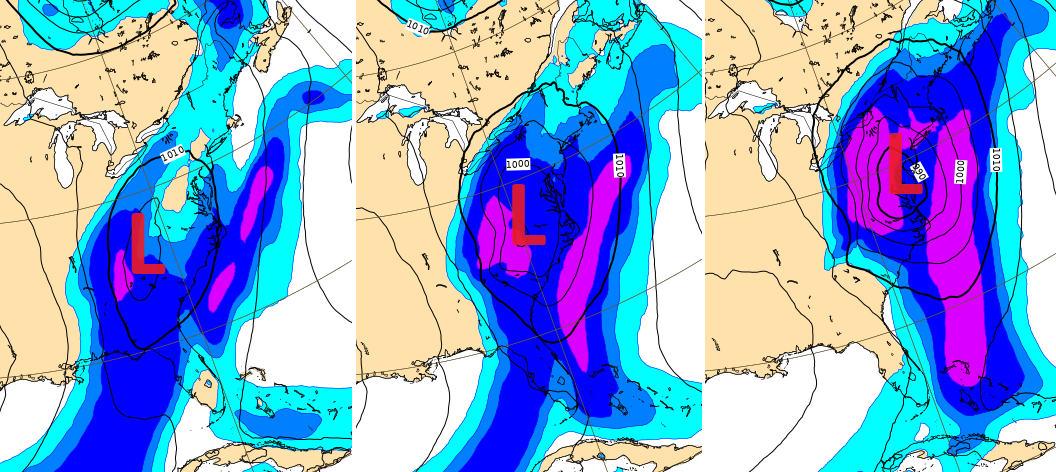
That doesn’t even show state lines and only shows pressure and precipitation, but one can infer what it’s suggesting.
That air isn’t especially cold, but it’s still plenty cold enough to fire up a big system capable of some winter weather behind it.
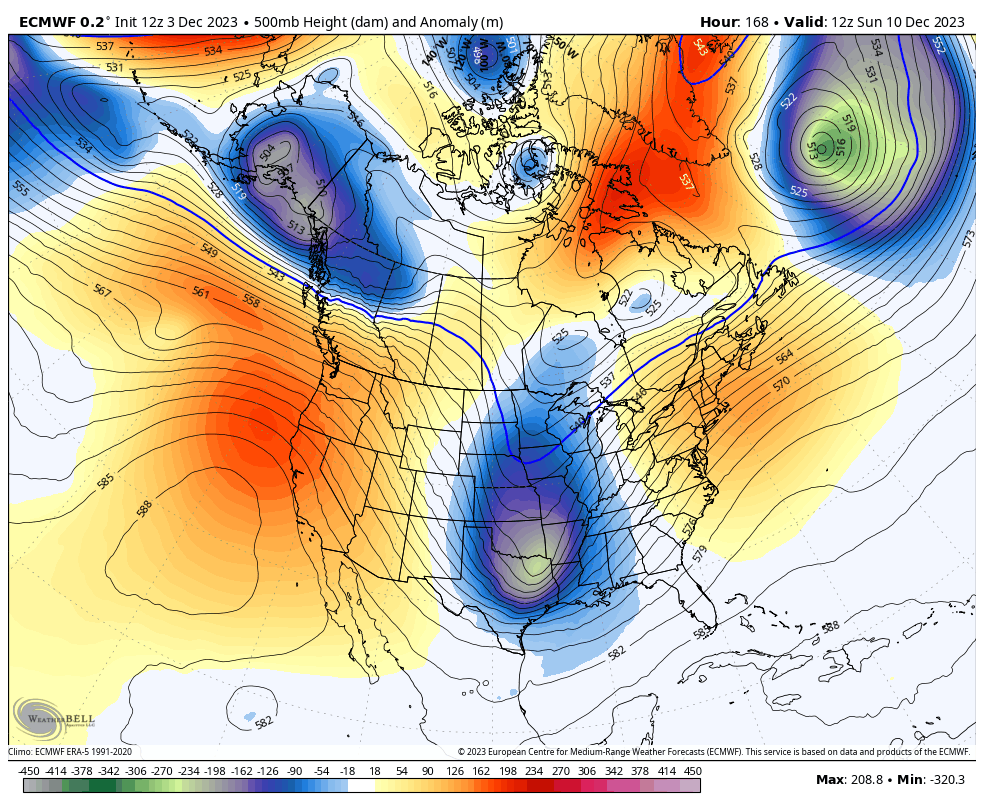
For what it’s worth, the EURO is trying to develop another deep looking system right behind that one…
I’ll see you guys later tonight for the full update. Have a great evening and take care.

That’s interesting but why do I feel if we get anything in the east it will be rain I think the temperature hovers around cold but doesn’t quite get there for flake action I hope I am wrong. I heard someone else say that’s something to watch. What is the deal with all that snow in Germany and isn’t that unusual for them?
Crystal, here’s the link to the Germany Snowstorms :
https://search.yahoo.com/yhs/search?hspart=litmus&hsimp=yhs-inboxzone&type=1470475-vsub-ext01&p=Germany+recent+Snows
Not unusual.