Good evening, folks. It’s another cold night out there but the overall weather pattern continues to be calm, cool and collected through the rest of the week. By the weekend, we continue to have all kinds of questions as to what happens with a big system coming from the deep south.
Let’s just go ahead and look at what the models are showing for the weekend.
To illustrate the volatility of the models, look no further than the GFS. The morning run of the model showed a deep storm system rolling from the Gulf and up the eastern seaboard, bringing rain into Kentucky with colder air following that…
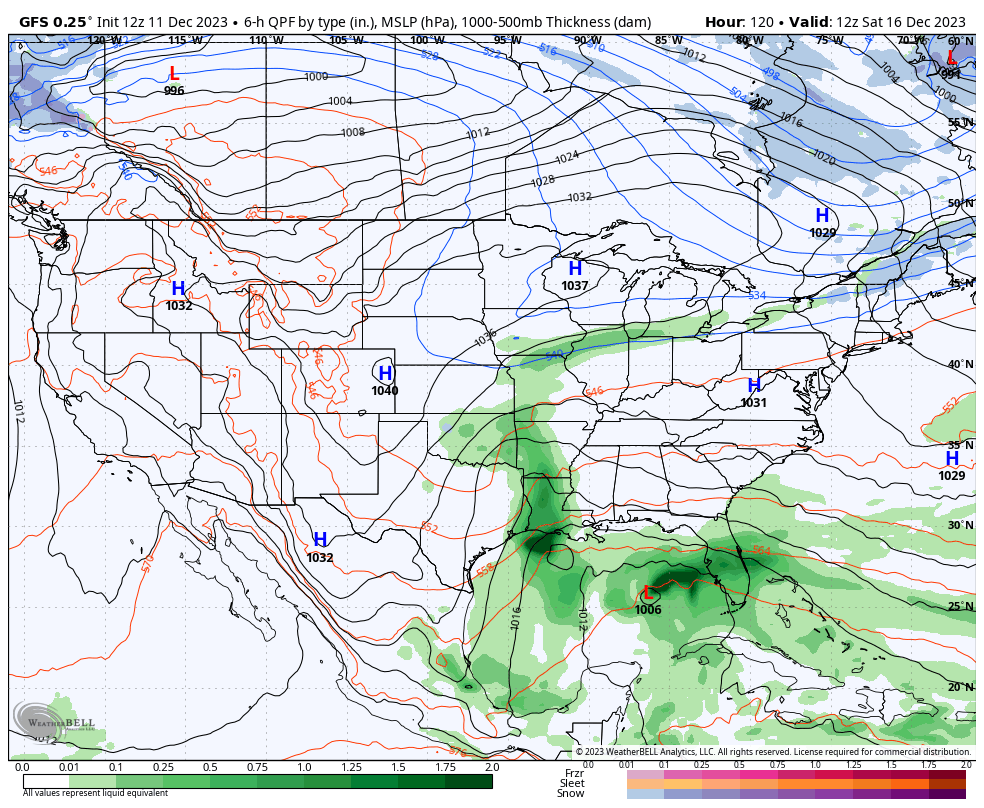
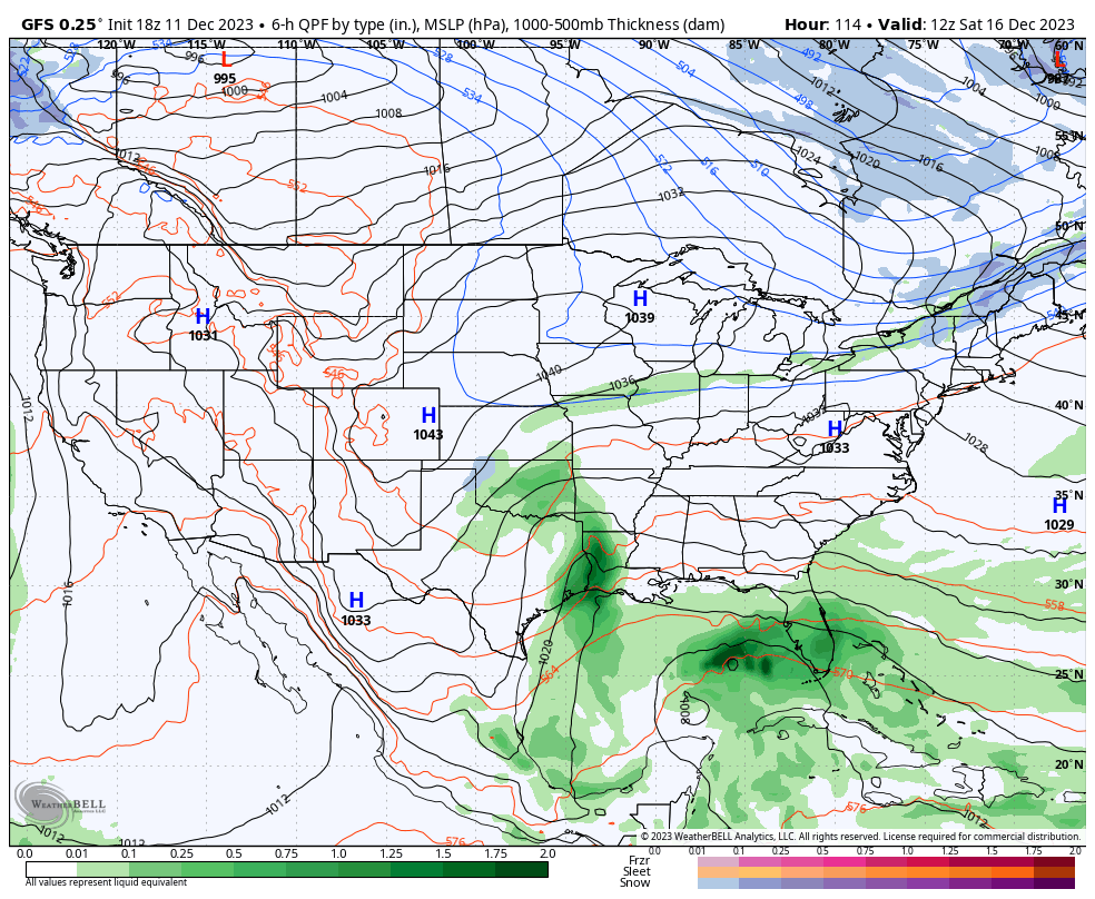
The afternoon run of the same model looks completely different and keeps our system off the southeastern seaboard…
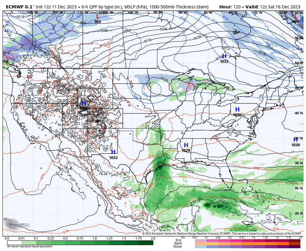
What about the other models? The EURO is back to showing more of a storm system but keeps it off the east coast. It does see the cold behind it…
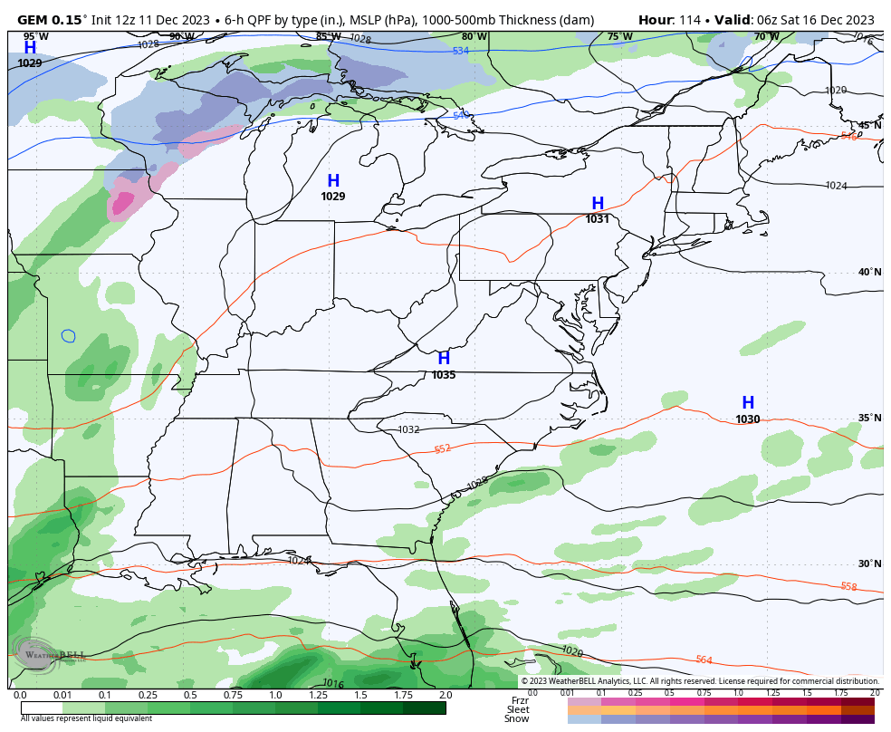
The Canadian Model keeps the main system east but has a clipper diving in trying its best to merge with it…
This is where we stand, folks. 😜
Enjoy the evening and take care.
